It’s easy to step foot in two states at the same time, but what about three states? Shae, Truffles and I decided to find out.
While staying in London KY, we drove an hour southeast to Cumberland Gap National Historical Park. The park is located where Kentucky, Virginia and Tennessee meet and is home to the Tri-State Peak Trail. This hiking trail leads you up to Tri-State Peak – the exact point where those three states meet.
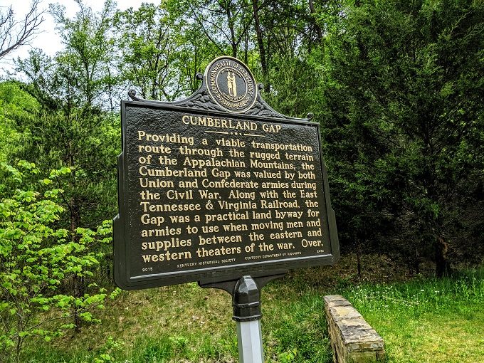
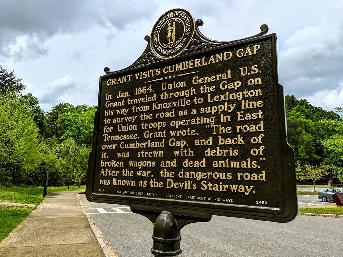
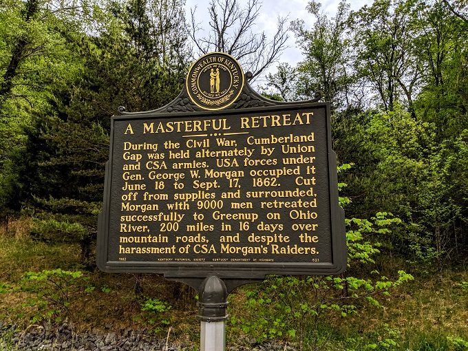
After stopping off at the Visitor Center, we drove about a mile up the road to the Thomas Walker Parking Area which is where a few different trails begin. Cumberland Gap was an important location in the Civil War and the parking lot had some historic markers with more information about what occurred in the area during that time.
Tri-State Peak Trail
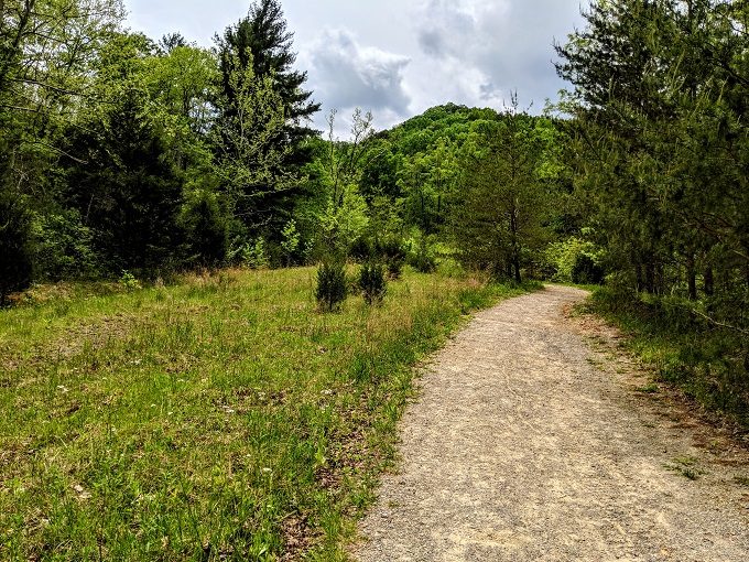
It’s a 2.4 mile round trip when hiking up to Tri-State Peak. The first 0.6 miles of Tri-State Peak Trail takes you along Object Lesson Road.
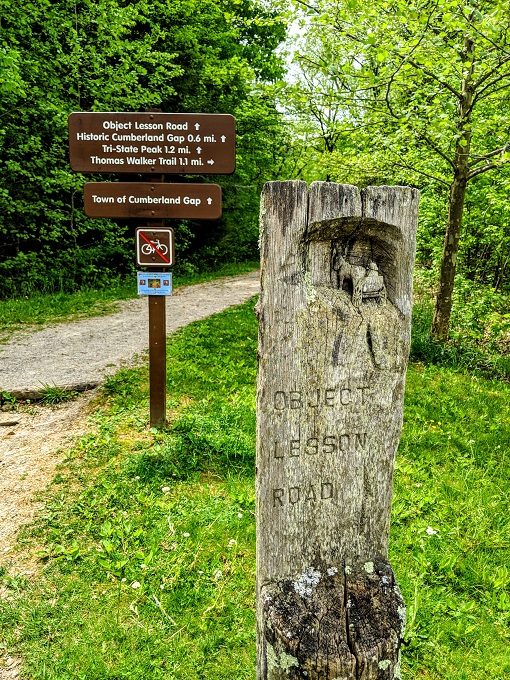
Back in the early 1900s, the US Department of Agriculture paid for short sections of roads around the country to be constructed with smooth, crushed rock. The purpose of this was to demonstrate as an object lesson (hence the name) how much more convenient life would be for voters in rural areas if they had better roads. Object Lesson Road at Cumberland Gap National Historical Park is a roadbed that was constructed in 1907 thanks to that initiative.
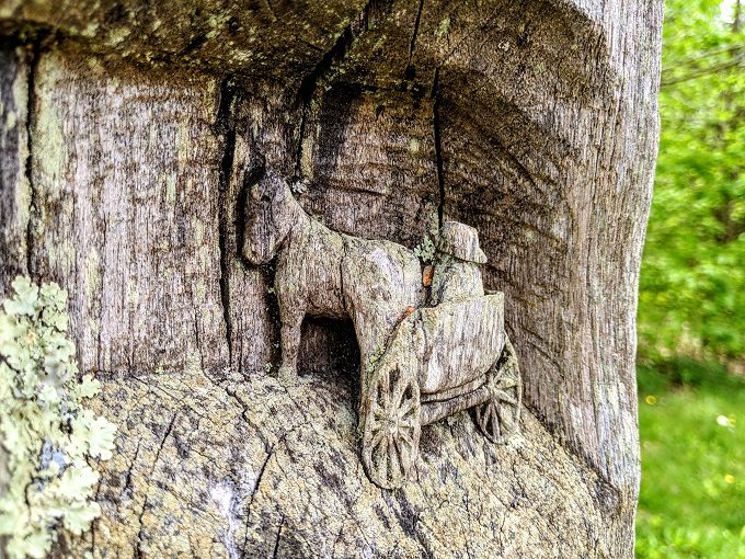
If you visit, be sure to take a closer look at the post in the above photo, as it has a carving of a horse and cart in it.
The road begins with a gradual incline. If you’re visiting on a hot, sunny day, you might want to wear a hat and sunscreen as there’s not much shade along this section.
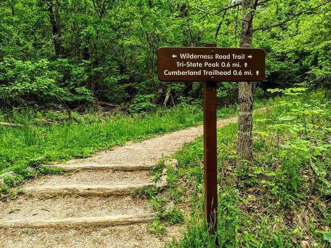
Halfway up to Tri-State Peak you’ll see a route marker on the right hand side, so you’ll want to continue along that trail.
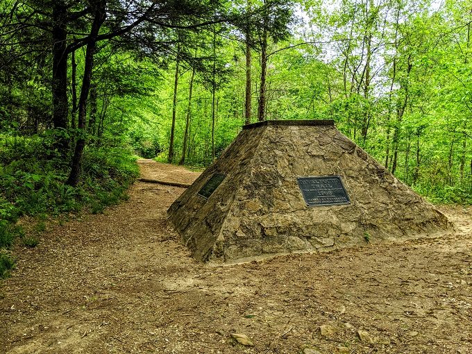
Along the way, you’ll spot a couple of monuments to Daniel Boone. Boone and his team used Cumberland Gap to make their way into Tennessee and Kentucky.
Cumberland Gap’s Civil War History
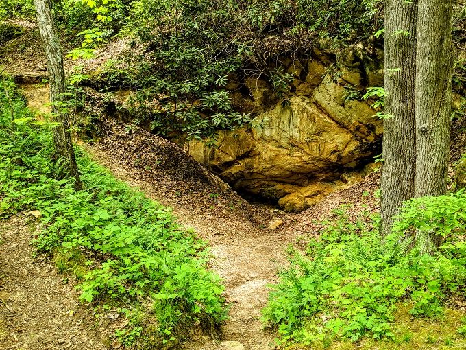
The Tri-State Peak Trail also takes you past a Civil War site of historic importance. There’s a crater off to the right hand side of the trail which was a Union warehouse up until September 17, 1862. An explosion blasted the munitions that were stored there sky-high, with Confederate soldiers subsequently having to wait 18 hours while explosions continued randomly.
There’s a board with more information next to the crater which contains Lieutenant Colonel George Gallup’s account of what happened:
The explosion shook the mountains like a toy in the hands of a monster. The air was filled with dense smoke, so that I could scarcely breathe. Huge masses of rock, cartridge boxes, barrels of powder, and other materials were blown to an indescribable height, and went whirling through the air in wild confusion, falling…a mile from the exploding magazine. A moment later, the burning roof of a building 180-feet-long, used as a store-house…fell in, and set fire to the [cannon] shells stored there.
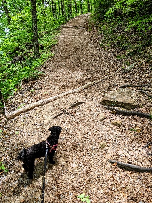
The Tri-State Peak Trail is dog-friendly, so Truffles thoroughly enjoyed coming along for the hike. One thing to be aware of is that even though it’s only 1.2 miles to Tri-State Peak, it’s uphill the entire way. It’s therefore much more tiring than you’d expect a 1.2 mile hike to be.
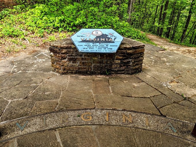
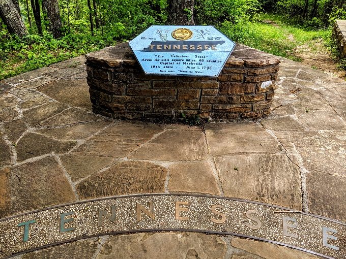
Tri-State Peak
The effort is worth it though as you’ll eventually reach Tri-State Peak.
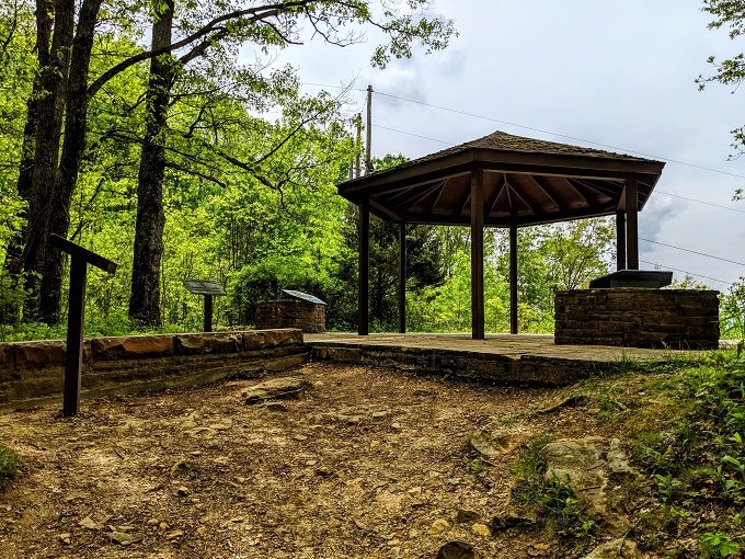
The base of the shelter is divided into three sections – Kentucky, Virginia and Tennessee.
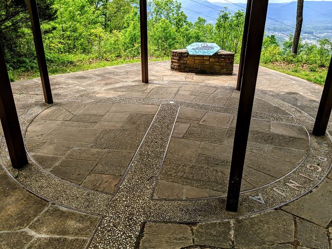
Each state has its own markers with a little bit of information about the state. I was surprised to learn that Kentucky and Virginia cover a similar area – for some reason, I thought Virginia was more than just 1% larger than Kentucky.
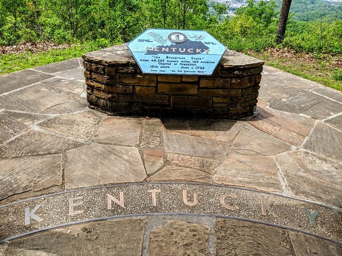
The good view you get from the top looks out over Kentucky.
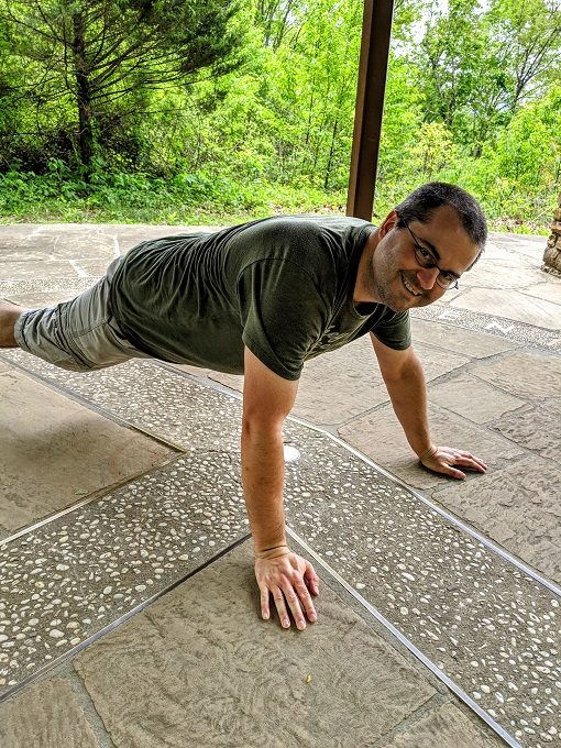
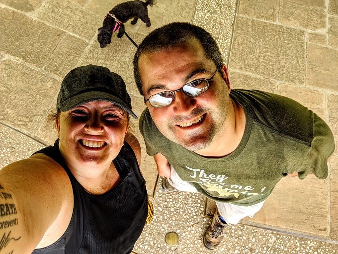
We were faced with a dilemma though. With three states but only two feet, how were we to step foot in all three states at one time. It was time for all hands (and feet) on deck:
With four paws, we’d hoped Truffles would be able to stand in all three states at the same time but alas, her little legs didn’t allow it. She therefore sniffed around all three states while we took a selfie.
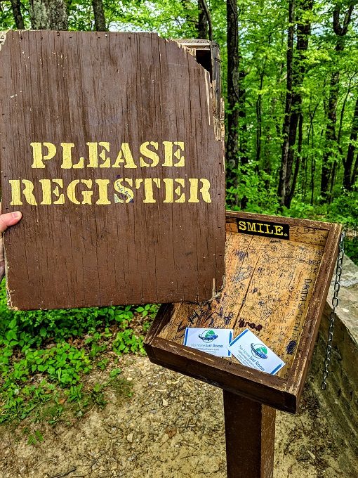
We stopped there for some lunch, then went to register our visit in the logbook. There was no book to be found though, so we did the next best thing.
The good thing about the hike there being straight up is that the hike back to the parking lot is straight down.
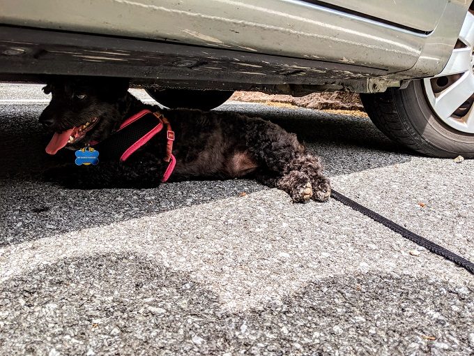
While Shae and I changed out of our hiking boots, Truffles took advantage of being so small by sitting in the shade beneath the car. Apparently she deemed her hind paws as being in need of a tan though…
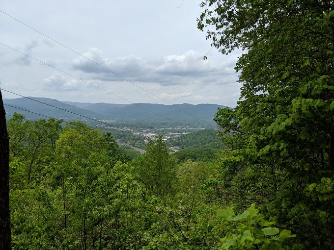
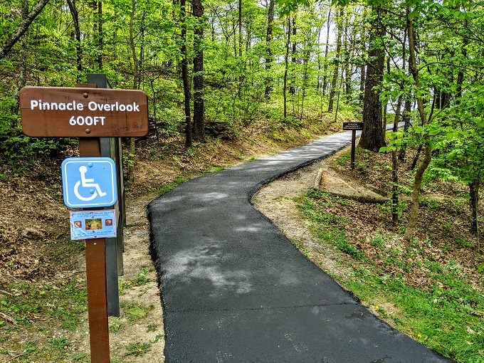
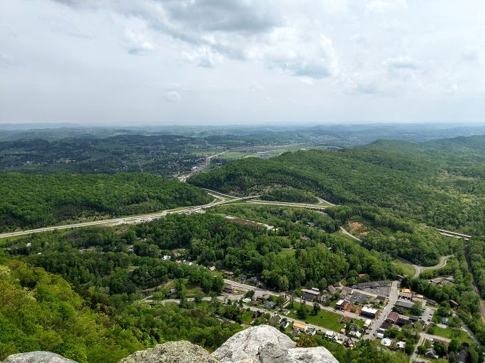
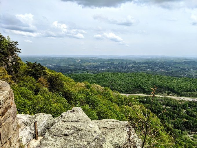
Pinnacle Overlook
While hiking up to Tri-State Peak and back down, you might see an offshoot trail leading up to Pinnacle Overlook. If you don’t feel like extending your hike, be sure to drive up there instead.
From the parking lot at Pinnacle Overlook, it’s a short path that you can do in flip-flops if you wanted (which I did). From what I can remember, I think the length of it was also wheelchair friendly.
As the name suggests, Pinnacle Overlook provides some great views of the area. In the photo below, you can see Fern Lake in the distance which is in Kentucky. To the left is Tennessee, with Virginia being in the bottom-right corner.
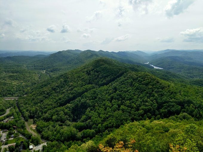
We’ll be visiting Tennessee in November and December of this year, so we’ll be seeing much more of the view below.
Final Thoughts
Hiking up to Tri-State Peak and getting to stand in three states at once was fun and definitely worth doing. Although the hike was fairly easy in that the path was mostly flat, it was more strenuous than expected because of it being all uphill with no respite. Rounding it off with a trip to Pinnacle Overlook made it worth visiting even more.
A couple of other nice features of visiting Cumberland Gap National Historical Park is that it’s free to enter and the trails are pet-friendly – two things we always appreciate on our road trip.
If you’re looking for other things to do in the area, be sure to check out everything that we got up to / get up to in Kentucky, Virginia and Tennessee. We’re spending August/September 2019 in Virginia and November/December 2019 in Tennessee, so the archived posts for those states will be much more complete by the end of the year.
I LOVE your blog! I’m getting ready to make a post about the Tri state peak trail myself. We hiked it on a whim one day, and were not prepared for all the uphill walking, lol. But it’s def a cool place! The pinnacle overlook is beautiful!
Yep, the uphill has pretty hard going, but it was definitely worth it – I’m glad you had a great time there!
When was the tri state peak built for people to see
I’m afraid I’m not sure when they placed the markers at the peak. There’s a sign designating the Royal Colonial Boundary of 1665 as a National Historic Civil Engineering Landmark which was designated in 1989, but I don’t know if the markers were there any earlier than that.