It took three attempts over the course of two separate days and 17 miles of hiking, but I finally made it to Dog Slaughter Falls in Daniel Boone National Forest, Kentucky.
There are different reasons as to why the first two hikes didn’t lead to Dog Slaughter Falls, so I was grateful that there was an alternative route there.
Here’s what happened the first couple of times we tried hiking to this waterfall and how I ultimately reached them.
Attempt 1
When Shae asked what I wanted to do for my birthday, I said that I wanted to go hiking. She did a little research and found out that Cumberland Falls State Resort Park (which is located inside Daniel Boone National Forest) not only had Cumberland Falls but also a 7 mile round trip hike to a waterfall called Dog Slaughter Falls.
We were staying in London, Kentucky which is about 30 miles away from Cumberland Falls State Resort Park, so it didn’t take too long to get there.
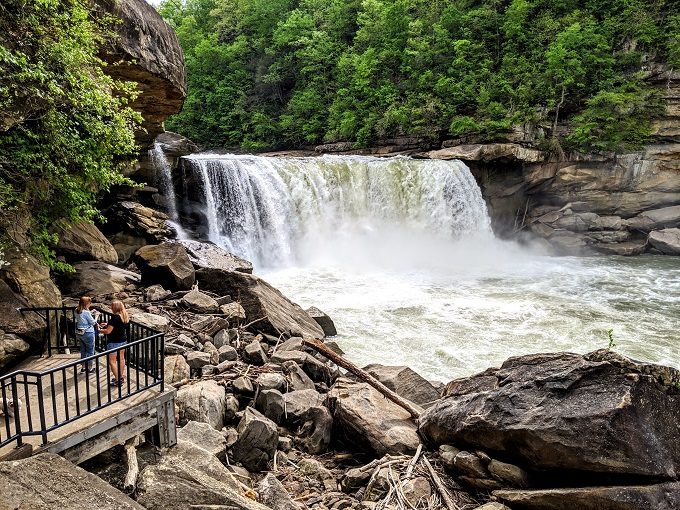
If all you want to do is see Cumberland Falls, it’s only a short (and wheelchair friendly) walk alongside the Cumberland River and down to the observation decks – more on those falls later.
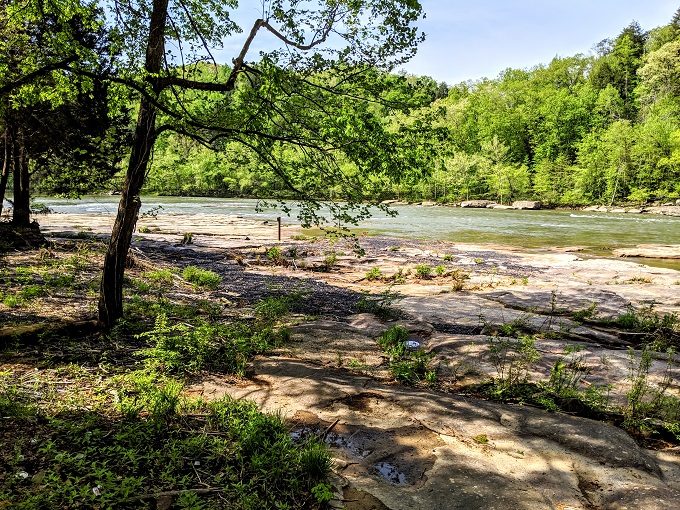
We bypassed Cumberland Falls as we wanted to get our hike underway and planned to check them out afterwards. Shae and I – and our dog Truffles – therefore made our way down to the start of the Sheltowee Trace Trail.
As you can see in the photo below, it’s a 3.5 mile hike to Dog Slaughter Falls when starting at Cumberland Falls, so a 7 mile round trip.
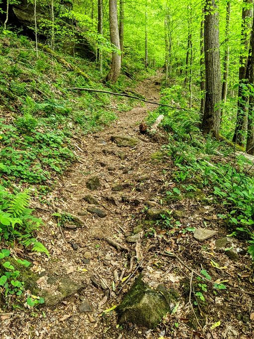
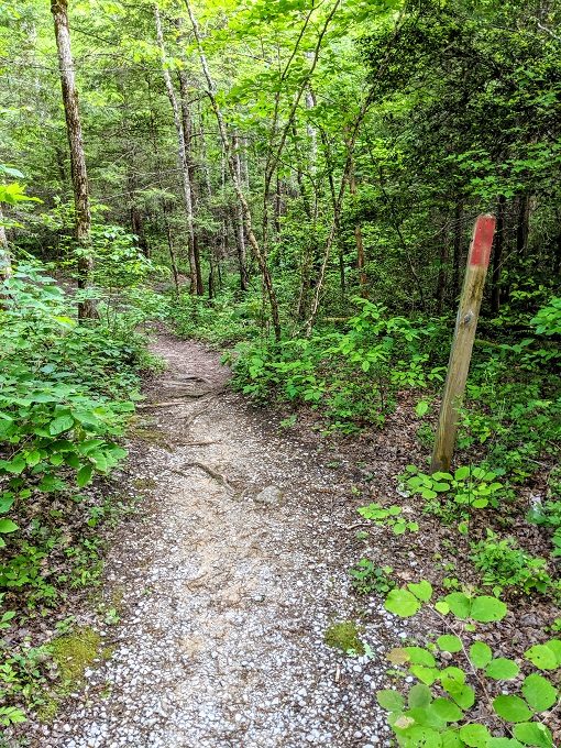
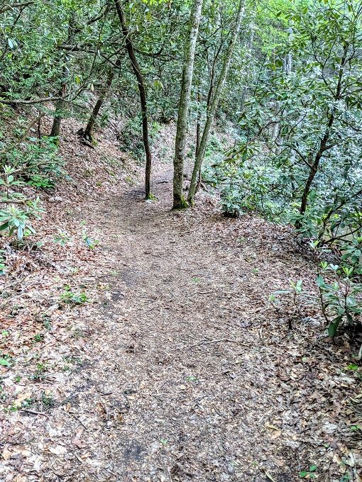
The Sheltowee Trace Trail is a moderate trail, although it’s on the upper end of moderate. There aren’t too many level sections of the trail, but it’s thankfully up and down rather than straight up like our hike up to Tri-State Peak was a few days later.
It was pretty warm that day (82°F/28°C), but the temperature on the hike was much more reasonable than we’d expecting which I think is helped by three features. The trail is pretty well shaded the entire way, most of it goes alongside the river and the bluffs rising on the right help keep it cool.
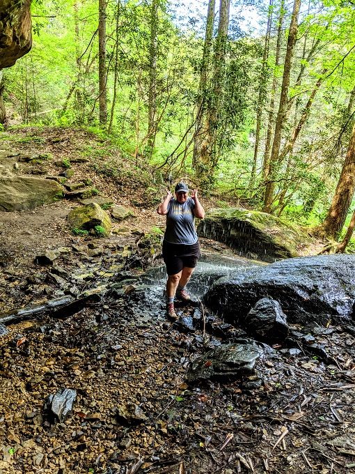
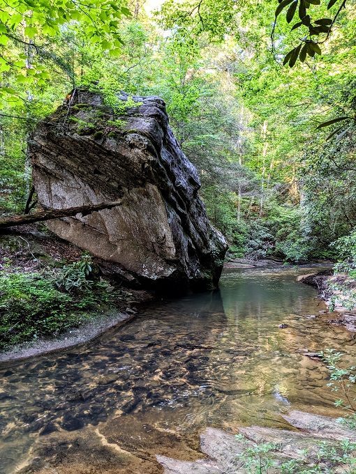
Despite all that, Shae and I still decided to cool off a little beneath a waterfall along the way.
We hustled along the trail as quickly as we could because Shae had to be back to our hotel by 5pm to teach a class online. We were therefore grateful when we came to a sign advising that there was only one mile left to go until we reached the falls.

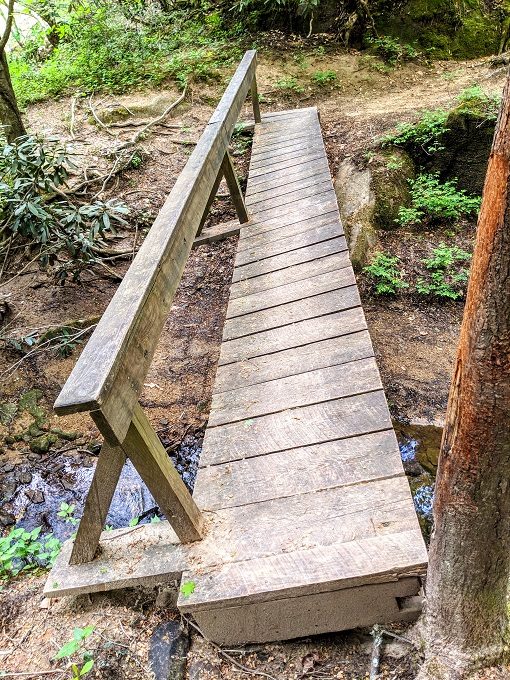
Fairly shortly after that, the trail took us across a wonky bridge. It’s not too bad crossing it when it’s dry, but be careful when it’s wet as I almost slipped off when returning a couple of weeks later. It’s something like a 6 foot drop into the rocky creek below, so you could get a nasty injury if sliding through.
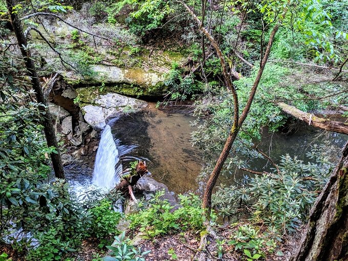
We eventually turned off the Sheltowee Trace Trail to the right to start walking up the Dog Slaughter Falls Trail. We reached a section where water was flowing down, although it didn’t really look like much of a waterfall. I’d noticed trail markers continuing uphill, so I wondered if there was more to see up there. However, time had ticked down and we had to make our way back along the trail if we were going to get back in time for Shae’s class.
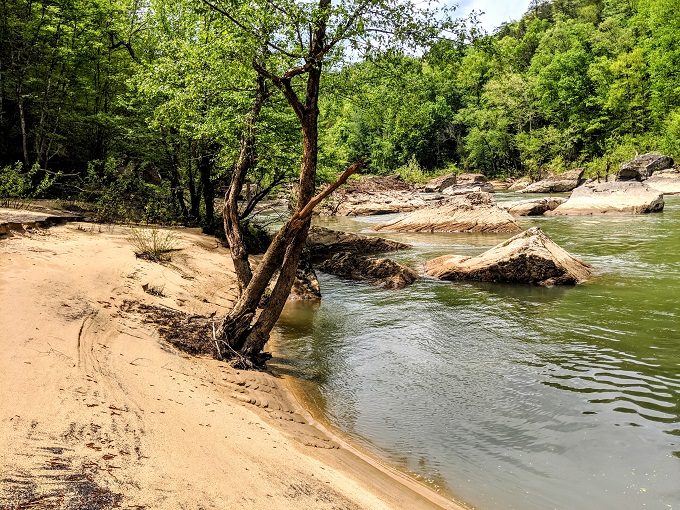
Even though we were in a rush, we stopped for a few minutes to have lunch as it was 2pm by that point. There was a nice beachy area along the river, so that seemed like a perfect place to stop.
The hike back seemed to go a little more quickly than it had out towards Dog Slaughter Falls, so I think it must be a little easier in that direction.
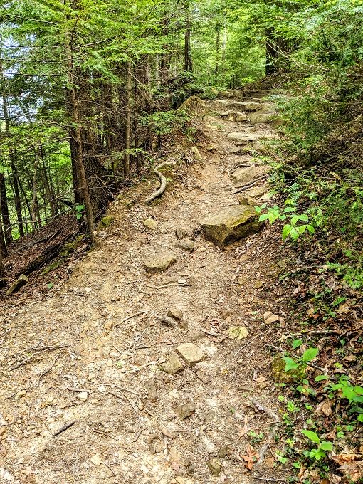
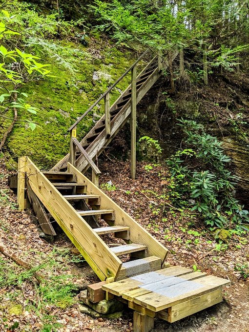
The hardest part of the trek back was probably walking up these steps. They might not look like much in the photo, but they go further up than it appears and they’re very steep.
We made it back in better time than expected, so we had a couple of minutes to wander down to the observation decks to check out Cumberland Falls.
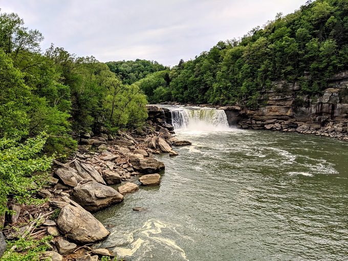
There are a few different observation decks from which you can view the falls.
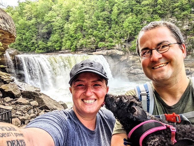
After taking a family selfie, we walked back up to the parking lot and headed back to our hotel.
Attempt 2
A couple of weeks after our visit, I was working on the photos of Cumberland Falls for a blog post and, just out of interest, decided to search on Google for images of Dog Slaughter Falls.
I was gutted.
The photos online showed a beautiful-looking waterfall, so I was disappointed to have missed out.
A day or two after that, I had a fairly open day. Shae had a bunch of things to work on including teaching another online class, so I decided to take Truffles back to Cumberland Falls State Resort Park to redo the hike and walk however much farther was necessary to actually reach Dog Slaughter Falls.
I’d had a couple of things to work on that morning, so didn’t leave until just after lunch. We were in Lexington by this point, so it was also a 90 minute drive there rather than the ~35 minutes it took when we were staying in London. Truffles and I therefore didn’t set off on the hike until about 2:45pm.
The first thing I noticed when we arrived was how much higher the Cumberland River level was. That was reflected in the noise too, as the significantly stronger current made the Cumberland Falls much louder.
We set off on the Sheltowee Trace Trail again, but encountered a problem fairly early on.
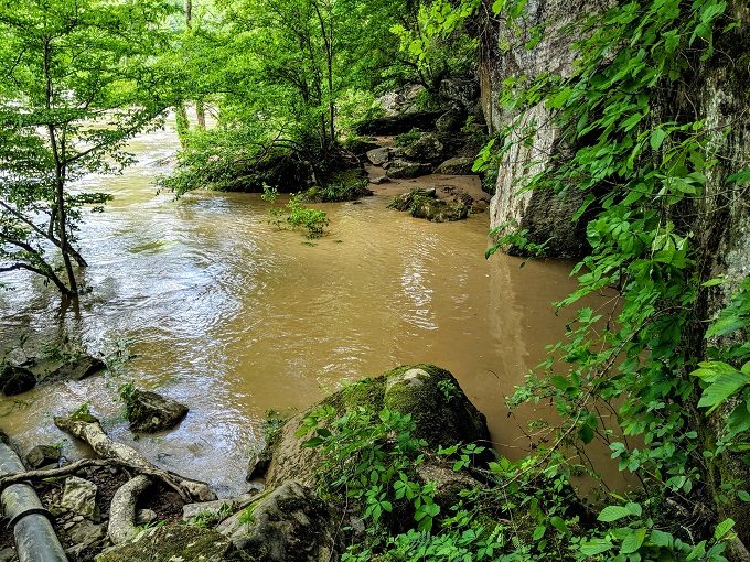
Our path was flooded.
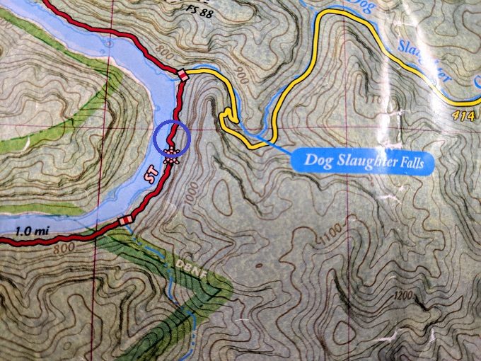
I thankfully had the trail map on me that we’d gotten on our previous visit. The visitor center charges $1 for the map rather than giving them away free, but it’s definitely worth the investment.
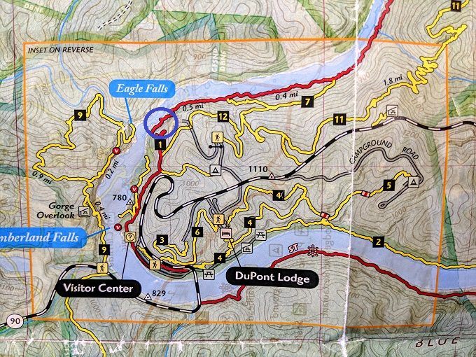
I was therefore able to check the map and find an alternative route. The blue circle in the photo below is where the trail was flooded. I think it was where the path juts out as it’s where you have to walk much closer to the river.
That meant we had to retrace our steps and walk back up the steep staircase I mentioned earlier. We subsequently had to take the 12 and 7 trails until it met back up with the Sheltowee Trace Trail (the red trail).
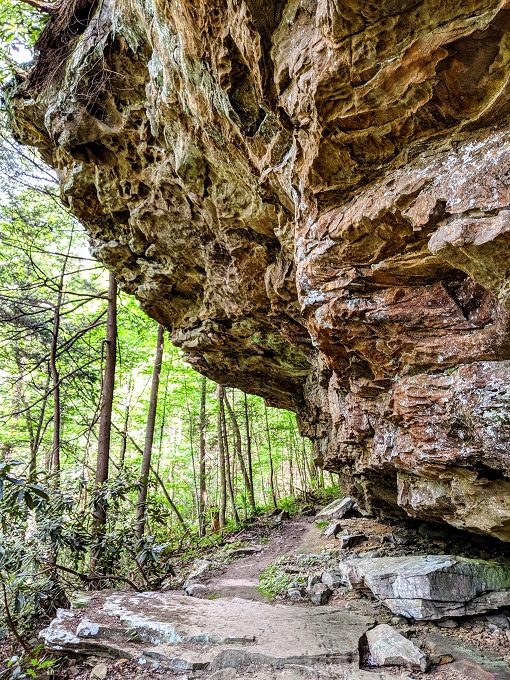
With the backtracking and the slightly longer route round, it probably added a mile or so to our journey. It wasn’t terrible though and meant I got to see a different part of the park.
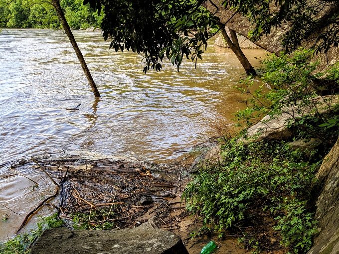
I did get a little concerned at one section as the trail took me along the sand by the river. The river level was very close to the path, so I was worried it might be underwater when we walked back.
I therefore picked up our speed while continuing along the trail. As we neared the section where you turn off the Sheltowee Trace Trail and on to the Dog Slaughter Falls Trail though, my heart sank.
The trail was flooded again.
This was a huge problem as there was no other trail I could take at this point. It was either go through the water or head back.
It might’ve been possible for me to wade through, but I decided against it in the end. For starters, the thought of hiking another ~3.5 miles in wet boots wasn’t appealing.
Even more concerning was the safety aspect. I’d have had to carry Truffles as she’s only 10bs and so wasn’t tall enough to make it through. With the strong river currents, I was also worried that losing my footing could lead to us being swept away.
That could only mean one thing – we’d have to give up on seeing Dog Slaughter Falls. Cursing (quite literally!) my luck, we began the long trudge back.
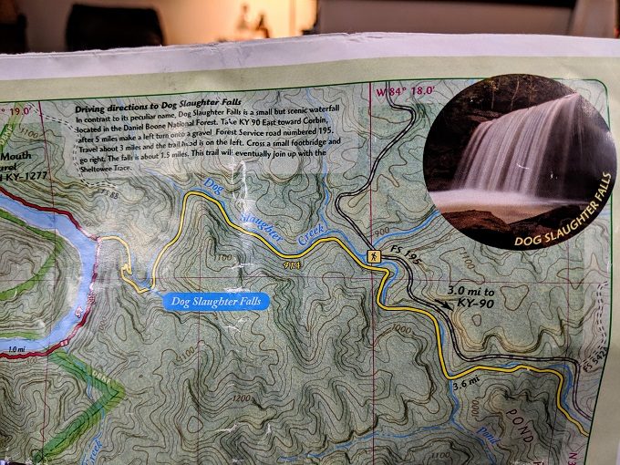
The map below shows how close we were. The blue circle marks the flooded section; from there, it would’ve been less than half a mile to the falls.
While walking back, I took a look at the map to see if we could reach Dog Slaughter Falls from any other direction. After driving 1.5 hours and hiking another 7-8 miles on top of the 7 miles we’d done during our initial visit, I was determined to see the falls if it was the last thing I did!
I was in luck. In the top corner of the map, there was a small box providing driving directions to Dog Slaughter Falls.
It would involve hiking another ~3 miles that day on top of the 7 miles we would’ve done by then. I was up for it – I just hoped that Truffles’s short legs would last that long! The longest hike she’d ever done at that point in time was 8 miles, so 10 miles could be pushing it. She still seemed perky on the way back to Cumberland Falls though, so I decided we’d give it a try.
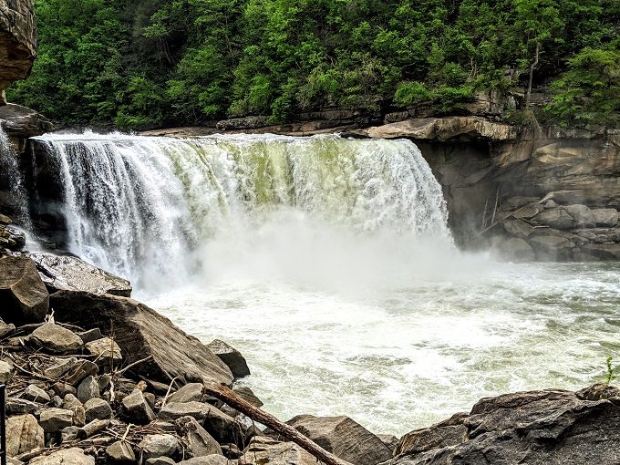
Speaking of Cumberland Falls, we stopped at the bottom observation deck for a quick photo.
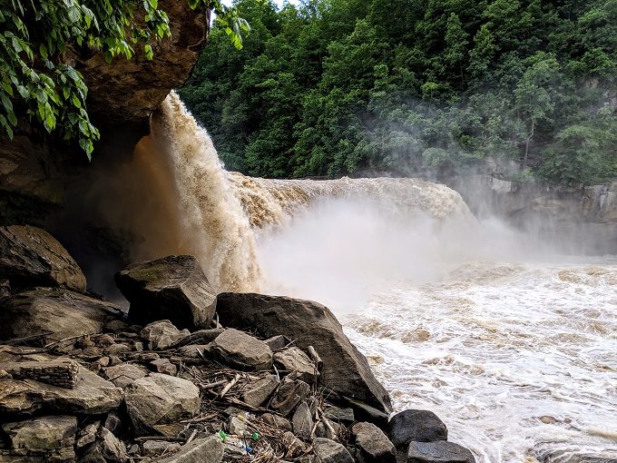
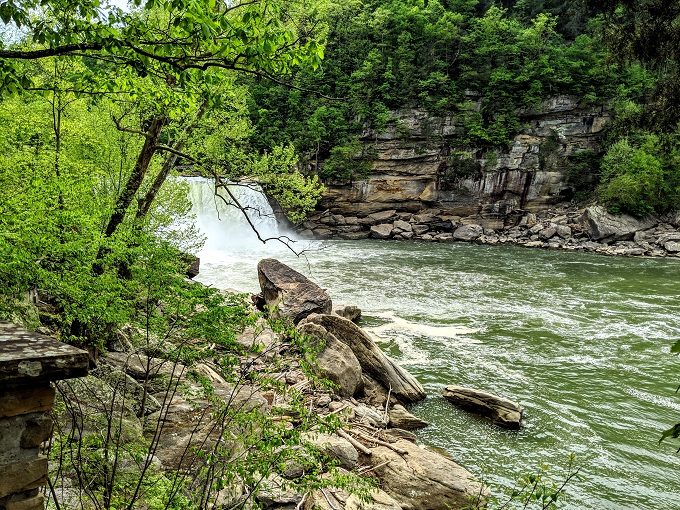
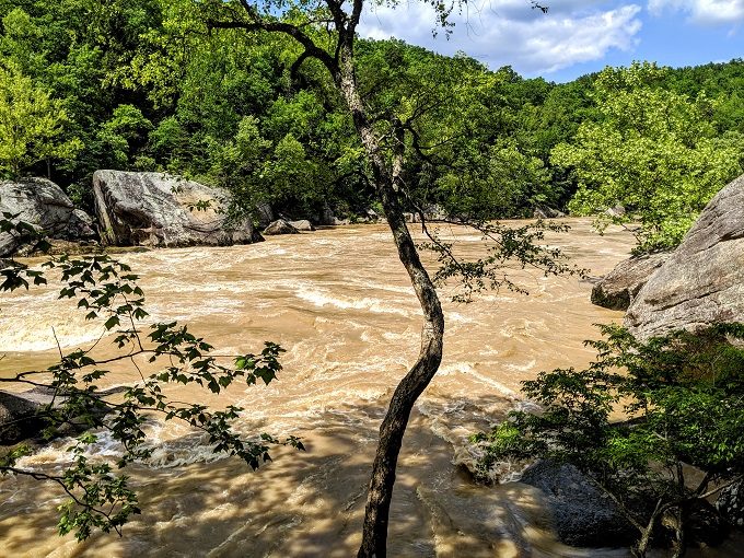
To give you an idea of how much stronger the water flow was, here’s a photo from the same spot a couple of weeks earlier.
As you can see, not only was it much stronger, but the raging waters had churned up so much sediment that Cumberland Falls was brown on my second visit.
Attempt 3
I’m directionally challenged (i.e. I’m pretty bad following driving directions), so I was a little worried that I’d not end up in the right place if I simply followed the driving directions noted on the map.
As always, Google Maps came to my rescue. Before leaving the Cumberland Falls parking lot, I was able to find Forest Service Road 195 in the app and pinned the general area where the trailhead was due to be.
In the end, I found my way there pretty easily. The directions they gave on the map were accurate as it’s about 2.9 miles down FS 195. Be careful driving down that road though as it’s covered in potholes. Many of them were pretty hard to see until we were almost on them, so I was grateful to not end up with a flat tire.
As you drive down, also keep an eye out for a fairly deep gully in the road on the right hand side. It’s very deep and I narrowly avoided it, otherwise our car could’ve been in bad shape.
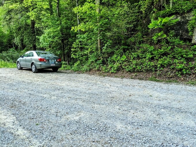
Ultimately though, we arrived at the small parking area by the trailhead in one piece. There are small inlays on either side of the road which are large enough for 2-3 cars on each side.
Here’s a link to the GPS coordinates of the parking area on Google Maps in case you’d like to get driving directions.
We arrived at the parking area just after 7pm. With sunset due to be at 8:37pm, we only had 1.5 hours to make it to Dog Slaughter Falls and back, so we got our hustle on.
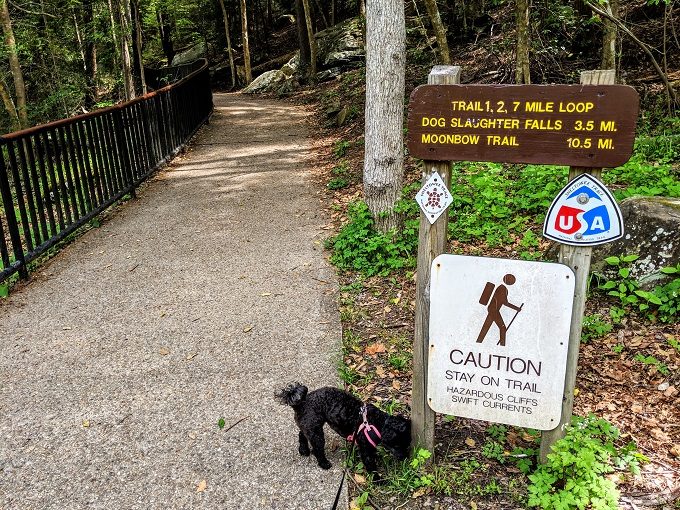
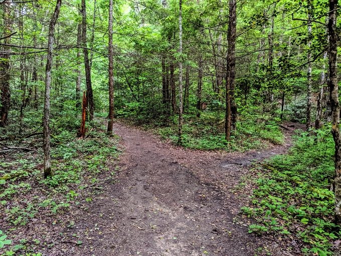
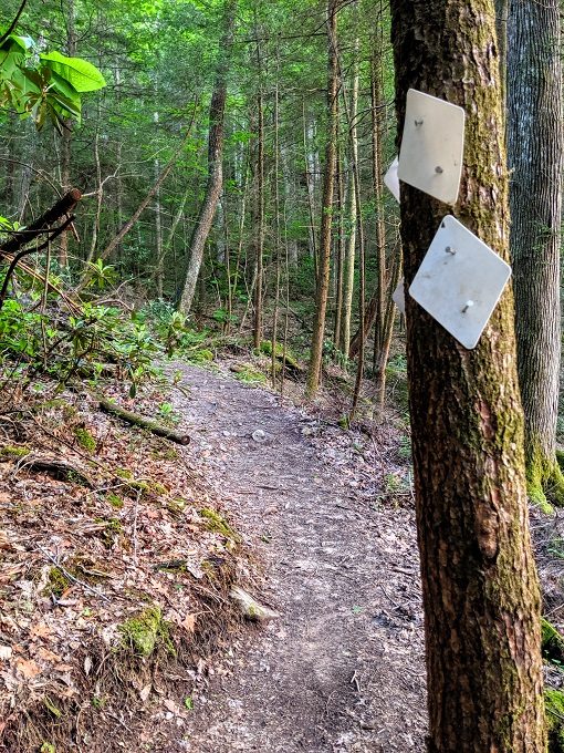
The trailhead is on the left side of the road. There are two different paths, so take the one on the left with the red trailhead marker.
It won’t be long before that path branches off again, so take the left path.
You’ll soon arrive at a footbridge, so cross over that…
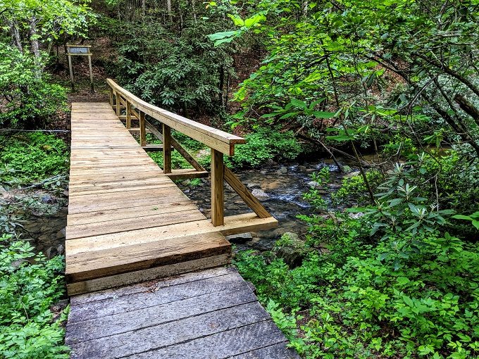
…and you’ll be greeted by a sign directing you off to the right which is the Dog Slaughter Falls Trail.
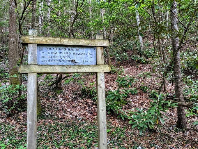
I’m not entirely sure how long the Dog Slaughter Falls Trail is. The sign above said 1 mile to the falls, whereas the map from Cumberland Falls said 1.5 miles. Based on how long it took us to hike it, we’ll go in the middle and say it’s 1.25 miles.
The trail itself is fairly straightforward. It’s a clearly defined path and doesn’t really have any offshoots, so there’s little concern that you’ll head off in the wrong direction. The trail is also marked with white trail blazes.
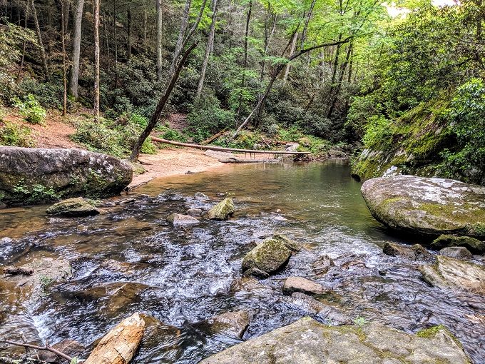
If nothing else, you could just follow Dog Slaughter Creek as the trail runs alongside it most of the way.
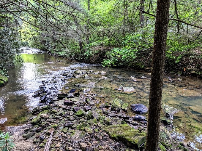
With the picturesque, babbling creek to our right, it made for a lovely walk.
Despite having already hiked 7 miles that day, Truffles was a real trooper and didn’t lag behind. That meant we made good time and it didn’t seem long before we heard the sound of the falls.
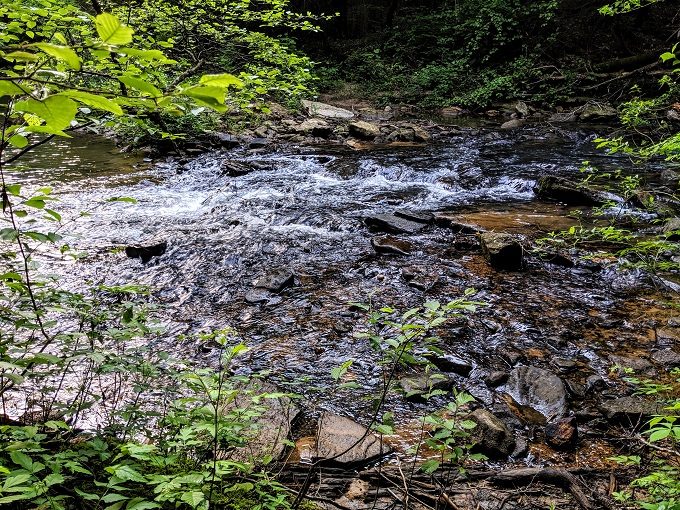
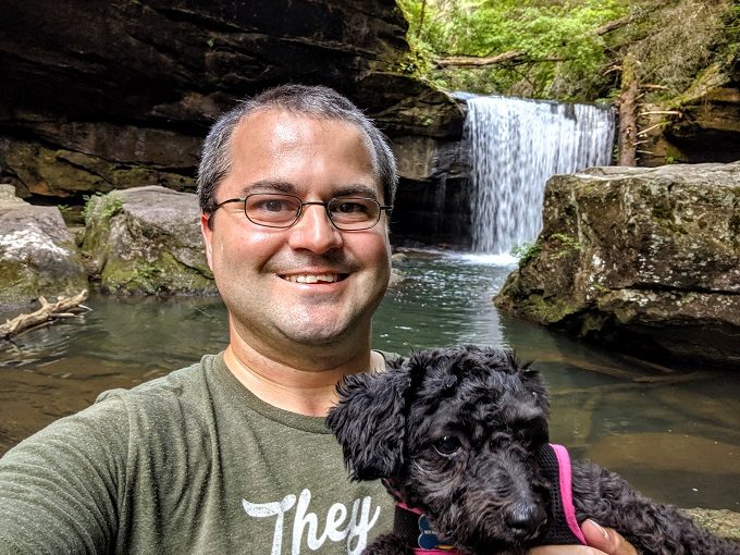
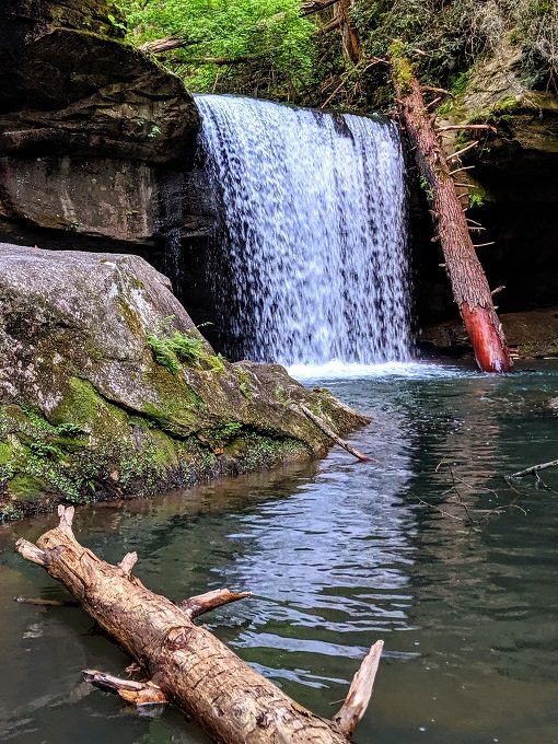
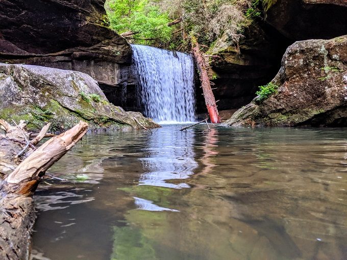
Sure enough, there they were. After three attempts, we’d finally made it to Dog Slaughter Falls!
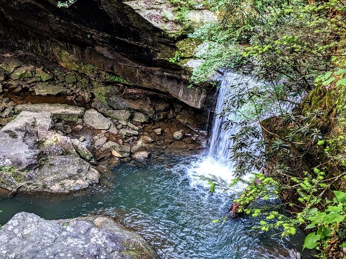
You arrive at the falls from above, but if you follow the trail along, there’s an obvious path to get down closer to them.
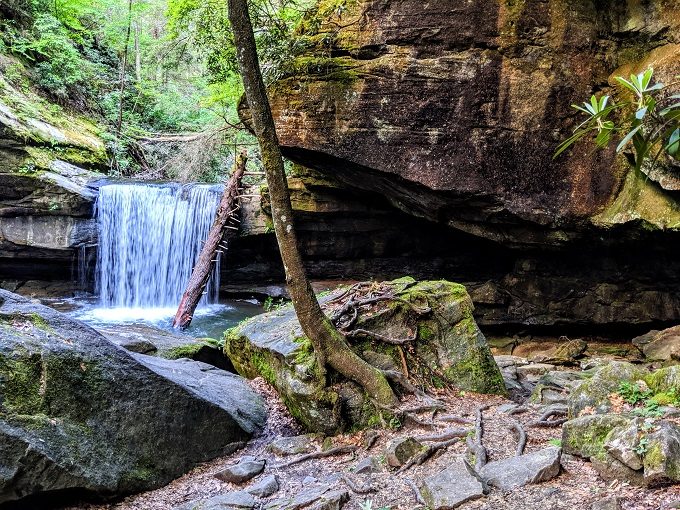
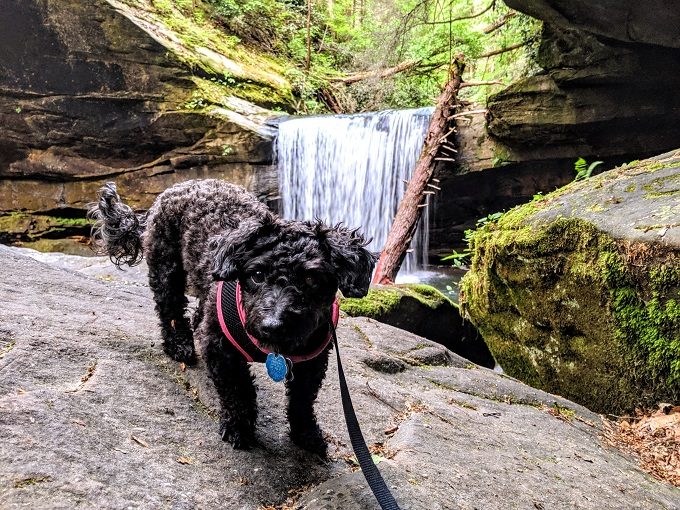
I scooped up Truffles and walked on to a rock for a daddy/daughter selfie.
I then attached her leash to my hiking backpack so that she wouldn’t wander off, then hopped over a few rocks to get photos from a few different angles.
It reminded me of our visit to Mize Mills Falls in Bankhead National Forest in Alabama. I think I preferred Mize Mills Falls to Dog Slaughter Falls as the former felt a little more magical. Mize Mills Falls also felt enclosed on all sides, giving more of a secluded feeling.
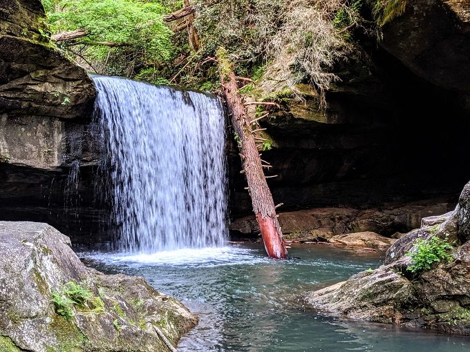
There was a tree trunk in the water leading to some rocks that were closer to the falls. If Shae had been with me, I probably would’ve tried traversing it. Being by myself though and with no cellphone reception, I decided not to risk it in case I slipped and fell.
Looking away from the falls, I wondered how close we’d come on our first visit.
It was about 7:50pm by that stage though, so we only had just enough time to get back to the car before it got dark. After taking a couple more photos, we headed back along the trail.
Given the name of the falls, Truffles didn’t seem too impressed. Despite that, she’d been willing to hike 10 miles that day to humor me, so she got a Greenie when we got back to the hotel, as well as a decent-sized helping of roast beef I picked up for dinner from Arby’s on the way back.
Final Thoughts
It took 3 attempts on 2 different days, 255 miles of driving and 17 miles of hiking to finally see Dog Slaughter Falls.
So the big question is – was it worth it?
I’d say yes. In theory, I’d have preferred to have not had to go on three separate hikes in order to see them. Having said that, all three hikes were enjoyable, other than the initial disappointment on the second hike when the trail was flooded.
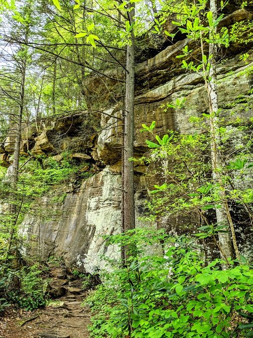
Each trail I took was beautiful in its own way. The first attempt took us along the Cumberland River the entire way and included an additional waterfall. The second hike took me on a different route and featured more bluffs and caves. Walking alongside the Dog Slaughter Creek on the third and final hike was stunning and a (somewhat) relaxing end to the day.
If you want to visit Dog Slaughter Falls and you’re interested in a more strenuous hike, take the Sheltowee Trace Trail that sets off from Cumberland Falls State Resort Park. The 7 mile round trip hike is worth it, but if the water level of the Cumberland River is high when you arrive, check with the visitor center before setting off to check if the trail is flooded.
If you want an easier hike, take the Dog Slaughter Falls Trail as that’s only 3 miles round trip. Just take it easy when driving down there as the road could do damage to your car.
Either way, Dog Slaughter Falls is definitely worth a visit, no matter how you reach it.
[…] legs, our six mile hike was nothing to her seeing as she did a much more difficult 10 mile hike to Dog Slaughter Falls in Kentucky earlier this […]