Shae and I have gotten to see some beautiful views while hiking on our 50 state road trip. Mt Pisgah in Vermont, Blood Mountain in Georgia, Quartz Mountain in Oklahoma and many more.
There’s one view in particular which is my happy place though – McAfee Knob on the Appalachian Trail in Virginia.
We first hiked up to McAfee Knob a few years ago when my parents came to visit from the UK. They wanted to visit the Blue Ridge Mountains, so we took them up to Roanoke for a few days and hiked to McAfee Knob while we were there.
The views from the top were stunning, so I was keen on returning to see them again. We recently spent 9 days in Roanoke, so on one of those days we hiked back up to McAfee Knob.
At almost 8 miles round trip with most of the first half being uphill, it’s not the easiest of hikes. It’s worth the effort though as you’re rewarded with views of the Blue Ridge Mountains and the surrounding area that are simply wonderful. Here’s more about what the hike is like.
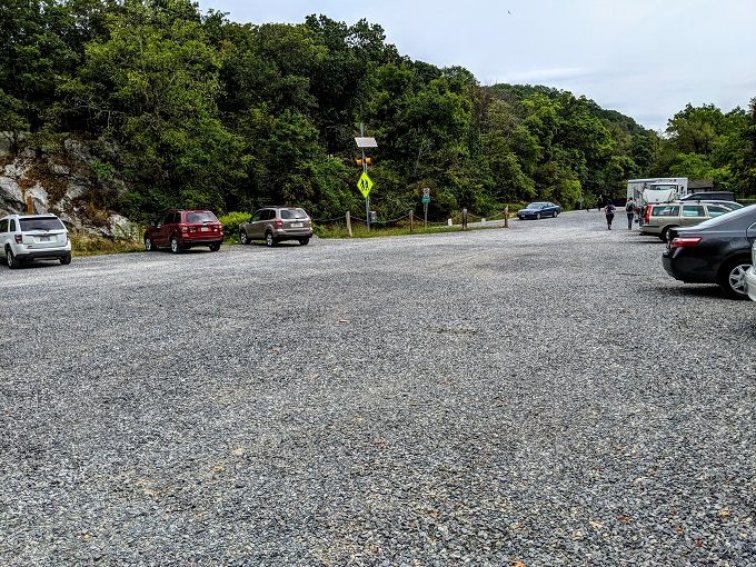
There’s a good-sized parking lot at the McAfee Knob trailhead. You drive uphill for quite a while to get there, so it feels like you might be driving all the way to McAfee Knob, but you’re not!
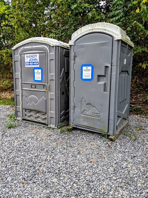
The parking lot has a couple of portable toilets you can use before setting off on a hike that’ll take several hours.
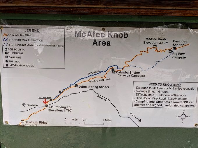
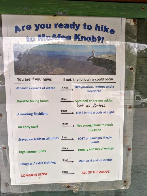
There’s a noticeboard in the parking lot with a map of the trail, hiking advice and some other information and recommendations about the local area.
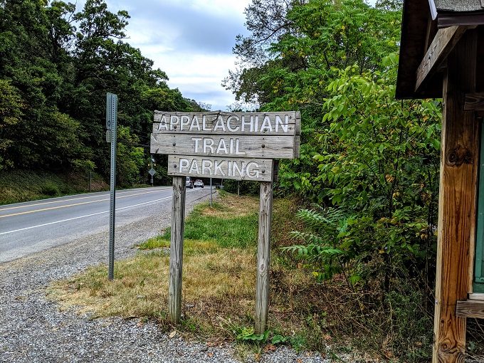
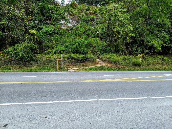
The trail itself starts across the road. It’s a fairly busy road, so be careful when crossing as trucks come downhill fast from the left.
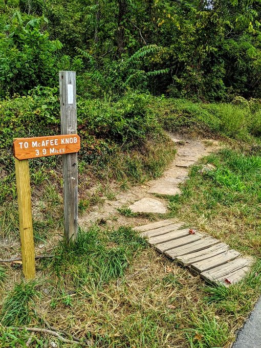
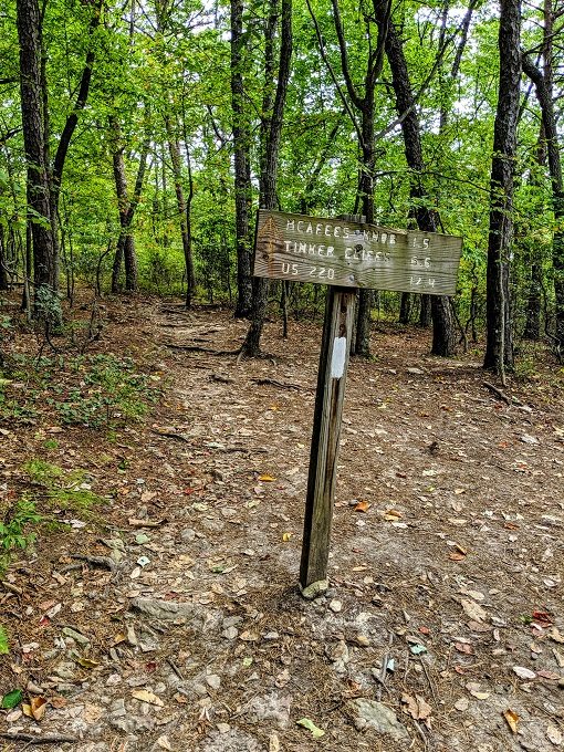
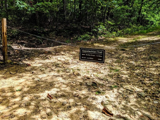
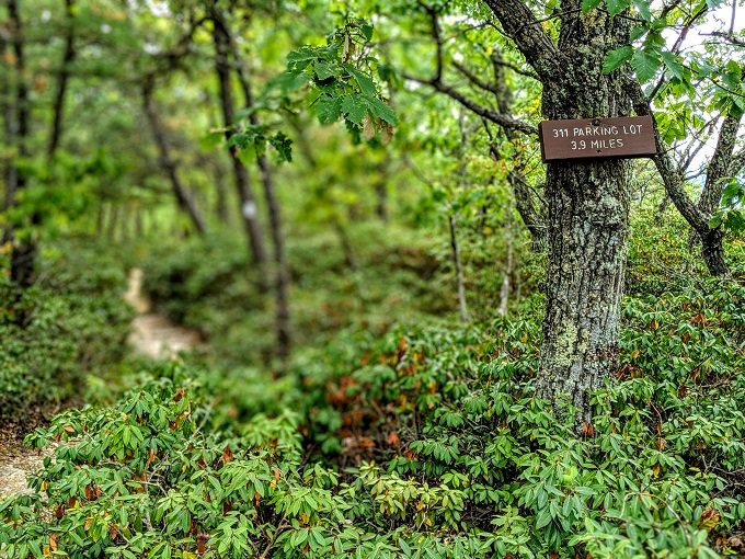
As you can see in the photo below, the hike up to McAfee Knob is 3.9 miles and it definitely feels that long.
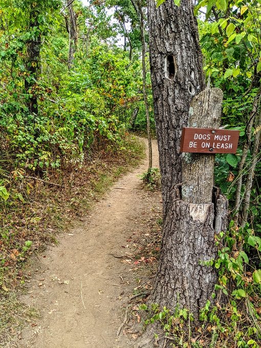
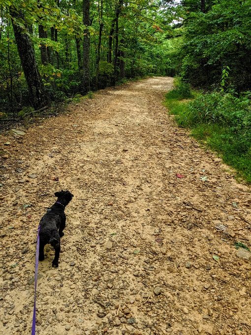
We like hiking with our dog Truffles, so it’s nice that this is a pet-friendly trail. Dogs have to be on a leash which isn’t a problem for us as we don’t trust Truffles enough to not go running after a squirrel if she was off-leash.
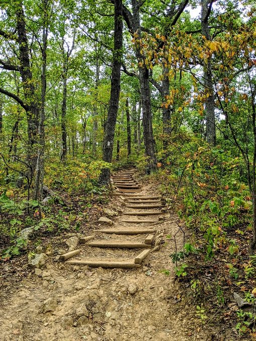
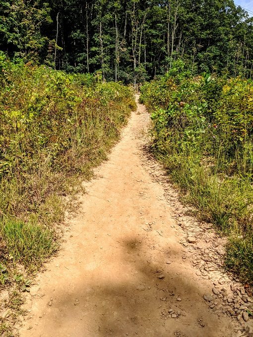
The start of the trail gives you a taste of what’s to come as you’ll find yourself heading uphill.
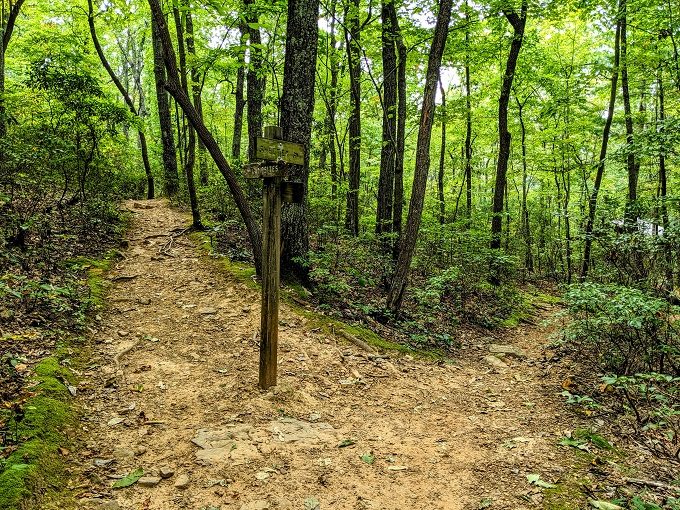
After half a mile, you’ll come to a signpost directing you left to head south or right to head north. At first we were going to head right because we figured north would take us up. Then I realized that heading up the mountain wasn’t necessarily based on a compass direction. After all, north was heading downhill whereas south was heading uphill.
Thankfully, we worked out the correct route before heading on the south route as north was indeed the correct way to go. For starters, there were white trail blazes heading north which is what we were following.
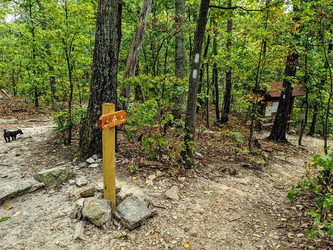
In addition to that, there was a sign attached to a tree in the distance (you can see it in the photo above on the right). That confirmed that the way up to McAfee Knob was along the north route, even though it headed downhill at first.
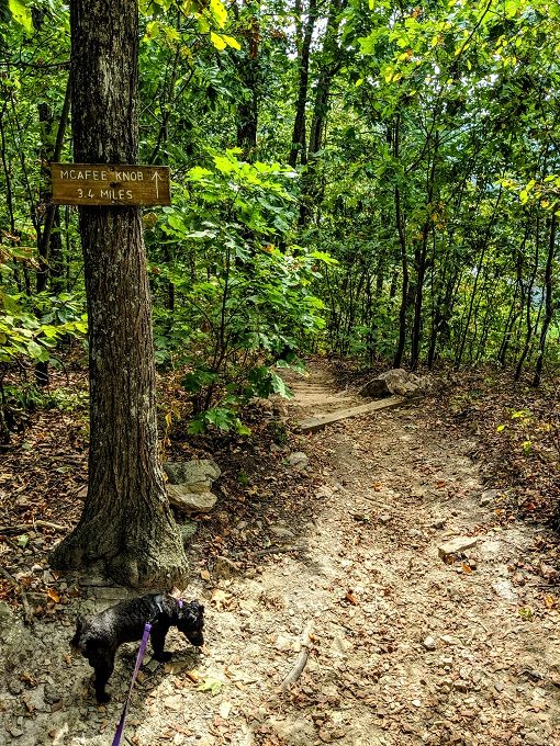
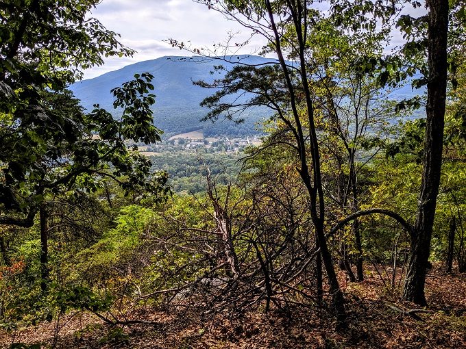
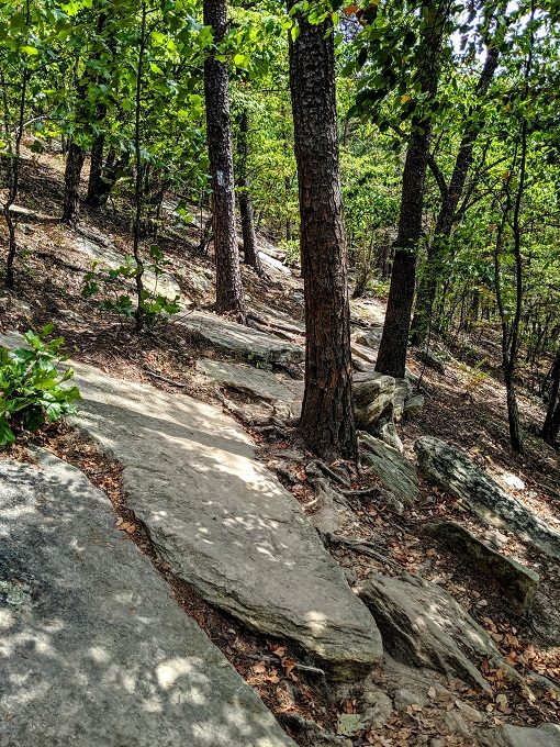
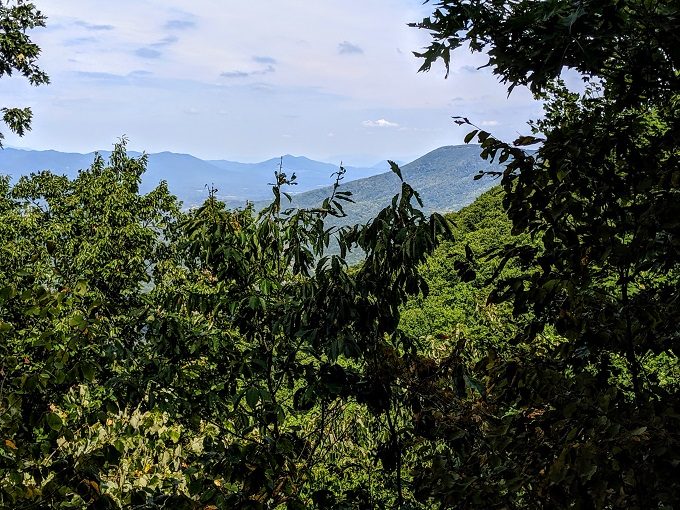
Continuing along the trail, we started getting some glimpses of the views to come.
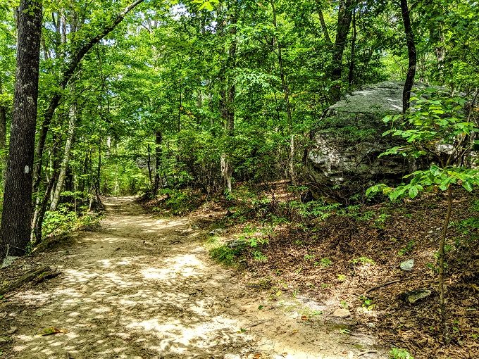
The hiking tips on the trailhead’s noticeboard recommended wearing hiking boots. That’s definitely a good idea as there’s a lot of uneven terrain where it’d be easy to turn your ankle or slip.
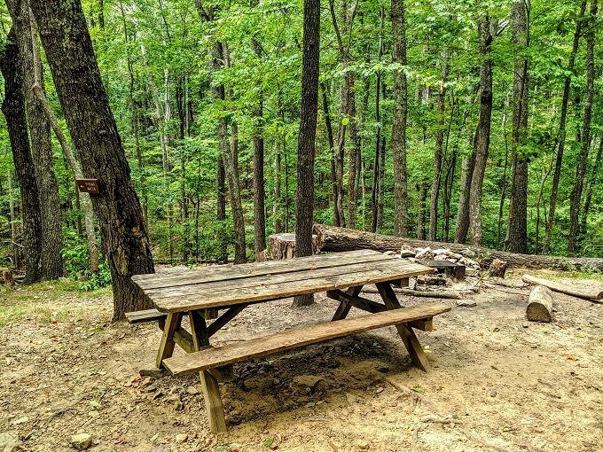
About halfway along the trail you’ll come to the Catawba shelter off to the right.
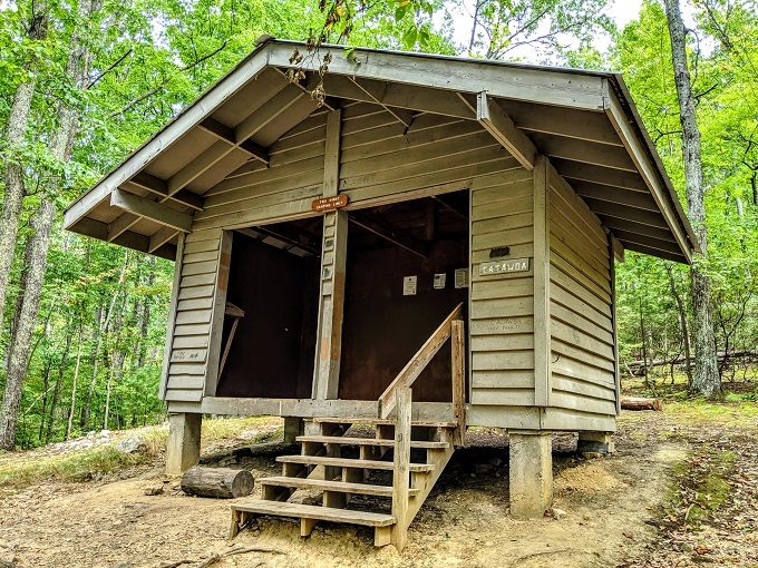
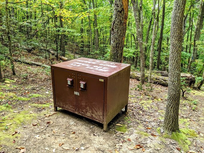
Along with the shelter, there’s a picnic area and food storage containers for people hiking and camping along the Appalachian Trail to keep bears away from their food.
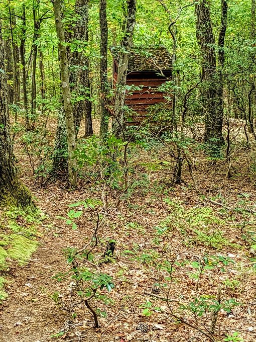
A little further up the trail there’s an outhouse…
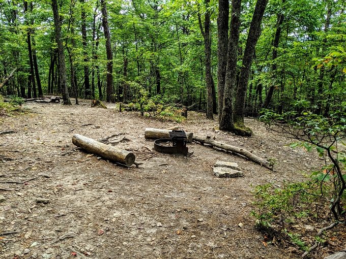
…along with the Catwaba campsite.
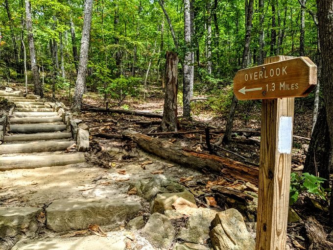
While I’d class the hike to McAfee Knob as moderate rather than difficult, it is very strenuous. We were therefore pleased when we saw a sign saying there were only 1.5 miles to go.
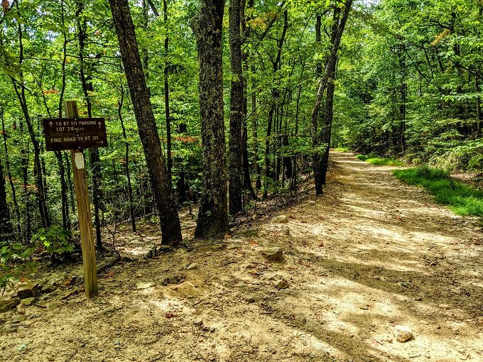
Shortly after that you cross over the Fire Road. This is an alternate route up and down the mountain which is easier than the main hiking trail.
It’s just over 1.25 miles to go at this point and most of it is uphill.
One of the nice things about the hike to McAfee Knob is that it’s in the shade pretty much the entire way. Summer in Virginia gets hot, but the temperature that day was much more bearable thanks to being shaded.
Well, apart from one short section that has no tree cover. We walked much more quickly along this ~100 yard stretch as the sun beating down wasn’t where we wanted to be.
Continuing on the trail, you start getting some more glimpses of the views to come.
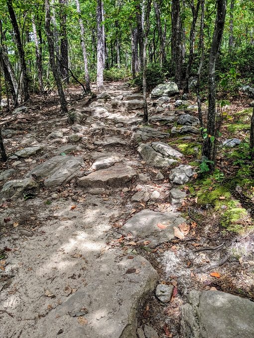
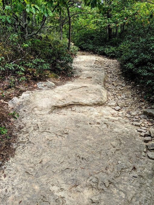
You’ll soon start seeing some giant boulders on your right. This is good as it means you’re only about 10 minutes from the overlook.
Continue following the rocky path…
…which will take you off around the corner.
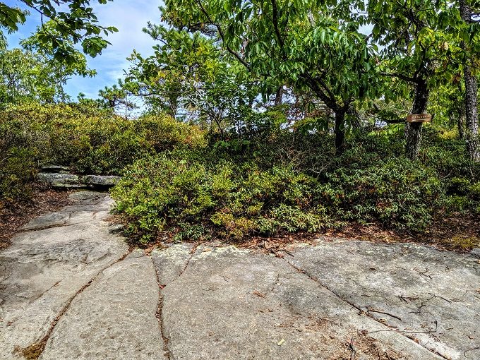
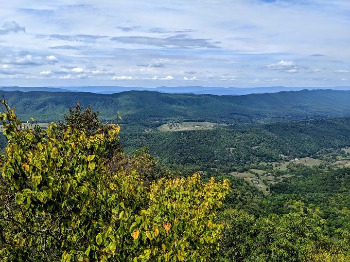
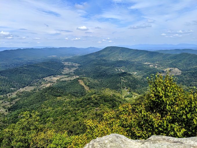
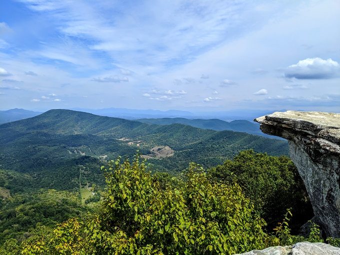
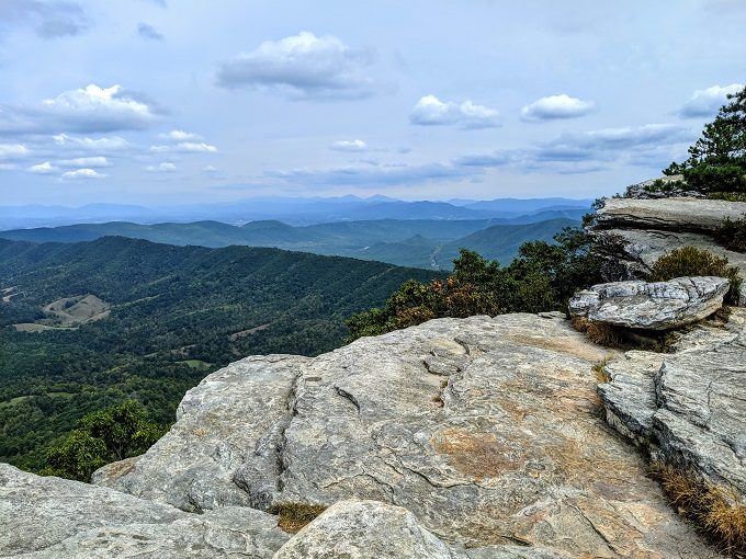
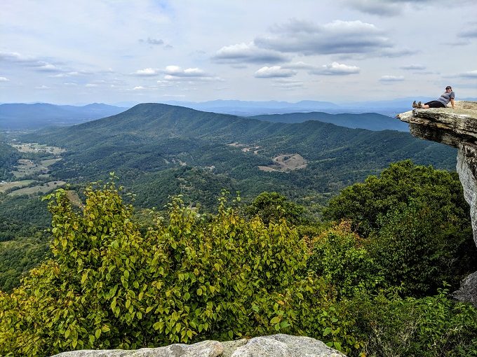
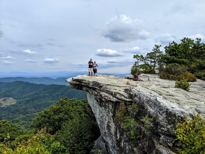
Once you’re round the corner, you’re rewarded with the views you came for. My photos don’t do justice to how truly beautiful it is up there, but here’s a taste.
Rather than trying to take a panorama photo, I figured a video might give a better idea of the view as you look around.
We were incredibly fortunate the day we hiked to McAfee Knob. When we visited with my parents a few years ago, we hiked up there on a Saturday and so it was very busy.
This time around we hiked on a Thursday, so it was much quieter. 25+ people came down the mountain as we went up, while only one person passed us on the way up – that person was one of the people who also came back down the hill by the time we got there!
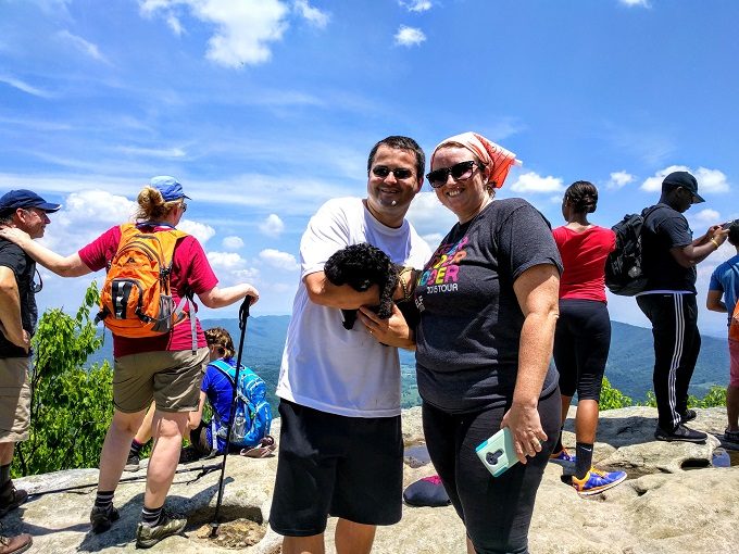
That meant when we arrived there were only two people up there. They left soon after, with only two other people reaching the overlook while we were there.
That made the experience much more peaceful and enjoyable as we weren’t jostling for space, photo opportunities, etc. It was therefore possible to sit and take in the views.
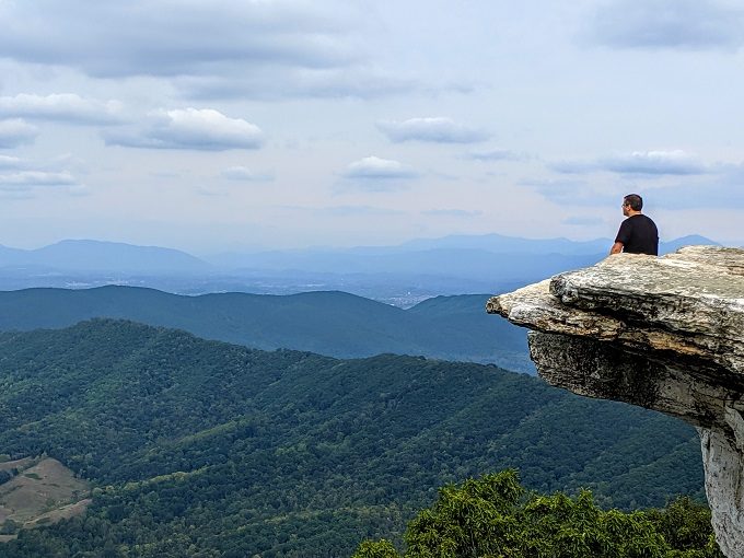
It might look like I’m sitting right at the edge, but I’m not quite that daring. There was a ledge that my feet were resting on, so there was no danger of my falling over the edge. Shae on the other hand got a little closer.
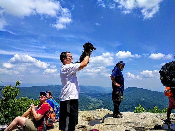
Even Truffles got in on the action.
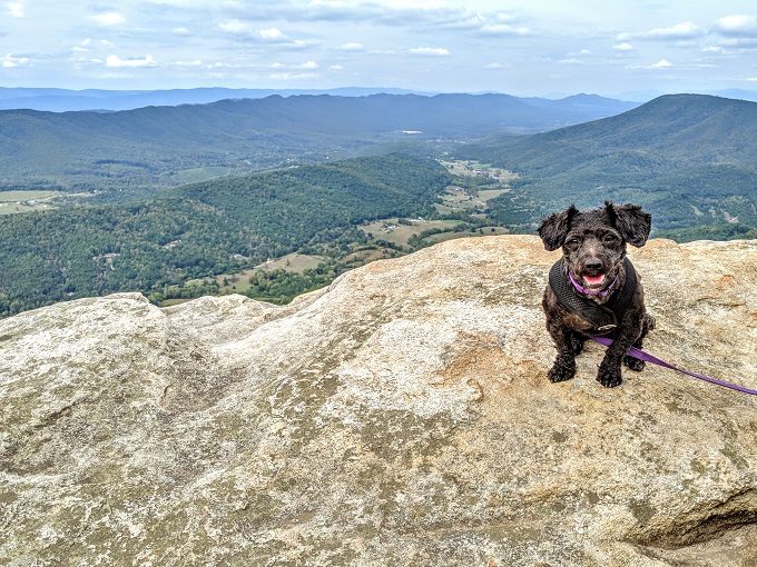
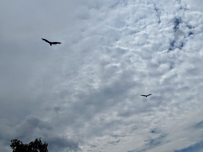
Don’t worry, we kept a tight grip on her leash up there. Not just because of the steep drop down, but also due to the hawks circling overhead that probably viewed her as a 10 lb tasty treat.
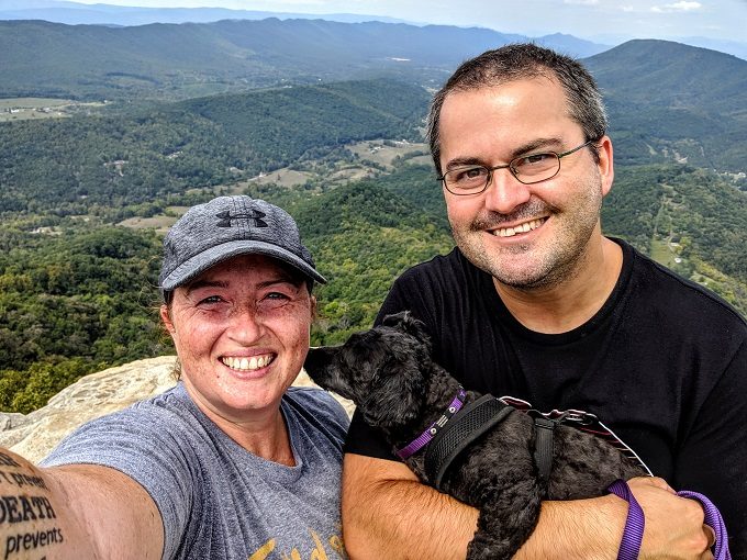
While it would’ve been nice to have had the entire place to ourselves, having someone else there meant they were willing to take a photo of us. We could’ve gotten this ourselves using a timer on Shae’s camera, but it’s easier having someone take it for you.
Shae had to be back for an online meeting that evening, so we didn’t stay as long as we would have otherwise. With a final selfie, we started heading back down hill.
The hike back down the mountain is, in theory, also 3.9 miles.
Our journey might have been a little shorter though as we took the Fire Road back down to speed things up. Despite laying down a couple of times to try getting us to carry her, Truffles did the entire ~7.8 mile hike on her little legs. This was shorter than the 10 miles I hiked with her to Dog Slaughter Falls in Kentucky, so I knew she had it in her.
Final Thoughts
Hiking to McAfee Knob isn’t easy, but it’s certainly worthwhile. The effort it takes to get up there is rewarded with the beautiful views you get of the Blue Ridge Mountains.
If you’re looking for a great hike near Roanoke VA, I’d highly recommend McAfee Knob.
This was so helpful and informative. Thank you!!
Awesome, I hope you had a great hike up there 🙂
Thank you so much for your thorough account and photos! I’m heading down to SC pick my son up after his freshman year of college; we’re going to hike to McAfee Knob on the drive home. I’m from New England so completely unfamiliar with the area and I’ve been doing my research. Your blog post has helped tremendously and I feel confident and prepared for what we’re dealing with!
Awesome, I’m glad it’s been helpful – I hope you enjoy the hike as much as I do.