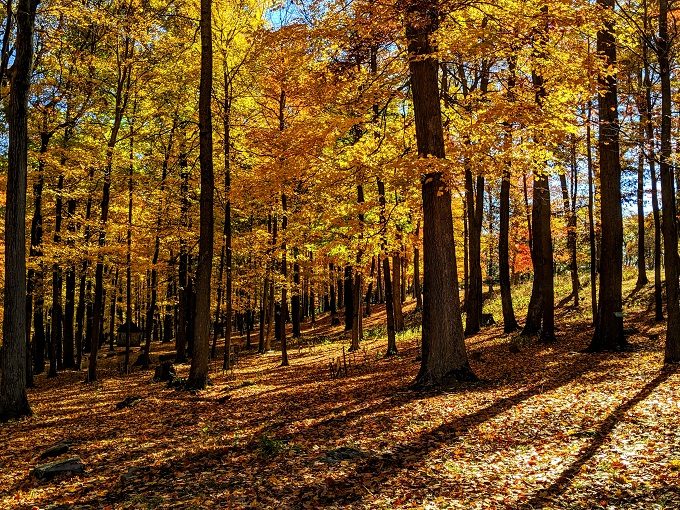
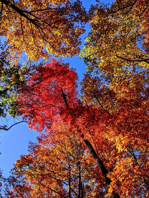
One of the best parts of visiting West Virginia in October/November was getting to enjoy all the fall colors. One of the best places we found to see those colors was Coopers Rock State Forest.
Coopers Rock State Forest is just outside of Morgantown WV and about 90 minutes south of Pittsburgh PA. It covers almost 13,000 acres and contains numerous hiking trails and overlooks, making it a great place to go hiking.
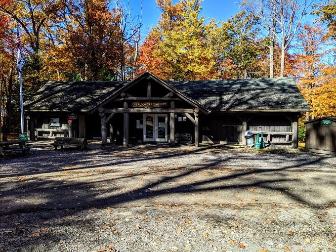
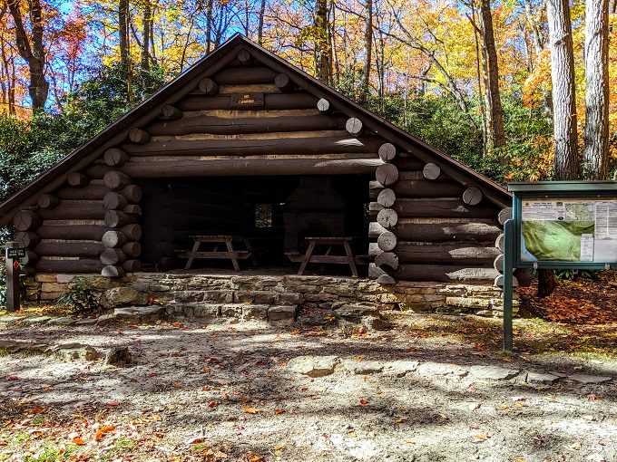
There’s a fairly large main parking lot, along with a few other parking areas near different trailheads along the way. At the main parking lot there’s a Trading Post store…
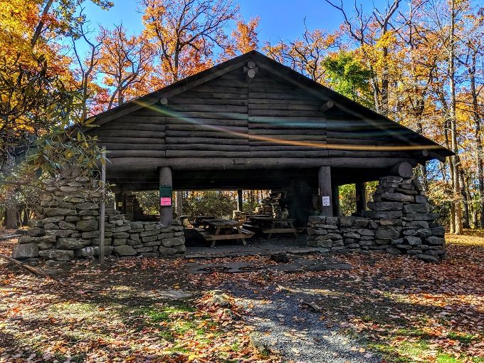
…several picnic shelters and tables…
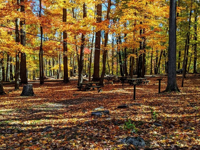
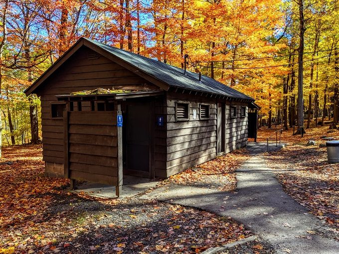
…and restrooms.
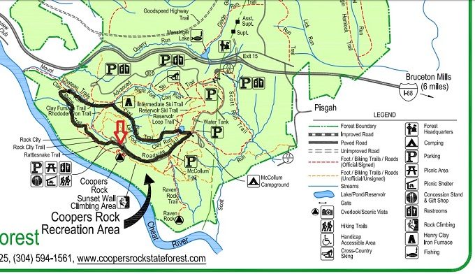
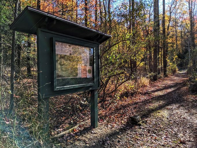
The Trading Post has free maps of the area, so it’s worth picking up one of those. A lot of trails intersect with each other and so it’s likely that you’ll take several of them when going for a hike.
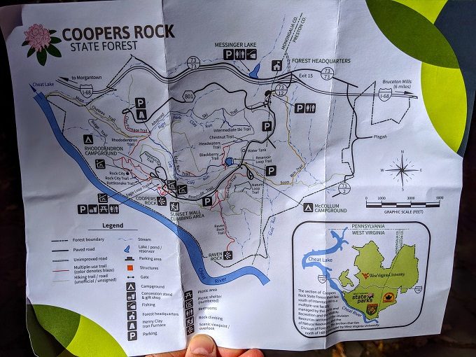
You can download/print a copy of the map here, although that version of the map seems to be a little different to the paper copy we received at the park itself. For example, the paper map we received clearly labeled the Eagle Loop Trail, whereas it doesn’t seem to be displayed on that PDF version. I think the Eagle Loop Trail might be a newly developed trail which might be why; the rest of the map might be exactly the same, but I didn’t study both to check.
We decided to take a route that included a number of different trails which ended up being about six miles long. I’ve marked our route on the map below; we started at the main parking lot where the arrow is pointing and took the route clockwise.
Before setting off on our hike, we took the short path from the parking lot to Coopers Rock Overlook.
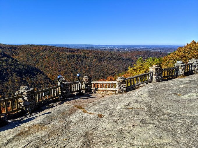
The overlook provides some beautiful views of the forest and surrounding area, enhanced by the fall colors on the trees below.
Something that’s a little bit of a shame is that Coopers Rock Overlook is closed at sunset. I imagine sunset would provide photographers with some amazing lighting, so I’m surprised it’s not kept open until it’s dark.
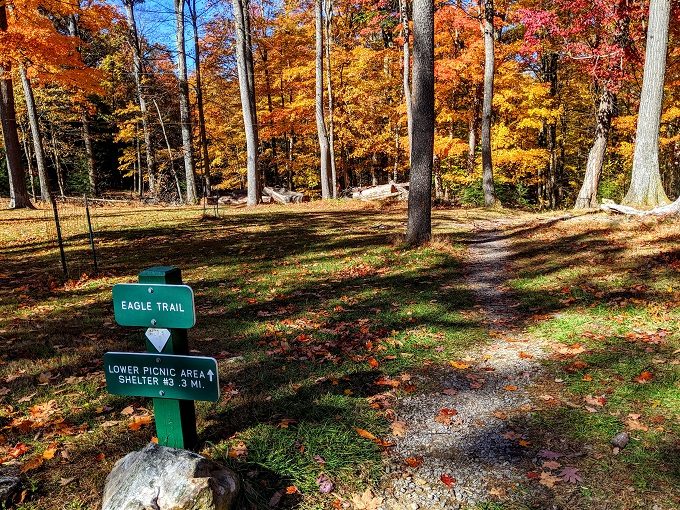
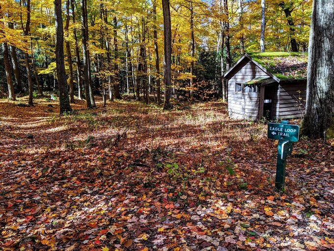
After enjoying the view from Coopers Rock Overlook, we made our way back to the parking lot. About 50 yards to the right of the Overlook Trading Post is the start of the Eagle Loop Trail, so we headed down there.
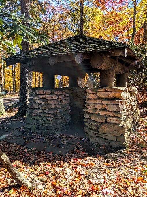
After about 1/4 mile we reached another nice picnic shelter.
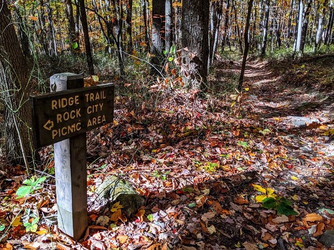
Although there had been a couple of signs for the Eagle Loop Trail, this particular trail wasn’t very well defined. I’ve a feeling it’s a fairly new trail and so hasn’t been worn down by a lot of hikers, which would also explain why it’s not specifically mentioned on the trail map on their website.
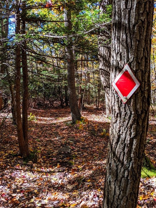
We followed what seemed to be a path and eventually found ourselves on a much more obvious trail. Shortly after that we reached the start of the Rock City Trail.
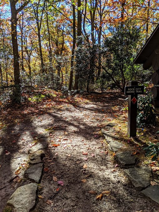
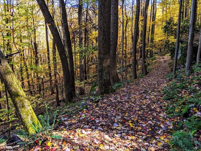
This was a much clearer trail and we had no problem finding our way along this one, especially because it was well marked with red trailblazes.
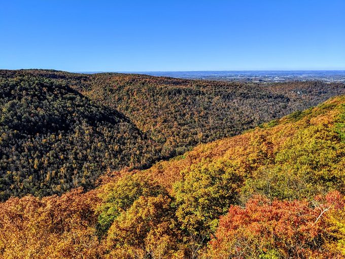
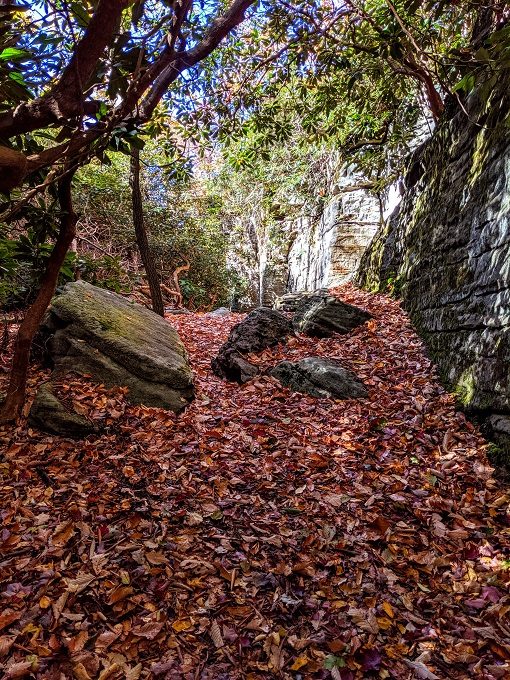
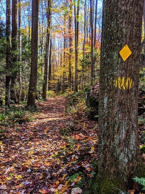
Forest hikes can sometimes be a little boring as there’s nothing to see other than trees. Coopers Rock State Forest had much more than that to offer though. For example, the Rock City Trail is so named because of all the rock formations that you’ll walk past and through.
After a relatively short distance on the Rock City Trail, we moved on to the Ridge Trail which heads northwest.
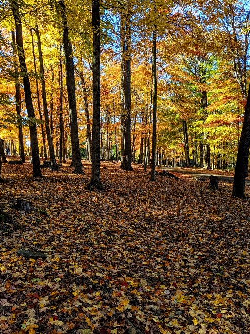
We did this hike on October 28, so red, orange and yellow leaves carpeted the path ahead of us.
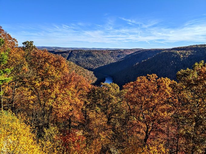
The top end of the Ridge Trail meets up with the Mont Chateau Trail. You can take the trail down to the Cheat River, but we headed in the opposite direction. The photo below makes it look like we headed to the left, but when approaching the Mont Chateau Trail from the Ridge Trail, you actually turn right.
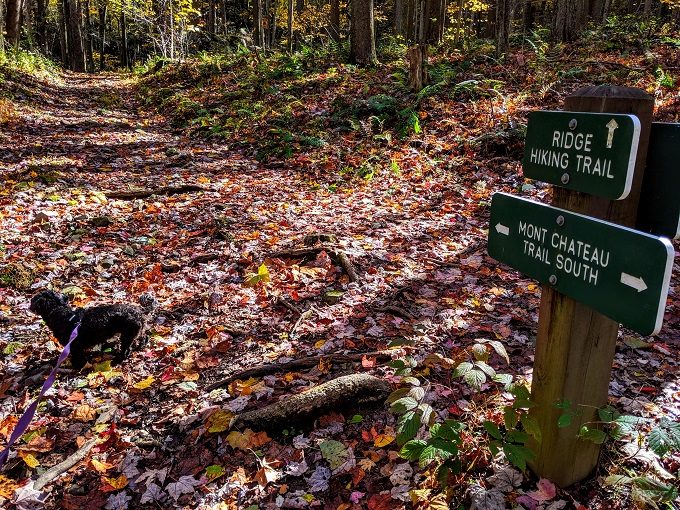
The different trails are marked with different colors, so you follow the yellow trailblazes on the Mont Chateau Trail.
The Mont Chateau Trail went on for about a mile before coming to an end where the Clay Furnace Trail and Clay Run Trail meet.
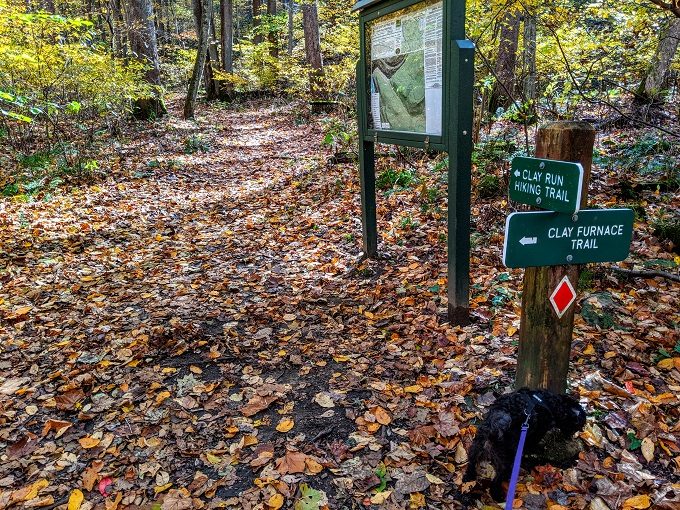
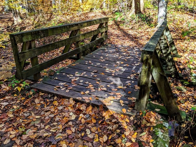
We wanted to take the Clay Run Trail to continue our hike, but decided to take a quick little diversion on the Clay Furnace Trail. That’s because when you cross over the bridge…
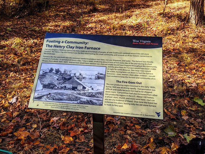
…you arrive at the Henry Clay Iron Furnace. This was built from 1834-1836 and was a cold-blast furnace that produced four tons of pig iron every day for about ten years.
The Henry Clay Iron Furnace was a large source of employment, providing about 200 jobs. As a result, there was once more than one hundred homes, a schoolhouse, church and store nearby.
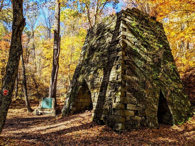
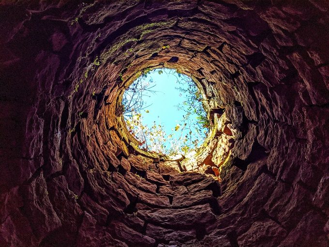
One of the fun things about the furnace is that you can now go inside the furnace and look up through the chimney.
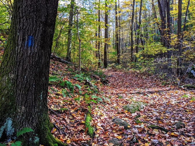
After checking out the furnace, we headed back over the bridge and took the Clay Run Trail which uses blue trailblazes to mark the path.
At about 1.75 miles long, I think the Clay Run Trail was the longest trail on our hike. While it wasn’t a difficult trail, a fair bit of it was uphill in the direction we were heading.
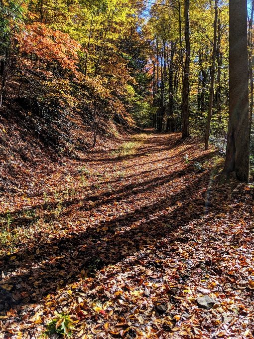
It was worth the (moderate) effort though as it was a pretty walk and helped us take in even more colors along the way.
The Clay Run Trail leads you to what’s labeled as a reservoir on the map, but looks more like a large pond or a small lake. It was 3pm by the time we reached the reservoir, so we sat on the jetty and ate our packed lunch.
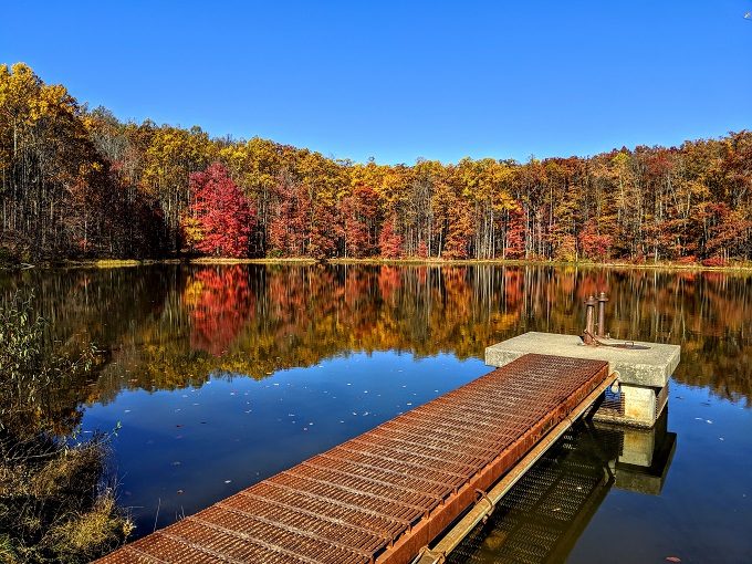
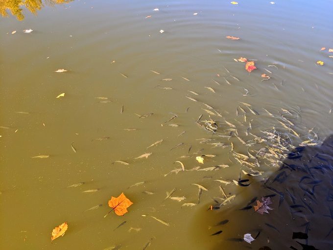
Shae and I were surprised when looking down at the water as there were tons of fish swimming around, seemingly hoping we’d throw in some food.
Once we’d finished eating, we finished walking along the Clay Run Trail until it ended at the road leading to the parking lot. From there we turned right and walked back towards the parking lot along the Roadside Trail.
The roadside trail is three miles long, but we only had to walk about half that distance as it starts about 1.5 miles in the opposite direction.
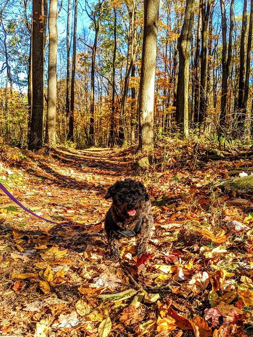
Not only did Shae and I enjoy our hike, but Truffles did too. Even though she has short legs, our six mile hike was nothing to her seeing as she did a much more difficult 10 mile hike to Dog Slaughter Falls in Kentucky earlier this year.
As the name suggests, the Roadside Trail runs along the roadside, although towards the end of the trail you have to cross over the road.
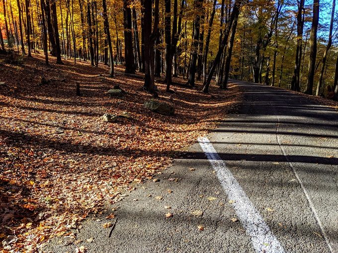
From there it was just a couple of hundred yards to get back to the parking lot.
Final Thoughts
Coopers Rock State Forest was definitely my favorite forest hike on our road trip so far. The fall colors were stunning, the inclines made it a little more strenuous than normal forest walks, the Rock City part of the trail added some interesting things to see, as did the Henry Clay Iron Furnace about halfway through. The reservoir was also a quiet, peaceful place to have lunch.
If you’re looking for an enjoyable and not-too-difficult hike in the north of West Virginia, we highly recommend our six mile route in Coopers Rock State Forest, especially if you’ll be there in the fall.
Address
Coopers Rock State Forest, 61 County Line Dr, Bruceton Mills, WV 26525
[…] Thinking back over the various hikes we did in West Virginia, I think this one tied with Coopers Rock State Forest for being my favorite […]