Both before we visited West Virginia and while we were there, several people recommended that Shae and I go hiking at Dolly Sods Wilderness, a wilderness area in Monongahela National Forest.
On our penultimate day in West Virginia, we finally made our way there and are glad we did. Although it was too late to enjoy the fall colors there (we visited in November), it was still a pretty hike and involved fairly unusual terrain which made it much more interesting.
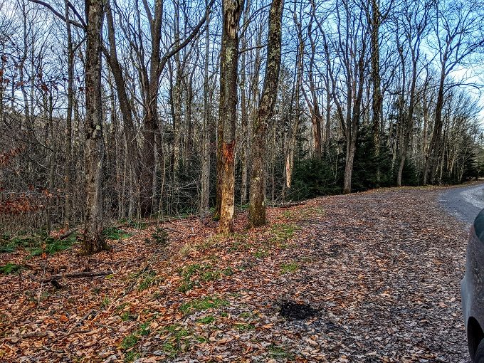
There are a few parking areas along Forest Road 80 leading up to Dolly Sods Wilderness. You’re not able to park at the very end of the road (it’s well marked to advise you of this), so we turned around there and parked a little further back at the final parking area just before Wilderness Way. There were two other cars there when we arrived and it seemed like you’d be able to fit a maximum of five cars.
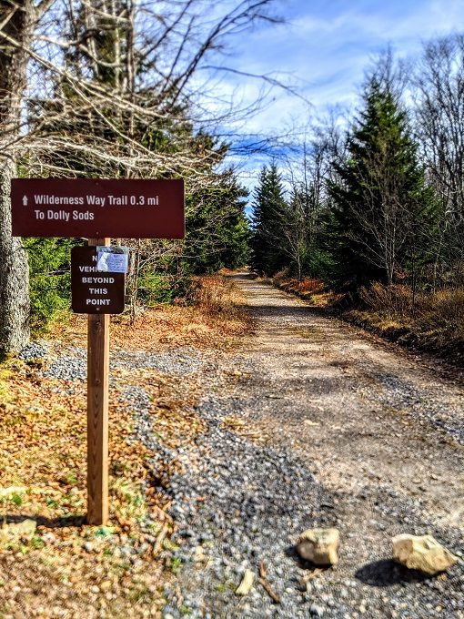
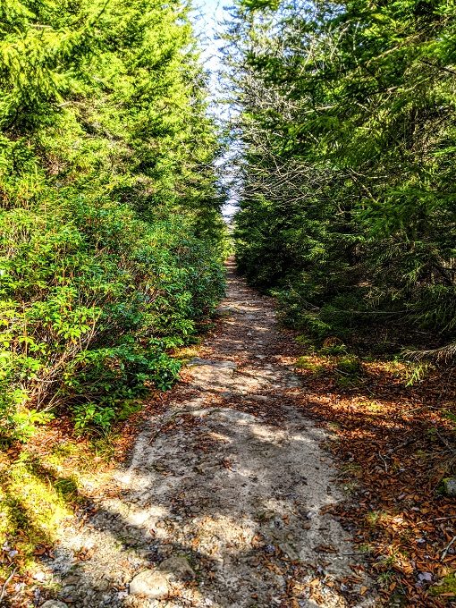
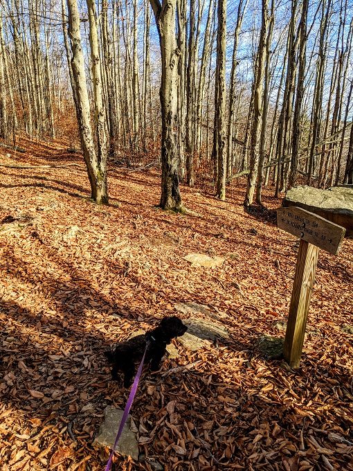
From the parking area, it’s a 0.3 mile walk to Dolly Sods. The route is obvious thanks to the sign and the clear path leading that way.
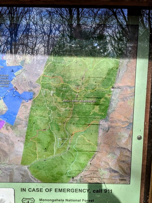
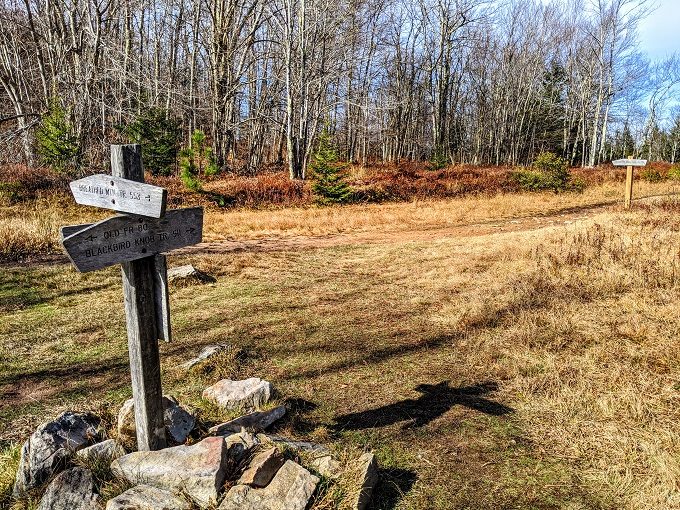
At the end of Wilderness Way there’s a noticeboard with information about Dolly Sods Wilderness, including a map of the area. Dolly Sods has 47 miles of trails which are clearly marked on the map.
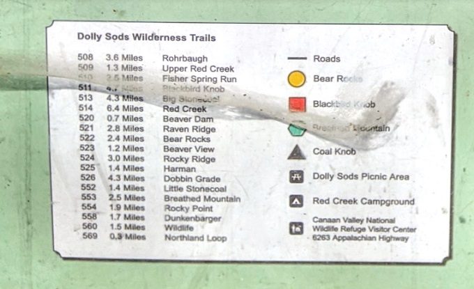
In the bottom corner of the poster it listed all the different trail numbers, their distances and their names.
The center of the map showed that there was a peak called Blackbird Knob. That was just over halfway along trail 511 which is 4.7 miles long, so we figured hiking to Blackbird Knob and back would be a five mile hike or so. The route began with an easy gravel path.
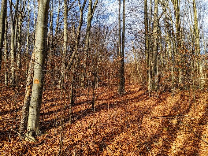
Many of the trails interconnect with each other and they’re all very well marked.
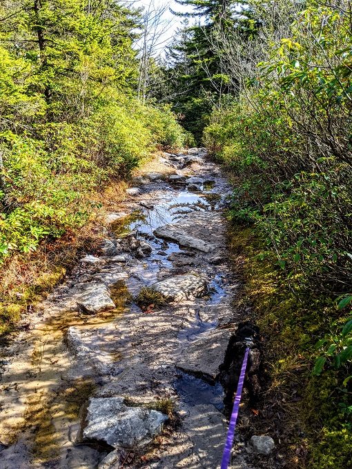
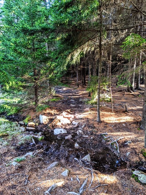
I mentioned earlier that there was some unusual terrain at Dolly Sods. That’s because a reasonable amount of the trail was along a rock bed that looked like it was an empty stream bed. Due to some recent rain, some parts did have some standing water and so those sections got a little muddy. A couple of other areas had gotten iced over, so watch your footing if you’re visiting in winter time.
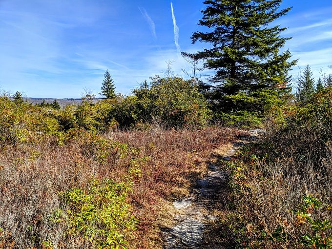
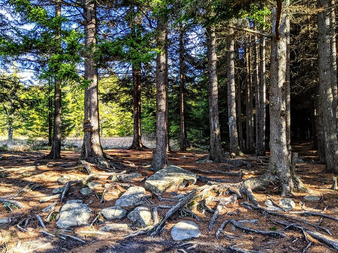
In addition to the sometimes unusual trail, the hike was made more interesting by the surrounding flora. We missed out on some of the fall colors, but there was still a lot of greenery around, especially thanks to the large number of evergreen trees that were all around.
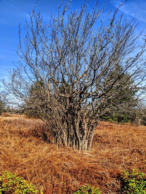
Some of the trees were particularly interesting. I’ve no idea what kind of tree is in the photo below, but it looked like its trunk had been buried below ground, with only its branches escaping. Please let me know in the comments below if you know what kind of tree this is – I tried Googling it (including uploading my photo to Google to do a comparison image search), but didn’t have any luck identifying it.
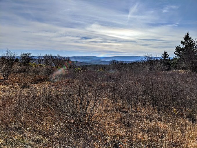
Even though some parts of the hike looked very wilderness-y, the views were enhanced by the surrounding mountains.
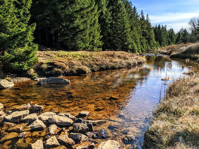
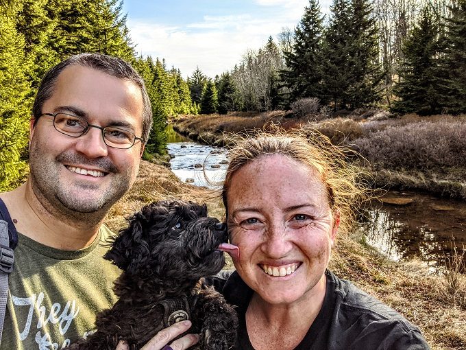
A little further along we heard the sound of water which turned out to be the left fork of Red Creek. It was a really pretty setting, so we sat on the bank for a while and ate our lunch.
After finishing our lunch, we continued along the trail. Well, we thought we did, but we got a little lost. There are a few worn paths around there and so we started following one, thinking that was still the Blackbird Knob Trail.
It turns out it wasn’t.
Thankfully we didn’t get too far along before we realized our mistake, so we retraced our steps back to Red Creek. One of the reasons our picnic spot had been so nice was because we had the creek on one side and the forest on the other.
It hadn’t looked like the trail continued into the forest which is why we’d taken a different route. Upon returning to this spot though, we noticed trail 511 – the Blackbird Knob Trail – continuing through there.
In case we were in any doubt as to whether we were still on the right path, Truffles found a trail marker that confirmed we were heading the right way.
Having said that, the sign confused us a little. It stated that trail 514 headed south from that point, which meant Blackbird Knob was only a short distance to our north. I’d expected that there would be a path leading up there, but there wasn’t anything other than evidence that a few other people had walked uphill through the trees in the past.
Not wanting to miss out, we did the same thing. The thing is, it didn’t seem like Blackbird Knob itself would have any views due to all the trees at the peak, so we didn’t end up walking all the way to the top after all. I hope we didn’t miss out on anything spectacular!
Instead, we headed back along the trail as Blackbird Knob had been our planned spot to turn around. We stopped at Red Creek for a couple more photos, then continued back along the trail to our car.
Final Thoughts
Shae and I really enjoyed our hike in Dolly Sods Wilderness. Thinking back over the various hikes we did in West Virginia, I think this one tied with Coopers Rock State Forest for being my favorite one.
I loved the Coopers Rock hike due to all the beautiful fall colors, but I also loved Dolly Sods for how different it seemed to our normal hikes. It truly felt like we were in the wilderness and yet was beautiful in its own way. It also helped that the trail we took was a steady mix of inclines and declines, so neither direction was overly exerting.
[…] close to the Airbnb we were staying at. We’ll share more about our hikes at Seneca Rocks and Dolly Sods Wilderness in the coming days, but for now here’s more about our visit to Spruce […]