After spending a couple of weeks in Roanoke, Shae and I moved on to the next state on our 50 state road trip – Maryland.
Our first stop was Frederick which is where we stayed for another couple of weeks. One afternoon when Shae had stuff to work on, I decided to go for a hike with our dog Truffles as we both needed to get out of the hotel and stretch our legs.
There were several hiking options in the area, but I’d been busy in the morning and so we didn’t get going until early afternoon. I therefore wanted to find somewhere fairly close by which wouldn’t take too long and Sugarloaf Mountain seemed to fit the bill.
We’d asked for suggestions of things to do in Maryland last year as that’s when we originally planned to visit, but our plans subsequently changed. We received a bunch of suggestions from people and made a note of all of them, with Devin on Facebook suggesting Sugarloaf Mountain as an option.
That was a short drive from our hotel and had some trails that didn’t look like they’d take too long to take, so off Truffles and I went to explore.
In case you’re wondering, this isn’t the more well-known Sugarloaf Mountain that’s out in California – it just has the same name. The shape of the mountain was apparently reminiscent of sugarloaves back in the day which is how it got its name.
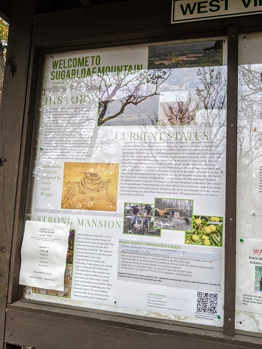
The land was purchased in the early 1900s by Gordon Strong, a Chicago businessman. He subsequently established a trust fund to maintain the mountain and its trails. The mountain is now owned by Stronghold, Incorporated and is free to visit, although they do ask for $5 donations.
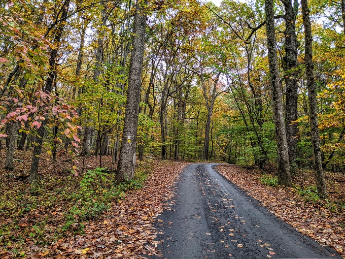
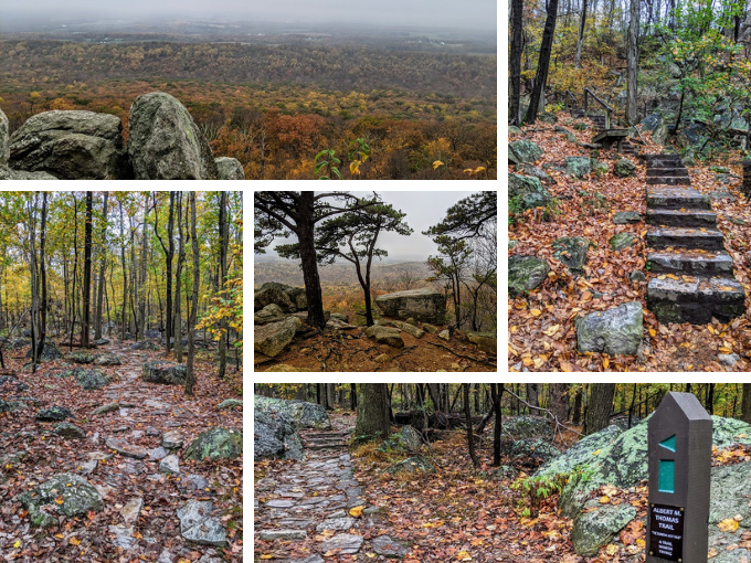
Truffles and I visited in October 2020, so during prime fall season. It was therefore a pretty drive up the hill to West View parking lot.
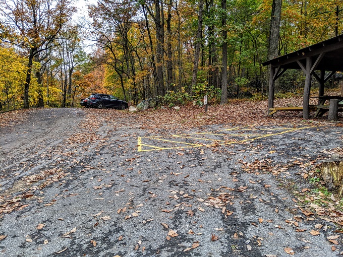
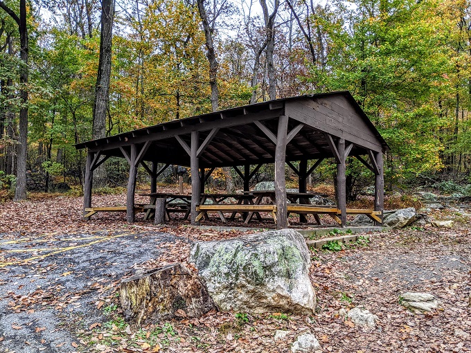
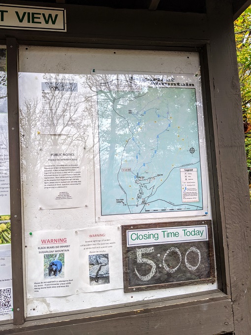
There are three different parking lots on Sugarloaf Mountain – West View, East View and Potomac Overlook. I’m not sure if the other two parking lots have any amenities, but this one had a picnic shelter and porta-potties.

I wanted to go on a slightly longer hike, but the trail to the summit of Sugarloaf Mountain is only 0.25 miles each way. I therefore figured we’d hike that first, then hike one of the other trails afterwards.
At the entrance of Sugarloaf Mountain, there were leaflets and trail maps you could take, so I’d grabbed one of each of those. The parking area also had a board with information about the mountain and a trail map.
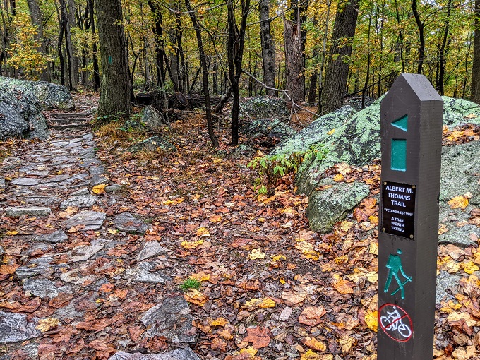
The hike to the summit is along the A.M Thomas Trail, named after Albert M Thomas who was the first superintendent of Stronghold.
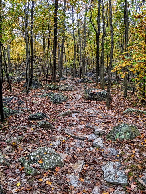
Even though the trail is only a quarter mile each way, it’s fairly hard-going as it’s uphill nearly all the way.
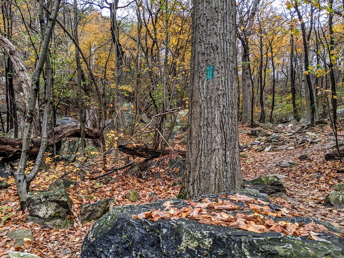
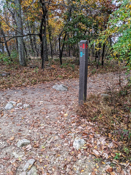
The trail is marked by green trail blazes along the way. The trail was fairly obvious for the most part, but with so many leaves on the ground it was helpful to have the markers nonetheless.
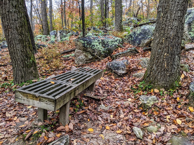
Despite being a short trail, the fact that it’s fairly steep means they’ve added a couple of benches along the way in case you need to take a breather. Truffles is a trooper though, so she was happy to keep going.
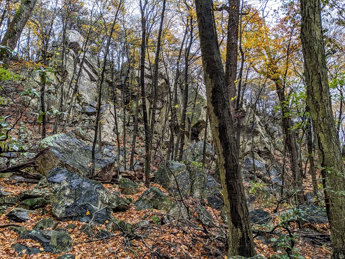
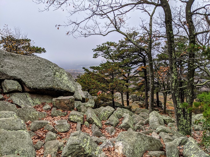
In addition to the fall colors, there was also rocky terrain to enjoy on the way up.
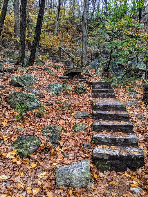
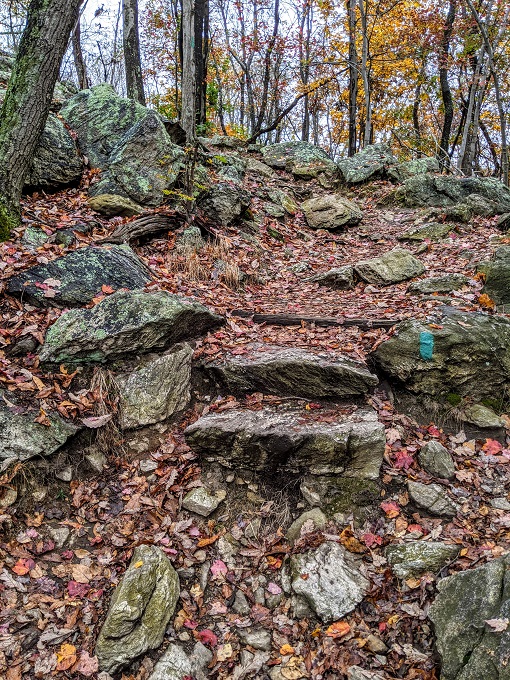
What was less enjoyable was the next step. Or, more accurately, the next 168 steps (yes, I counted!) This was the hardest part of the trail and might leave you with jelly legs at the top if you do it in one go.
There weren’t any benches along this section, but there were areas you could step off the trail and sit on a rock if you needed to pause.
Once you reach the top of the steps, that’s not the end of the uphill climb, but the worst is certainly over by that point. Continue heading up the A.M. Thomas trail to the left, following the green trail blazes which can sometimes be found on rocks as well.
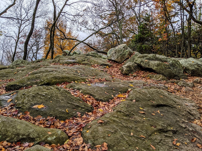
The trail flattens out a little as you approach the summit; follow the green directions to continue heading the right way.
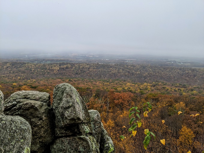
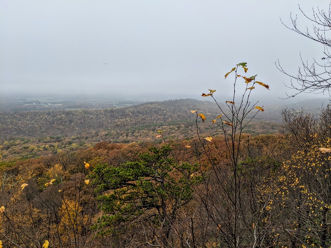
You’ll soon come upon a clearing which marks the top of Sugarloaf Mountain.
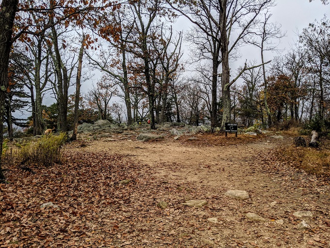
This is where the A.M. Thomas Trail ends, but you can walk around at the top to take in the views of the local area. Despite the route up being fairly strenuous, the views after a relatively short climb make it worth the effort.
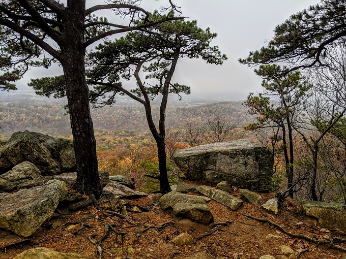
It was about 2:30pm by this stage, so Truffles and I sat down to have the lunch I’d brought with us and enjoy the views.
Knowing that we wanted to hike another trail on Sugarloaf Mountain, we only stuck around for about 20 minutes before heading down. We had to watch our footing though because along with the steepness there were wet and slippery leaves blanketing the ground.
Once back at the parking lot, we set off on the Northern Peaks Trail which didn’t quite go as expected!
Address
If you’re wanting to visit Sugarloaf Mountain and hike the A.M. Thomas Trail yourself, here’s a link to the West View Parking Lot on Google Maps so that you can get directions.
I very much enjoyed your photos and and descriptions of your hikes on Sugarloaf Mountain. When you are next in that area I encourage you to visit Catoctin Mountain Park, Cunningham Falls and Gambrill State Parks.
I went to Cunningham Falls, so that’ll be coming up on a future post. We had Catoctin Mountain Park and Gambrill State Parks on our list, but ran out of time. I enjoyed all the hiking in that area, so I’d like to return in the future.