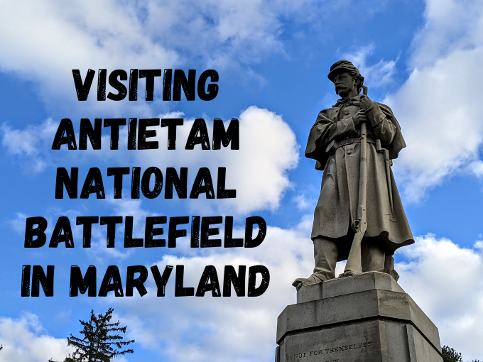
One of the reasons why we decided to stay in Frederick while visiting Maryland on our 50 state road trip was because we wanted to visit Antietam National Battlefield which is located about halfway between Frederick and Hagerstown, close to the border of West Virginia.
Antietam was the site of not only the bloodiest battle of the Civil War, but the bloodiest day in US history. On September 17, 1862, Union and Confederate forces clashed for 12 hours in the Battle of Antietam. By the end of the day, about 23,000 soldiers were left dead, injured or missing out of approximately 100,000 participants.
We visited Antietam National Battlefield at the end of October 2020, so during COVID. Although we have a National Parks pass which we bought earlier in the year, we didn’t need to use it as admission was temporarily free. Ordinarily it would cost $20 per vehicle or $10 per person if visiting on a bike or motorcycle.
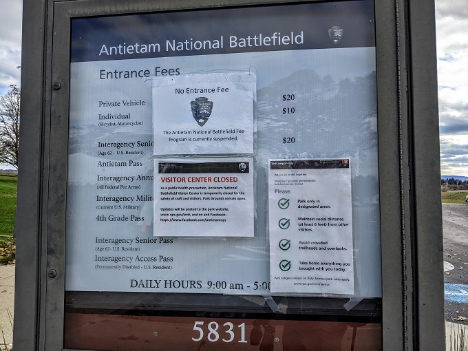
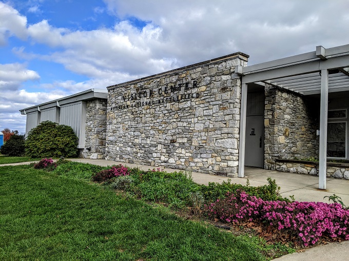
Also due to COVID, the regular visitor center was closed. The restrooms were available though as their entrances are on the outside of the building.
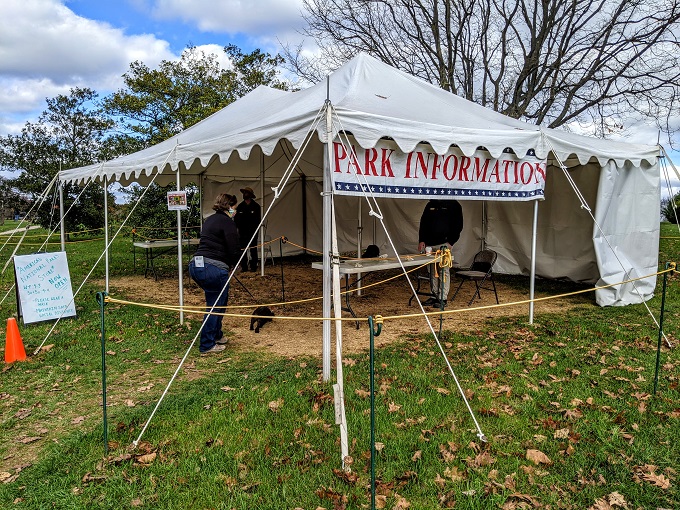
To make up for the fact that the building couldn’t be open, the National Park Service had a tent outside acting as a makeshift visitor center. This was helpful as it meant we could ask a couple of questions as we didn’t know what to expect of the site. We were also able to obtain a leaflet about the park which contained information about the battle, as well as a map of the site. That map was extremely useful, so I highly recommend picking up one of those.
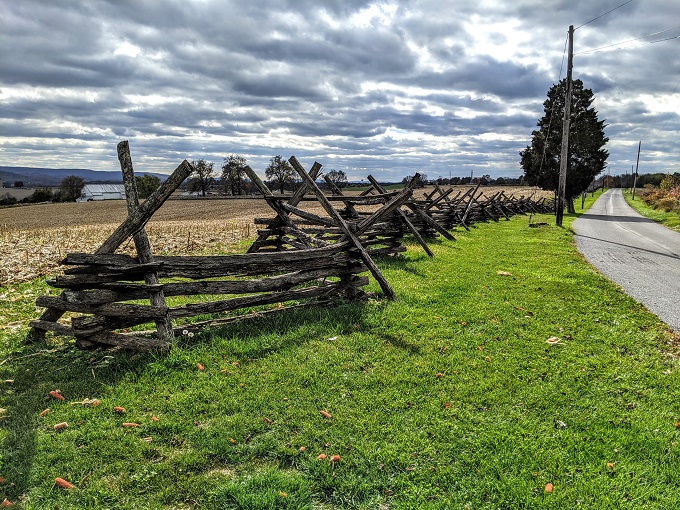
Although we knew of the battle, we didn’t really know what to expect when visiting. I’d therefore imagined the site simply being a large battlefield. However, the site covers more than 3,230 acres, some of which is now private land. As a result, visiting Antietam isn’t simply a case of walking around a large field – there’s so much more to it than that.
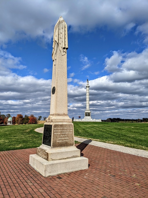
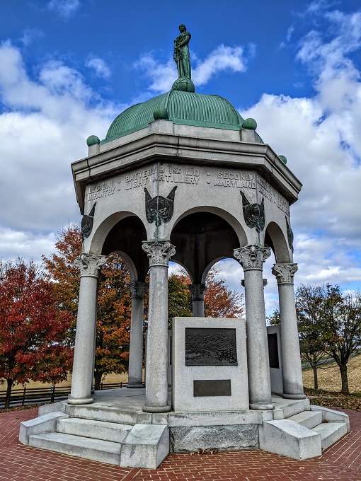
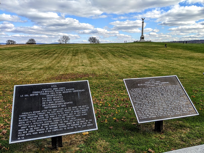
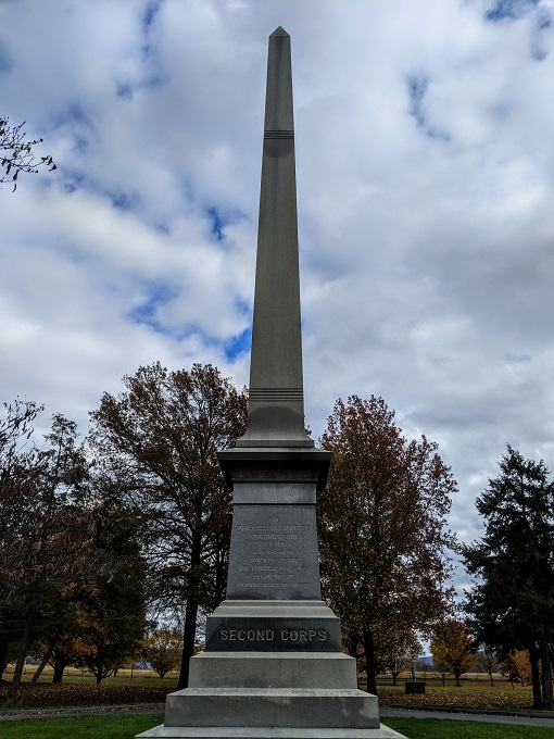
To start with though, we did walk around a large field as there were several monuments and memorials to see.
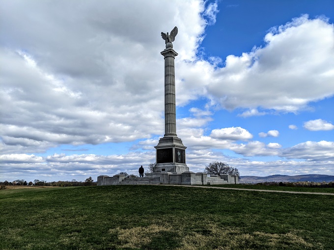
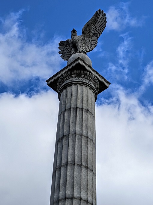
The 20th New York Volunteer Infantry Monument had a stunning design, with the sculptor carving a draped flag over the top of it.
The Maryland State Monument also had a nice design, but some of the brass artwork on its side was particularly impressive.
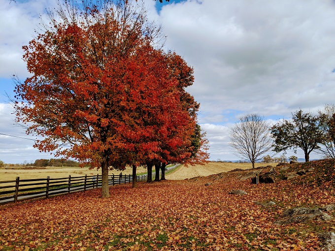
The beautiful fall colors stood in contrast to the sad nature of the site’s history.
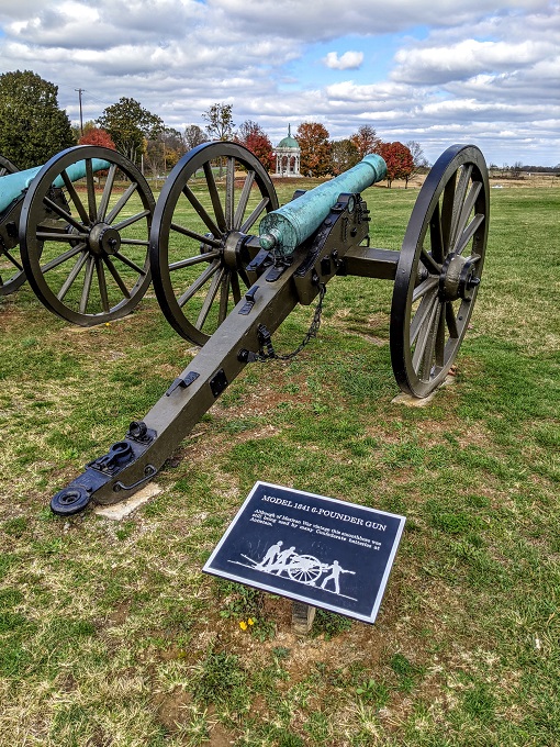
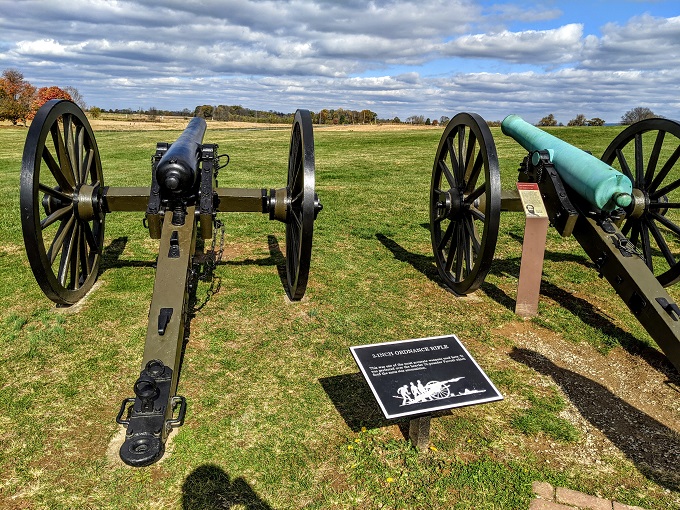
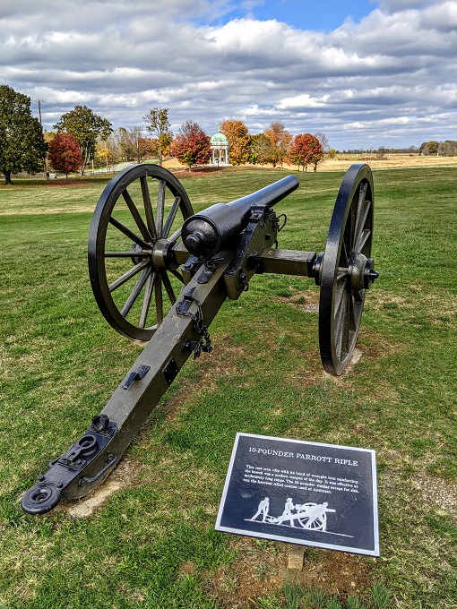
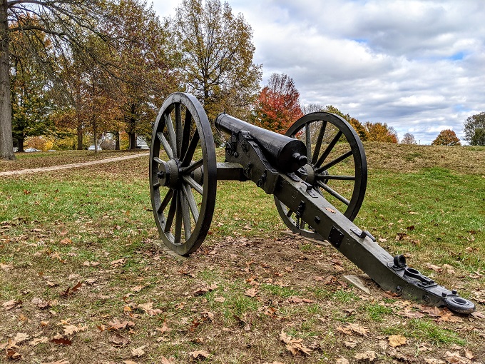
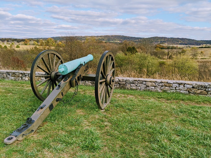
There were four cannons on display, with a National Park Service employee (or possibly volunteer) sharing more information about them. The first cannon – the Model 1841 6-Pounder Gun – was only used by Confederate forces as it was out of date.
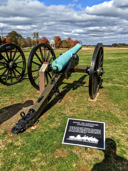
The other three cannons were used by both Union and Confederate soldiers. The second cannon – the Model 1857 12-Pounder Gun-Howitzer – was used by Confederate soldiers to fire canister at the approaching Union soldiers. Canister was a can which contained 27 balls which sprayed out when fired, increasing the likelihood of injury or casualty of Union soldiers. I can’t even imagine what it would be like to run headlong into that.
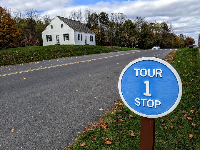
Due to the size of Antietam National Battlefield, you drive (or bike) through the site and stop along the way at various marked points. There are 11 different stops, with the first one being right next to this large field. It’s therefore worth crossing the road to visit the first tour stop before getting in your car to visit the rest of the stops.
Tour Stop 1 – Dunker Church
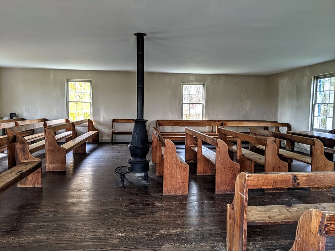
As mentioned above, you can walk across the road to visit Dunker Church.
The church was built in 1852 – 10 years before the battle. Ironically, Dunker Church was home to the pacifist German Baptist Brethren, but September 17, 1862 saw battles raging around it. The name ‘Dunker’ was a reference to their practice of full immersion baptism.
The church survived the Battle of Antietam, but was blown down during a storm almost 70 years later. It was subsequently rebuilt for the Civil War Centennial.
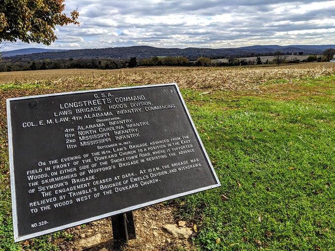
While visiting Antietam, you’ll see a number of different information boards which provide more information and context about skirmishes that happened during the battle.
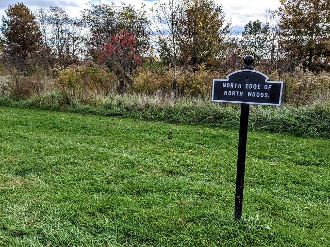
Tour Stop 2 – North Woods
After taking a look at Dunker Church, we returned to our car in the visitor center parking lot and drove to the second tour stop which was about a mile away. That second site was the North Woods.
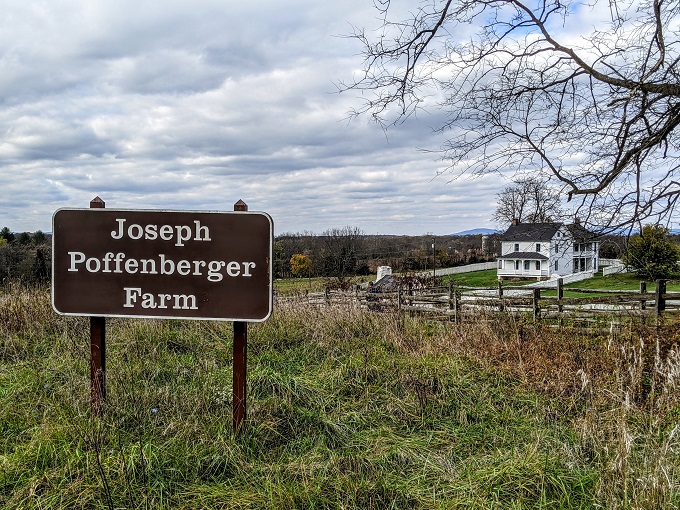
Union General Joseph Hooker’s soldiers spent the night before the battle at the Joseph Poffenberger farm.
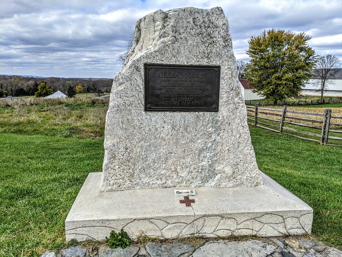
The second tour stop also has a monument for Clara Barton who was a nurse during the Civil War who went on to found the American Red Cross.
Tour Stop 3 – East Woods
The East Woods were the site of a small skirmish the night before the main battle.
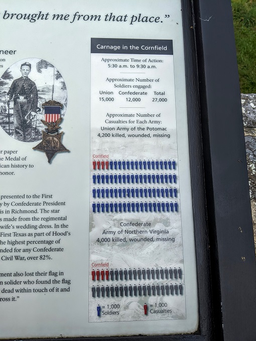
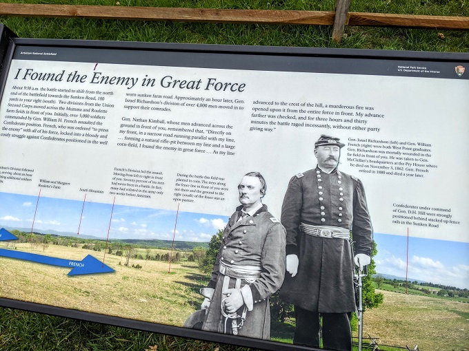
Tour Stop 4 – Cornfield
The fourth stop on the tour is located at a 24 acre cornfield and was the site of one of the deadliest parts of the battle. For a few hours, Union soldiers commanded by Gen. Joseph Hooker and Gen. Joseph Mansfield battled Confederate soldiers commanded by Gen. Thomas J “Stonewall” Jackson.
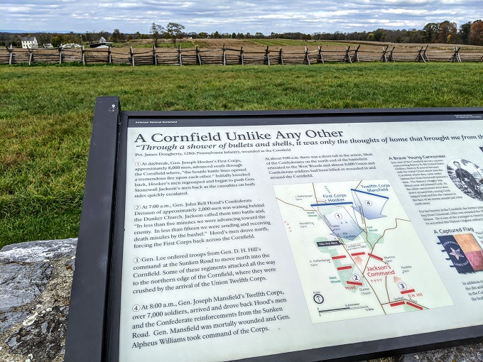
There were huge casualties on both sides. For example, within 30 minutes Hays’ Louisiana Brigade had more than 60% of its soldiers killed.
The information boards as you drive around have an interesting graphic on the right hand side displaying stats about the individual battles within the overall battle. In the case of the cornfield, about 27,000 soldiers fought and more than 8,000 were killed, wounded or missing – that’s 30% of those participating.
If you want to explore the cornfield more, there’s a trail that runs from tour stop 4 to tour stop 2 and beyond.
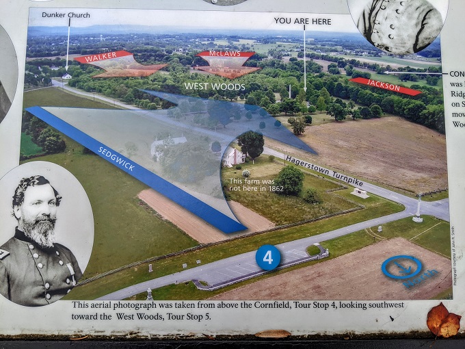
Tour Stop 5 – West Woods
Tour stops 2-4 are on a loop around the cornfield to the north of Antietam National Battlefield. The fifth stop takes you back towards the first stop and is found at the West Woods.
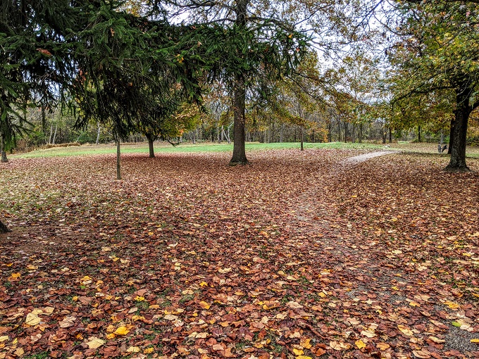
What’s now a peaceful place was the site of confusion and carnage.
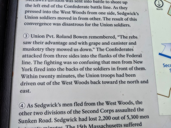
There was an information board at this stop which had a map showing the movement of the different troops. This was helpful in visualizing the battle and the places we were stopping at along the way.
Antietam National Battlefield felt very large as we drove around, but I’m sure for the soldiers it felt very small as they approached opposing forces and had cannons and muskets firing at them.
Tour Stop 6 – Mumma Farm & Cemetery
There was no deliberate destruction of property during the Battle of Antietam, with the exception of Mumma Farm. The farm was burned down by Confederate soldiers who were concerned that Union sharpshooters would use the buildings to attack them.
The Mumma family had thankfully been warned about the upcoming battle, so they’d already fled to safety by the time the fighting began. They rebuilt their home the following year and you can now visit the cemetery on the site.
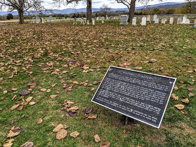
Antietam National Battlefield is pet-friendly, so we brought our dog Truffles with us. The only parts of the site where dogs aren’t allowed are inside buildings and in the cemeteries. As a result, Shae walked to the Mumma Cemetery first while I waited with Truffles, then we swapped places.
Tour Stop 7 – Union Advance
The seventh stop was a quick one, with information about the Union army advancing upon the Confederates.
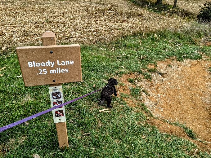
Tour Stop 8 – Sunken Road (Bloody Lane)
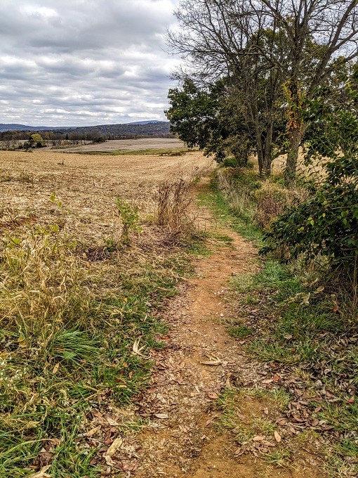
A longer stop was the eighth location on the tour – Sunken Road. This subsequently became known as Bloody Lane due to the sheer number of deaths that occurred here.
There are a couple of parking lots 0.25 miles apart, so we decided to leave our car at the first parking lot and stretch our legs by walking the quarter mile along the Bloody Lane Trail.
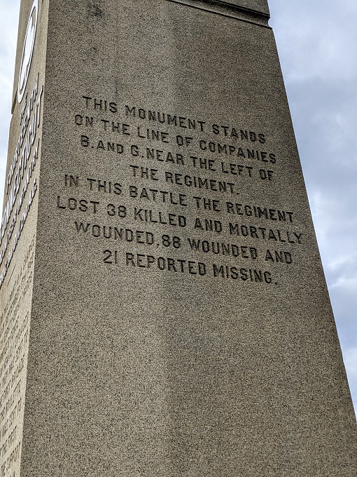
There were a couple of monuments to stop and look at along the way.
If we didn’t know any better, we’d have thought that we were just walking along a footpath through a field. On September 17, 1862 though, the scene was far different. Just over 2,000 Confederate soldiers (with reinforcements later on) managed to hold off an attack by ~10,000 Union soldiers. Their defense eventually gave way and they retreated several hundred yards.
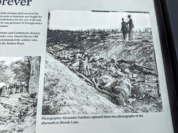
The Union soldiers had suffered massive casualties too though, so they weren’t able to press their advantage. An observer afterwards wrote the following about what they saw:
They were lying in rows like the ties of a railroad, in heaps like cordwood mingled with the splintered and shattered fence rails. Words are inadequate to portray the scene.
Although words were inadequate to portray the scene, there was an early photographer who was able to capture some of the aftermath.
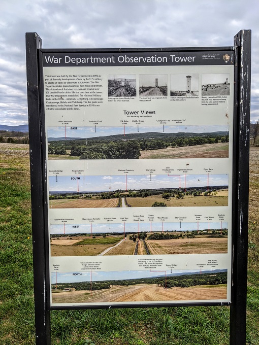
The Bloody Lane Trail ends at the other parking lot which is the site of the Antietam Battlefield Observation Tower. This tower wasn’t there at the time of the battle, but was subsequently built to provide a view of the Antietam Battlefield.
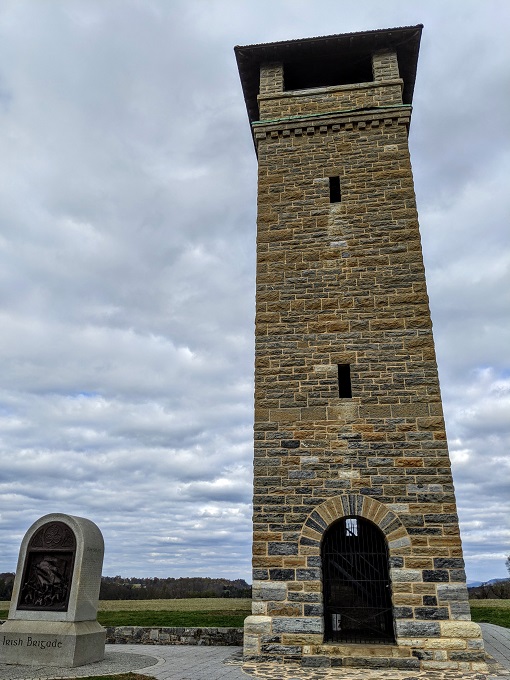
It seemed like the Observation Tower is ordinarily open for visitors to walk up and view the surrounding area, but COVID meant it was closed during our visit. There was an information board though which showed what you could see in all directions.
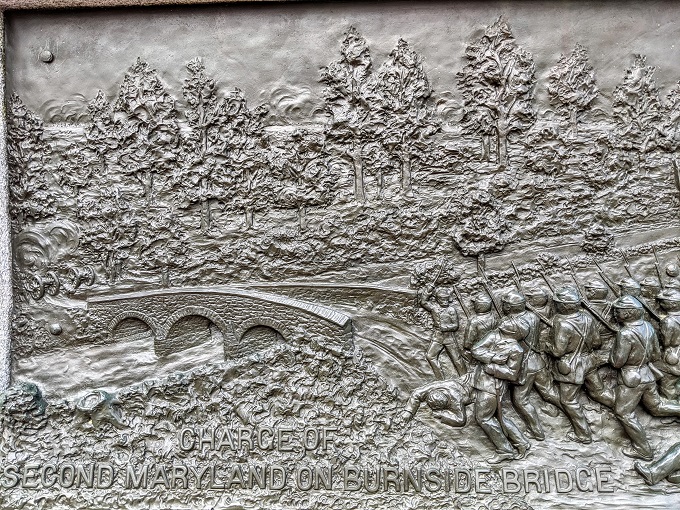
Tour Stop 9 – Lower Bridge (Burnside Bridge)
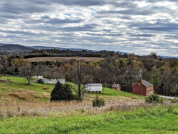
After walking back to our car along the Bloody Lane Trail, we continued on to the next stop. It’s about two miles away and you pass some farmhouses and beautiful scenery along the way.
The ninth stop is Lower Bridge which is also known as Burnside Bridge. You have to park in a parking lot and then walk down a short trail to get to the bridge.
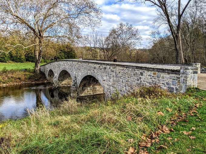
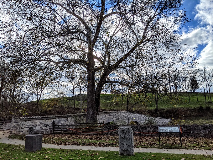
It used to be called the Rohrbach Bridge, but was renamed Burnside Bridge after the battle in honor of Gen. Ambrose Burnside. He was a Union General who led his soldiers to take the bridge from 500 Confederate soldiers who were trying to maintain their position there. Gen. Burnside’s troops were successful though which caused the Confederates to retreat to Sharpsburg.
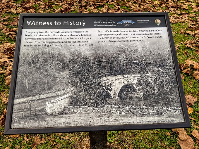
At the time of the battle, there was a young sycamore tree which you can see in the early photograph above. That tree is still standing but, as can be expected, is much taller now than it was then.
Tour Stop 10 – Final Attack
The tenth and final stop of the battlefield itself is the site of the final attack. After taking the bridge, Gen. Burnside and his men advanced on the Confederate army. They were initially successful, but Confederate reinforcements arrived from Harpers Ferry which led to Gen. Burnside retreating back to Antietam Creek. Eventually though, Gen. Lee and his Confederate troops retreated to Virginia.
By the end of the battle, 3,675 soldiers had died (2,108 Union and 1,567 Confederate), 17,301 were wounded (9,549 Union and 7,752 Confederate) and 1,771 were captured or missing (753 Union and 1,018 Confederate).
Neither the Union nor the Confederate army tactically won the Battle of Antietam. Although the Union army suffered the greatest loss of life and had the most wounded soldiers, they’re regarded as having won a strategic victory due to Gen. Lee withdrawing his troops to Virginia.
Gen. George B McClellan was later removed from command by President Abraham Lincoln for not pursuing Lee’s army into Virginia, but the result of the battle led President Lincoln to announce the Emancipation Proclamation just five days later on September 22, 1862.
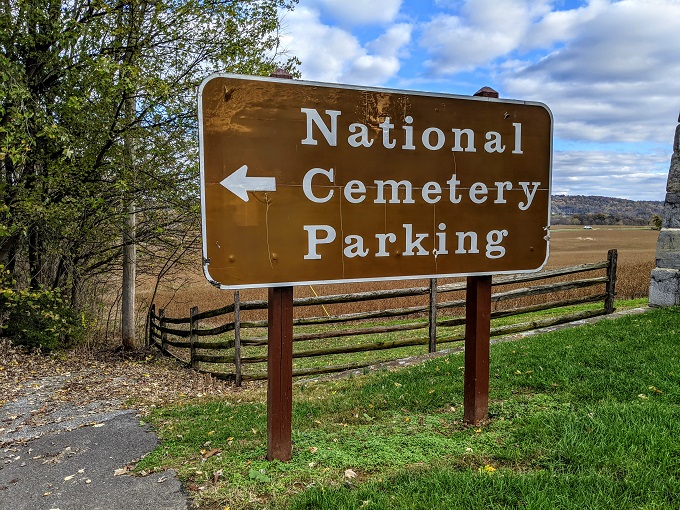
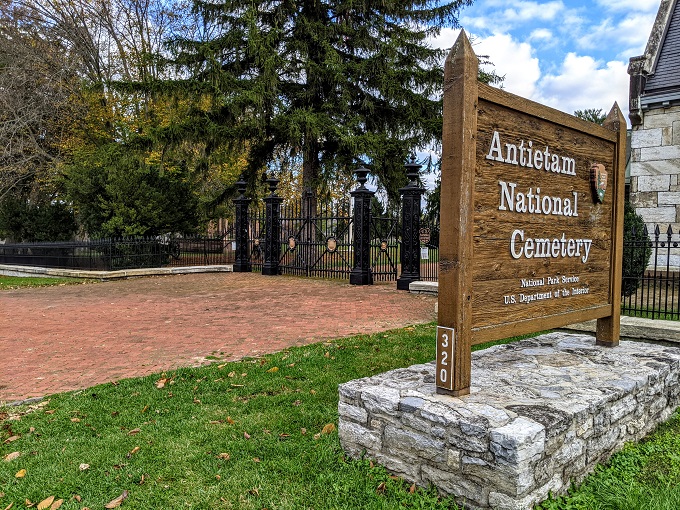
Tour Stop 11 – Antietam National Cemetery
The site of the final attack isn’t the end of the tour though. There’s one final stop to make which is the Antietam National Cemetery. This can be found just off Main St in Sharpsburg, with the parking lot being on the opposite side of the road to the cemetery.
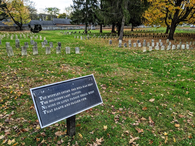
With this being a cemetery, it’s another location where dogs aren’t allowed if you’re visiting with your pup.
There’s a map as you enter showing the layout of the cemetery.
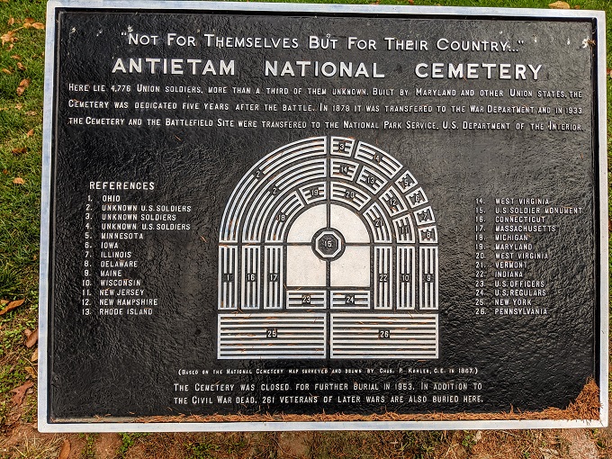
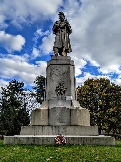
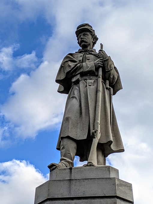
The focal point of Antietam National Cemetery is the U.S. Soldier Monument in the center.
There’s a poem you can read as you walk around, with different stanzas at each section of the cemetery.
Final Thoughts
I’m not someone who’s passionate about visiting lots of battlefields, but I’m glad we visited Antietam National Battlefield if for no other reason than its significance in both the Civil War and as the site of the bloodiest battle in US history.
They’ve done a great job with providing information at each tour stop, providing enough details and context to know what happened as the battle progressed without overwhelming you with too much information to be able to take it in.
Photographs from the aftermath and quotes from soldiers and observers as you go along help paint a scene of something that would otherwise be hard to imagine in what is now a peaceful environment.
Very interesting post!
Thank you! It was great meeting you the other day 🙂
Nice review.
The American Battlefield Trust has educational (and FREE!) apps for most of the major Civil War sites. I haven’t had the chance to try one yet.
Landscape Turned Red by Stephen Sears is a really REALLY well done history of Antietam.
Thanks – I’ll have to check it out 🙂
When living in Shepherdstown WV I frequently visited and walked the Antietam Battlefield. You did made an excellent presentation for those who have not had the opportunity of a personal visit!
Thank you! Hopefully it’ll encourage people to see it for themselves at some point.