Some hikes go as planned. Others don’t. Our hike to Subway Cave along the Boynton Canyon Trail in Sedona, AZ was one of the latter.
Don’t get me wrong – it was a great hike and we got to take in many beautiful views. We just hadn’t done enough research ahead of time which meant we ended up extending how far we had to hike because we took a long offshoot trail in the wrong direction that we shouldn’t have.
We’d therefore highly recommend hiking to Subway Cave – and the length of the Boynton Canyon Trail – but read this post to make sure you learn from our mistakes!
How To Get To The Boynton Canyon Trail
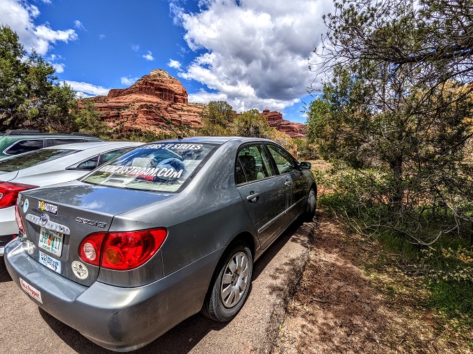
Parking for the Boynton Canyon Trail is about 8 miles northwest of downtown Sedona. We weren’t sure if we were going to find any parking spaces available when we arrived at 1pm on a Wednesday afternoon, but we got lucky as there were a few spots left.
Here’s where the parking lot is on Google Maps so that you can get directions easily.
There’s a fee station at the parking lot. It costs $5 for a one day Red Rock Pass or $15 for a seven day Red Rock Pass. These passes are good at most locations in Red Rock Country (such as Devil’s Bridge and Cathedral Rock), although there were a few exceptions listed on the sign.
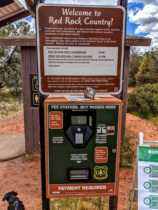
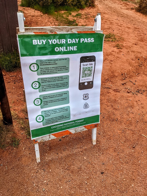
The fee station takes credit cards, but you can also buy your pass online if that’s easier. It’s also probably faster if there’s a long line for the machine.
Interagency passes are valid too, so if you have a National Park Service annual pass then that’s sufficient (that’s what we used).
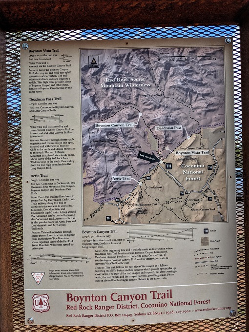
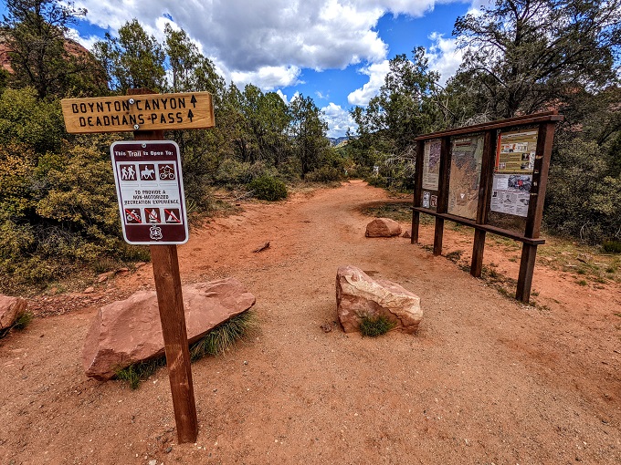
The parking lot also had notice boards with trail maps, hiking safety tips and other information about the local area.
Boynton Canyon Trail – Part 1
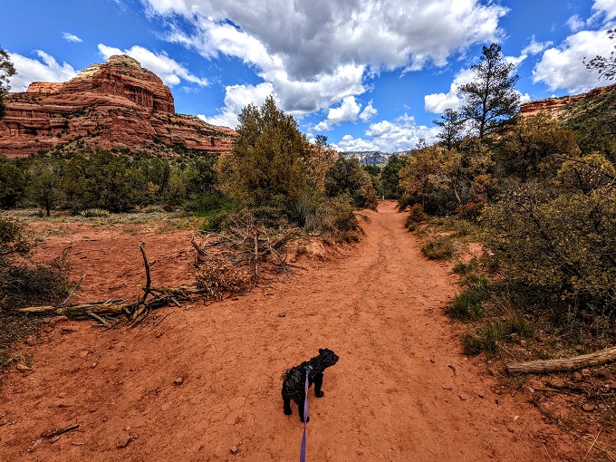
The Boynton Canyon Trail is 3 miles each way and is a very straightforward hike if that’s all you want to do. I’ll be covering it in a few different stages though because there are a couple of offshoot trails (we accidentally made that three offshoot trails) that are worth taking. Neither of the offshoots are particularly long, so we’d recommend taking both of them if you don’t mind lengthening the 6 mile round trip to more like 7.5 miles or so.
Sedona seems to be very pup-friendly and dogs are allowed on the Boynton Canyon Trail, so Truffles came with us.
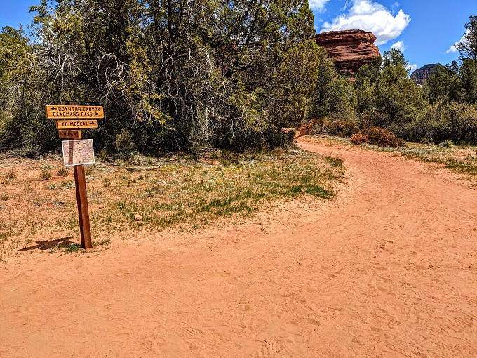
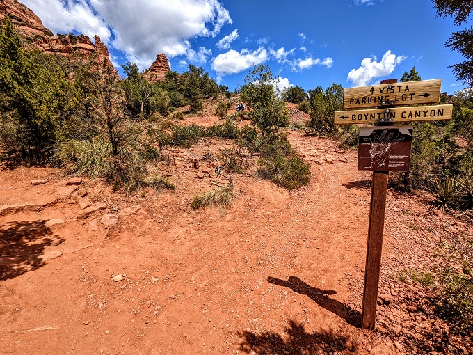
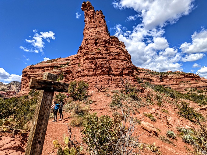
The trail is clearly marked, so be sure to keep following the signs to Boynton Canyon rather than Deadman’s Pass.
Boynton Vista & Boynton Canyon Vortex
After about a third of a mile you’ll see a sign for a trail to Boynton Vista leading off to the right.
The Boynton Vista Trail is only about 0.25 miles each way, so it doesn’t add much time or distance to your hike.
The Vista does what it promises by giving you some tremendous views of the area.
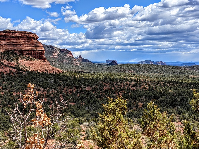
It was about 1:30pm by this stage, so we decided to stop for lunch and enjoy the views.
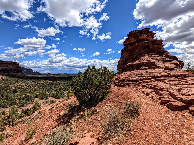
I don’t know if the rock formation where we ate our lunch has a name, but nearby there was a different rock formation called Kachina Woman.
What we hadn’t realized until afterwards was that this was the site of the Boynton Canyon Vortex. There’s a sign at the end of the trail and this is supposedly where the Vortex is. If you’ve never heard of the Vortices (or Vortexes) in Sedona, I’ll let Visit Sedona explain it.
Boynton Canyon Trail – Part 2
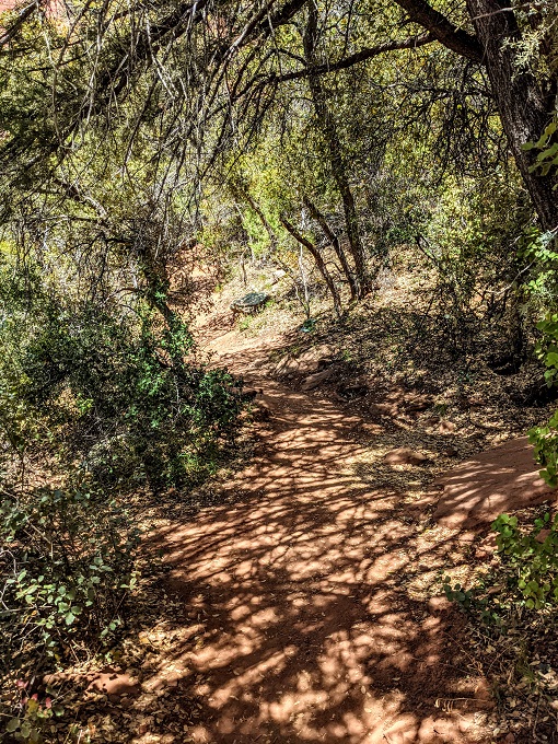
Having stopped for lunch, we headed the quarter mile back down the Boynton Vista Trail and continued on the Boynton Canyon Trail. One of the nice features of this trail is that there’s a fair amount of shade along the way which can make it a much more pleasant hike in warmer temperatures.
Not The Subway Cave Trail
Here’s how our misadventure came about. Shae had seen online that there was an offshoot trail that leads to a place called Subway Cave. The instructions had said to turn right at an alligator juniper tree, but we realized on the trail that we didn’t know what one of those looked like and by the time we were along the trail, we had no internet connection on our phones to Google what they looked like.
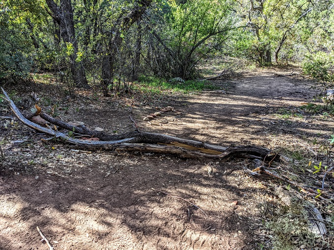
We asked someone heading back along the trail if they knew where the offshoot trail for Subway Cave was and she did. She said that it was about another half mile along, that there was a branch laid across the start of the offshoot and that someone had written ‘Subway’ using sticks.
Feeling more confident about finding that side trail, we continued along Boynton Canyon Trail. After what seemed to be about half a mile, we spotted a tree with bark that looked like alligator scales, so figured that must be an alligator juniper. To the right of that was a side trail with a branch laid across it.
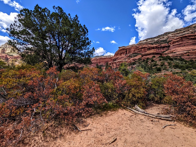
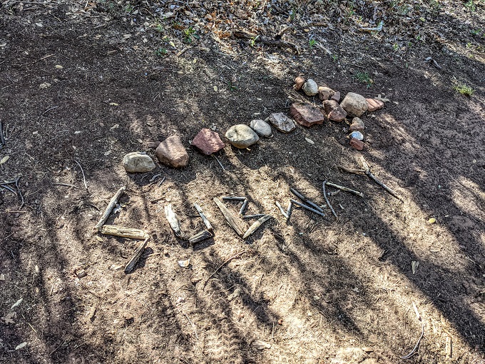
In front of that branch were a bunch of randomly scattered sticks. It certainly didn’t spell out Subway, but we figured another hiker might’ve accidentally kicked the sticks. The stick on the far right looked like it made up two-thirds of a Y, so it was conceivable that the other sticks made up the first five letters.
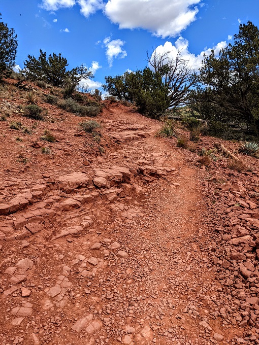
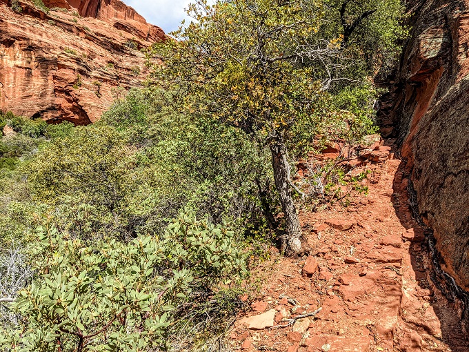
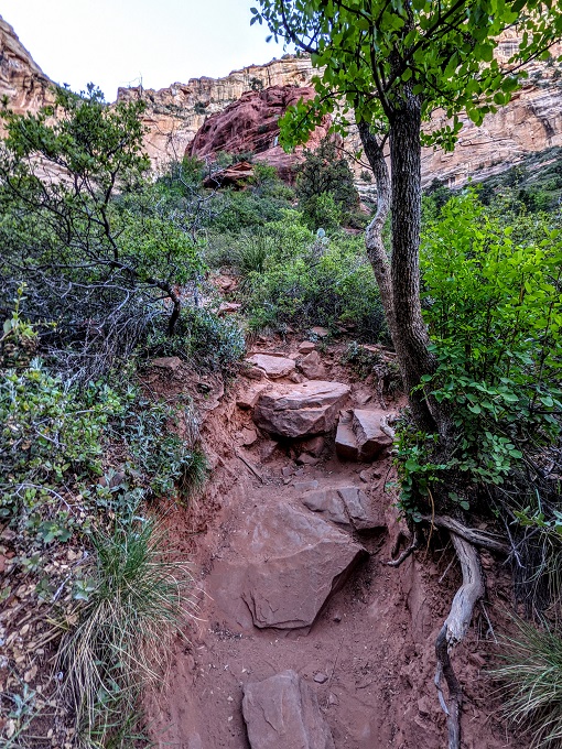
Fairly confident that this was the route to Subway Cave, we headed down the path. What initially seemed to be a trail became a lot less clear. Shae and I followed what seemed to be a semi-trodden route which took us up some fairly steep inclines.
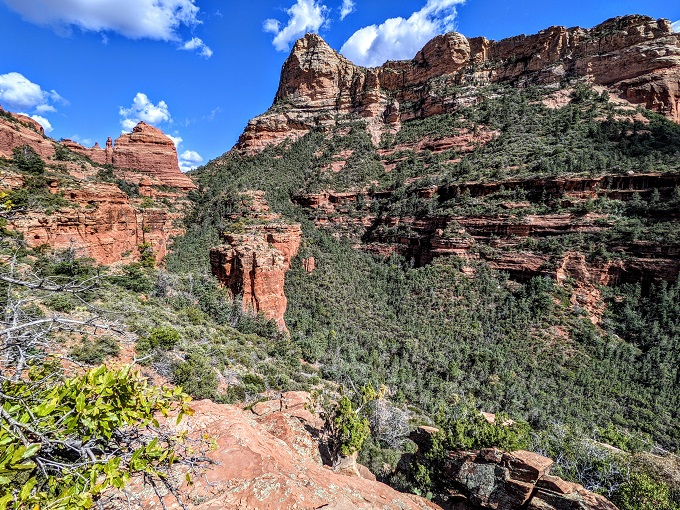
The views along the way made the effort worthwhile.
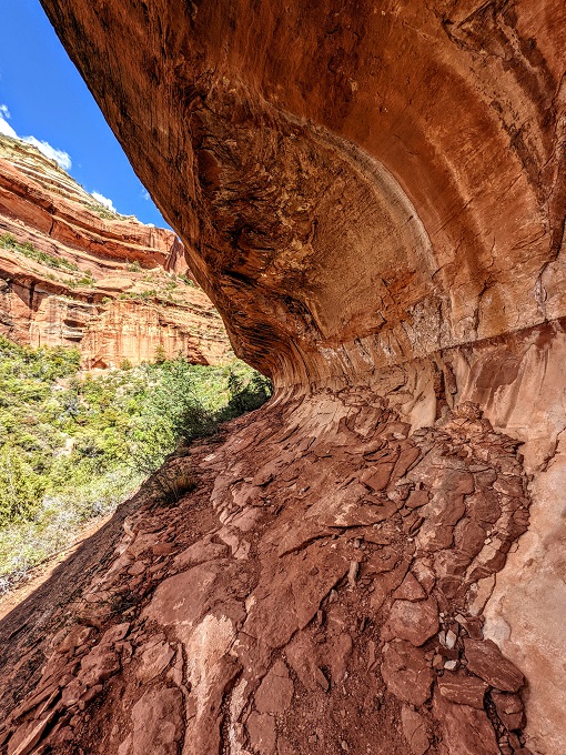
We followed what seemed to be a path along a cliff edge. After a while we came to a curved rock formation that looked like half a subway cave, so figured that we must be on the right trail, although there was some uncertainty by this point.
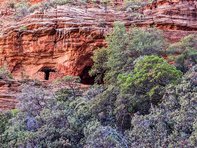
We walked through that semi cave-like section, at which point the trail got even more undefined. Off to the left though, we spotted the top of a cave – could that be it?
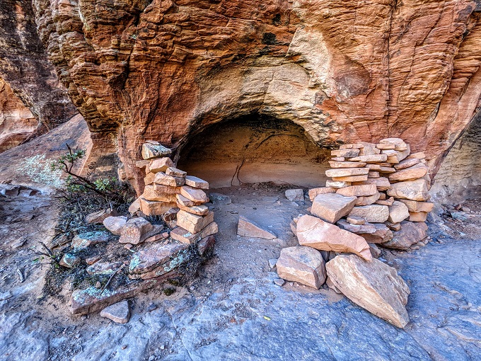
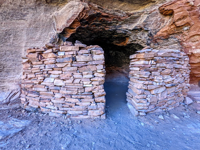
Shae, Truffles and I managed to make our way through to the cave and found what seemed to be the remains of a cliff dwelling.
Shae knew from the online article that there were meant to be stone structures at Subway Cave, so it seemed like we’d finally made it.
Except it also seemed like we hadn’t. I hadn’t read the post about Subway Cave and so didn’t know what it was supposed to look like. Shae had seen a picture of what it looked like when looking out from inside the cave and where we were had nothing resembling that. We wandered all around and couldn’t find any other caves, so all kinds of confused we headed back down.
What was strange was that so many things seemed to indicate we’d taken the correct route. We’d found an alligator juniper, seen a branch across the side trail, come across what looked like half a subway cave and ended up in a cave with cliff dwellings.
As it turns out, those were all just incredibly strange coincidences.
Boynton Canyon Trail – Part 3
We eventually got back to Boynton Canyon Trail after what had probably been a 1.5 mile diversion round trip. If nothing else, it had added 1.5 hours to our day which we hadn’t been expecting.
Somewhat confused and despondent, we continued up the trail where, after a short distance, we passed a couple hiking back. Figuring it wouldn’t do any harm, we asked them if they’d been to Subway Cave. As it turned out, they had.
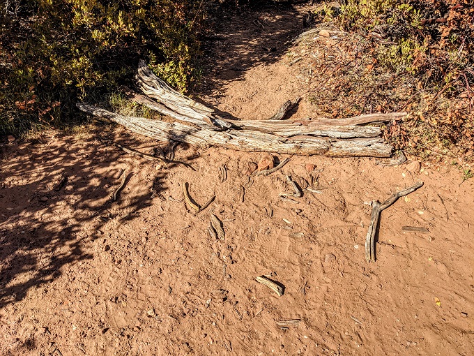
They said that all we had to do was walk a short distance further. We’d then see a branch laid across a side trail off to the right and ‘Subway’ written in sticks, just like the other hiker had said earlier.
The Actual Subway Cave Trail
Sure enough, a short distance later, there was the tree branch…
…and on the other side was ‘Subway’ written in sticks, with a stone arrow pointing the way for good measure.
Shae and I laughed ruefully. We couldn’t believe our bad luck that by taking the wrong trail probably less than 0.25 miles earlier, we’d wasted 1.5 hours looking for Subway Cave in the wrong place.
In hindsight, it’s kinda funny. We also got to see some other kind of cliff dwelling and other views that other hikers don’t get to experience, so it’s certainly not something we regret.
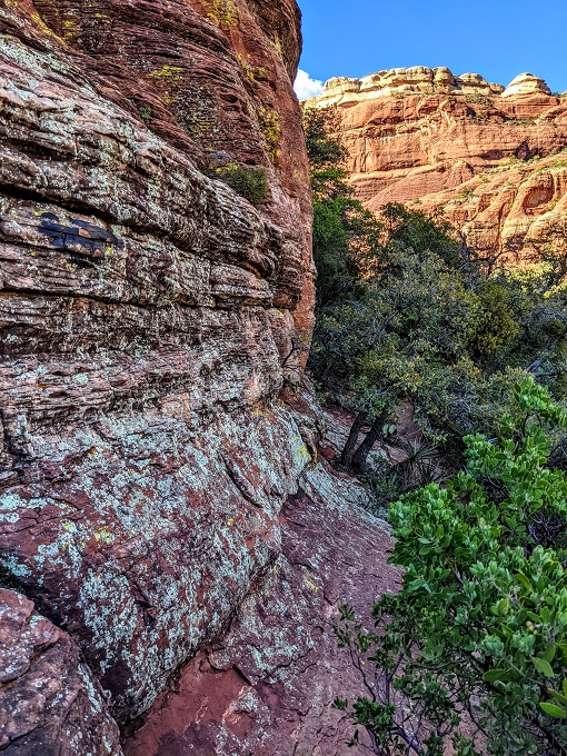
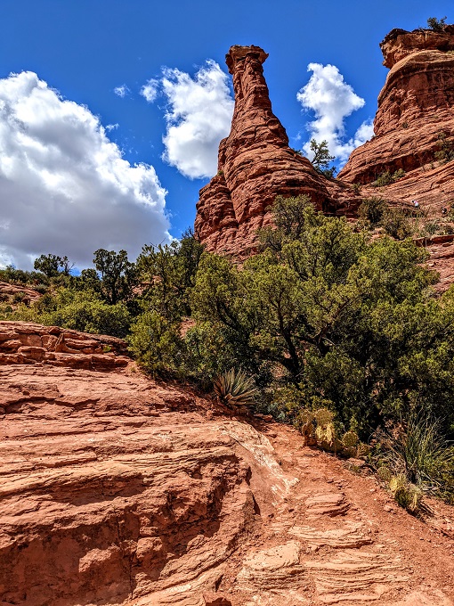
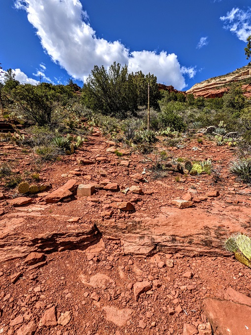
The trail to Subway Cave was much more of a defined path and just before we got there we saw a sign on a tree about the site.
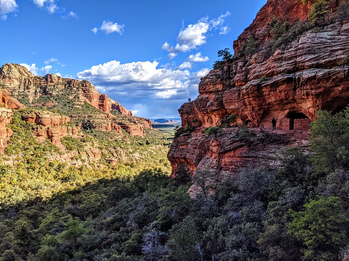
Rounding the corner, we could see some stone structures in the distance.
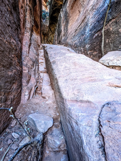
To get up into Subway Cave you have to take a fairly steep, narrow path. The rock wall on the left and rock ledge on the right make it easier to help pull yourself up, although it was a little tricky getting Truffles up due to the smooth rock and how steep it was. Thankfully she’s only 10 lbs or so which made it easier to help her along.
Subway Cave
Finally – we’d made it!
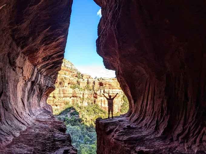
Now that we were in the correct spot and looking at its curved walls, we could see why it was called Subway Cave.
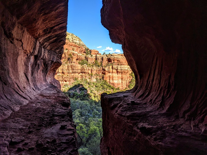
You can walk along both sides of the cave wall, although it’s a dead end on the left. You can still get some spectacular views from there though.
To explore the area more, you have to walk along the cave wall around to the right.
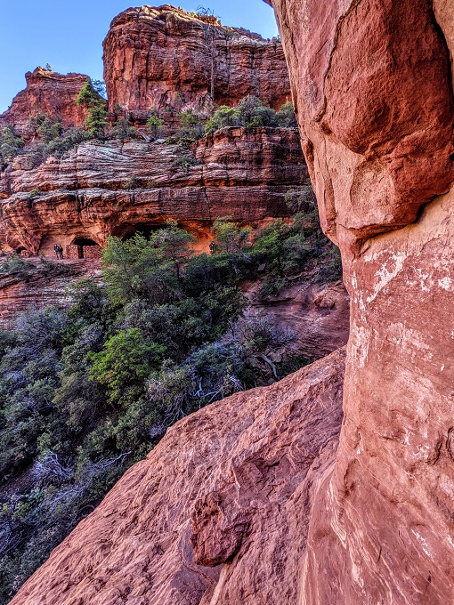
It looks precarious and super narrow, but it actually wasn’t too bad. The path then gets wider around the other side and it serpentines back until you get to the cliff dwellings.
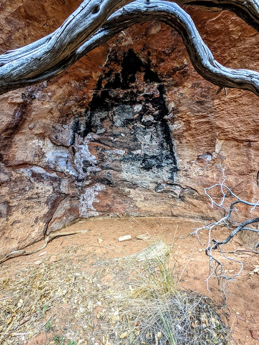
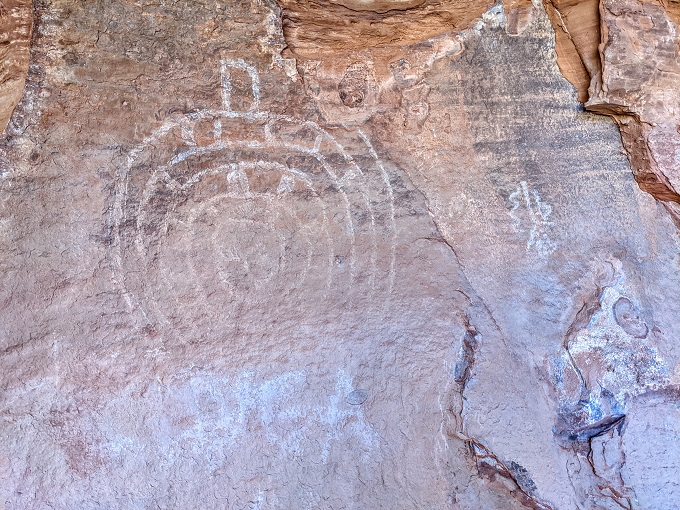
There are a couple of petroglyphs on the wall of one of the caves too.
It was so beautiful up there that we didn’t want to leave. However, we wanted to hike the rest of the Boynton Canyon Trail and then had to hike the 3 miles back, so after almost an hour of being up in Subway Cave, we headed back down.
Boynton Canyon Trail – Part 4
Feeling a little more energized having found the correct Subway Cave, we continued along the Boynton Canyon Trail. We didn’t think there was too much further to go, but apparently we’d underestimated how far we’d already hiked along the trail.
You gain about 700 ft in elevation from the start of the trail to the end, with more than half that elevation coming in the last mile. Having added about 2.5 miles to our hike due to the Boynton Vista Trail, the incorrect trail and the Subway Cave Trail, our legs didn’t appreciate what seemed like the constant incline for that last mile.
Someone else was hiking back, so we asked her how much further it was and she said it was only a little further. Her definition of a little further is apparently a little longer than ours as we seemed to clamber up several more rocks and walk round a seemingly endless number of corners before we finally reached the end of the trail. After our misadventures earlier that day, we were grateful that there was an official sign letting us know we’d reached the end!
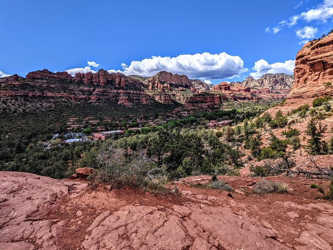
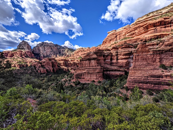
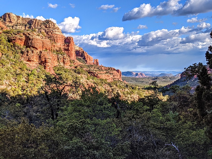
Seeing as the trail had led us deeper into Boynton Canyon, Shae and I figured that the end of the trail might be a little lackluster with high rock walls on either side, but not much of a view. It turned out to be more expansive than we were expecting and gave some fantastic views.
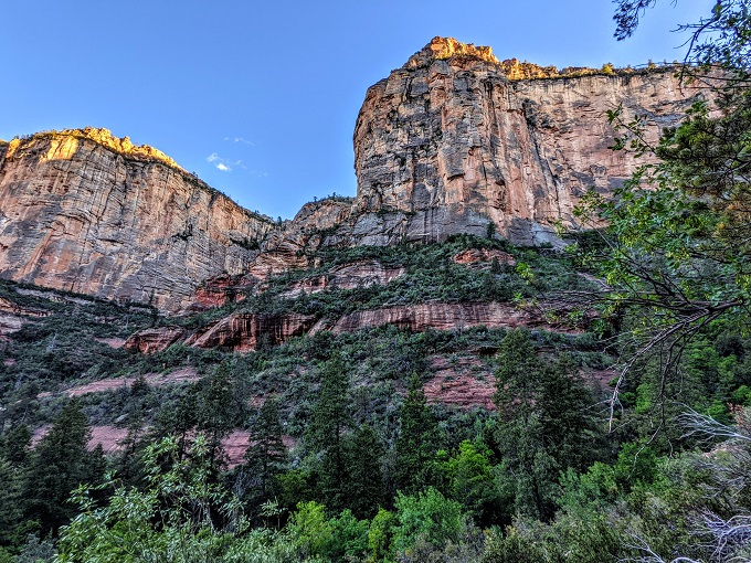
These views made it worth hiking all the way to the end of the trail.
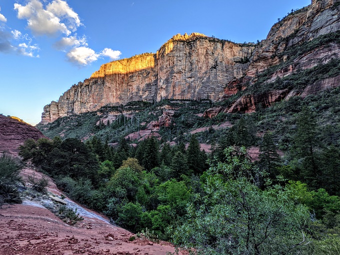
As you can see from those last two photos though, the sun was going down by this point. We reached the end of the trail at 6:37pm, with sunset that day being at 7:10pm. That gave us 30 minutes or so to hike back 3 miles if we wanted to get back to our car before sunset.
Needless to say, that wasn’t going to happen.
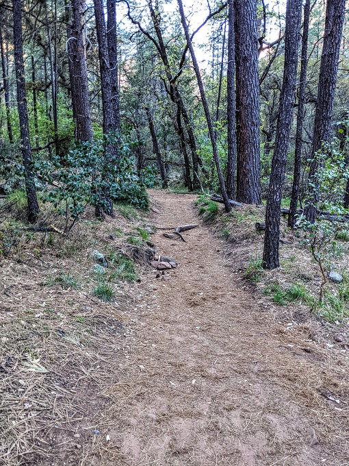
Thankfully both our phones still had about 75% charge, so we were able to use the flashlights on them to help us find our way back. I mentioned at the beginning of the post that the Boynton Canyon Trail is very straightforward, so that was helpful as it meant we didn’t have any problems with getting lost on the way back.
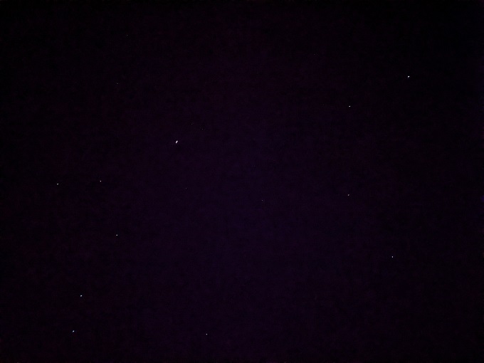
I’d highly recommend having some kind of flashlight with you (whether that’s a standalone flashlight or one on your phone) when hiking the Boynton Canyon Trail in the afternoon/evening because this was the night sky by the time we were on the last mile of the trail.
Final Thoughts
Despite taking a lengthy side trail that simultaneously led to nowhere but somewhere, Shae and I loved hiking the Boynton Canyon Trail. Funnily enough, the best parts of the trail weren’t the Boynton Canyon Trail itself – it was the views you get on the Boynton Vista Trail and Subway Cave Trail that really make it worth hiking. Even the incorrect trail we took provided some amazing views that made it a beautiful day out in Sedona.
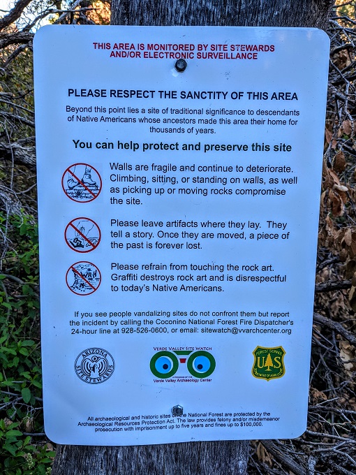
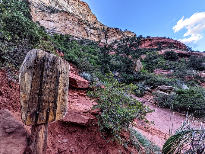
Congratulations! You’ve sold out a site that has Native American ruins sacred to the Yavapai Apache tribe to get clicks on the internet. We have documented evidence of the ruins having already suffering damage this year thanks to bloggers like yourself! I hope you feel great sleeping at night knowing that in order to get likes and clicks you’ve disrespected native culture.