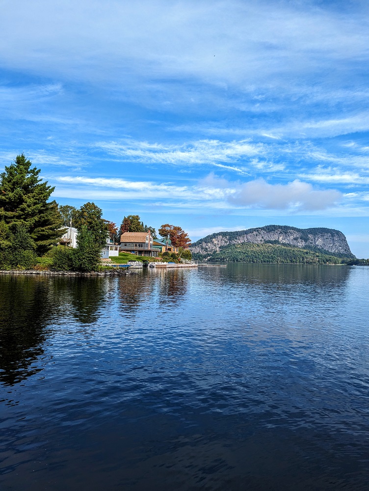
Our first week in Maine involved several hikes. We started off at Lily Bay State Park and then a couple of days later we headed to Mount Kineo State Park to hike up the mountain it’s named after.
It was a fairly strenuous hike uphill, but it was most definitely worth it. The views on the way up are lovely, while the views from the summit are spectacular courtesy of the Observation Tower at the top.
The hike includes the added bonus of getting a round trip ferry ride, so here’s everything you need to know about hiking up Mount Kineo.
Kineo Shuttle
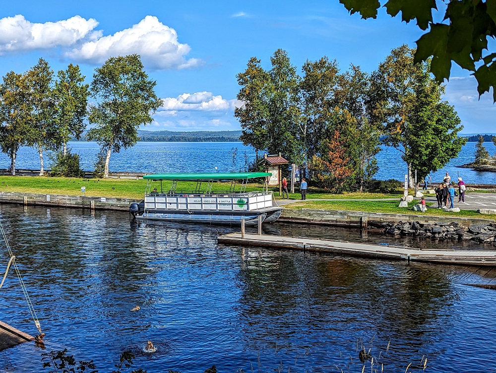
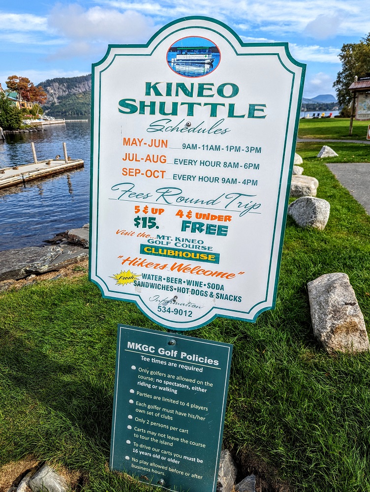
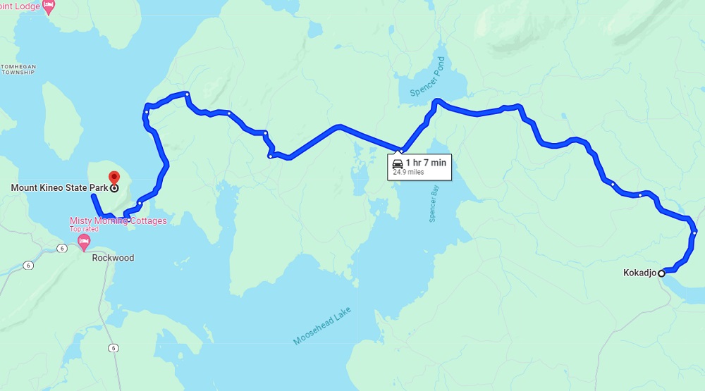
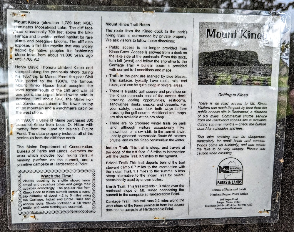
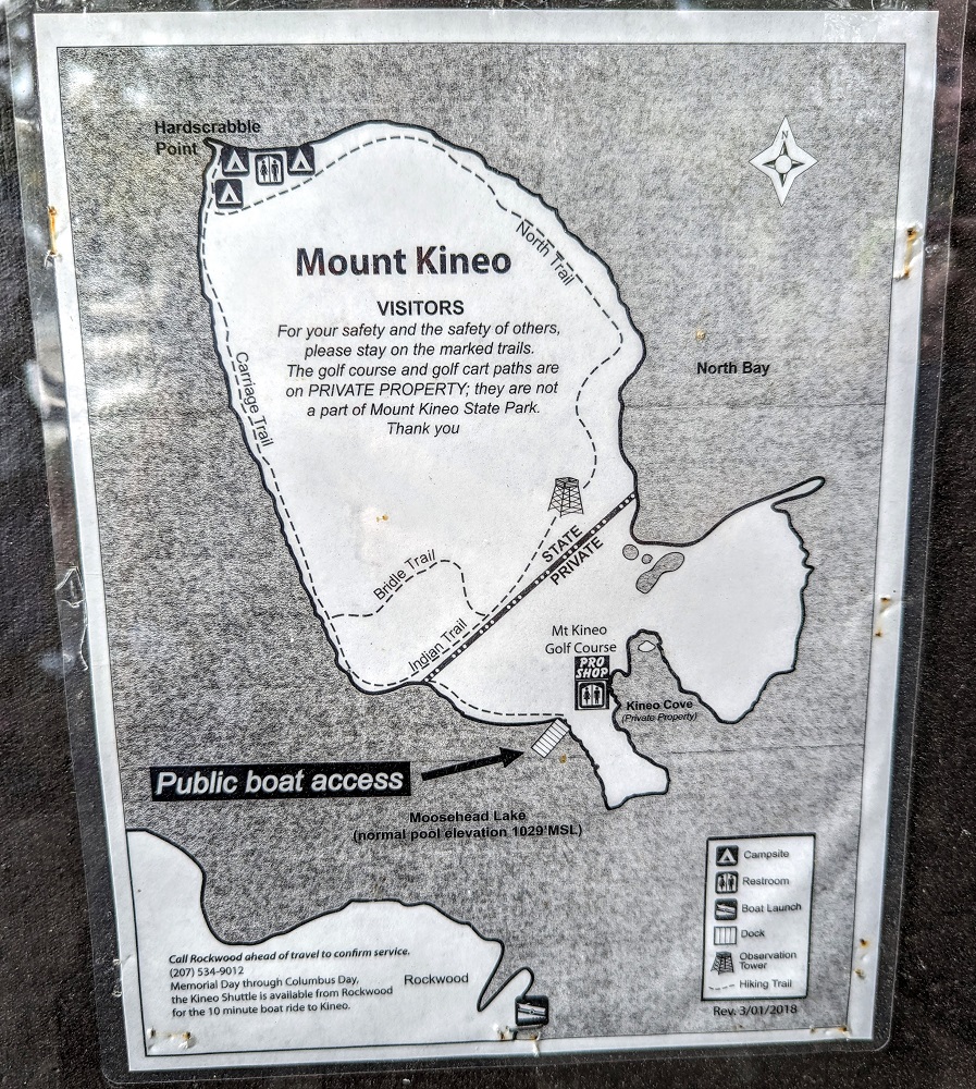
Mount Kineo State Park is a peninsula opposite the town of Rockwood in Maine. When researching how to get to Mount Kineo State Park, I saw that there’s a boat shuttle that ferries you across from Rockwood and back again afterwards. The Kineo Shuttle leaves on the hour every hour from Rockwood, so we headed there just in time to catch the 10am ferry crossing. You can find its location here on Google Maps in case you want to get driving directions. This shuttle runs from May to October; outside of that time you need to cross in your own boat, although the lake does apparently ice over during the winter preventing you from doing that.
At the time of our visit in September 2023, it cost $15 round trip for passengers ages 5+, with those 0-4 years old being free. Good news if you’re traveling with pups – dogs are allowed on the boat and it’s free for them to join you.
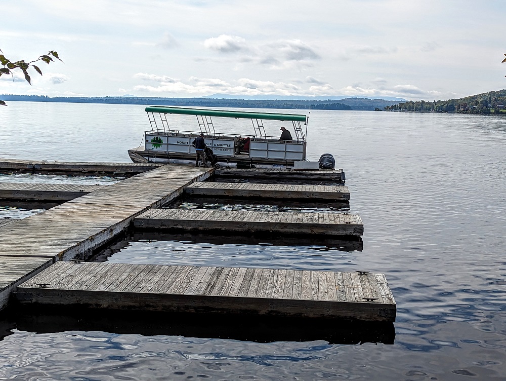
The boat journey was much quicker than I was expecting, so it only took about five minutes to make our way across the narrow stretch of Moosehead Lake.
At the end of your time at Mount Kineo State Park, you can catch the ferry back on the :45, with the last journey being at 4:45pm. You board the Kineo Shuttle for the journey back at the dock where they drop you off.
What I hadn’t realized until writing this post is that there is – in theory – a driving route across seeing as it’s a peninsula rather than an island. We were staying in Kokadjo and Google Maps suggests it’s possible to drive it. However, an information board at the park said it’s not accessible by road, so don’t be fooled – you will need to visit Mount Kineo State Park by boat.
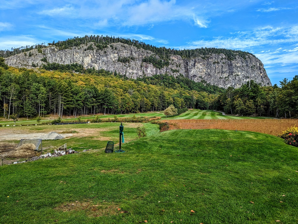
Mount Kineo Golf Course
The area surrounding Mount Kineo isn’t only home to the state park, but a golf course as well.
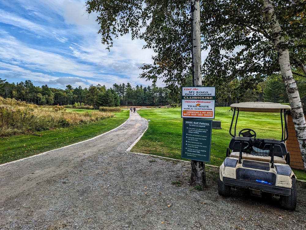
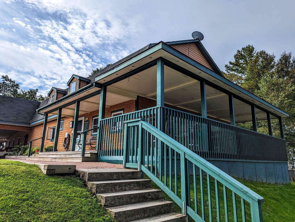
When arriving on the Kineo Shuttle, the park’s hiking trails are off to the left, while the golf course is off to the right. The golf course welcomes hikers and has a clubhouse where you can use their restrooms before and/or after your hike, get something to eat and drink, etc.
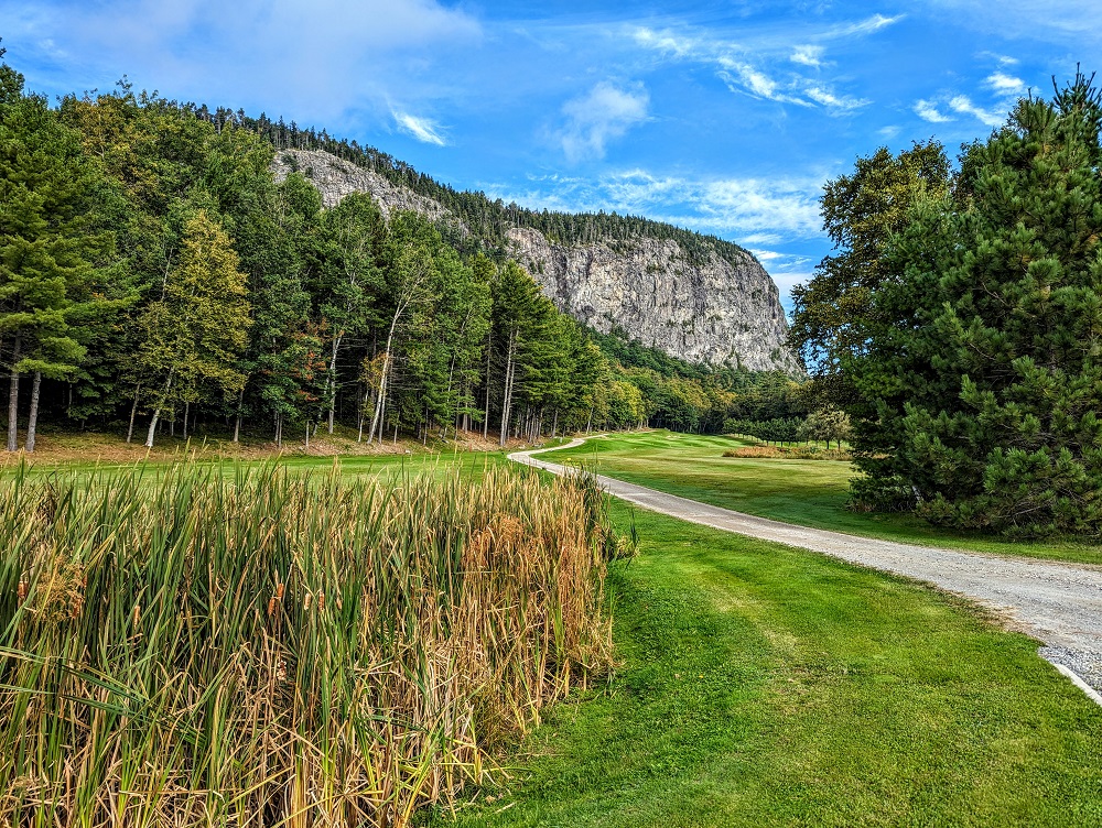
I’m not much of a golfer (occasional rounds of Topgolf have been the extent of my playing in the last 15 years), but if I lived in that general area of Maine I could be convinced to take up golf. That’s because the Mount Kineo Golf Course is in such a beautiful setting – having the mountain as a backdrop and the coastline nearby makes for an amazing place to play a round.
Carriage Trail
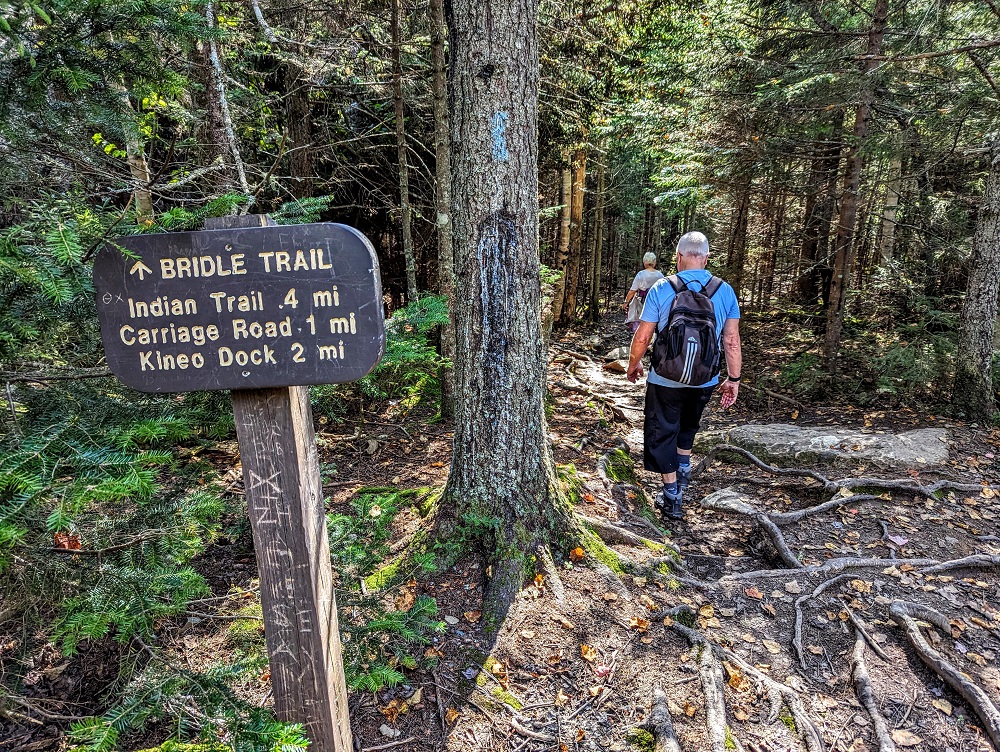
Anyway, we weren’t there to play golf – we were there to hike! As we disembarked from the Kineo Shuttle, the captain suggested to the hikers (there were golfers on the boat too) that they should take the Indian Trail on the way up and the Bridle Trail on the way down.
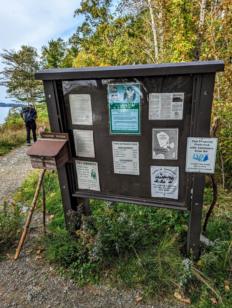
To get to either of those trails though, you first have to take the Carriage Trail. Similar to the National Park Service, Maine has a passport you can get to collect stamps at their various state parks. At the start of the Carriage Trail there’s a passport station to collect Mount Kineo’s stamp.
Mount Kineo State Park does have a nominal fee of $3 for Maine residents and $4 for those from outside of Maine. That’s the adult rate; it’s $1 for those aged 5-11 and free for children younger than that. Seniors ages 65+ are free if they live in Maine or only $1 if they’re non-Maine residents.
I’m not sure where you’re supposed to leave your money though as I don’t remember seeing a pay station. We’d bought a Maine State Parks annual pass at Lily Bay State Park though, so we weren’t on the lookout for a pay station as our fees were covered by that pass.
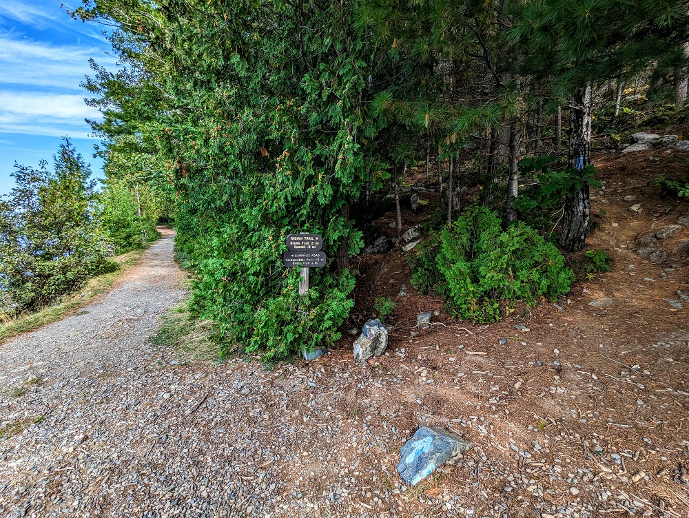
The information board at the start of the Carriage Trail also has a map of the handful of trails in the park. The trails are all well marked, so I imagine it’s hard to get lost there.
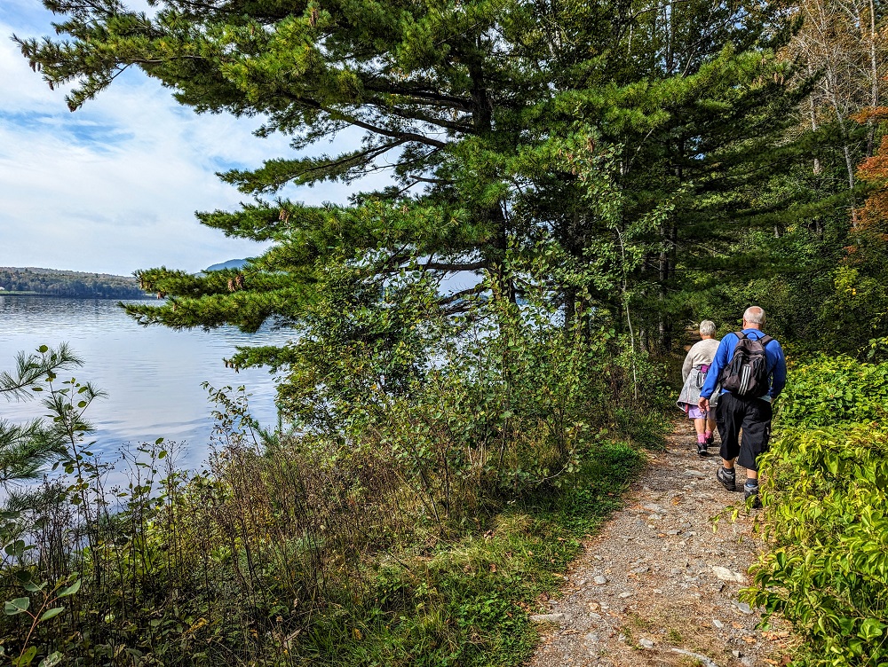
The Carriage Trail follows the shoreline, so it’s fairly flat and easy to walk along. If you just want an easy hike, you can walk the Carriage Trail out and back which takes you along the western side of the peninsula.
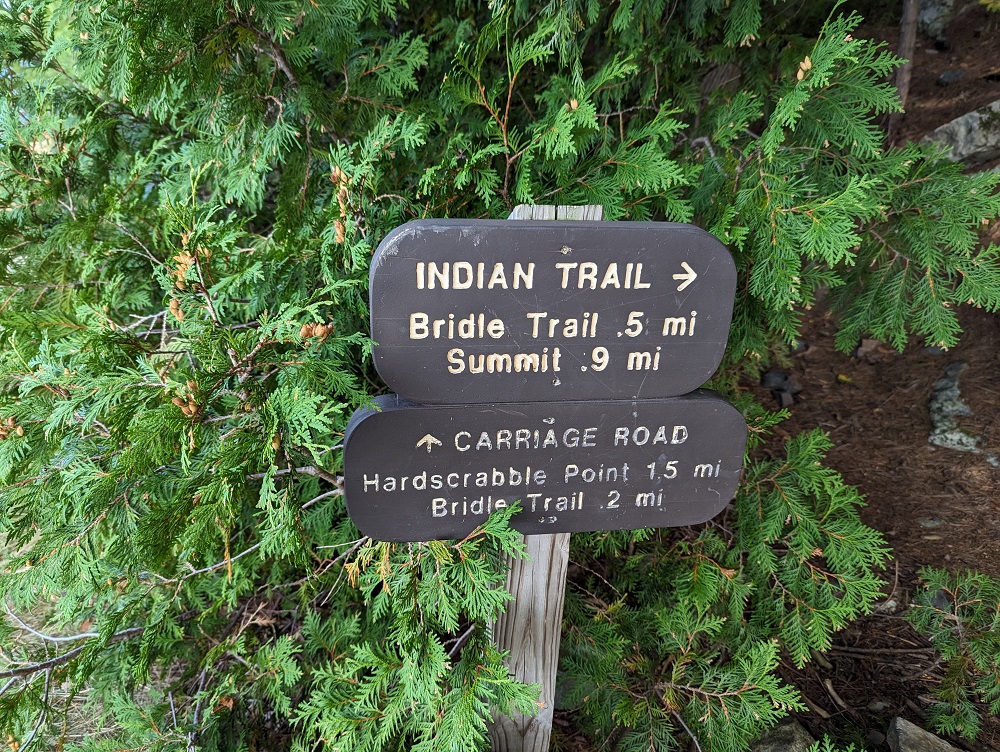
Indian Trail
If you want something more challenging though, you’ll want to take one of the other three trails – the Indian Trail, Bridle Trail or North Trail. The North Trail will take you the farthest distance, so be aware of how long it’ll take you to hike that based on when the last Kineo Shuttle journey back to the mainland will be.
The boat’s captain had recommended we take the Indian Trail up rather than the Bridle Trail, so we followed his advice. The Indian Trail is the first trail you’ll see branching off to the right.
It’s only 0.9 miles from the start of the Indian Trail up to the summit, but it feels longer than that as it’s uphill most of the way.
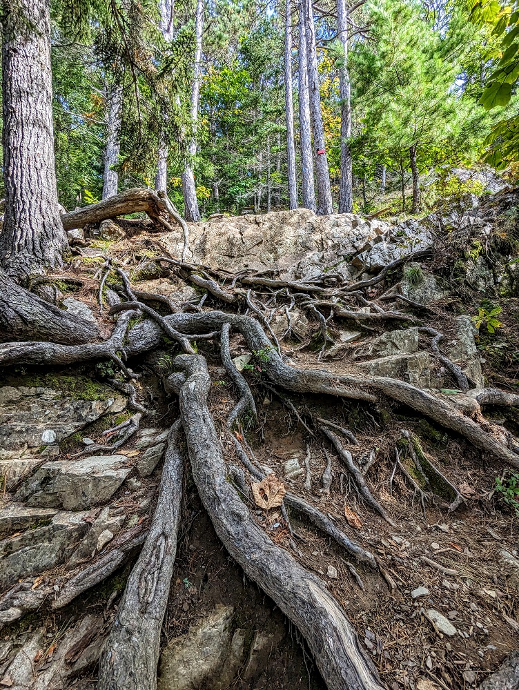
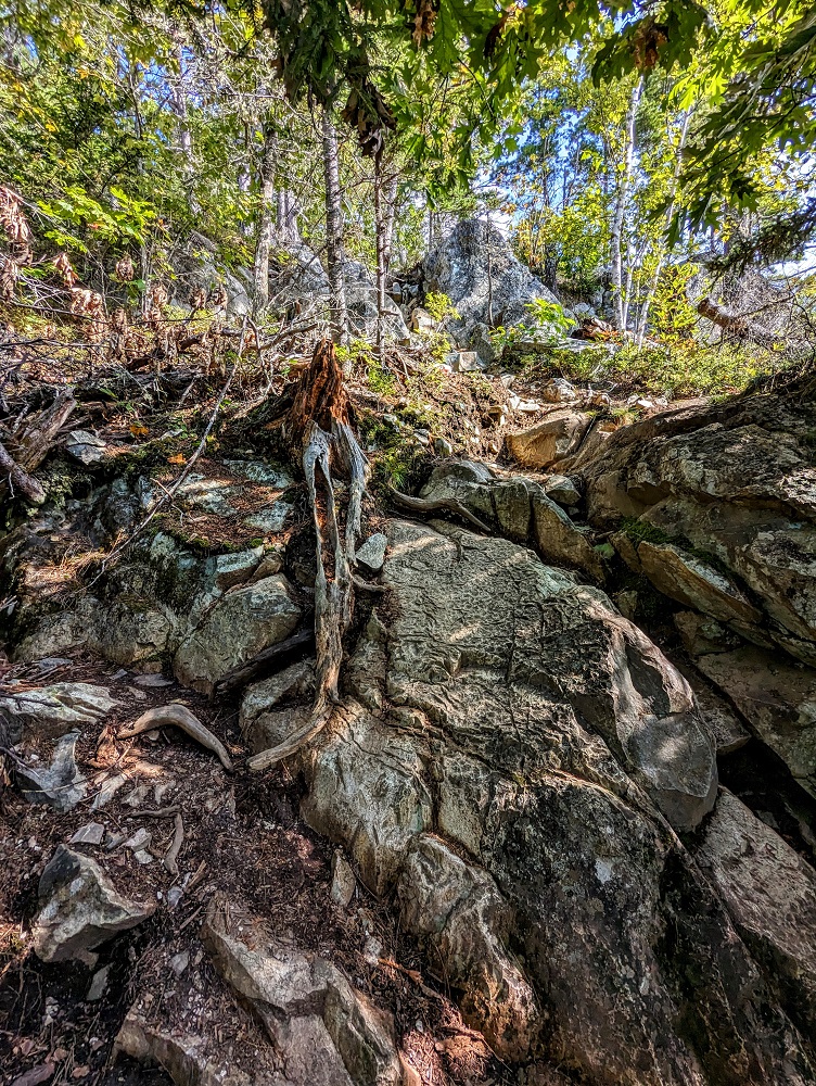
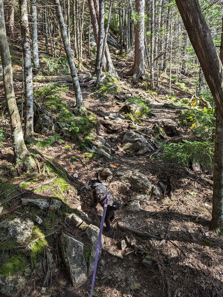
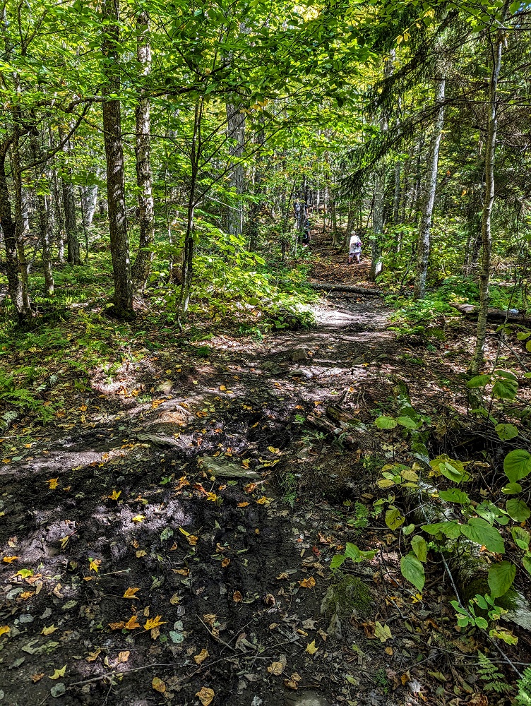
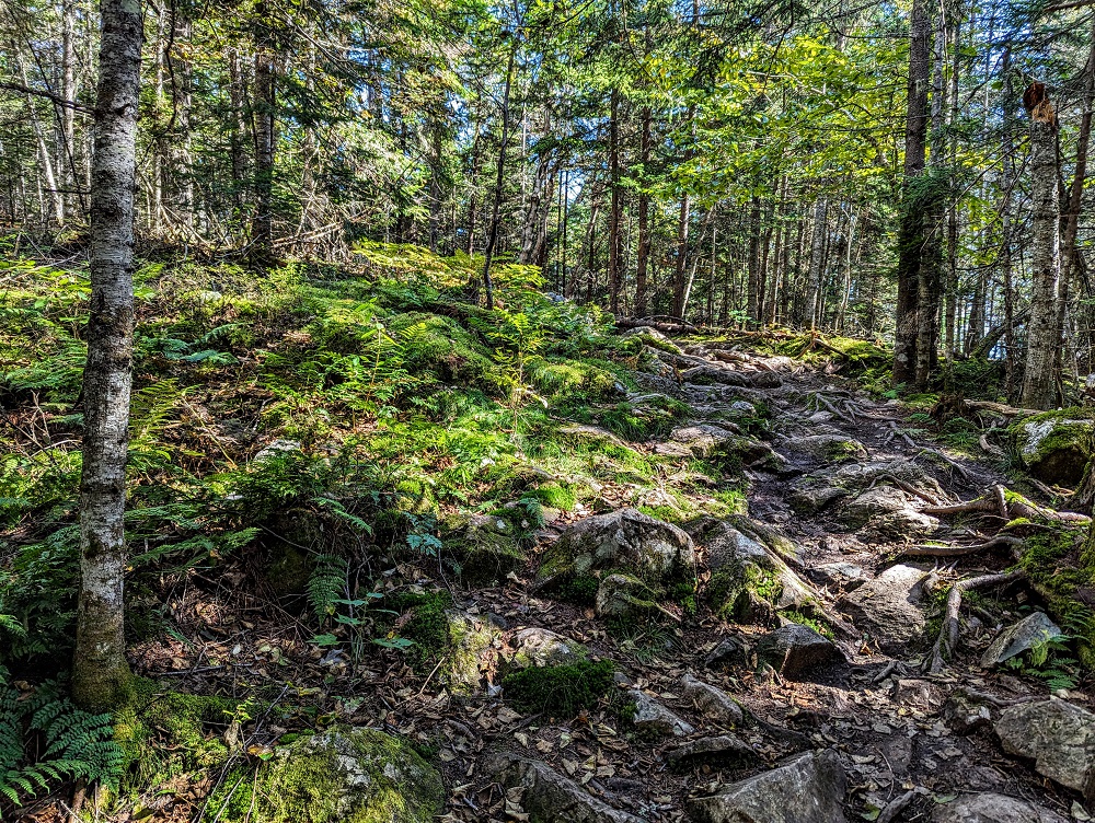
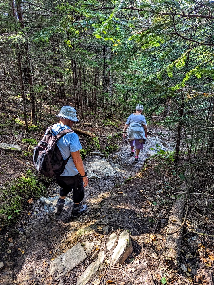
The Indian Trail is easy to follow, but there are tree roots and rocks all along the trail, so decent footwear is a must.
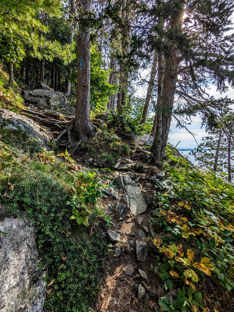
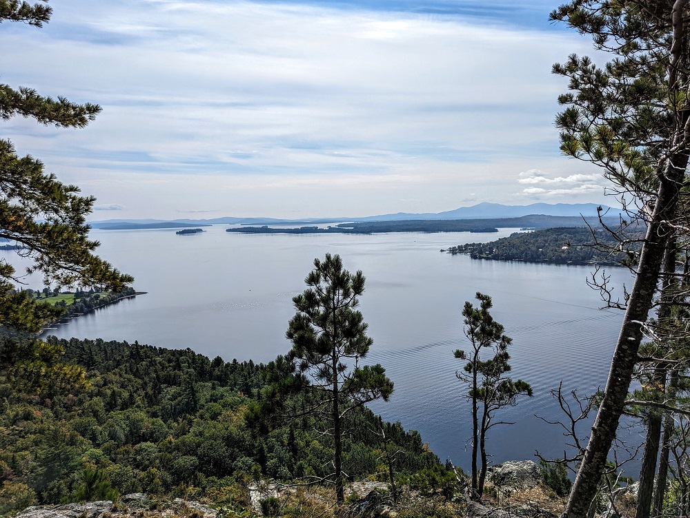
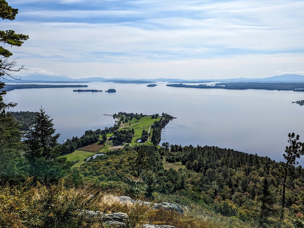
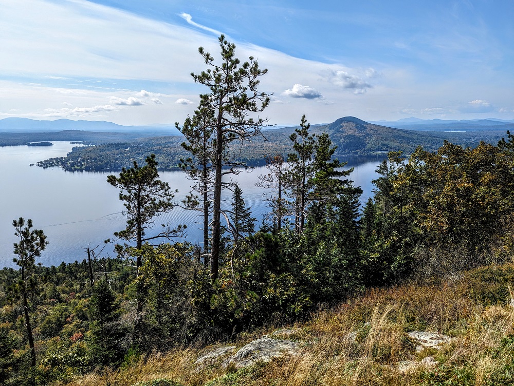
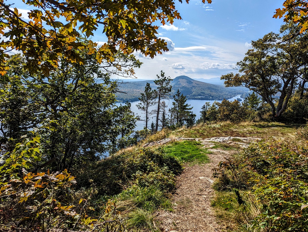
I can see why the Kineo Shuttle’s captain had recommended taking the Indian Trail on the way up. Both routes would be hard going, but the Indian Trail follows the cliff line and so rewards you with awesome views on the way up – it’s a great excuse to take a breather and admire the view!
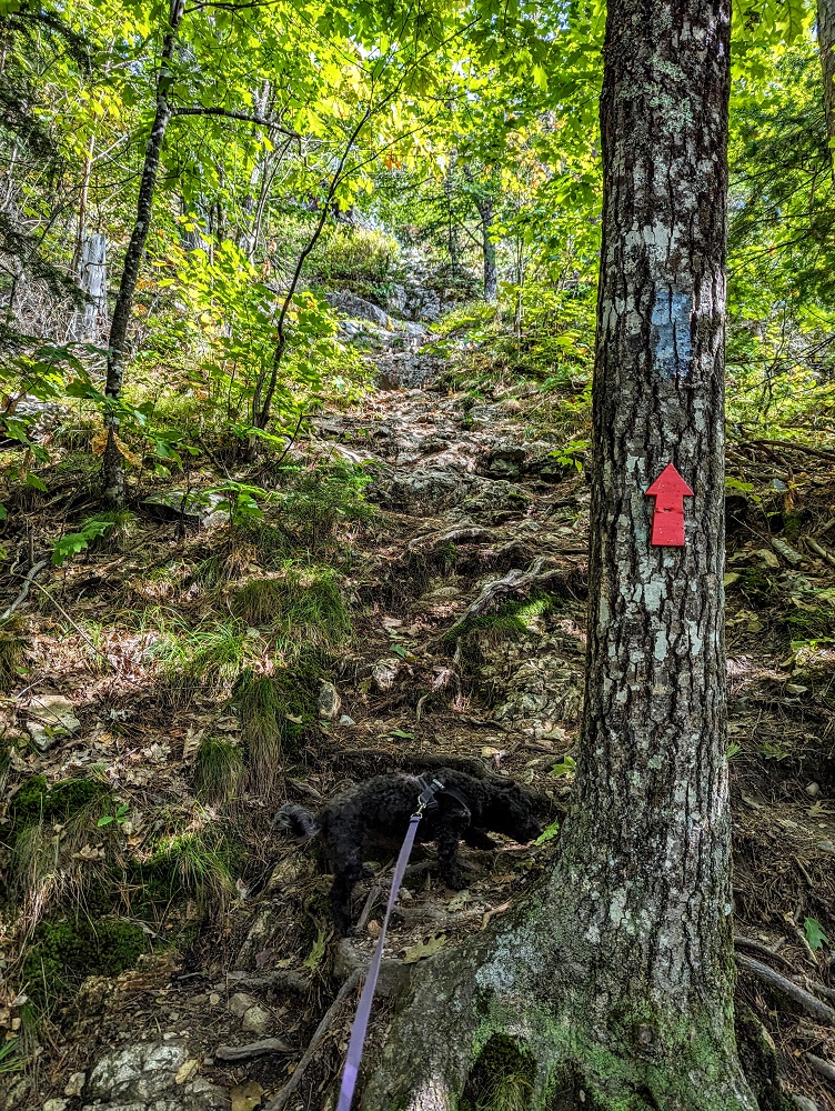
The trail uses blue trail blazes on trees to mark the way, although you’ll also sometimes see red arrows pointing straight ahead, left or right where there might be confusion about which way to head.
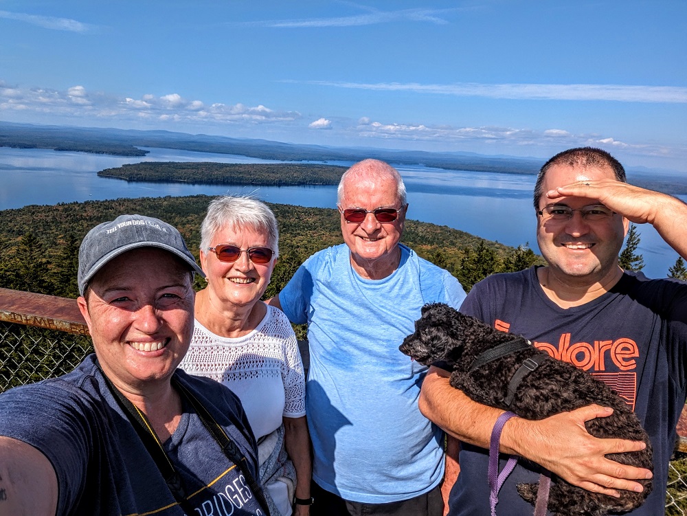
As you can see in the photo below, Mount Kineo State Park is pet-friendly, so we brought Truffles along with us.
My parents were also over from the UK to join us on our 50 state road trip for a month, so they joined us on the hike too. This next photo gives a sense of how steep some of the trail is!
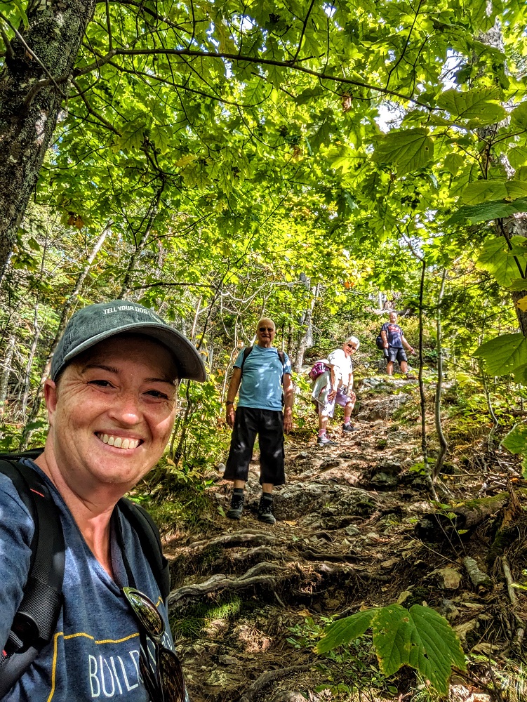
Seeing as the Indian Trail is only 0.9 miles long, I don’t know if I’d classify it as difficult. However, it is strenuous and requires some scrambling at points.
Don’t worry if you’re scared of heights. Although the trail follows closely enough to the edge to continue getting nice views as you hike uphill, you’re far enough from the edge to not have to worry if you lose your footing.
Despite being 10 years old and only 10 lbs, Truffles had no problem leading the way up to the summit.
The views from the trail didn’t get old. At one point you could see one or two of the holes on the golf course which further made me want to take up golf in Maine.
Bridle Trail
The Indian Trail runs for about half a mile, then turns into the Bridle Trail for the remaining 0.4 miles up to the summit.
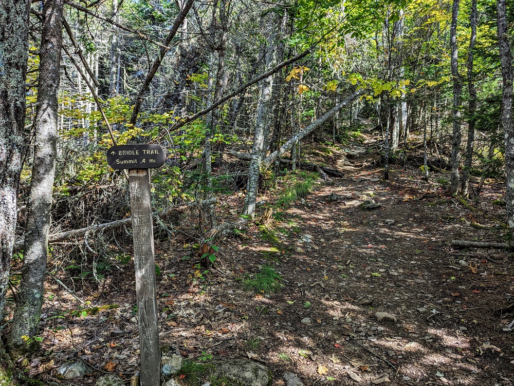
For some parts of the Bridle Trail the incline is less steep, offering a little respite, but then continues more steeply again later on.
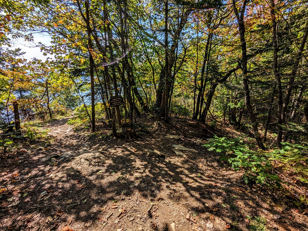
Observation Tower
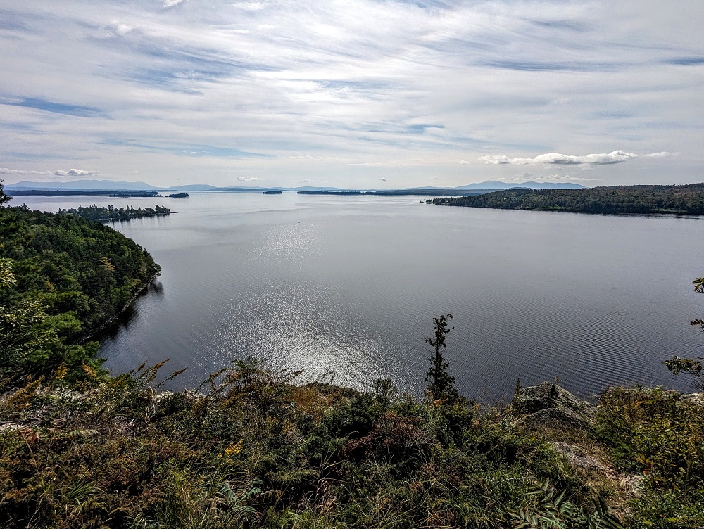
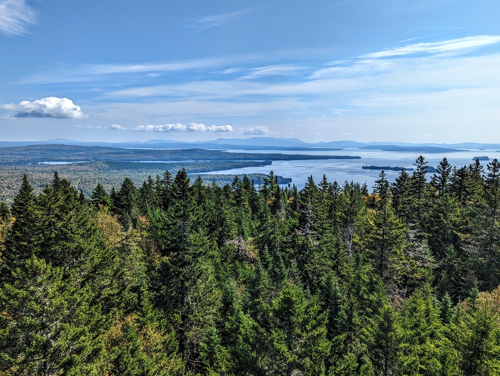
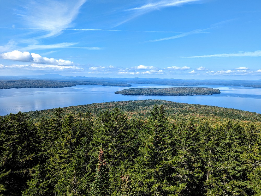
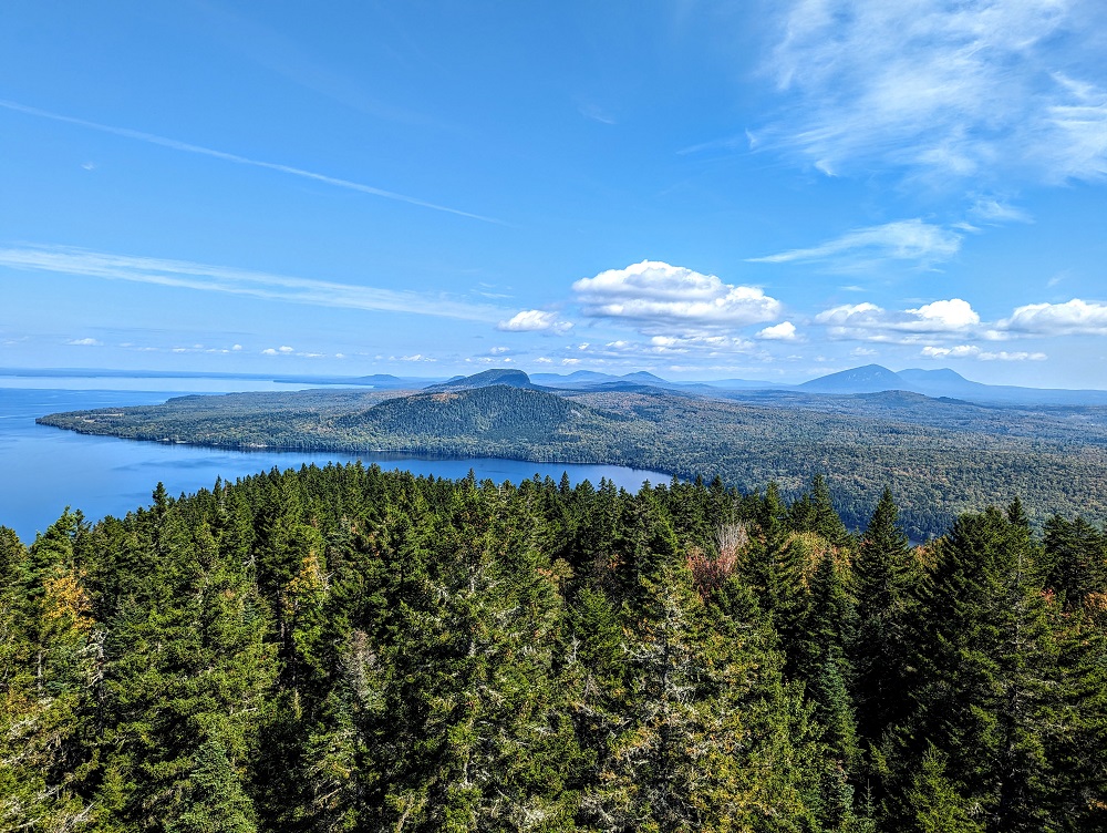
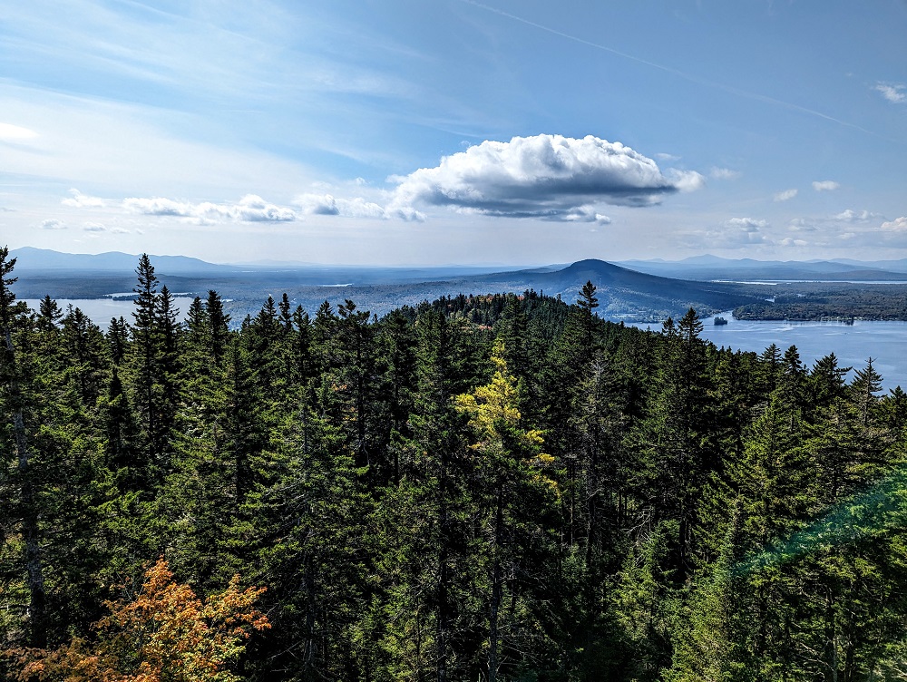
While you get excellent views along the Indian Trail on the way up, the hike’s payoff comes when you reach the summit. The view from the summit itself isn’t special as you’re surrounded by trees. However, there’s an observation tower (which I think is a former fire tower) which you can climb up.
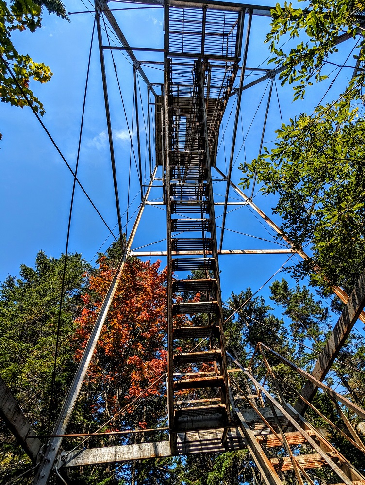
There are 73 steps up the observation tower and it’s totally worth making that additional effort. The views from the top really are spectacular as you get 360 degree views of the surrounding area. We visited at the end of September; I imagine in early-to-mid October the views are even more incredible due to the fall colors.
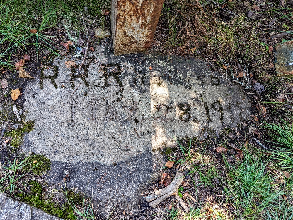
At the base of the tower there was a carved stone suggesting this tower – or perhaps an earlier incarnation of it – was erected on May 28, 1918.
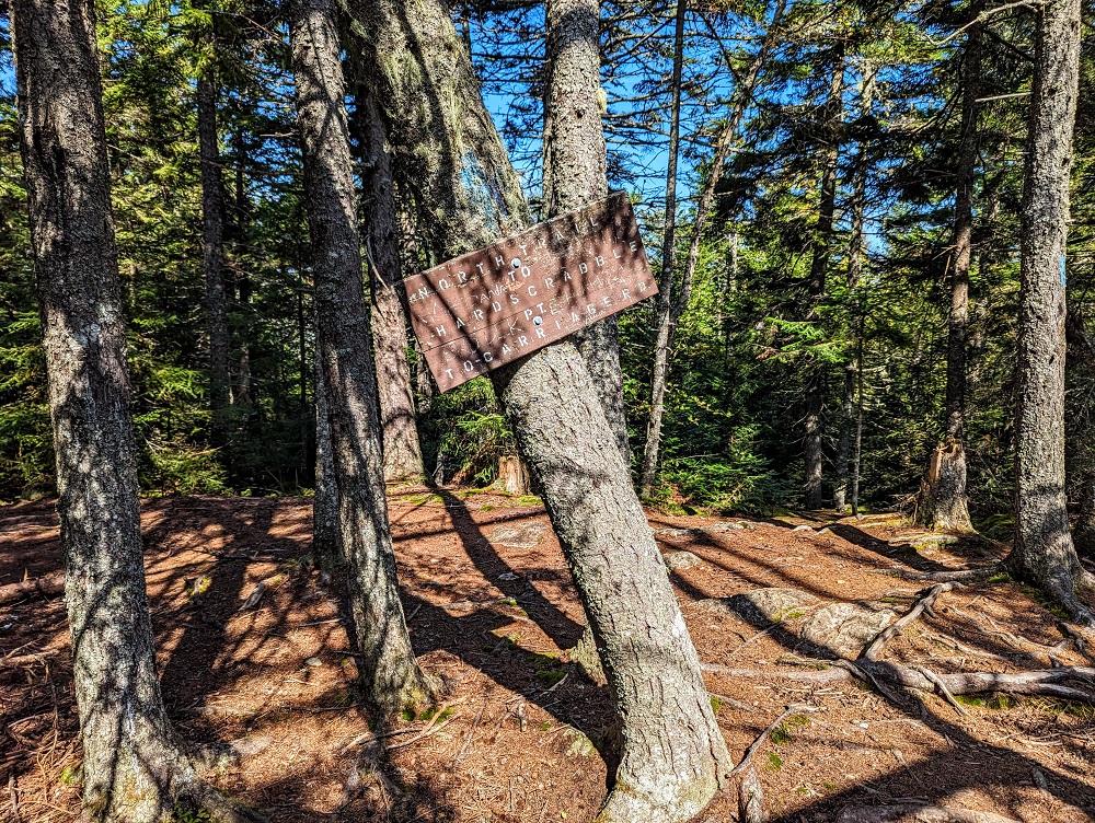
Just beyond the tower is the start/end of the North Trail, the other trail in Mount Kineo State Park. That leads you to the northern part of the peninsula, up to Hardscrabble Point. That trail adds quite a bit of distance to your hike, so if setting off in that direction make sure you have enough time to get back to the shuttle in time for its last journey back at 4:45pm (n.b. the latest shuttle time might be earlier or later at different times of the year, so be sure to verify before you set out hiking).
Bridle Trail Back Down
Seeing as the Kineo Shuttle’s captain had suggested taking the Indian Trail up and Bridle Trail back down, we did indeed take the Bridle Trail back down.
After 0.4 miles it splits, with the Bridle Trail continuing down to the right and the Indian Trail back off to the left.
We paused at the split because just off to the left was a good spot for a picnic thanks to the views of Moosehead Lake and some larger rocks to sit on.
The Indian Trail is 0.5 miles down from there, while the Bridle Trail is 0.6 miles down. I think that means the descent is a little less steep, although there are still some steep parts and you’ll want to mind your footing as some sections were wet.
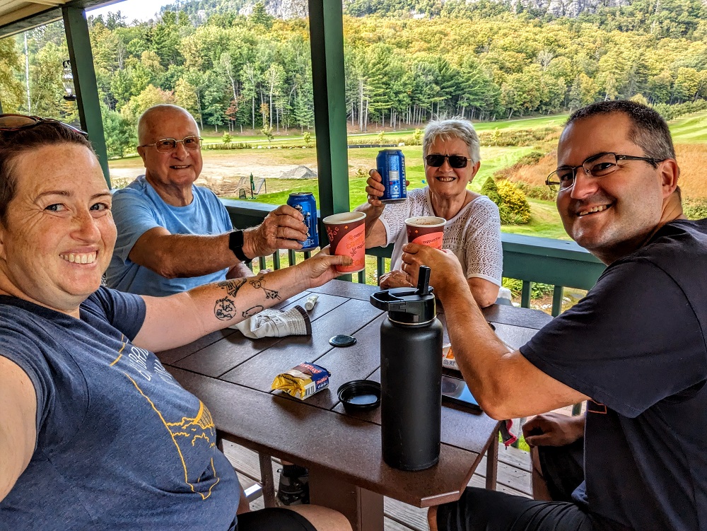
We made it back to the dock about 10 minutes after the 1:45pm shuttle had returned to Rockwood which meant we had just over 45 minutes to kill. There was only one thing for it – refreshments at the clubhouse!
In addition to soft drinks, tea, coffee, etc., you can get beer or wine there and so that’s what Shae and my parents had. I was going to be driving back, so I rewarded myself with a hot chocolate and ice cream.
Final Thoughts
The four of us (well, five including Truffles) had a fantastic time hiking up Mount Kineo. It was hard going at times due to how steep it could be, but with the trails up being only one mile long it was doable even for my parents who are in their 70s and 80s (albeit in great shape for their age!)
The views are incredible from both the Indian Trail and the top of the Observation Tower, so I’d highly recommend this hike in Maine.
[…] from the summit where there’s an observation tower looking out over Moosehead Lake. Check out this post for more about the […]