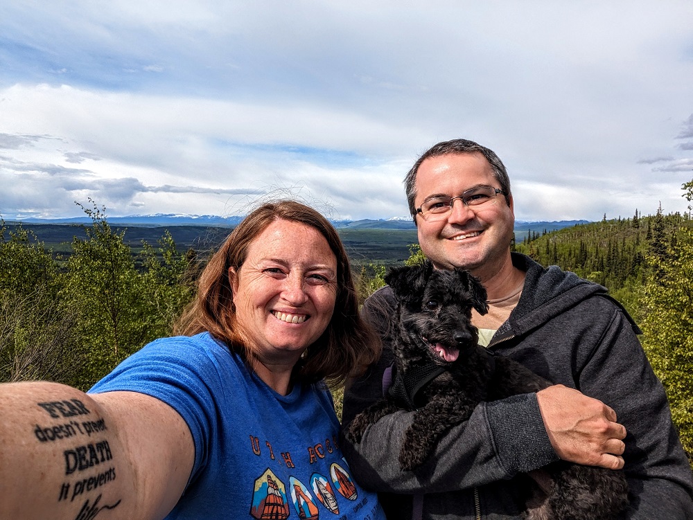
We enjoyed our drive up to Alaska far more than we’d anticipated.
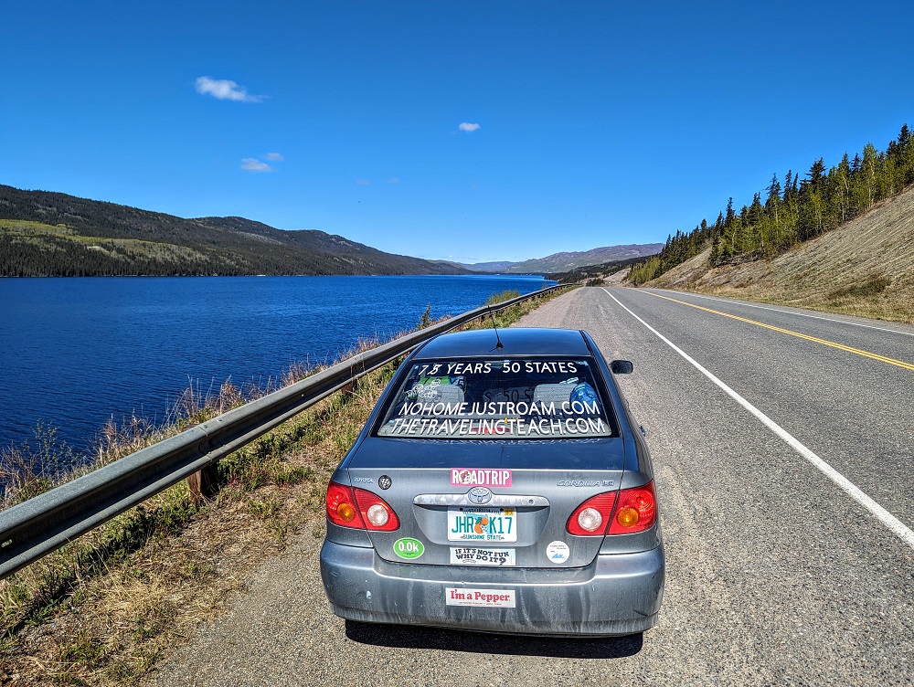
Despite the fact that we’re on a 7 year, 50 state road trip, we don’t enjoy driving long distances or spending a lot of time in the car. The prospect of 2,000+ miles up to Alaska and back again 1.5 months later didn’t fill us with excitement. We couldn’t wait to explore Alaska – we just weren’t looking forward to all that time in the car in order to get there.
We needn’t have feared. On the way up to Alaska we spread the journey out over the course of a few weeks so that we could spend a little time in Canada too. On the way back down, we did it over the course of a week or so. Despite ultimately spending about a month in total on the roads to and from Alaska, we have fond memories of the experience and would highly recommend it. It’s a superb road trip and one that I’d like to do again in the future.
There are slightly different routes you can take to and from Alaska, plus lots of little towns along the way you can stop at. Here’s an account of each of our days both on the way up to Alaska and on the way back. I’ve also published a separate post with 21 tips and tricks for driving to Alaska.
For this guide about our drives each day, it’s based on our actual driving days. We only stayed one night in some places, while in others we stayed up to six nights. That means that when you see Day 1, Day 2, Day 3, etc., those are driving days; in reality we might’ve had several days between them.
Day 1 Of Driving To Alaska (Osoyoos to Kamloops)
Day 1 driving distance: ~180 miles
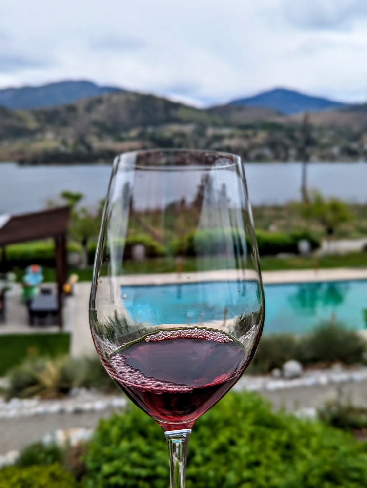
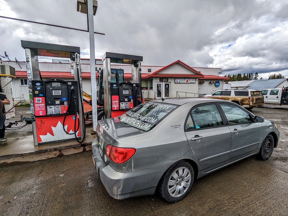
After spending a month in Washington state, we drove up to Osoyoos in British Columbia, Canada – a city just across the border from the US. That’s because I’d really wanted to visit Spirit Ridge Resort – a resort bookable with Hyatt points that features North America’s first indigenous-owned winery. It’s a beautiful property overlooking Lake Osoyoos – you can read my full review here.

After checking out of Spirit Ridge, we continued up to the city of Kamloops, only having a relatively short drive on this day of 3.5-4 hours. Although it wasn’t the fastest route, we drove up via Kelowna as there was a winery we wanted to visit…
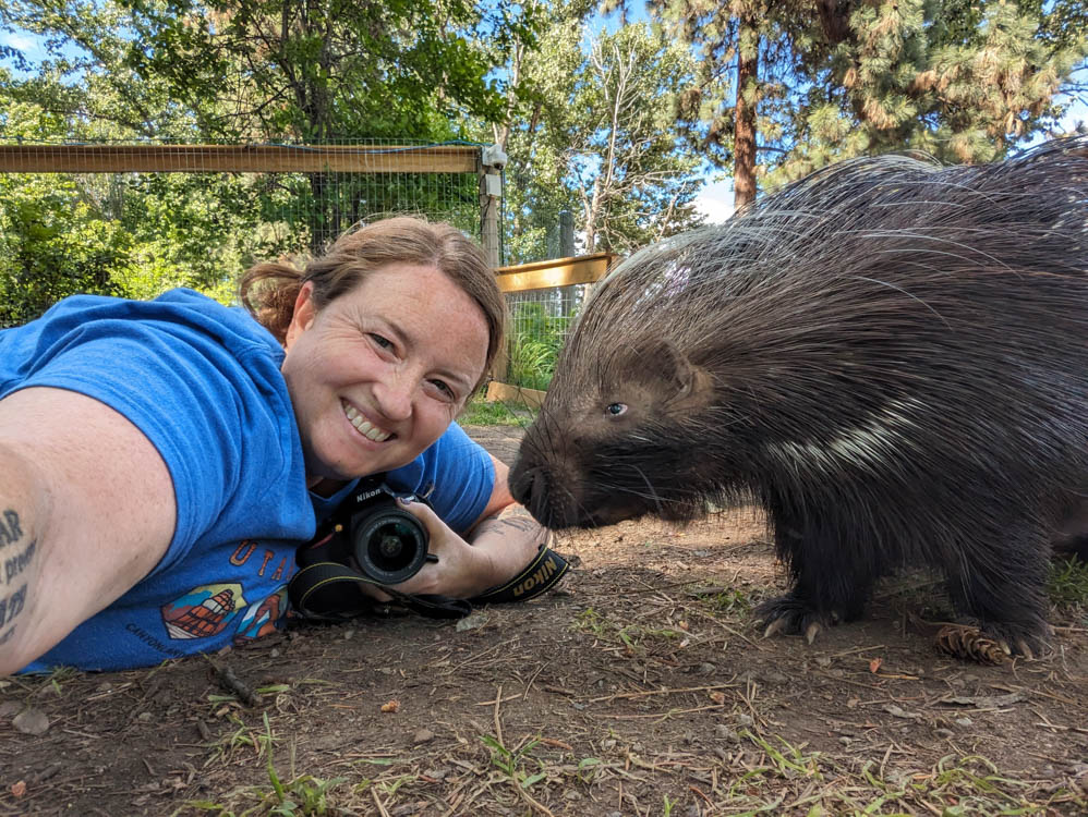
…as well as Kangaroo Creek Farm where you can meet porcupines, kangaroos, capybaras and many more animals. Check out Shae’s post here about this fun experience.
We stayed in Kamloops for four nights at the Holiday Inn Kamloops. A four night stay was ideal because a) we had a couple of work days in there and b) IHG gives every 4th night free on award stays, so by booking with IHG One Rewards points we only had to pay for three of those nights.
Kamloops has a population of ~100,000 people, so it’s a decent size. As a result, there was quite a bit to do in the area in terms of museums, hiking, etc. Unfortunately, with our work days and other stuff that we had to get on with, we didn’t spend any time exploring Kamloops.
Day 2 Of Driving To Alaska (Kamloops to Prince George)
Day 2 driving distance: ~330 miles
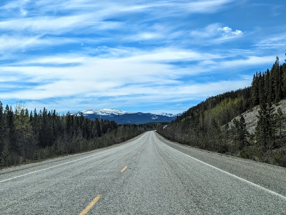
At the end of our stay in Kamloops, we drove up to Prince George which was about 5.5 hours away. Most of the drive is along BC-97 N which is known as Cariboo Highway. It’s a regular highway, so it was paved nicely throughout.
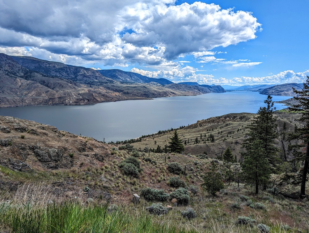
Before turning on to Cariboo Highway, the first hour was spent on Highway 1. About 30 minutes along that stretch we stopped at Kamloops Lake View Point as it was such a nice view.
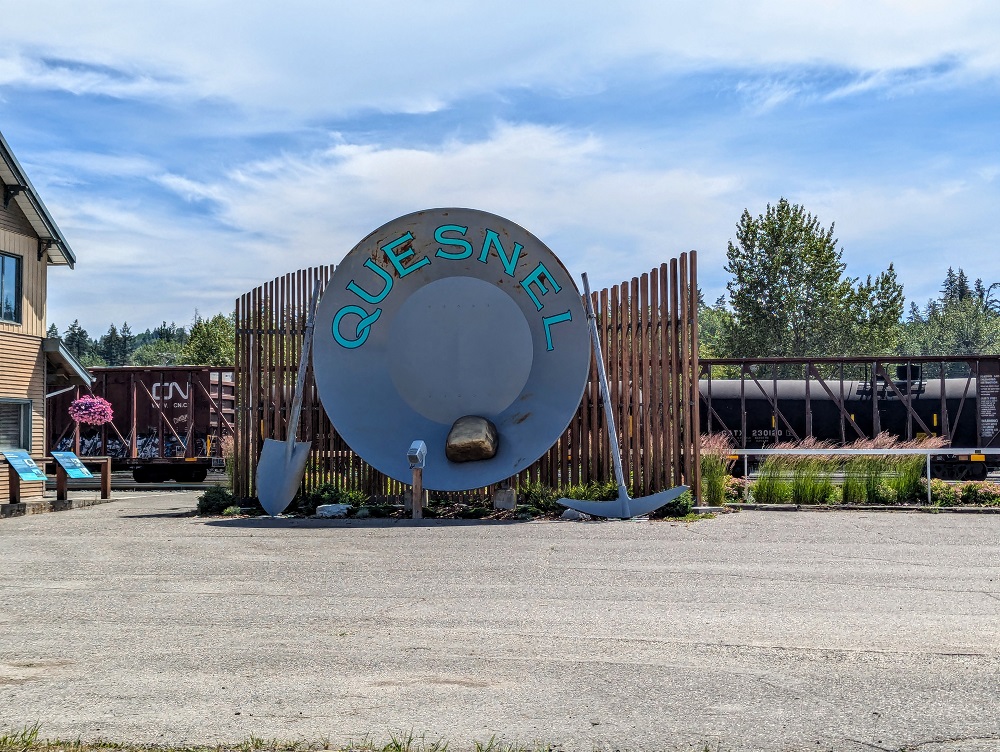
About 2/3 of the way along our route was a town called Quesnel. Quesnel has a population of ~25,000 people and seemed like it could be a good place to stop overnight depending on your plans. It’s a pretty location alongside a river, there were several hotels there, as well as a Walmart, Safeway, etc., lots of restaurants and many gas stations.
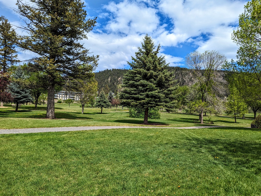
It was about 2pm as we were driving through, so we stopped in a local park there to have a picnic lunch before continuing on to Prince George.
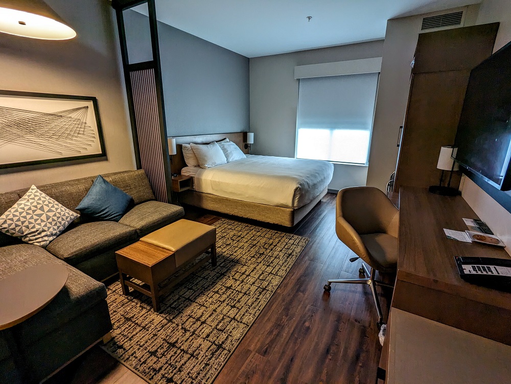
I’d picked Prince George to stay in because there was a Hyatt Place hotel there which is a category 1 property in the World of Hyatt program. That meant we only had to redeem 5,000 points per night which was a great opportunity because there weren’t many hotels between Prince George and Alaska where we’d be able to redeem points.
Day 3 Of Driving To Alaska (Prince George to New Hazelton)
Day 3 driving distance: ~275 miles
After leaving Prince George, we’d originally planned to drive up via Fort Nelson and Watson Lake along BC-97, but wildfires in the area meant Fort Nelson’s residents had been evacuated. Fortunately (for us), that happened a week before our stay and the two hotels we’d booked along that route were refundable.
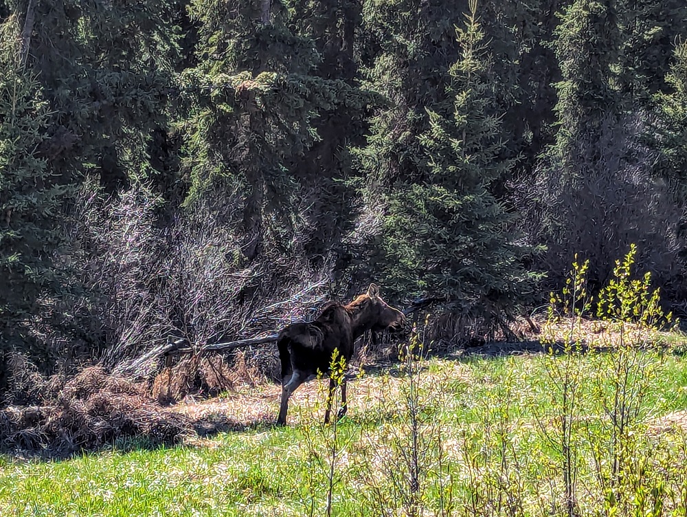
We therefore cancelled those stays and booked a hotel and Airbnb along BC-37 instead. The first of those stops was in New Hazelton, 5 hours northwest of Prince George. This was the first day where we saw some proper wildlife as we spotted a moose by the side of the road, but it moved too quickly for us to catch a photo.
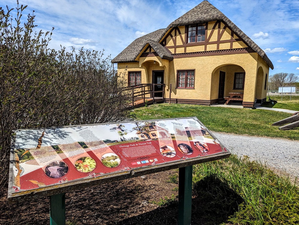
About an hour into our drive we stopped in a town called Vanderhoof for lunch. We parked at the Vanderhoof Tourism & Cultural Center as there were some picnic tables outside, as well as several historical buildings in their Heritage Park that you can explore.
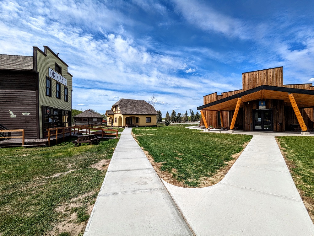
Vanderhoof’s Heritage Park ended up being a really interesting place to visit, so if you have time to stop there when driving to or from Alaska then it’s something we’d recommend.

From Vanderhoof on to New Hazelton it was an easy drive. There were frequent rest areas with pit or vault toilets; these were always well supplied with toilet paper, but it’s worth having soap and water or hand sanitizer with you.
We did this part of the drive on May 23, so early in the driving-to-Alaska season. That meant there wasn’t a large convoy of vehicles driving up there, although we did come across quite a few RVs driving in the same direction. Thankfully it was easy to pass slower vehicles. This day’s roads included occasional sections with two lanes in each direction, but even when it was only one lane each way the roads were straight enough and quiet enough in the other direction that it was safe to pass. We had a 2004 Toyota Corolla weighed down with most of our worldly possessions so it didn’t have great pickup, but it didn’t struggle with passing trucks, RVs, etc. when needed.
Keep a keen eye for wildlife as you drive along. In addition to possibly seeing moose and other larger creatures, you might also find smaller ones wanting to cross the road as you speed down the highway.
About an hour before reaching New Hazelton we drove through Smithers. We’d originally been booked in to stay there (at the Capri Motor Inn) on our drive back down from Alaska in July, but ended up rebooking things due to other changing plans. It looked like it would’ve been a pretty place to stop overnight though as there were nice mountain views.
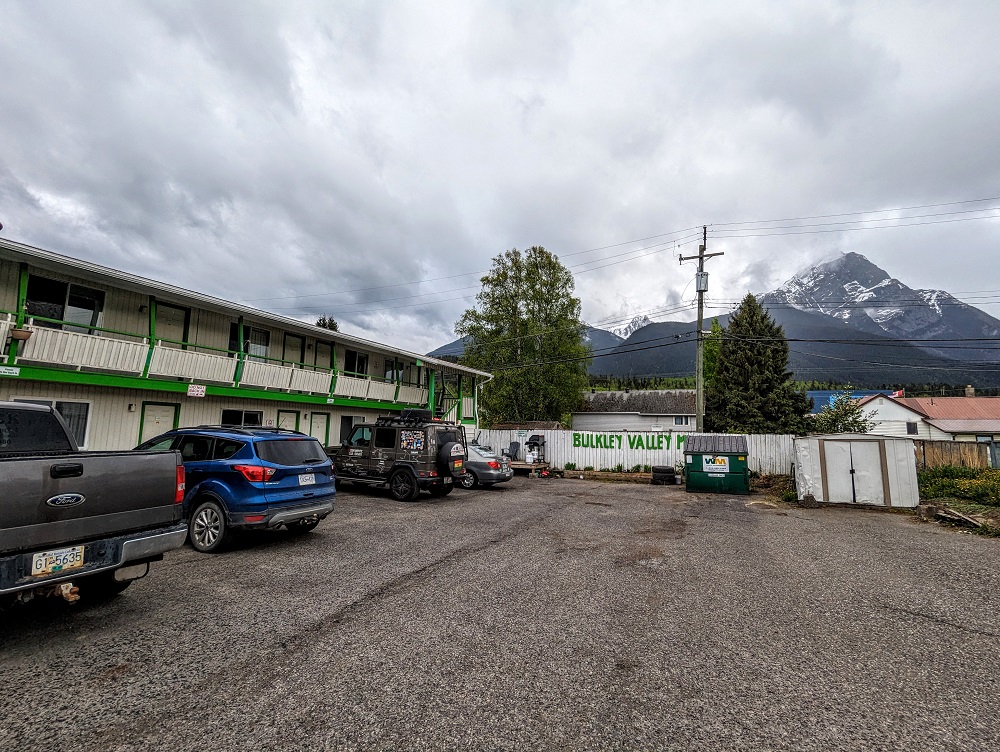
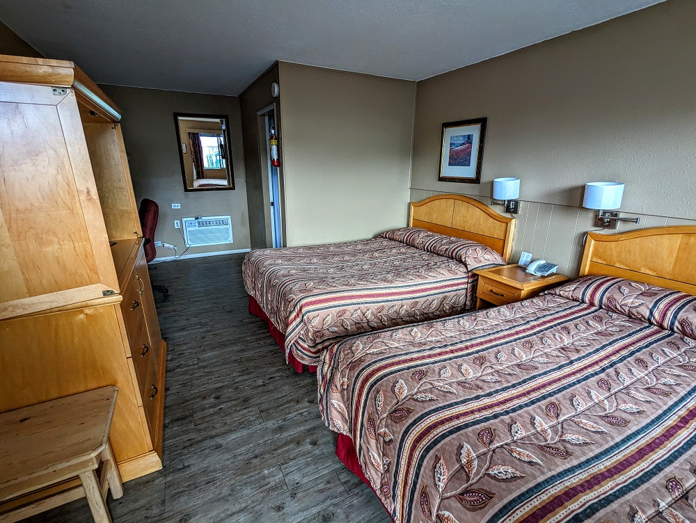
We eventually made it to Hazelton at about 5:15pm, so we made good time that day. Our accommodation for that night was at the Bulkley Valley Motel (our affiliate link), a motel we’d booked through Booking.com as it wasn’t bookable on other OTAs (Online Travel Agencies) like Hotels.com.
The Bulkley Valley Motel cost $134.47 Canadian (~$98.25 US) and was a great place to stay. It was nice and quiet, had mountain views when walking outside and was walking distance to a few restaurants and cafes.
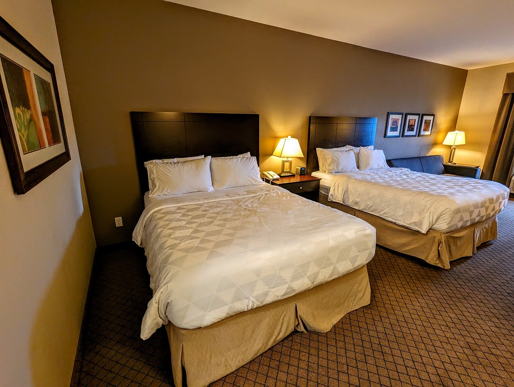
The room was a decent size with two queen beds, a mini fridge that was on the larger side of mini fridges, a microwave, work desk and chair and a bathroom with a shower that had good water pressure.
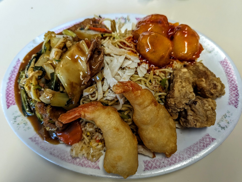
For dinner that night we ate at BC Eagle, a Chinese restaurant right next door to the motel. The food was good but not amazing; however, the portion sizes were sizable, so it’s a convenient and filling place to have dinner if you’re staying at the Bulkley Valley Motel.
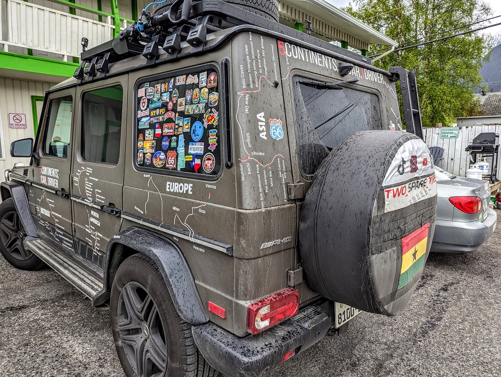
You might think we’re adventurous going on a seven year road trip around the US, but we have nothing on the guy who parked next to us that night. Two Spare Tires is from Ghana and is driving solo, visiting five continents in his vehicle!
Day 4 Of Driving To Alaska (New Hazelton to Jade City)
Day 4 driving distance: ~405 miles
After a good night’s sleep, it was time to get breakfast before continuing our journey. The motel doesn’t provide breakfast, so Shae popped across the road to a couple of eateries to grab us something to eat while I got us packed up.
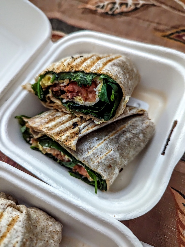
Her first stop was Zelda’s Travelling Mug Cafe where she got me a breakfast wrap. At first glance it looked a little spinach-heavy, but the breakfast meat and egg inside – along with whatever the condiment/sauce was – meant that it was very tasty.
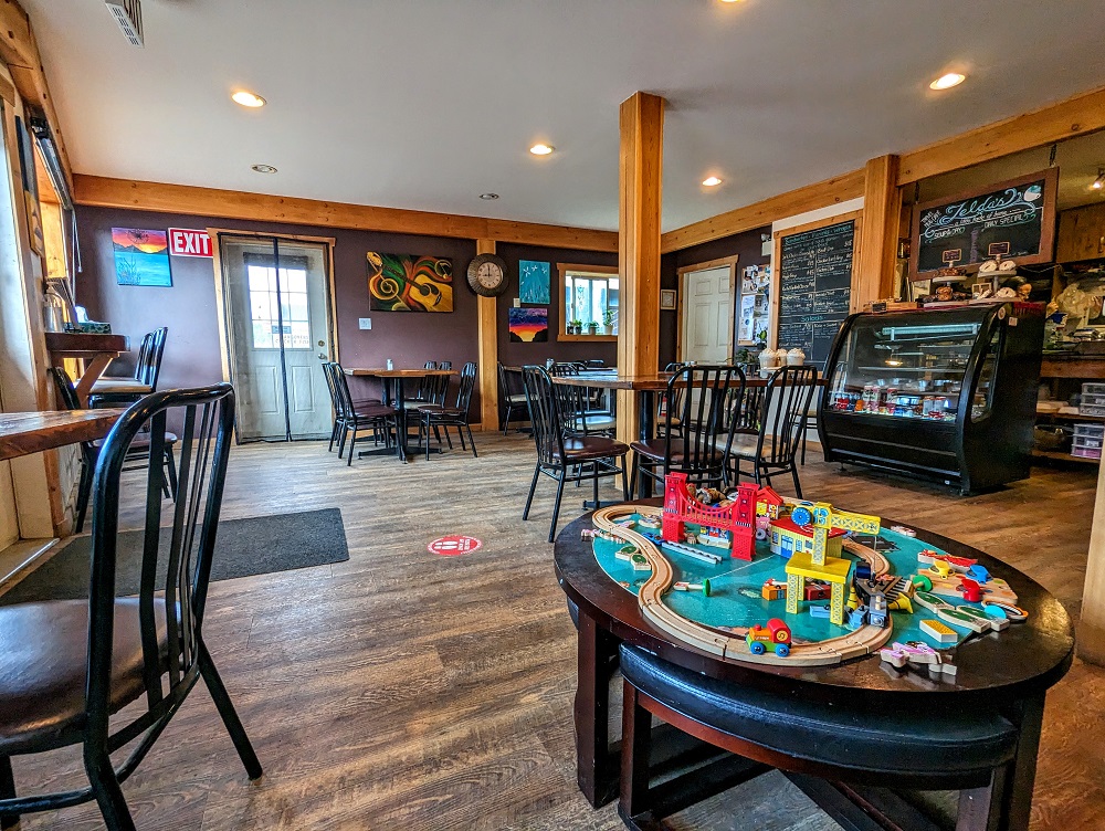
She then stopped in at Skeena Bakery which is to the right of Zelda’s.
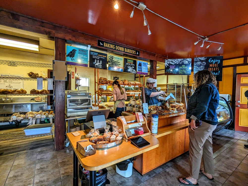
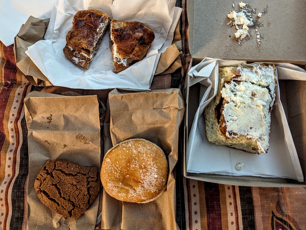
She picked up a selection of baked goods – a large cinnamon roll, donut, cookie and a chocolate bun. We heated up the cinnamon roll a little in our microwave and it was good. The chocolate bun was unlike anything I’ve had before, but not in a bad way. It was like a cinnamon raisin loaf (minus the cinnamon and raisin!) had a love child with a chocolate croissant/pain au chocolat.
This was due to be our longest driving day of the drive up to Alaska so far, but we didn’t bother rushing to get on the road and so left about 10:15am. The mountain views outside of the motel the night before had been nice, but they got even better five minutes down the road.
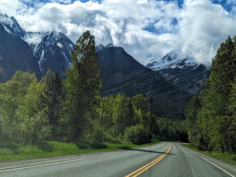
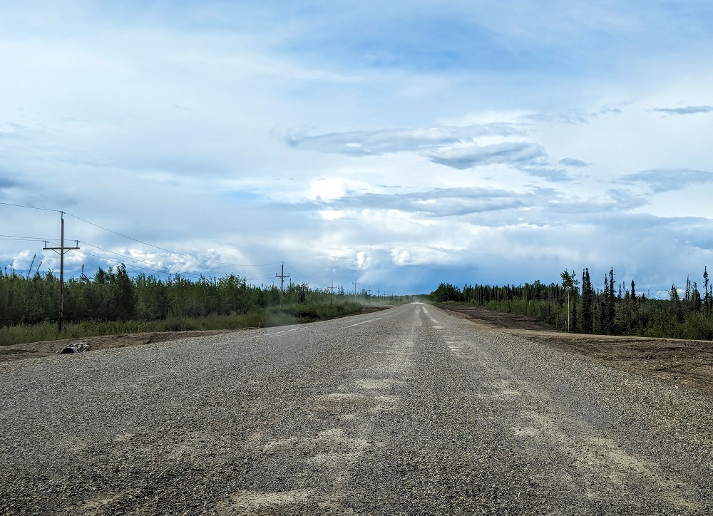
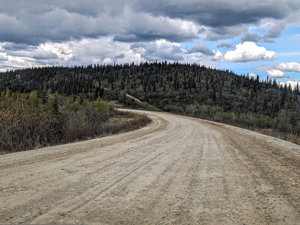
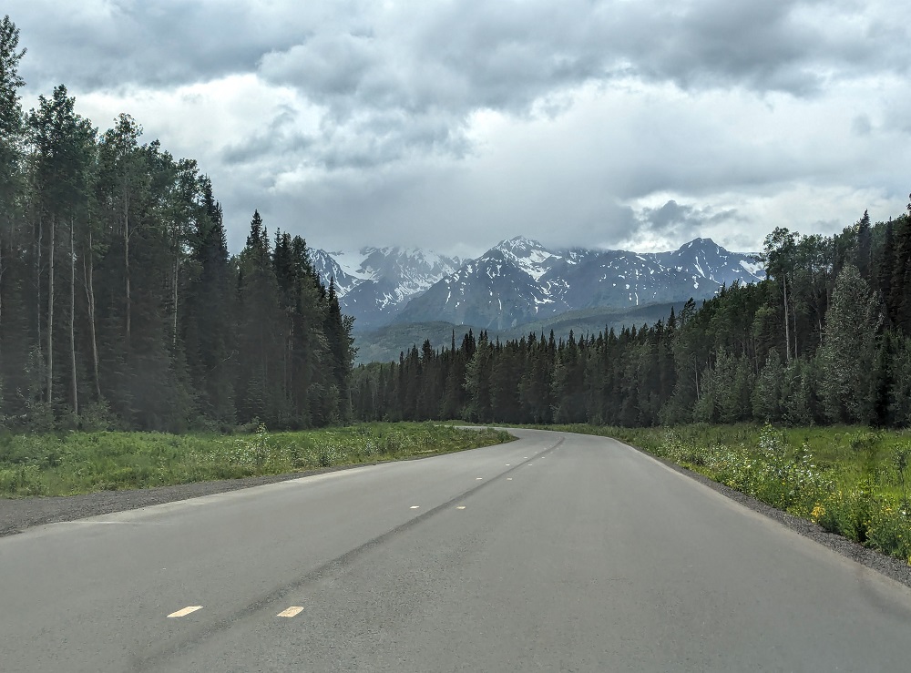
Shortly after that we turned right on to BC-37 – the Stewart-Cassiar Highway. It was this day that we really started to feel like we were driving to Alaska! There were far fewer passing lanes and the road quality declined both in terms of narrower lanes and an increase in the number of potholes.
There are also far fewer towns after New Hazelton, so be sure to bear that in mind when deciding whether or not to fill up with gas. We decided to fill up once we reached Meziadin Junction as there’s a Petro-Canada gas station there.
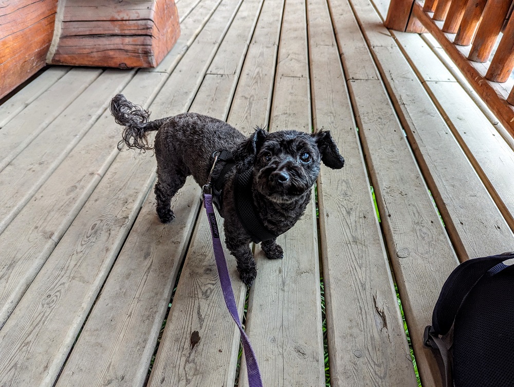
Truffles was also glad to have an opportunity to stretch her legs.
This day’s drive was awesome both in terms of the wildlife we saw and the scenery.
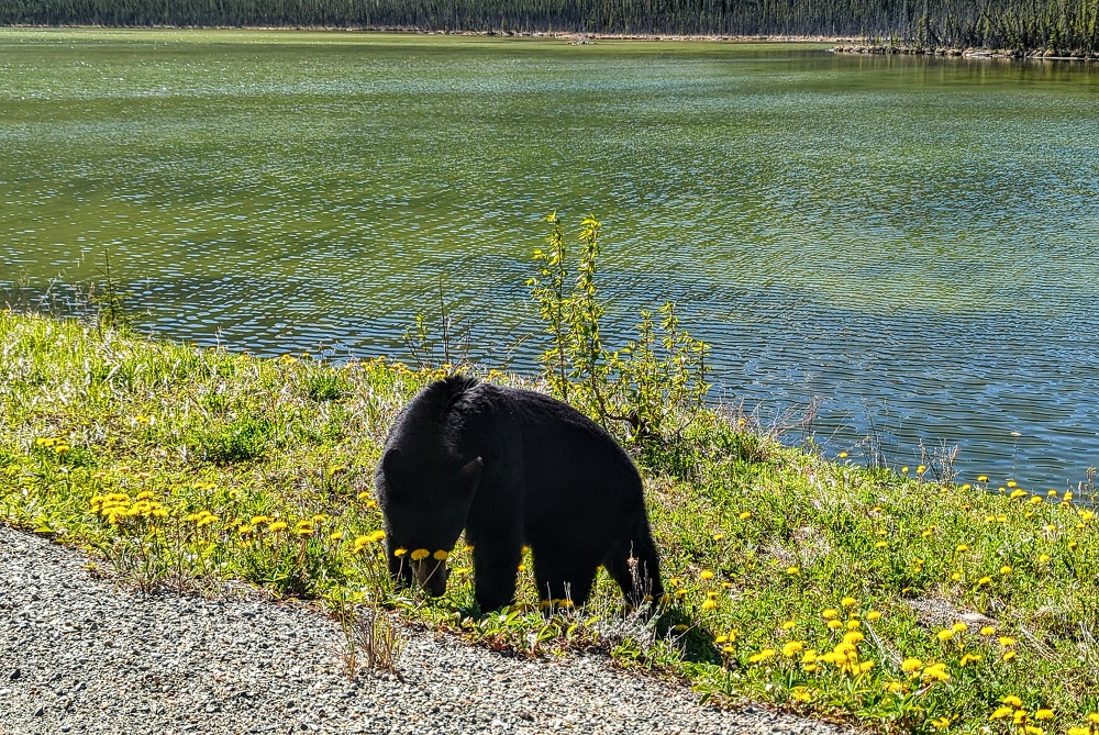
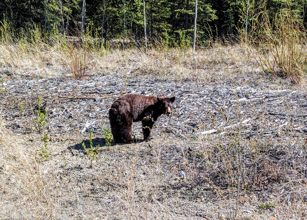
That day we saw two chipmunks, two porcupines and two black bears.
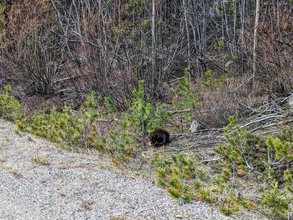
The first bear we saw was about 40 miles outside of Iskut. He was just ambling along the side of the road, snacking on dandelions.
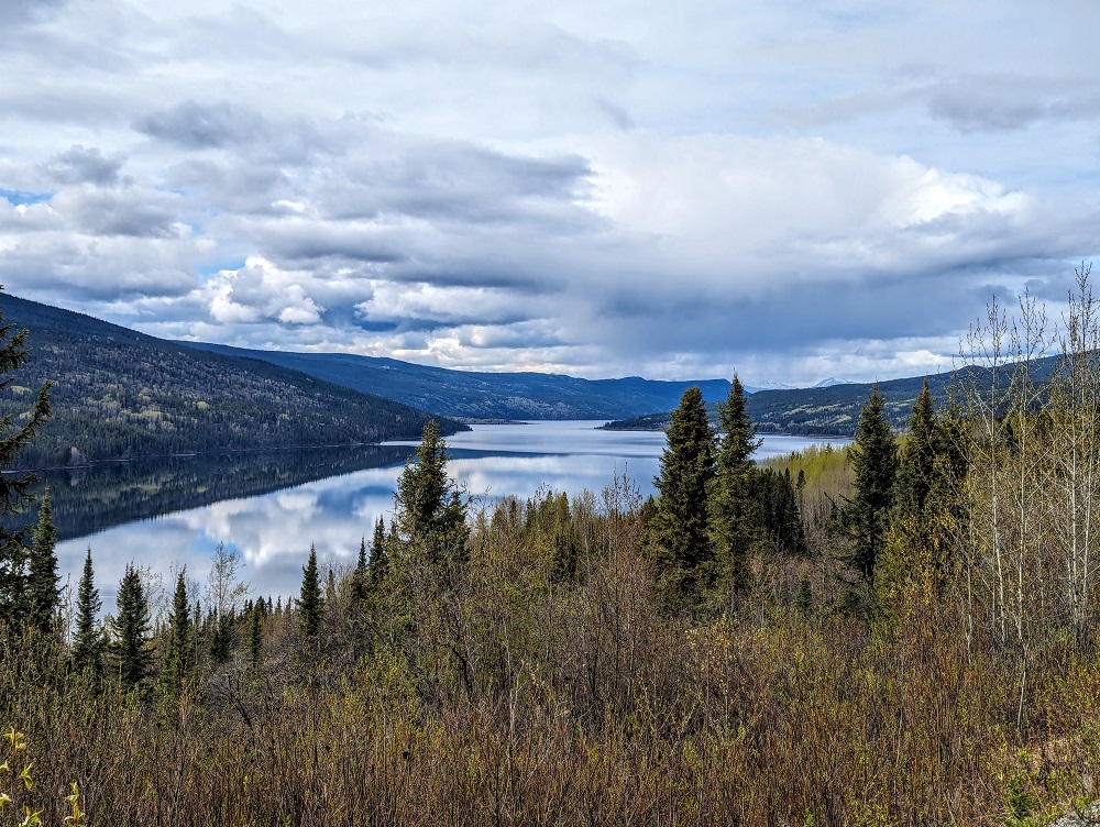
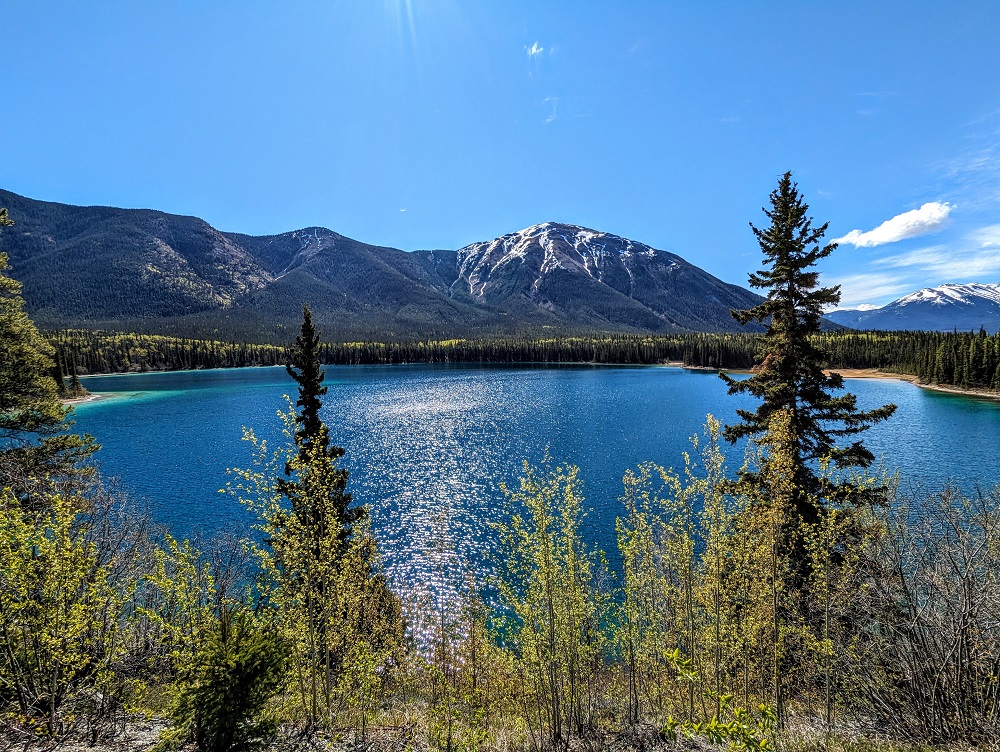
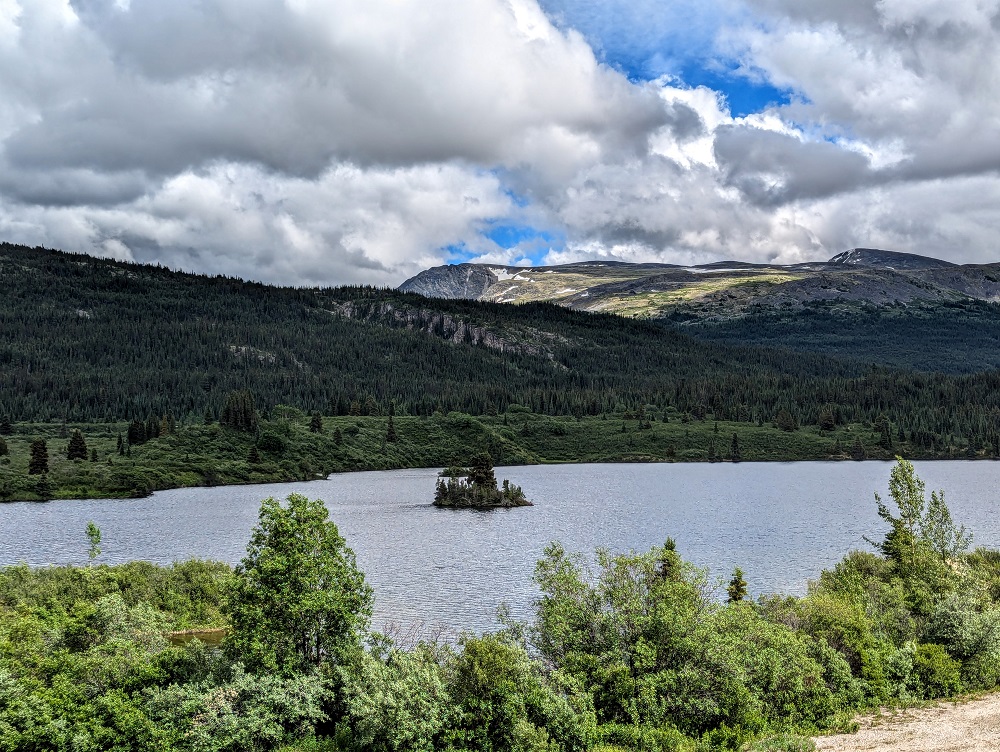
One of the best parts of driving up to Alaska is the sheer number of lakes you’ll drive past; it’s wonderful.
I mentioned earlier that the roads on this day weren’t always great. Although they were paved most of the way, there were dirt roads at times which got a little more precarious when they were wet from rain.

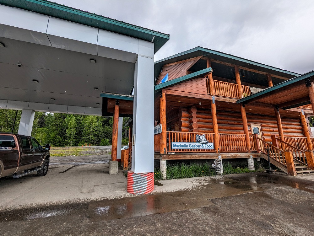
The Airbnb we’d booked for that night in Jade City had given us a heads up that Dease Lake was the last place to get gas and food before reaching Jade City. We therefore stopped there to fill up and grab some dinner to-go.
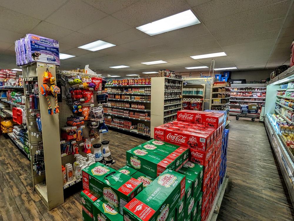
The Dease Lake Super A Foods store inside was far more comprehensive than we’d expected. Due to its remote location the prices were more expensive than you might pay elsewhere, but it’s nice that you have such a great selection of groceries.
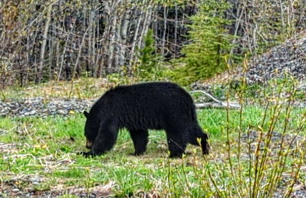
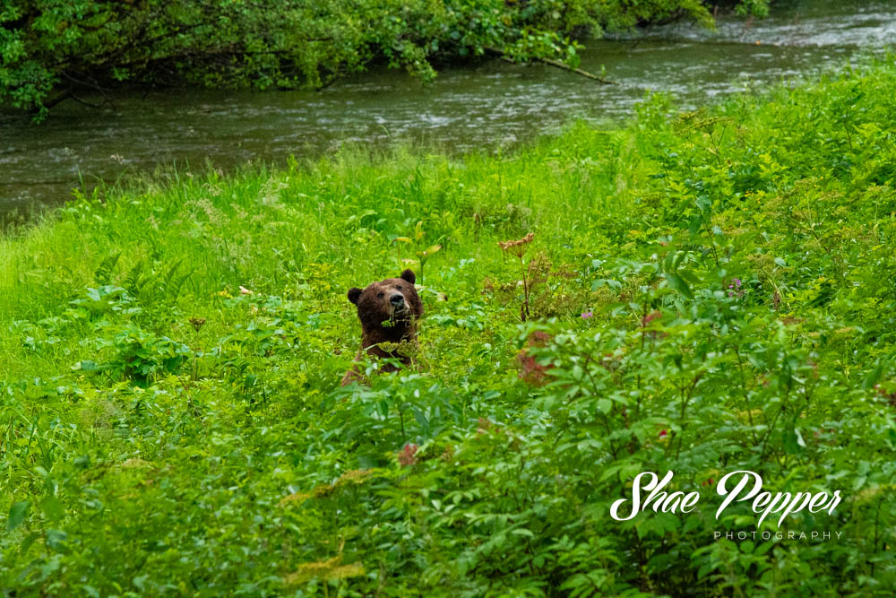
Less than half an hour after continuing on from Dease Lake, we spotted another black bear by the side of the road, so we pulled over to take photos and videos.
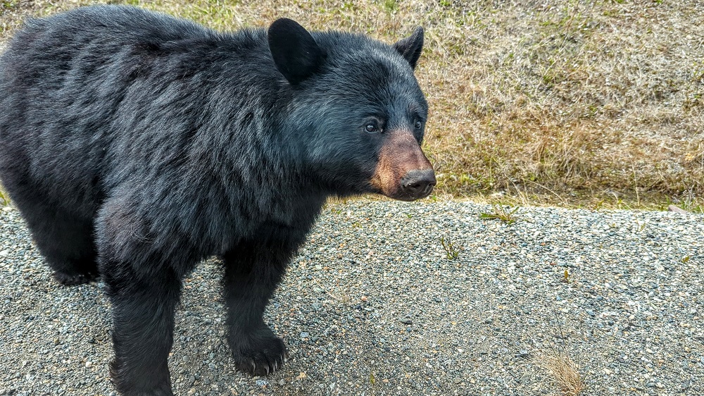
This ended up being a far more thrilling encounter than we’d anticipated. He was originally down in the ditch by the side of the road, but he got curious and decided to come over to say hi.
Shae initially had the window down so we could get decent photos and videos, but started putting it up as soon as he started to make his way closer. We locked the doors too because we didn’t want to risk him pawing it open. He soon got bored with us and walked off, but it was exciting being that close to a bear so unexpectedly.
Just as a reminder of the adage – a fed bear is a dead bear. If you ever have a similar experience that we did, please don’t give the bear food of any kind.
Here’s a video of the whole situation:
This close encounter of the furred kind happened while we were driving alongside the long, narrow Dease Lake – the lake after which the town we’d just stopped in is named.
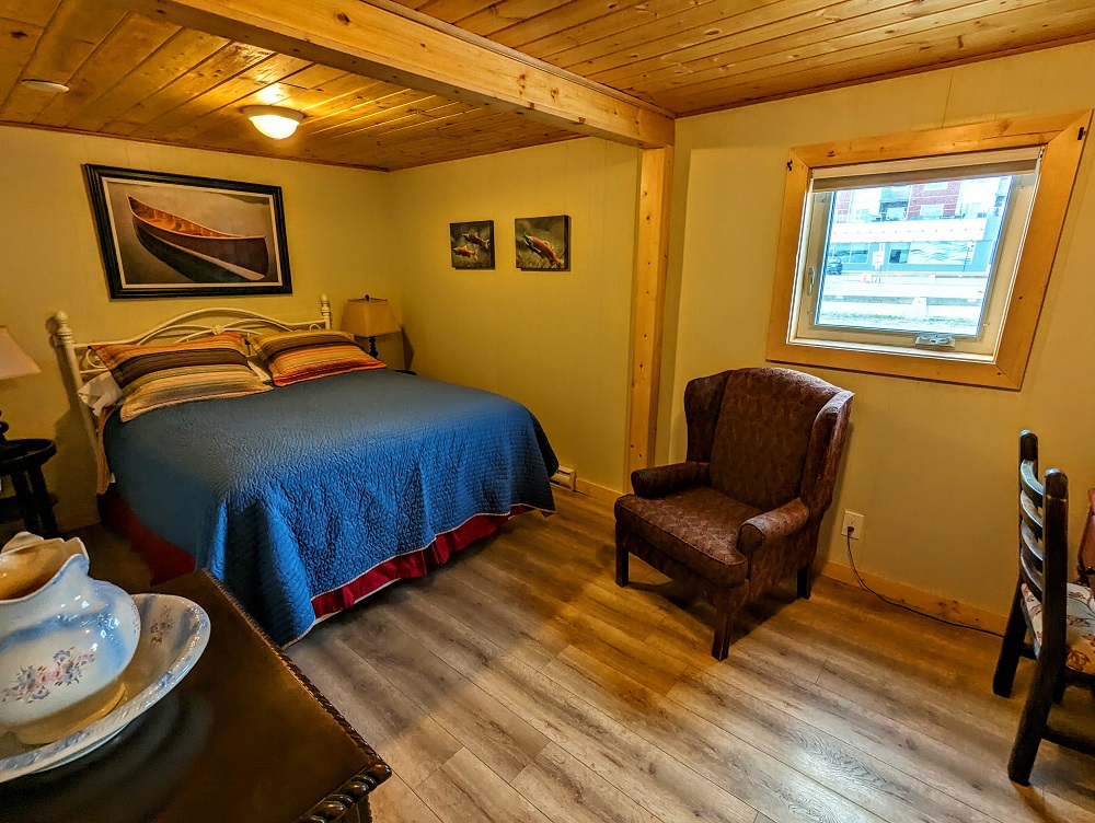
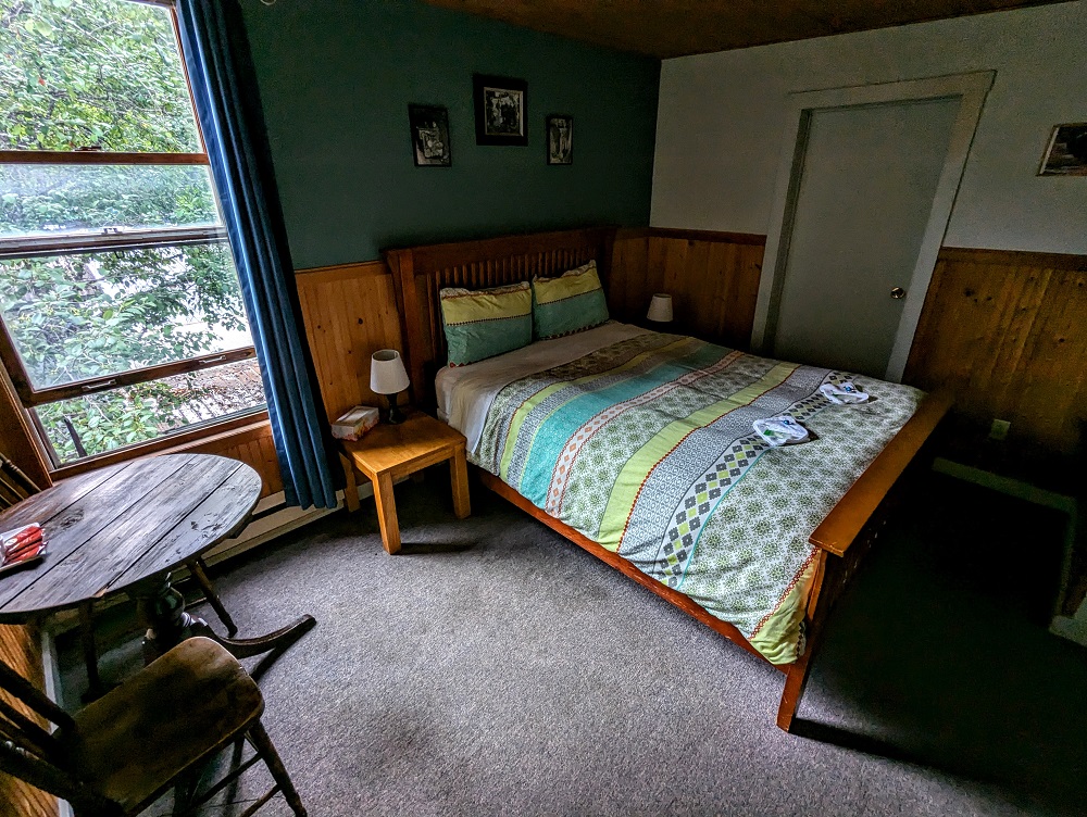
From there it was only an hour’s drive on to Jade City where we’d booked this Airbnb at Jade City Motel for the night. Jade City Motel has a number of accommodation options; there are several small cabin rooms in a row (one of which we booked), as well as a few standalone cabins.
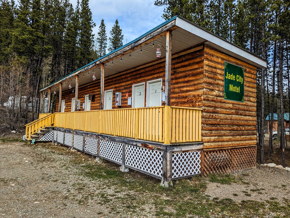
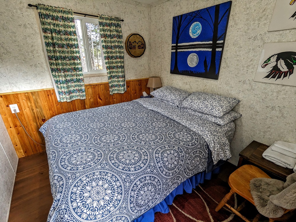
Our room wasn’t very big – what you see in the photo below is what you get. However, it was absolutely fine for an overnight stay; it was clean, comfortable and quiet which is all we were looking for.
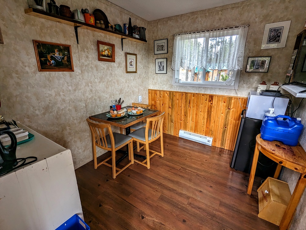
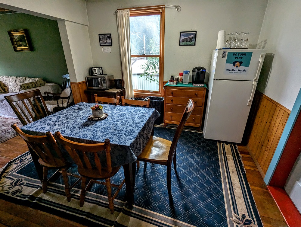
For these small room cabins, there’s a shared bathroom; if you book one of the standalone cabins I think they have their own bathroom. In the middle of this block of rooms, one of the rooms is a dedicated kitchenette with a mini fridge, microwave, electric kettle, coffee maker, toaster, etc.
The Airbnb had decent Wi-Fi access, so I was able to work at the table in there that night which was super-useful seeing as there wasn’t really any space to do that in our cabin.
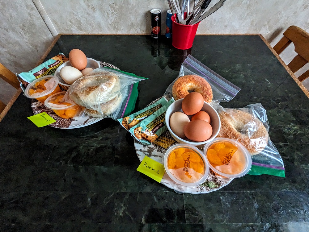
Another nice touch about this property is that they provide free breakfast for guests seeing as there’s nowhere else around to get that in the morning. A plate for each room was on the kitchen table and included bagels, breakfast bars, hard boiled eggs and fruit cups.
Day 5 Of Driving To Alaska (Jade City to Whitehorse)
Day 5 driving distance: ~360 miles
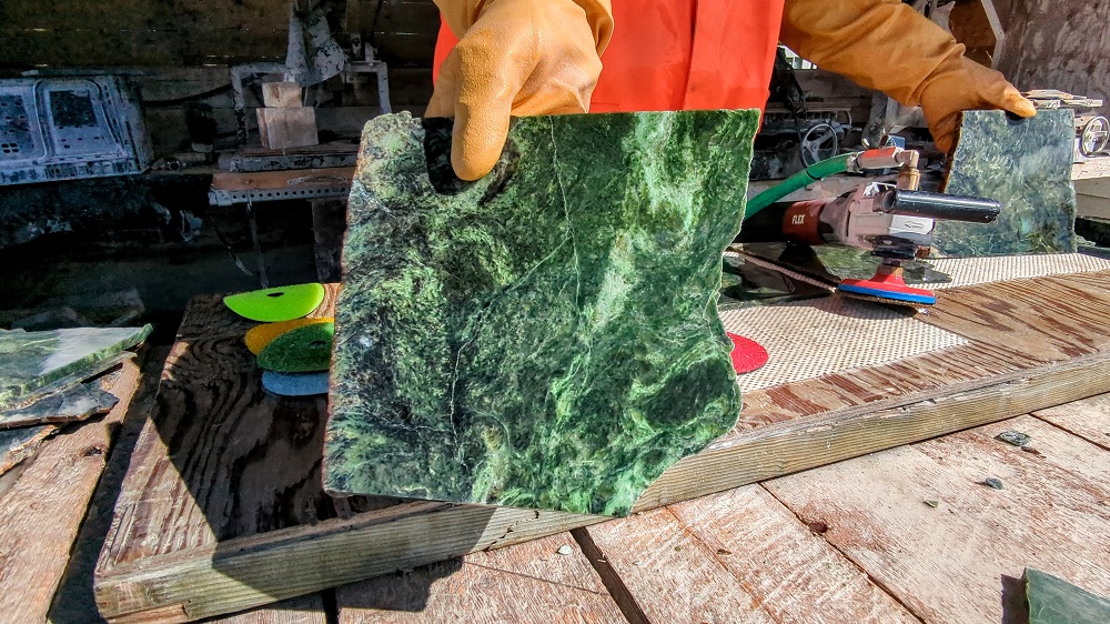
In addition to the accommodation at Jade City Motel, they have a store which sells jade products because the area is rich with jade (hence the city name). We checked out the store and also watched jade being polished outside.
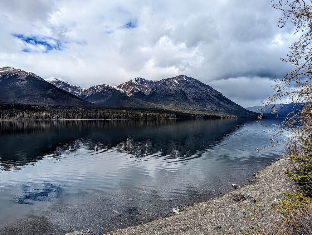
It was then time to get on the road and the drive that day was as beautiful as ever. Seeing endless amounts of rivers, lakes and snow-topped mountains never got old. If you’re in an RV or are camping, there never seemed to be anyone using the beaches or lakes, so you could probably have many of these places all to yourself.
Half an hour into the drive we had another black bear sighting, this one eating dandelions too.
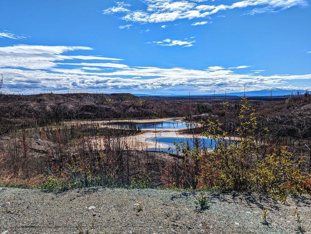
The previous year Canada had been devastated by wildfires which had a significant impact all around the US too in terms of air quality. On the drive from Jade City to Whitehorse we saw all kinds of signs of past wildfires.
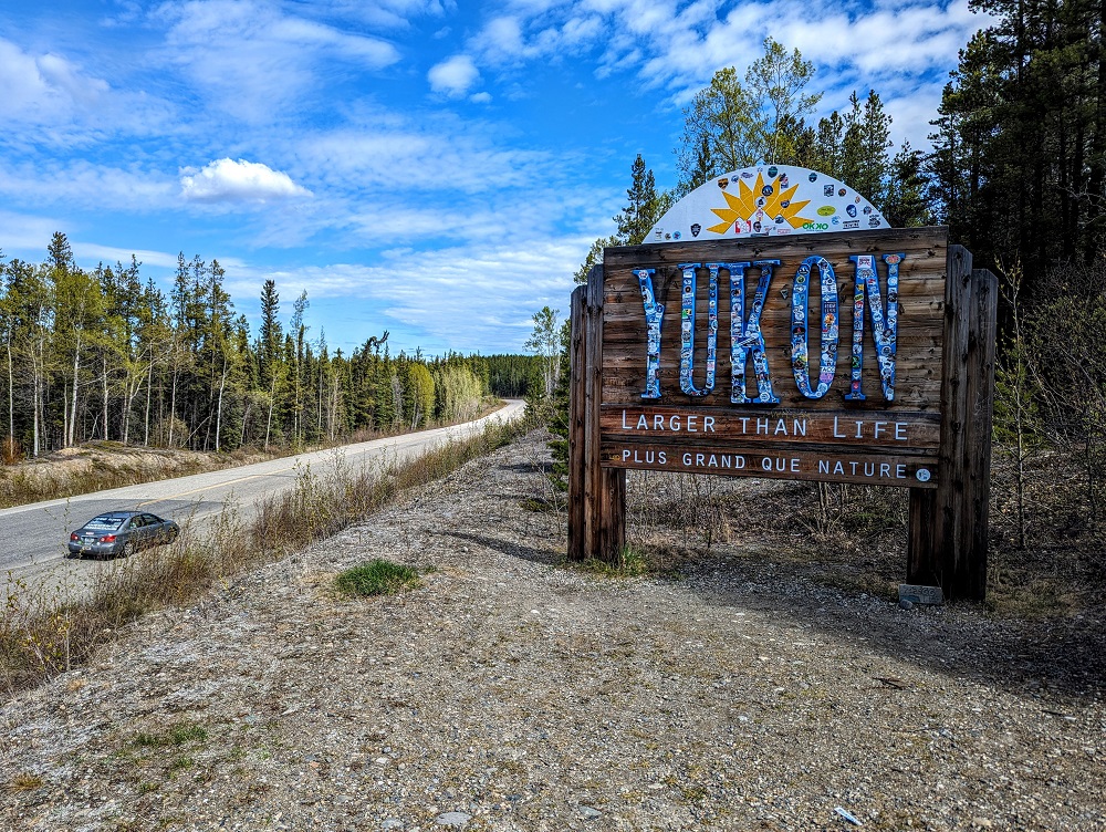
After spending the previous couple of weeks in British Columbia, we finally reached our next Canadian province – the Yukon (formerly the Yukon Territory).
The north end of BC-37 (the Stewart-Cassiar Highway) finishes where it meets Yukon 1 – the Alaska Highway. We were heading towards Whitehorse which is to the west, but when we reached the Alaska Highway we headed east initially instead. That’s because we wanted to make a quick diversion to Watson Lake. That’s only 15 minutes to the east, so stopping there only added half an hour to our day.
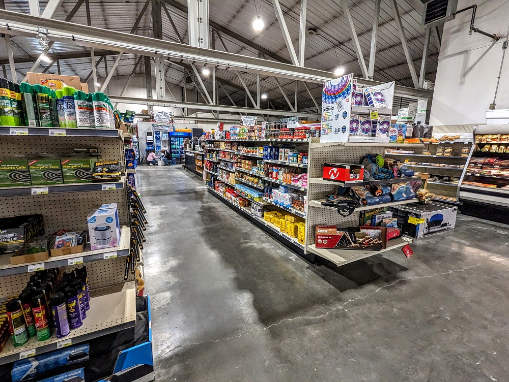
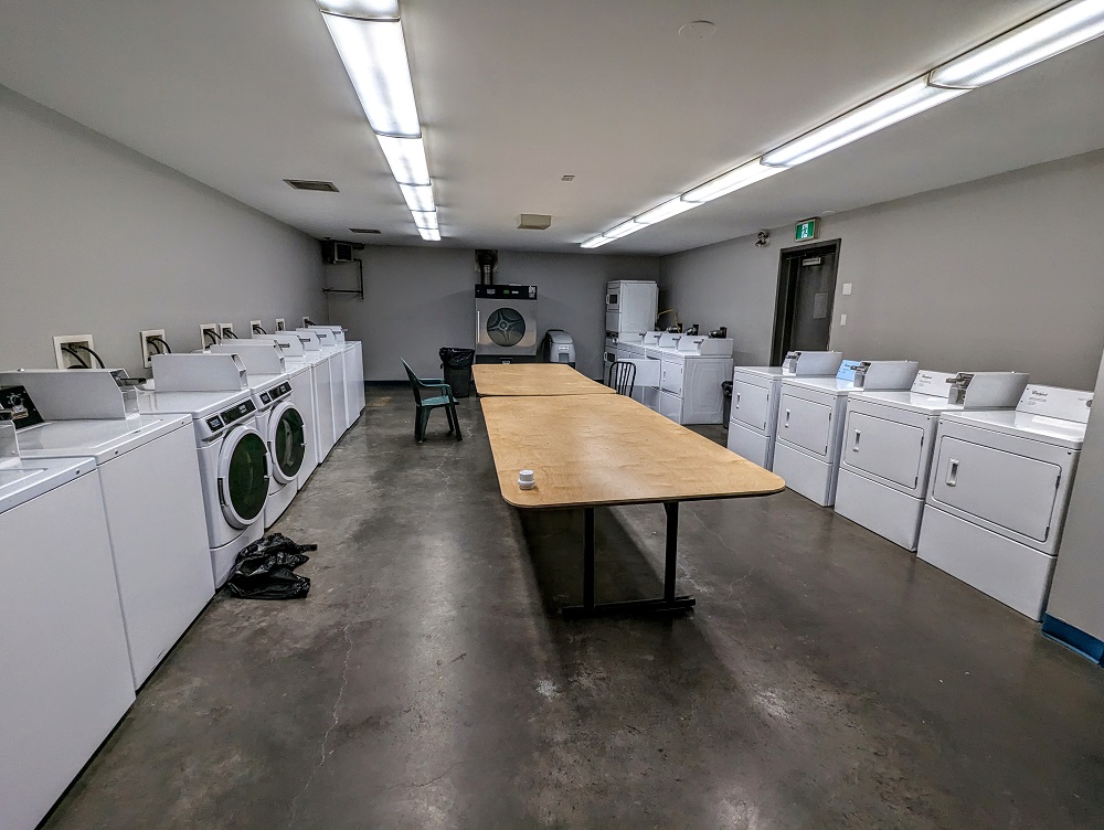
We had a couple of reasons for stopping in Watson Lake. One was to fill up with gas; there’s at least a couple of gas stations there and we stopped at Tags Food & Gas. In addition to having gas pumps, they’ve got a decently-stocked convenience store inside, a restaurant where you can dine in or take food to go, a laundromat and more.
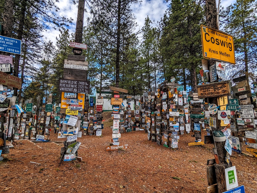
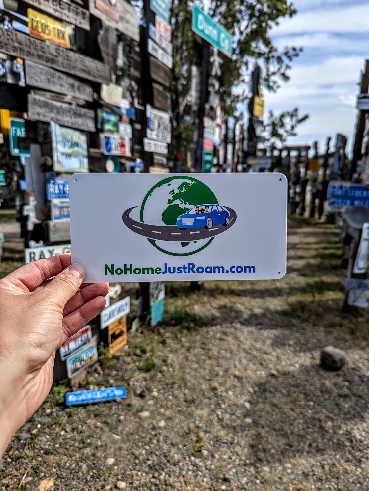
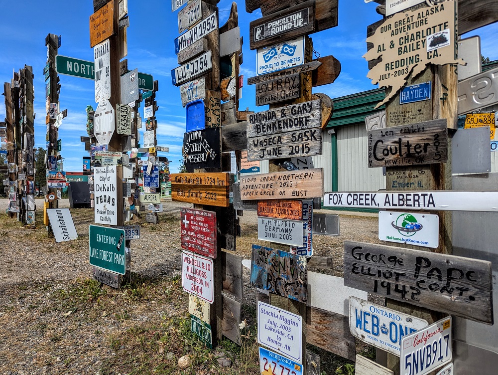
Our primary reason for visiting Watson Lake though was so that we could check out the Sign Post Forest. The Sign Post Forest is a fantastic roadside attraction featuring about 100,000 signs that people have left over the past 80+ years. Check out more about the Sign Post Forest in this post.
After exploring the manmade forest, it was time to head back west towards Whitehorse.
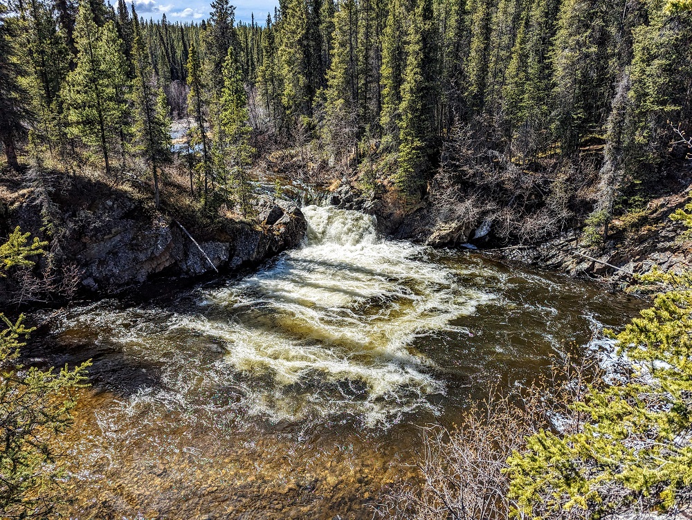
We were starting to get hungry for lunch as it was almost 2:30pm, so I checked on Google Maps to see if there was anything nearby that looked like it would be a good place to stop. We were in luck as Rancheria Falls Recreation Site was only a short distance up the road, so we stopped there for our picnic lunch.
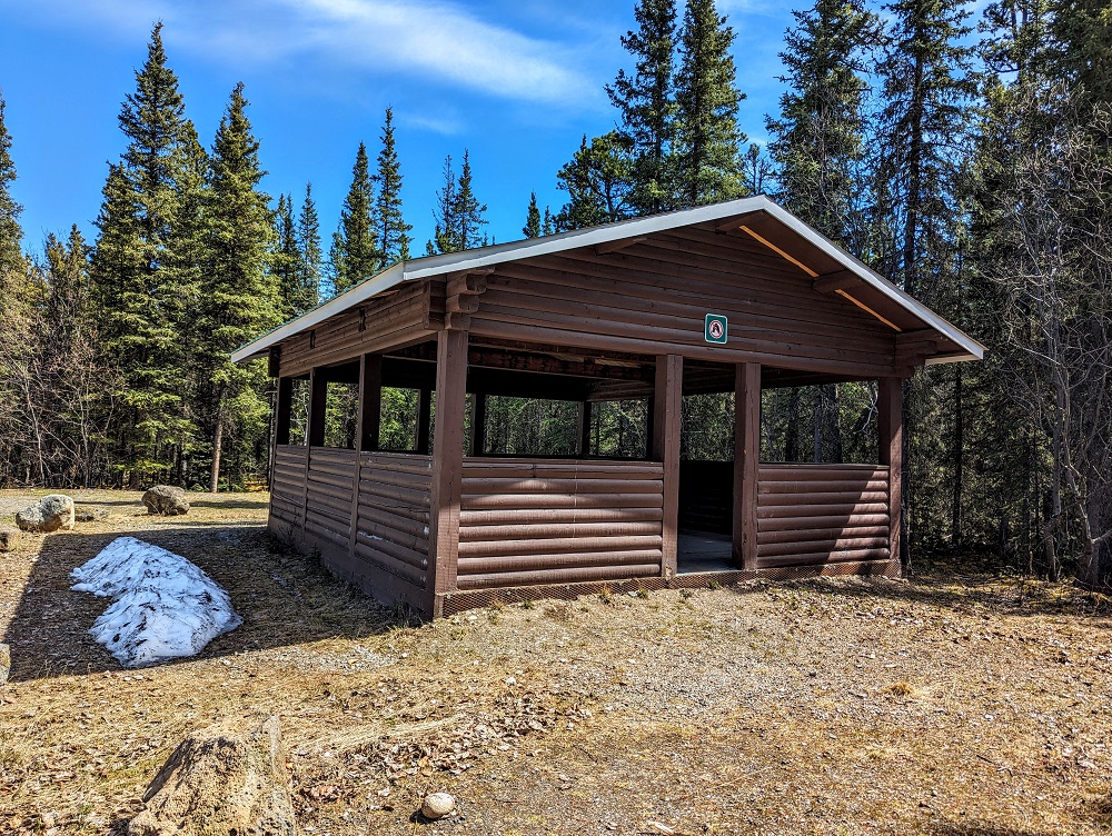
There was a nice picnic shelter to eat at, as well as some vault toilets. Once we’d finished eating, we took the 0.3 mile trail to the falls. The trail starts off as a dirt path, then it leads on to a raised walkway.
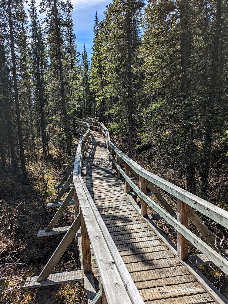
Rancheria Falls wasn’t the most spectacular waterfall we’ve ever seen, but it was a nice little stop and a great opportunity to stretch our legs halfway through the day before continuing on.
After a bear sighting that morning, we spotted a moose by the side of the road that afternoon. In total that day we saw four bears, two caribous, two foxes and this moose.
There were frequent rest areas along the highway that were well stocked with toilet paper.
We made it to Whitehorse at about 6pm that evening where we stayed at the 98 Hotel – see our review here.
Day 6 Of Driving To Alaska (Whitehorse to Dawson City)
Day 6 driving distance: ~335 miles
We ended up spending five nights in Whitehorse. Similar to Kamloops, the plan had been to visit some museums, go hiking, etc. Sadly, also similar to Kamloops, that didn’t end up happening. Between tiredness and work, we didn’t get out much to explore.
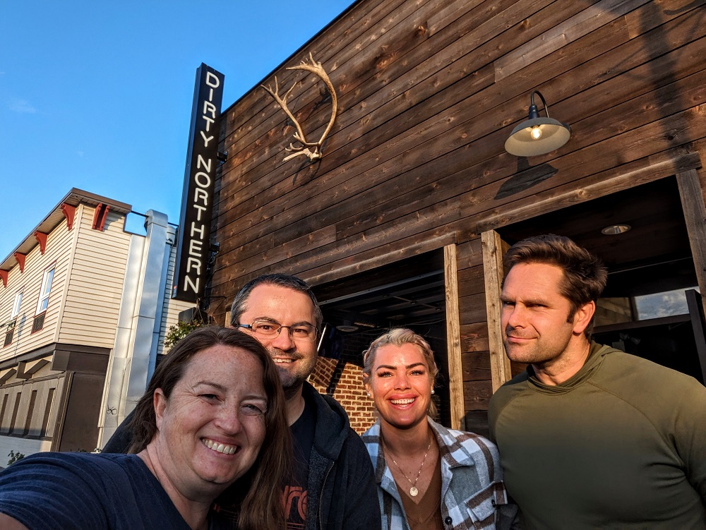
That’s not to say we didn’t have fun though. We got chatting to another couple at the bar at The 98 Hotel one night and discovered that, like me, she was from the UK. They were also staying at the hotel for a couple of nights, so we spent the rest of the night drinking far too much. We went out together again the following night and had a great time, so even though Whitehorse went unexplored, we loved getting to spend time with Brighton and Nate.
We ate out a few times during our stay there. On our first night we ate at the Gold Pan Saloon which is located in the Best Western Gold Rush Inn. I got their bison burger, while Shae ordered their elk burger as she’d never had elk before. I’d never had it either, so I had a bite and thought it was very good.
The second time we went out with Nate and Brighton we went for dinner at La Cara which offers burritos, tacos and bowls. Our server was extremely sweet and friendly and the food was delicious.
Lastly, before heading out on our final morning we had breakfast at Burnt Toast Cafe which was also good, so we can recommend all three spots as somewhere to eat.
After breakfast on that final morning we packed everything up and got on the road at about 11am. The Alaska Highway continues all the way up to Delta Junction in Alaska, about 100 miles before Fairbanks. We’d eventually be heading up that way, but we had another diversion to make for a couple of days as we wanted to visit Dawson City in the Yukon.
That meant that rather than taking Yukon 1 to the northwest, we left Whitehorse by taking Yukon 2 to the north – the Klondike Highway. As this is a lesser-traveled road, it didn’t seem like as much effort was made to keep it in good condition, with the harsh weather for much of the year not doing much to help matters. The road was therefore a little more rough at times; there were some fairly deep dips in the road that we had to slow down significantly for to ensure we didn’t hit them at full speed and damage our car.
Although the road conditions weren’t always amazing, the drive was still a lot of fun. We saw more critters…
…more lakes…
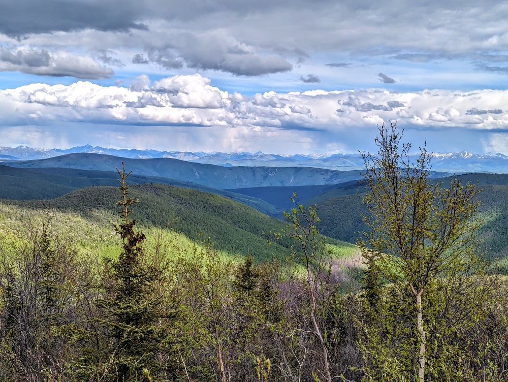
…and more scenic overlooks.
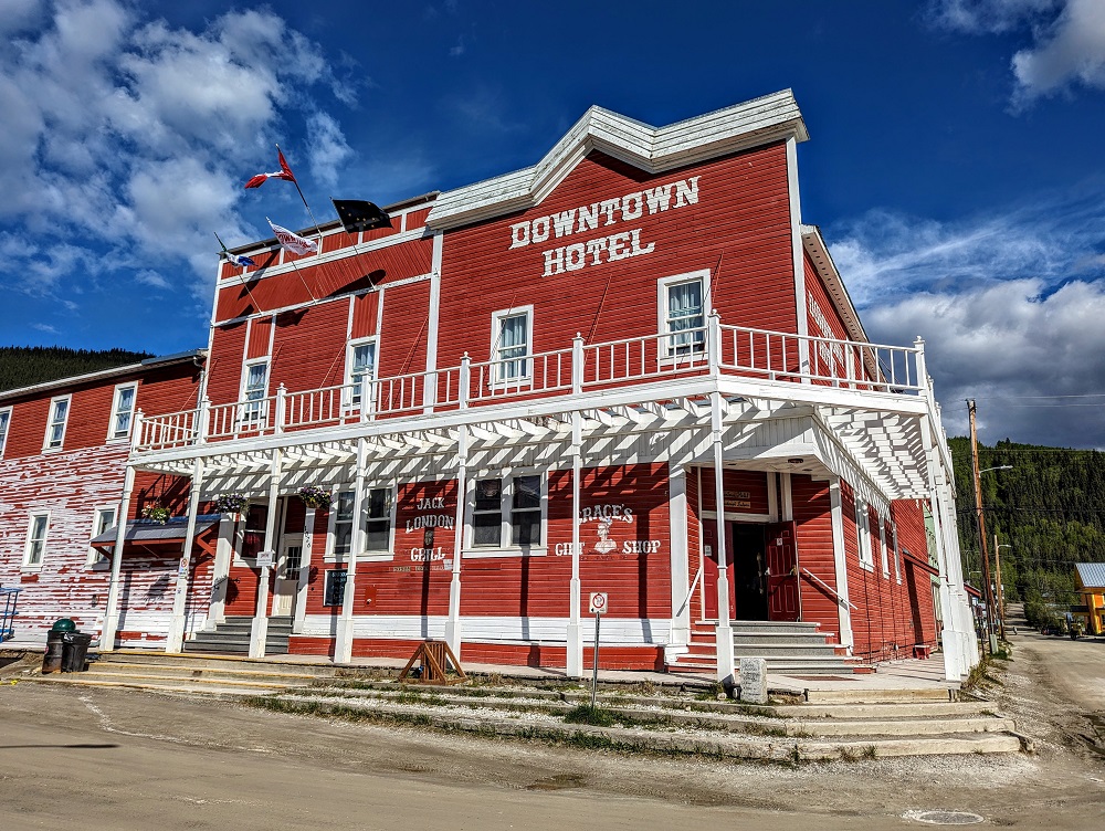
We made it to Dawson City just before 6pm, checking in at The Downtown hotel.
Day 7 Of Driving To Alaska (Dawson City to Tok)
Day 7 driving distance: ~185 miles
Our whole reason for visiting Dawson City was to do the Sourtoe Cocktail – a shot of Yukon Jack whiskey with a mummified human toe in it. When taking the shot, you have to let the toe touch your lips to get a certificate. It’s weird, but it’s fun and you should totally do it if you find yourself in Dawson City. Here’s a post about the experience and here’s a video of it:
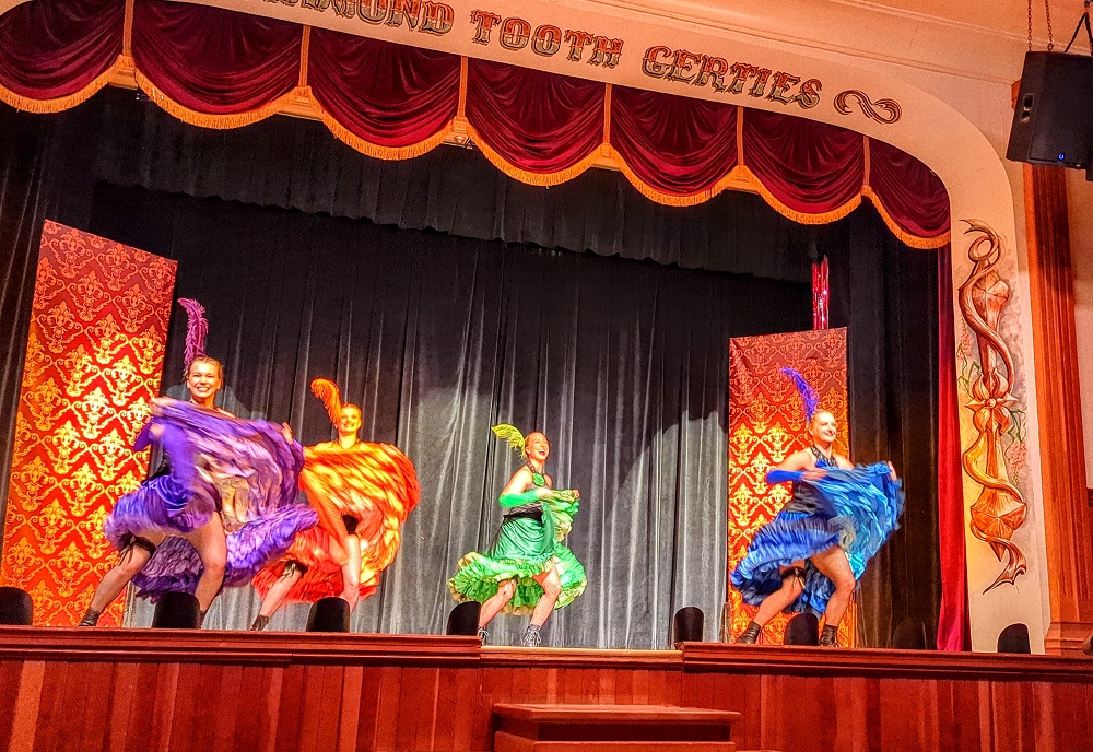
Other than the Sourtoe Cocktail, we had a couple of busy days in Dawson City and would’ve liked even more time there. It’s a cute place to walk around, there’s a beautiful viewpoint above the city, it doesn’t really get dark at night in the summer, there’s a casino that puts on three cancan shows each night and more. See this post for more things to do in Dawson City.
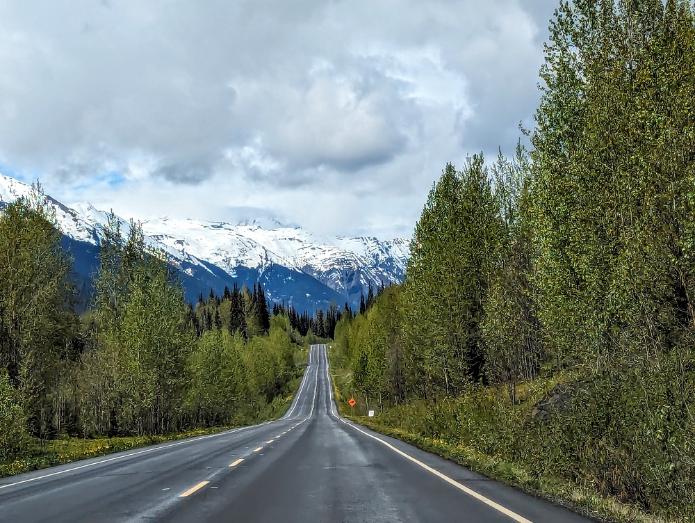
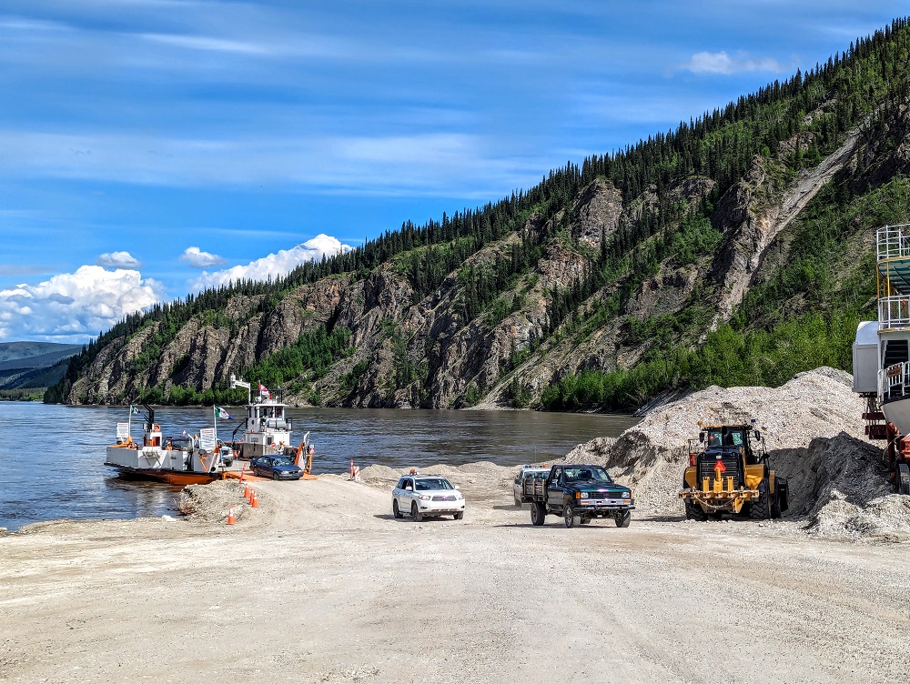
After those two days were up, it was time to drive the final stretch into Alaska. The Klondike Highway (Yukon 2) terminates in Dawson City at the edge of the Yukon River. The road to Alaska continues on the other side of the river, with Dawson City offering a free ferry that runs 24 hours a day.
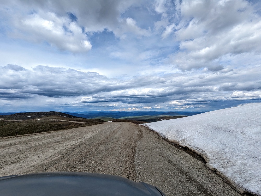
The road on the other side of the river is Yukon 9 and is known as the Top of the World Highway. It’s a dirt road for much of the way, but despite that it was in fairly good condition with very few potholes and – most importantly – it wasn’t a washboard road as those are always miserable to drive on in our 2004 Toyota Corolla.
While this part of the drive wasn’t the most scenic compared to some of our other days of driving, we were still treated to some lovely views.
As we drove further up the Top of the World Highway, we started encountering snowy sections on the hillsides. This was on June 1, so there’s still snow around fairly late in the year up there. It was fun getting to drive this highway because the road is only open for 3-4 months each year as the rest of the year it’s impassable.
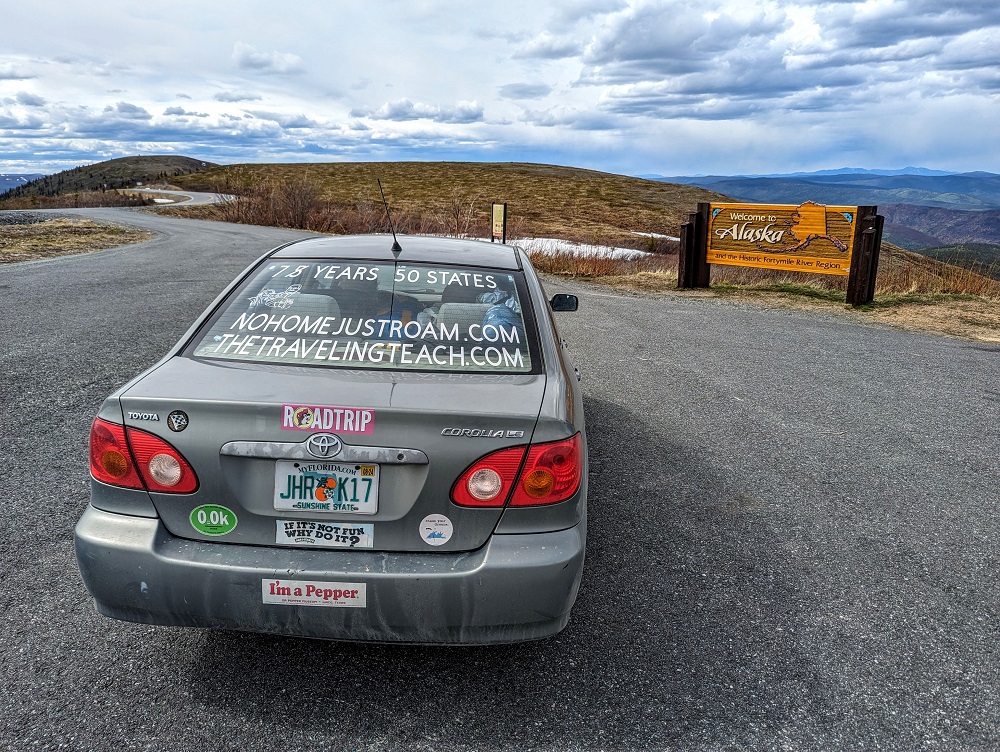
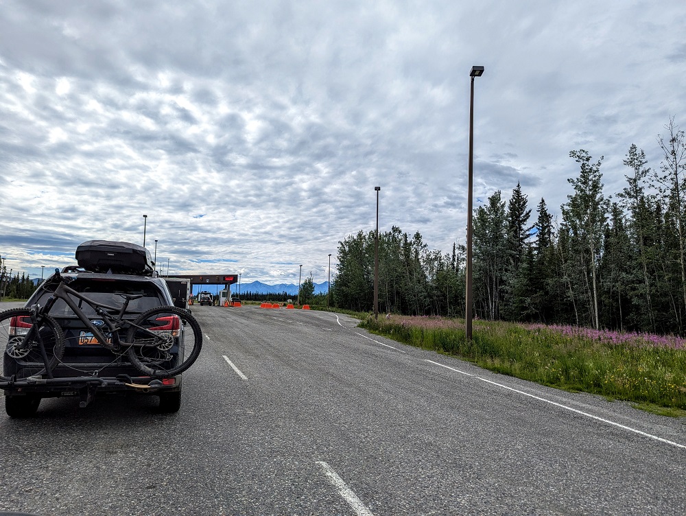
We made it to Poker Creek-Little Gold Creek just after 2pm which is at the border of the US and Canada. There’s a border inspection station there which is the northernmost international border crossing in North America.
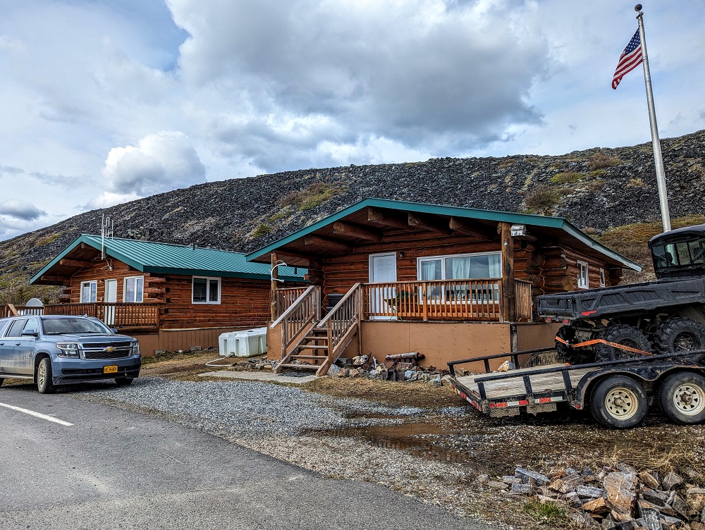
As you might imagine, it’s a remote location. That means that the border crossing guards live up there in what looked to be charming and cozy log cabins.
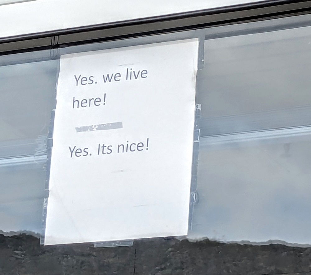
The border crossing guards must hear similar questions from many people crossing from Canada to the US or vice versa as their booth window had the following sign preempting what are presumably the most commonly asked questions!
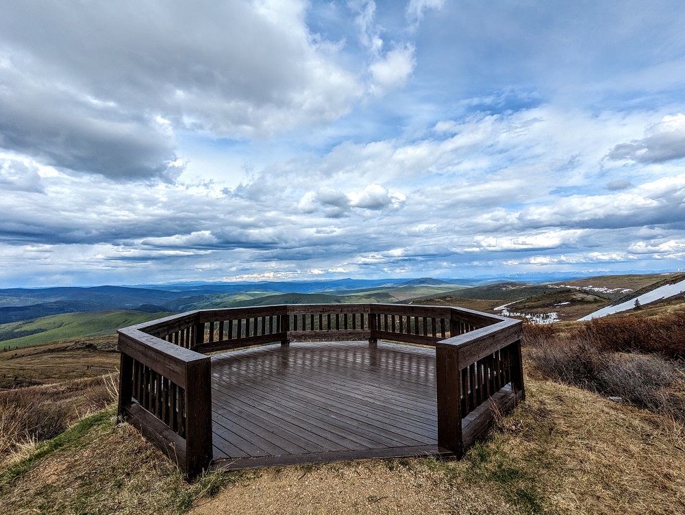
Once you cross over into the US, there’s a sign welcoming you to Alaska…
…as well as an overlook. It was extremely windy up there that day (I suspect that’s often the case), so we only stopped for a quick moment to grab a couple of photos and rushed back to the car to continue on.
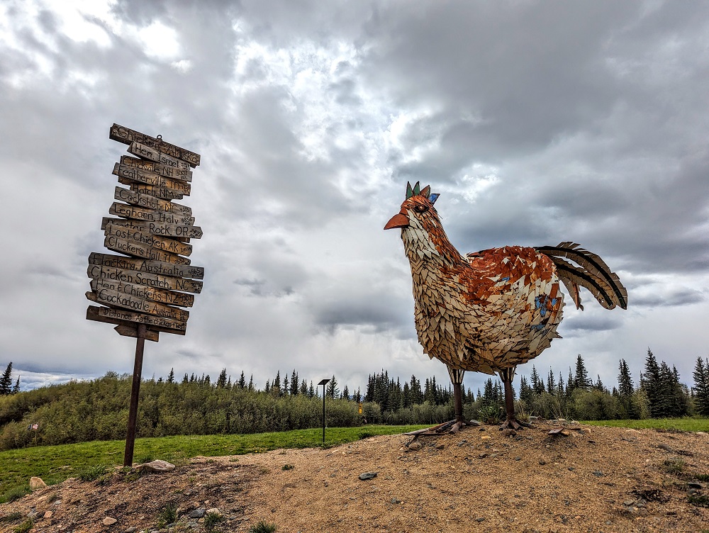
From there we continued on to the small and quirky town of Chicken where we stopped to look around and have a drink in their saloon bar. Find out more about Chicken, Alaska in this post.
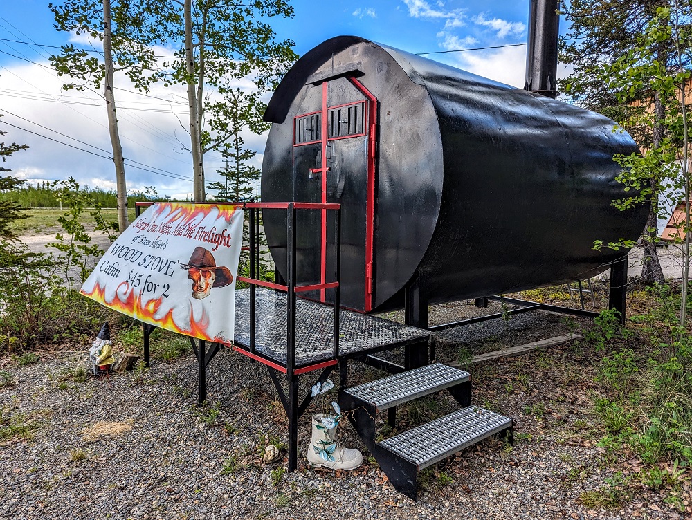
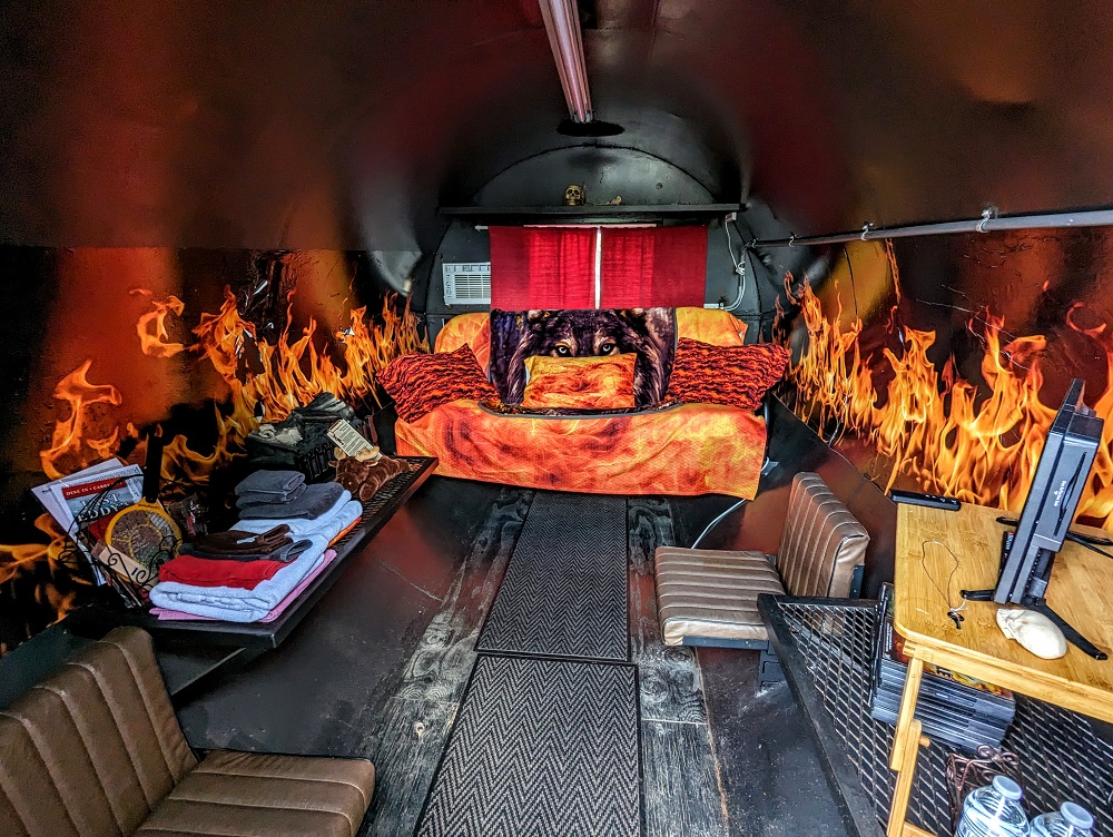
After Chicken we drove on to Tok (pronounced toke) where we stayed overnight in a wood stove cabin.
And thus began our Alaska adventure.
What We Did In Alaska
We’ve published more than a dozen posts about what we got up to in Alaska, so I won’t list them all here. You can see all our Alaska-related posts here, but here are a few of the key ones:
- 6 Nights In Fairbanks, AK
- 2 Nights In Healy, AK For Denali National Park
- 1 Week In Wasilla, AK
- 12 Days In Anchorage, AK
- 24 Hours In Utqiagvik (Formerly Barrow), AK
- 1 Week In Seward, AK
After spending five weeks in Alaska, we made the drive back down to Seattle in early-to-mid July. While we took several weeks to drive up through Canada to Alaska, we quickened our pace for the journey back, having longer driving days and fewer overnight stops.
Quite a bit of our journey back was along a similar route as the one we’d taken up to Alaska, but it wasn’t all the same. This next section will therefore be a little shorter than the first half of this post (I hear you breathing a sigh of relief 😉 ), but there were several things I wanted to highlight about what we saw and did on the drive back from Alaska.
Day 1 Of Driving Down From Alaska (Seward to Tok)
Day 1 driving distance: ~442 miles
We ended our official time in Alaska in Seward. For the start of our drive back we drove up to Tok, but along a different route. When arriving in Alaska, we stopped in Tok, then moved on to Fairbanks, Healy, Wasilla, Anchorage and finally Seward. Driving back up along that route would’ve added much more time to the journey though, so bypassing Healy and Fairbanks greatly shortened that part of the journey.
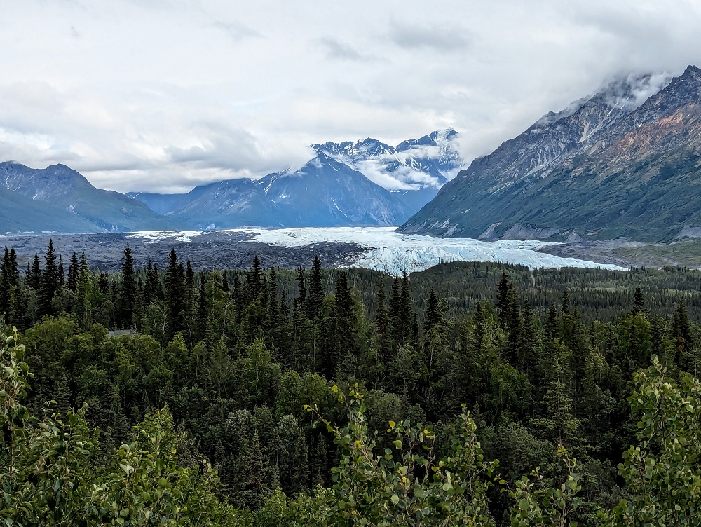
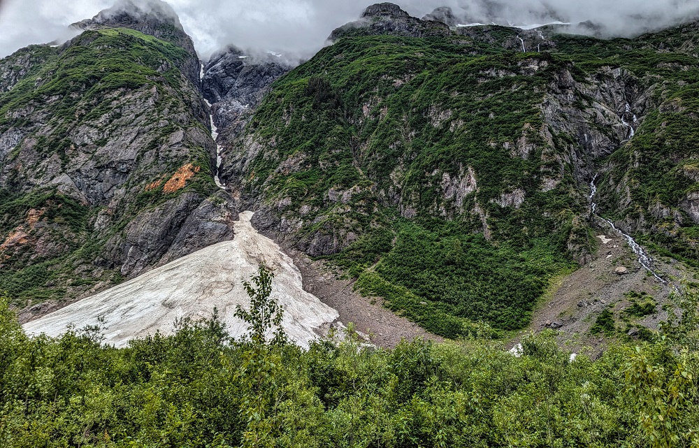
We had to run a couple of errands in Anchorage, then we stopped for a quick picnic lunch there. After getting back on the road, our route had us driving past Glacier View which, as the name suggests, provides a glacier view.
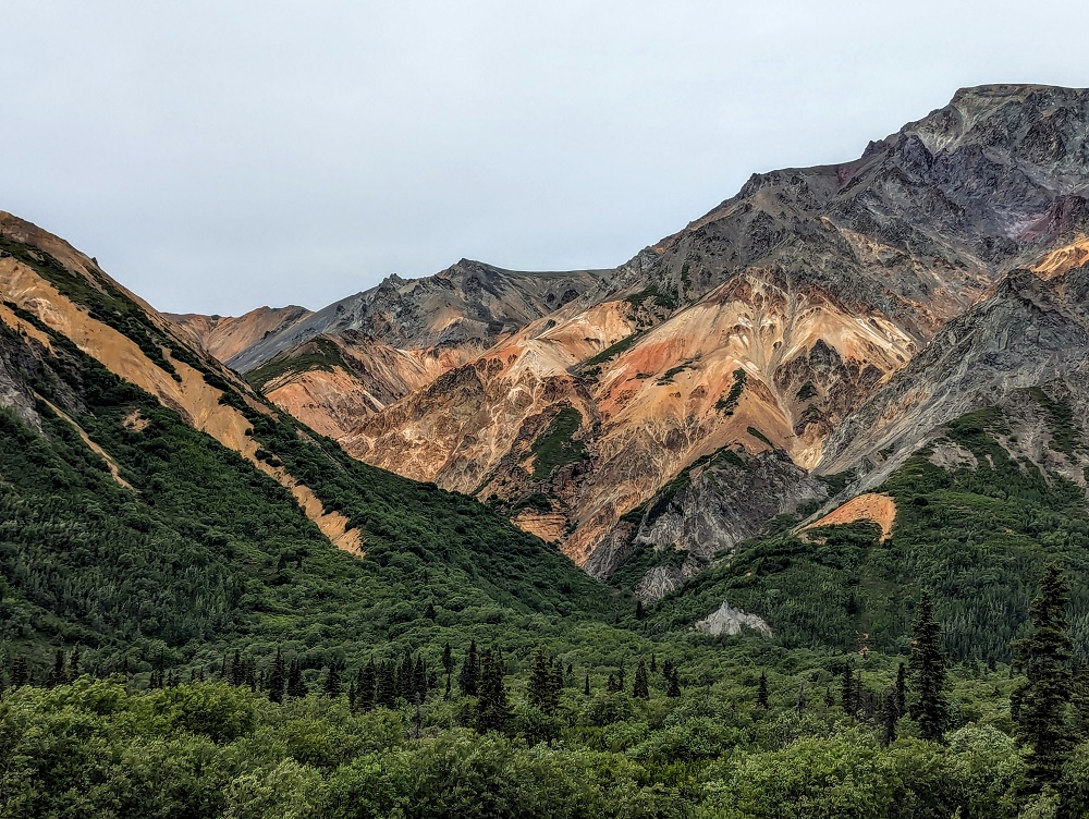
20 minutes up the road was Sheep Mountain. Its red and orange rocks looked more like something you’d find in New Mexico, Arizona or Utah than Alaska.
The road after Glacier View was very bumpy, so be cautious if driving an RV or towing one. We stopped to fill up with gas in Glennallen. Although it’s a small town, there was the gas station, a grocery store, Subway, other restaurants, a hotel and more. We also saw quite a few eagles at Chistochina Creek.
It ended up being a fairly long driving day due to the distance covered, so we didn’t reach Tok until about 7:30pm. We’d enjoyed staying in the wood stove cabin when stopping in Tok on our way up to Alaska, but that was booked up on the night we were passing back through on our way down. Instead, we stayed at Fox n’ Fireweed which we booked via Airbnb and it was a fantastic spot.
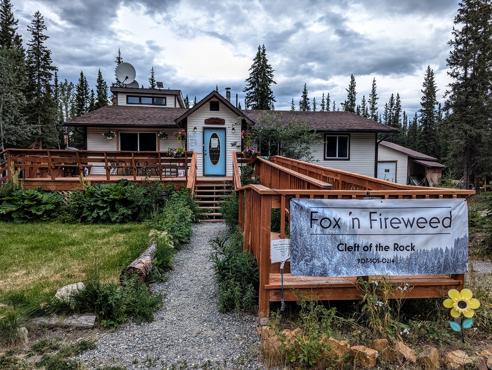
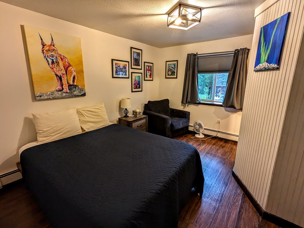
There are several accommodations here. The main house has several bedrooms, each with their own private bathroom. There are also private cabins behind the property. Seeing as we were only having a quick overnight stay, we booked one of the bedrooms in the main house which was a decent enough size.
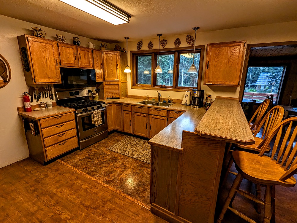
The house also has a shared kitchen, dining room and living room, with the hosts also providing complimentary breakfast which was a nice touch. They offer self check-in which can be particularly helpful if you anticipate arriving fairly late at night. Unlike the wood stove cabin we’d stayed in previously, Fox ‘n Fireweed does have Wi-Fi you can use.
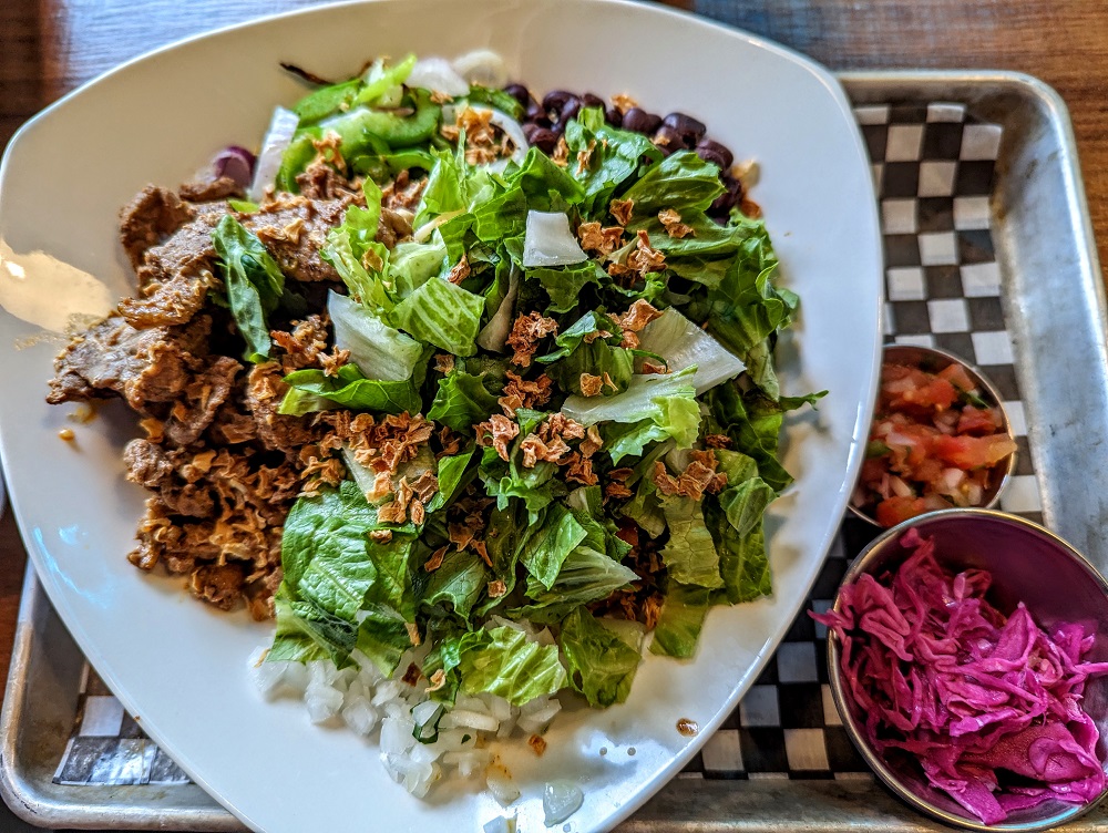
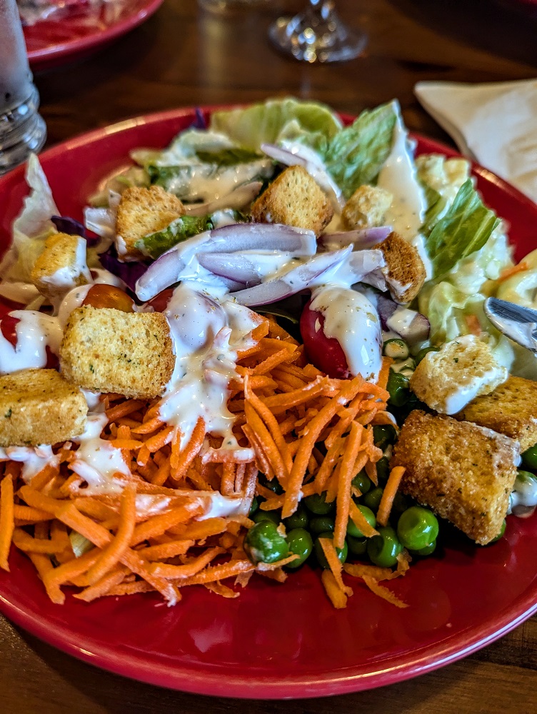
That night for dinner we drove up the road to Fast Eddy’s. There are very few restaurants in Tok and, with it being a Saturday night in prime driving-to-Alaska season, the place was packed. That meant service at Fast Eddy’s was a little less fast paced, but that wasn’t much of an issue because Shae ordered a Caesar salad and I went for their self-serve salad bar. After not eating particularly healthily in Seward the previous week, I was grateful to have several plates of salad.
Day 2 Of Driving Down From Alaska (Tok to Whitehorse)
Day 2 driving distance: ~387 miles
Our second day of driving back down to the lower 48 had us heading to Whitehorse again. Once again, there was a very bumpy road until just past Northway Junction. Along the way we had pretty views of Tetlin National Wildlife Refuge, but it wasn’t easy to get good photos due to trees blocking the view.
There was gas available at Border City Lodge a few miles before the actual US/Canada border. We were a little confused though because we crossed into Canada and there was no official border crossing station to be seen.
It turns out that came 30 miles further down the road. Seeing as we were driving the Alaska Highway back down rather than the Top of the World Highway, we ended up going through a different border crossing than the one we’d gone through on our way to Alaska.
Once back in Canada, the quality of the road surfaces was markedly improved. Some roads were gravel, but they were significantly less bumpy and there were far fewer potholes than on the US side of the border.
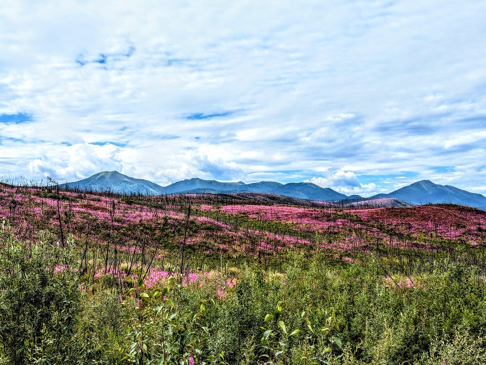
July was a beautiful time to drive through this part of Canada because there were fields and fields of vibrant magenta and purple wildflowers.
We stopped for lunch at Pickhandle Lake Recreation Site. This was a very pretty area, but there weren’t any picnic tables and so we just sat down on the small dock overlooking the water.
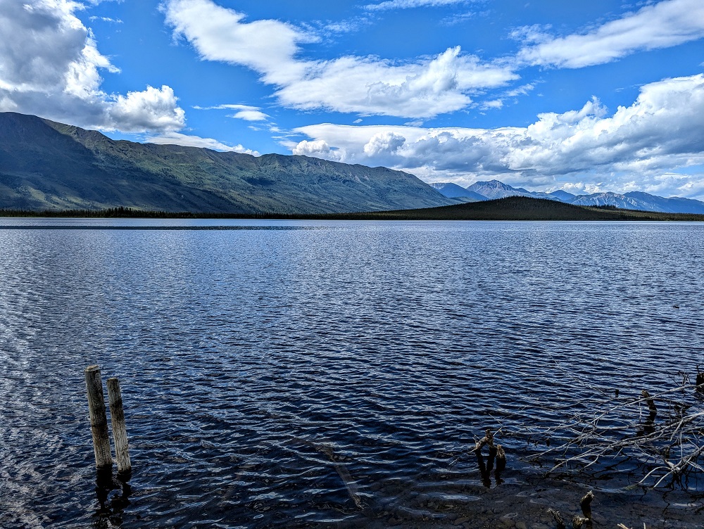
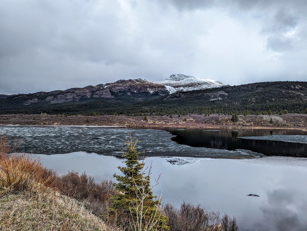
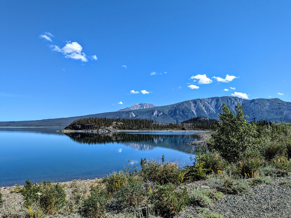
After lunch the road got bumpier again for about 30 minutes before smoothing out somewhat. Our route then had us driving alongside Kluane Lake for quite some distance which offered wonderful views.
Before reaching Whitehorse, we passed through Haines Junction. That looked like it could be a good spot to stay in as there were several hotels and motels, restaurants, a cultural center and more.
We made it to Whitehorse at about 7pm and once again stayed at The 98 Hotel, this time in the Prospector room.

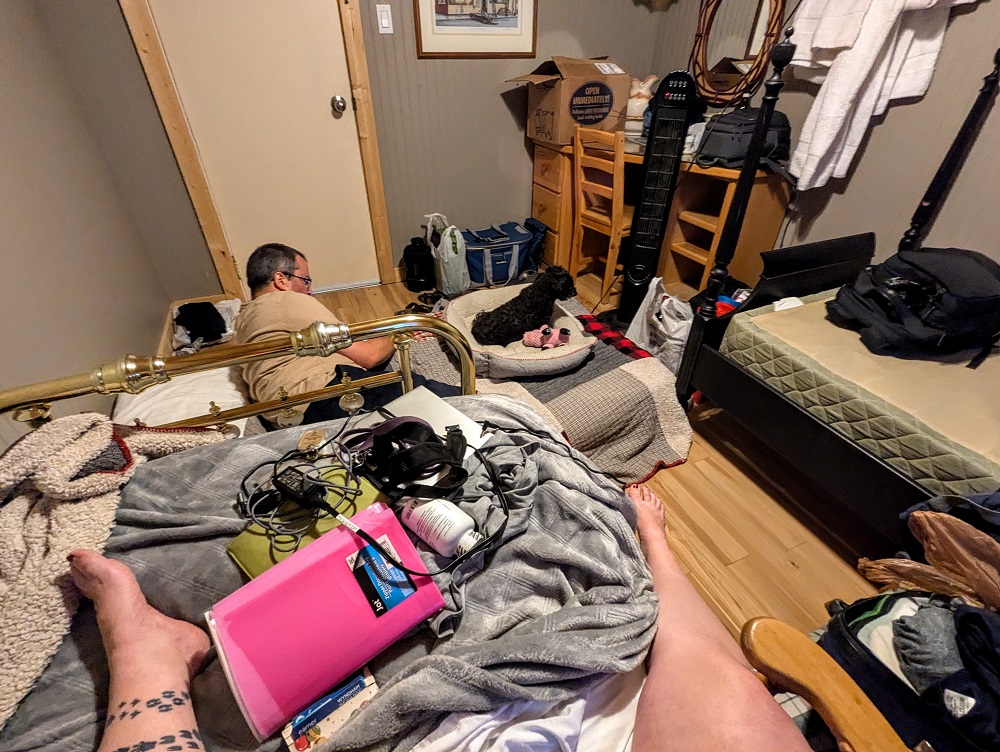
We were getting settled in for a quiet night when disaster struck. I was playing with Truffles on the bed and she started having zoomies. When getting her down off the bed, she landed awkwardly, slid into the metal bed post and let out a loud yelp. Looking down, her front left leg was in an awkward looking position, so we were worried she’d broken it or dislocated it.
With it being after 7pm on a Sunday, there were no vets open. Thankfully one of the local vets in Whitehorse – Alpine Veterinary Medical Centre – does have an emergency vet you can call. We called them, explained our situation and fortunately had a vet available to see her. Shae and I therefore rushed her down the road to be seen where they took some x-rays.
It seemed like it might’ve just been a dislocation of some variety, because the x-rays didn’t show any broken bones. When they were maneuvering her leg for the x-rays, it seemed to end up going back into its correct position. Due to her small size, they weren’t sure if it had been dislocated or not, but ultimately we were incredibly grateful that a) they’d been able to see her and b) that her leg was OK.
To make sure Truffles didn’t jump off the bed that night, we put one of the mattresses on the floor so she could sleep with one of us down there. It ended up being a long night as she still seemed to be in a fair bit of pain and so whimpered much of the night.
Day 3 Of Driving Down From Alaska (Whitehorse to Dease Lake)
Day 3 driving distance: ~430 miles
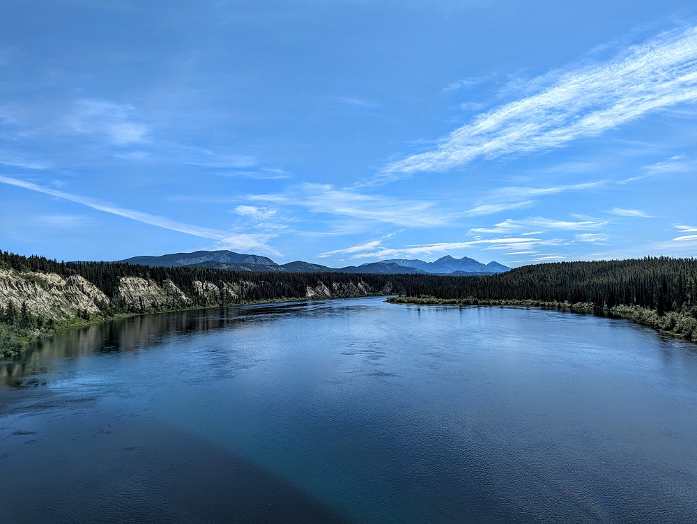
Our third day of driving back down was due to be another long one, but it had many pretty spots along the way. Early on that morning we drove alongside Marsh Lake, then crossed over the Teslin River at Johnsons Crossing.
Along the way we saw a sign saying “No shooting grizzly bears within 100 meters of the road.” We therefore hoped that we’d see some bears along that stretch, but sadly not.
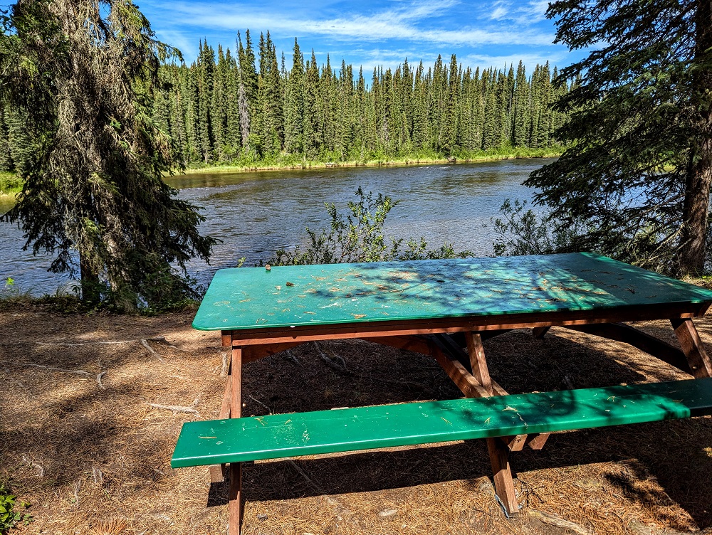
For lunch we stopped at this rest stop on the Morley River, just before heading back in to British Columbia. Unlike some of the rest stops we encountered on our drive, it was nice to have a picnic table available to sit at.
Shortly after lunch we spotted some wildfires in the distance. Helicopters were dropping water on them to try to contain them and thankfully the fires were far enough away to not pose any danger to us that day.

On our way up to Alaska we’d stopped in Watson Lake to visit the Sign Post Forest. We hadn’t realized before visiting that you can leave your own sign there, so we hadn’t come prepared. While we were in Alaska though, we designed a small sign via Office Depot/OfficeMax and had it shipped to one of their stores in Anchorage. One of the errands we’d run on our drive from Seward to Tok was to pick that up, so when driving down from Whitehorse we made another quick pitstop in Watson Lake to hammer it on to a post.
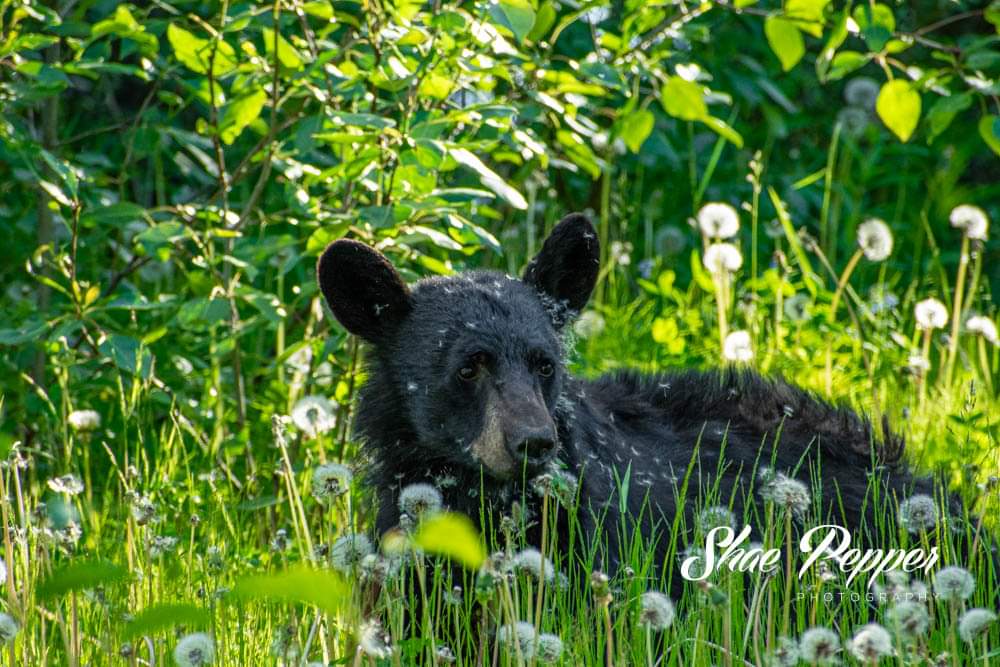
About 30 minutes after leaving Watson Lake we spotted a bear, then we spotted another one about 30 minutes before we arrived in Dease Lake. That latter bear was particularly cute as it was covered in dandelion fuzz.
In Dease Lake we stayed a couple of nights at the Northway Motor Inn. We ended up paying a little extra to have a kitchen which was useful.
It was a nice enough place to stay, but there were a few negatives. There was still food in the fridge from the previous guest, there was no toilet paper left in the bathroom, there was no shower curtain and no air conditioning. We therefore had to stop by the front desk to get toilet paper and a shower curtain which was fine. The lack of air conditioning wasn’t ideal though as it was very warm the two nights we were there.
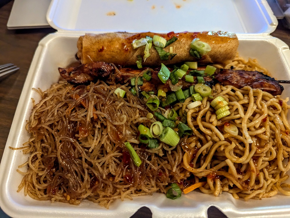
We’d grabbed dinner to take with us when in Watson Lake earlier that day. For our second night we got dinner from Nympha’s Asian Food Eatery. The selection was limited – the only main option was the daily combo which that day was pork kebab with chow mein, rice noodles, and meat or veggie rolls, with additional pork kebabs and spring rolls available to order too. The food was tasty and plentiful, so I had leftovers to take with me the next day.
Dease Lake also has a good-sized grocery store opposite the Northway Motor Inn called Dease Lake Super A Foods.
Day 4 Of Driving Down From Alaska (Dease Lake to Stewart)
Day 4 driving distance: ~245 miles
England were playing in the Euro 2004 championship the day we checked out, so after checking out I sat in the lobby watching the game. That meant we didn’t get going until early afternoon, but it wasn’t a huge deal as we had a shorter drive that day of ~4.5 hours.
We stopped for a quick lunch at Upper Gnat Lake. The lake is appropriately named because there were tons of gnats, so it was a very quick lunch.
It was another scenic drive, with lots of lakes and mountains to gaze at.
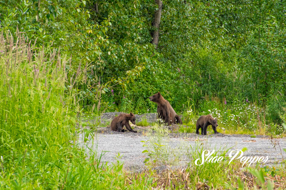
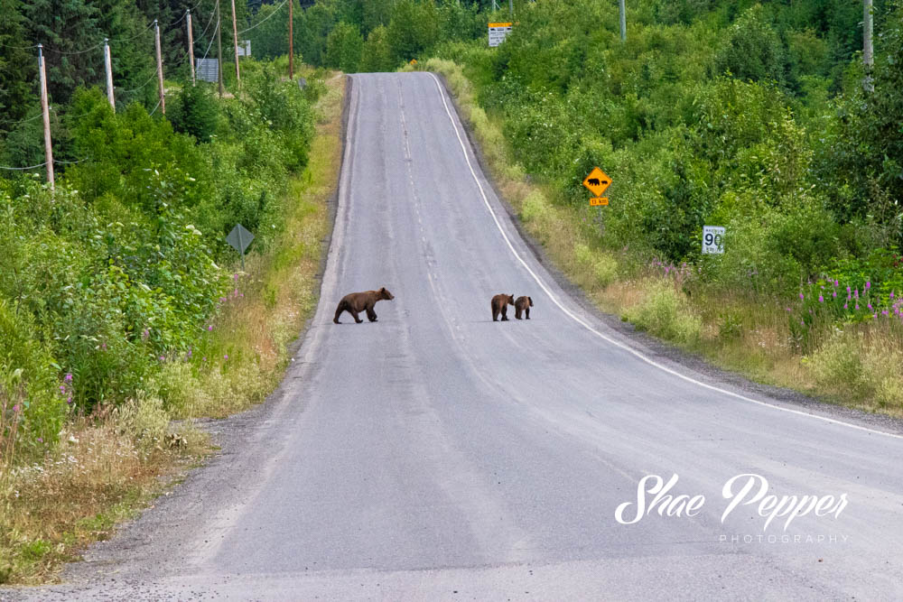
We’d been fortunate to see quite a few black bears on our way up to Alaska and a few on our way back down but hadn’t, up until that point, seen any grizzly bears in the wild.
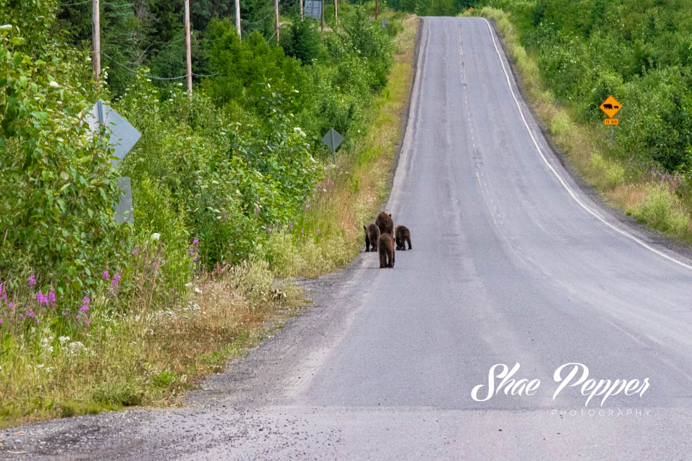
That changed when we reached Meziadin Junction. Shae had gone inside to use the restroom and I was sat at a picnic table trying to get Truffles to have some food when all of a sudden I heard someone shout “grizzly bear!” Looking around, someone in a car leaving the gas station was the one shouting and they pointed down the road.
Knowing that Shae would really want to see a grizzly bear, I legged it inside to find her, but she wasn’t there. It turned out she’d gone back to the car, so I grabbed her, left Truffles in the car for safety and we ran down to see the bear. It turned out that there was a mama bear with three cubs down the road. They were a safe distance away, but still close enough to be able to enjoy watching them wander around.
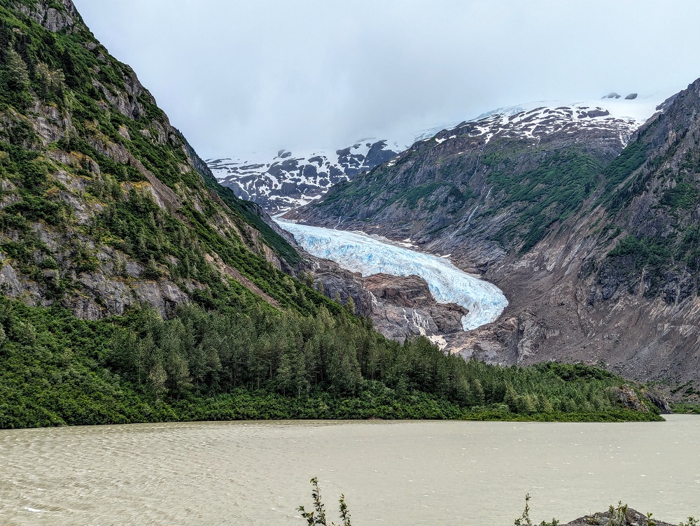
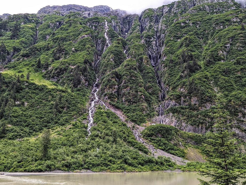
After spending a little longer at Meziadin Junction than anticipated in order to soak in the wildlife, we continued our drive down to Stewart. That drive from Meziadin Junction to Stewart along BC-37A (Glacier Highway) was one of the most stunning parts of our entire drive up to Alaska and back down again.
For starters, you pass by Bear Glacier.
The road is then flanked by towering cliff faces with waterfalls all along the way – a stretch of road known as the Wall of Tears.
We stayed in Stewart for a couple of nights at the Historic Hotel Bayview downtown. This is bookable on both Hotels.com and Airbnb; we ended up booking on Hotels.com as we had a Hotels.com gift card we wanted to use.
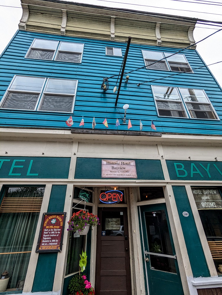
It was a very nice place to stay, with a private bedroom and bathroom, but also a communal kitchenette and living room.
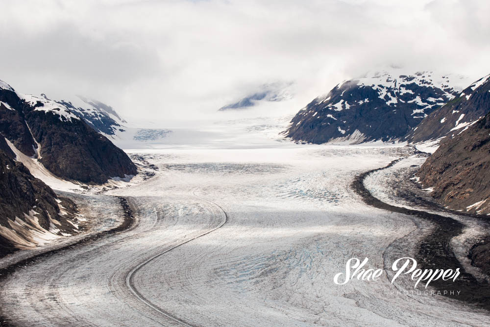
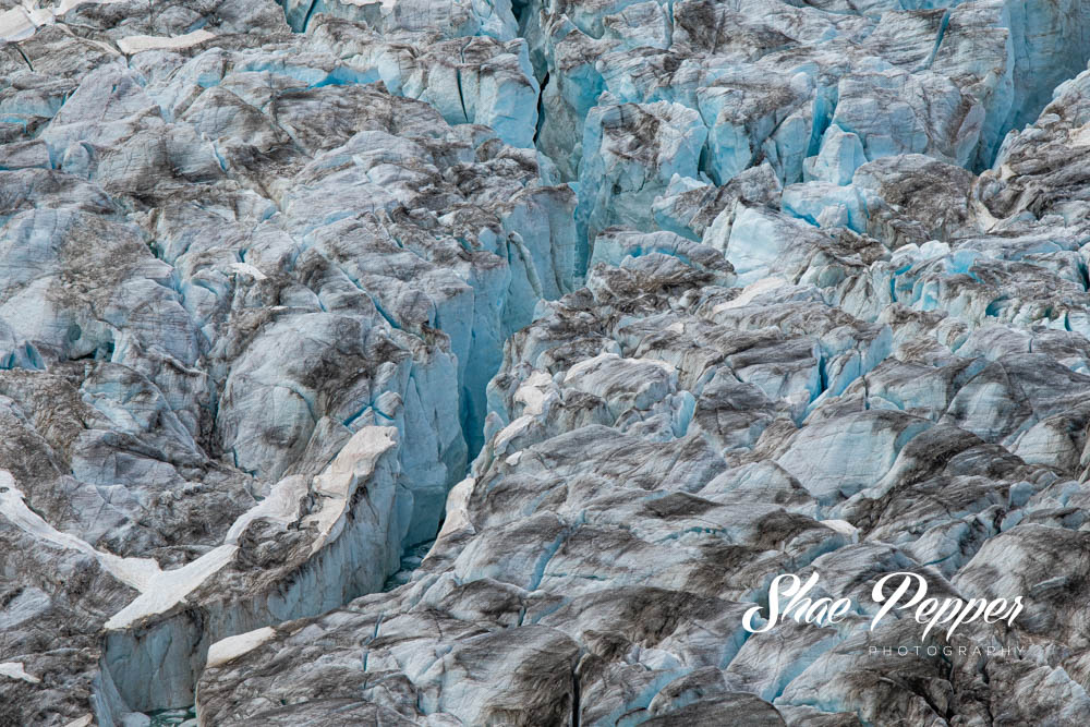
While in Stewart we drove up to the immense Salmon Glacier (read more about that here)…
…saw a grizzly bear and a couple of salmon at the Fish Creek Wildlife Observation site…
…and more. Check out this post for more about our time in Stewart.
Day 5 Of Driving Down From Alaska (Stewart to Prince George)
Day 5 driving distance: ~435 miles
We got on the road at about 11am with another long drive ahead of us that day. Driving along the Wall of Tears was once again amazing, with low clouds adding to the moodiness.
The drive that day was fairly uneventful which we were grateful for because we had a couple of Final Destination 2 flashbacks (IYKYK).
After stopping for lunch at a rest area just outside of Smithers, we drove the rest of the way to Prince George. We’d stayed in Prince George for a few nights on our way up at the Hyatt Place and planned to stay there again on our way back down. However, when rejigging our plans to fit in a couple of days in Stewart, we had to move our dates for Prince George and the Hyatt Place was already fully booked.
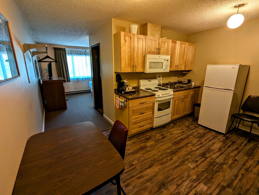
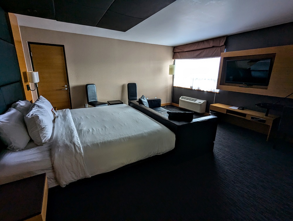
Instead we redeemed Wyndham Rewards points to stay at the Ramada Plaza. What was particularly great about this option is that we could book into a 1 King Bed Executive Long-Term Suite with points. That suite was much larger than a standard room there and had a full kitchen.
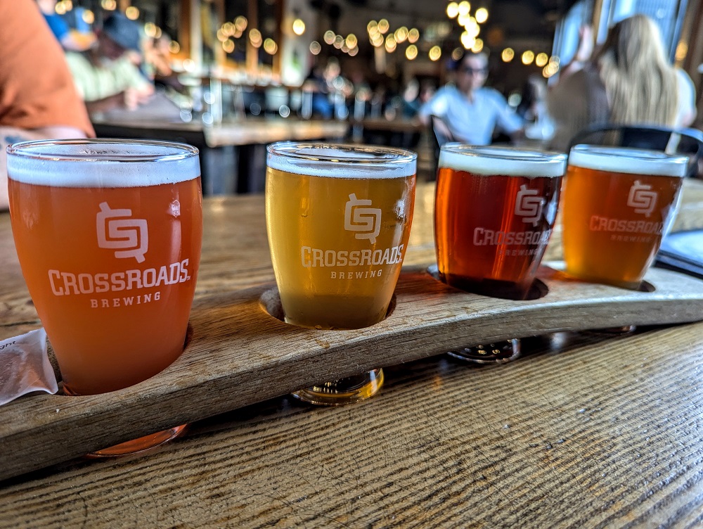
The hotel was across the street from Crossroads Brewing & Distillery, so after checking in we popped in for a quick drink. Shae got some kind of cocktail (I forget which one) which she enjoyed. They were sadly out of nearly every dark beer on their menu, so I had to settle for a flight of some of their lighter beers. Those were good, but not so good that I wanted to buy some to go.
After that we grabbed some fast food for dinner and headed back to the hotel for the night.
Day 6 Of Driving Down From Alaska (Prince George to Bellingham, WA)
Day 6 driving distance: ~530 miles
For the final day of our drive back to the lower 48, we had our longest driving day of all. It wasn’t originally meant to be such a long day as we’d previously planned to stay a night in Kamloops before driving down to Washington state the day after.
However, England had made it through to the final of Euro 2004 and I wanted to be able to catch the game. Our driving schedule meant it would be hard to fit that in, so we decided to have one much longer driving day to make it back the day before the game so that we could then watch it at a friend’s house.
This plan came with a problem though. We’d arranged for some mail to be sent to the Holiday Inn Kamloops that we were originally going to be staying at, but we were no longer staying there. That meant we had to add an extra 60 miles to our day to divert via Kamloops to stop at the hotel, pick up our package and then drive down to Bellingham.
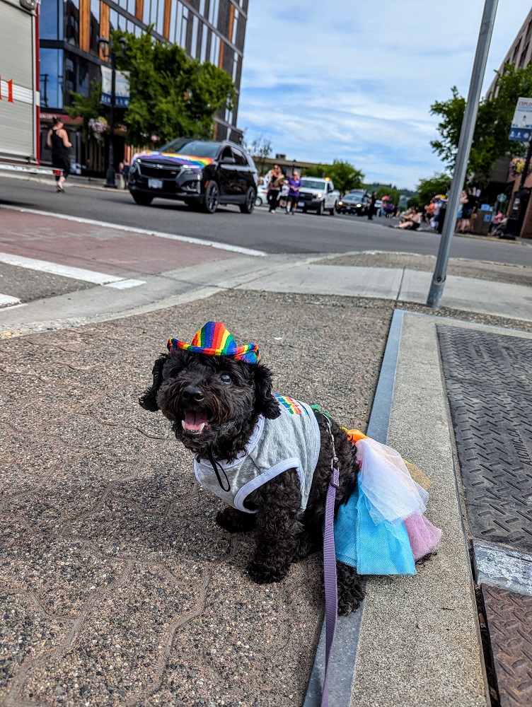
Before setting off, Shae noticed that Prince George was running a Pride parade which was a little strange because it was July – the month after Pride month. Still, Truffles wanted to go out and show her support, so she got dressed up while I finished packing our stuff and loading the car.
With it being such a lengthy drive, we didn’t have time to stop and smell the roses enjoy the sights that day. We did get a quick drive-by photo of the world’s largest gold pan as we passed through Quesnel though.
About halfway between Prince George and Kamloops we stopped for lunch at Lac La Hache Provincial Park. This was an extremely pretty park and, with it being a Saturday and exceedingly hot out, there were many people enjoying the lake and beach. We were just grateful that there was a shaded picnic shelter as it was sweltering out.

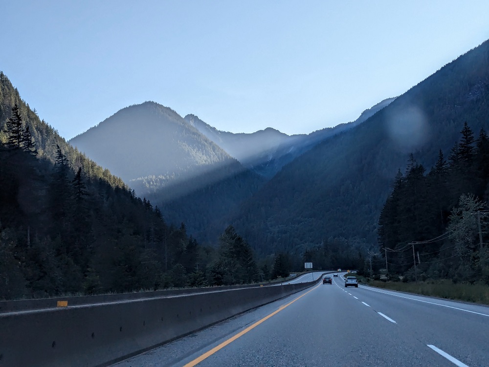
Even when you’re driving on the highway in British Columbia the views are immense.
A couple of hours after that photo, we arrived in Bellingham, WA after passing through US Customs & Border Protection – the end of a long, but incredible, drive up to Alaska and back.
Wow what a lot of driving and scenery. The Salmon Glacier pix was amazing!!
Yep, Shae got some great shots!