While staying in nearby Manteno, we visited Kankakee River State Park to hike the Rock Creek Trail.
The Rock Creek Trail is a two mile loop which includes a cave and “waterfall” (you’ll see later why that’s in quotation marks). The dog-friendly trail itself is easy as it’s level the entire way, so that part of it is more of a walk than a hike.
However, to get the most enjoyment from the trail, you’ll want to take some tricky offshoots down to the creek. That makes it more of a workout as you’ll be clambering up and down, so be sure to wear good footwear.
Entrance to Kankakee River State Park in Illinois is free, but we stopped by the visitor center to pick up a map of the park. On one side was a map detailing the biking trails…
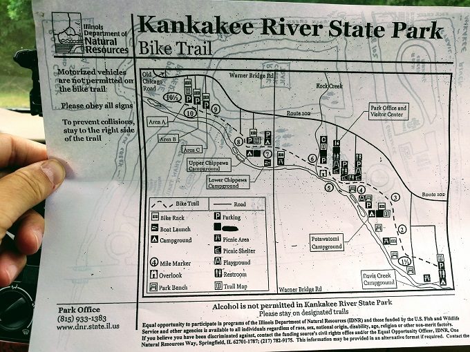
…while on the other was a (not entirely accurate) map of the hiking trails.
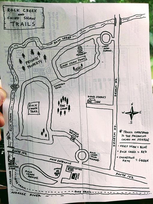
On the hiking trail map above, there’s a black rectangle in the bottom center of the map which is where the main office is located. To get to the Rock Creek trailhead from there, you need to take a right back out on to Route 102, then take an immediate left.
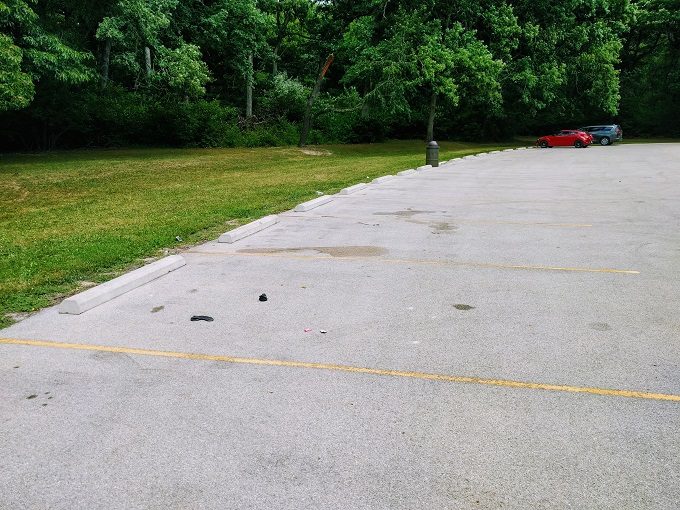
The map above makes it look like there’s a small roundabout, but it’s actually much bigger than it appears. Follow it about half the way around until you come to a fairly good-sized parking lot.
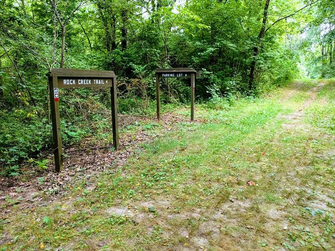
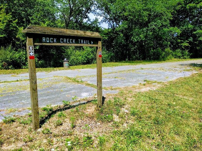
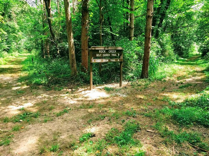
You’ll know you’re in the right location as there’ll be a map showing both the Rock Creek Trail (in red) and Chief Shaw Trail (in blue). Both of these loop trails are two miles long and have a path connecting them.
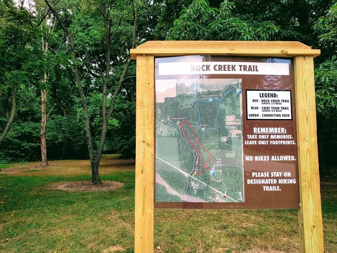
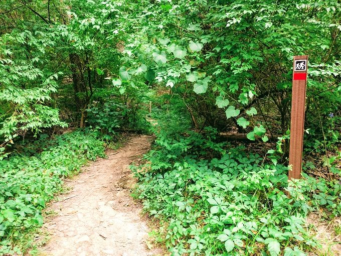
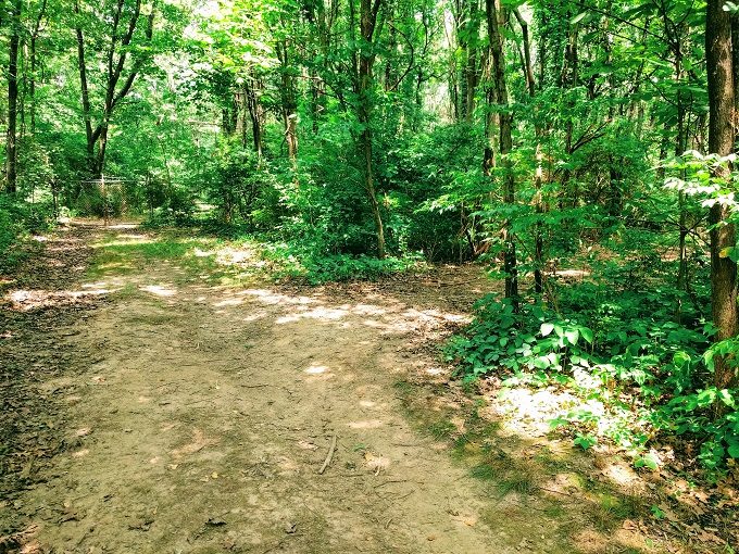
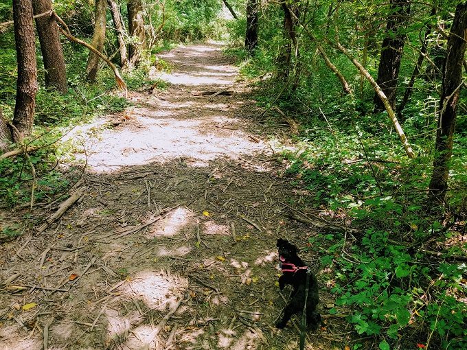
Walk past the sign and through the gap in the trees and you’ll reach the start of Rock Creek Trail.
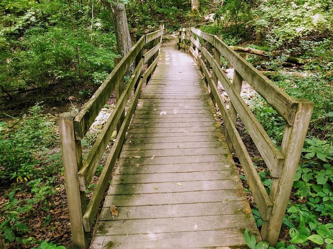
The well-worn path brings you to a bridge crossing over a rocky creek. It was completely dry when we visited at the beginning of August, but I imagine you’ll see water flowing through it after the winter snow has melted. Don’t worry though – this isn’t Rock Creek!
The photo doesn’t do it justice, but the bridge is rickety and leans up and to the side a little, so it’s an odd sensation walking across it as you’ll be leaning to the right.
Once over the bridge, continue following the path until you reach the signs below. At this point, you can take the trail to the left or right seeing as it’s a loop. The sign indicates you should head to the left, presumably because that’s the closest route to the cave and waterfall.
This part of the hike had a fair bit of shade which we appreciated as it was a hot summer day when we visited.
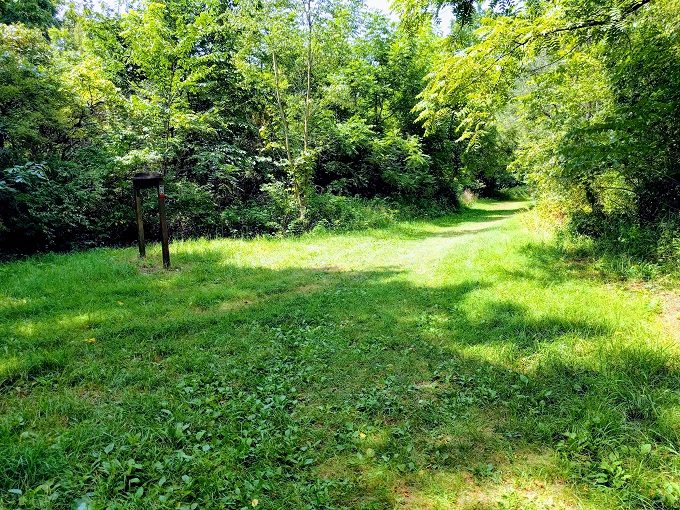
After walking a little further, the path takes you to a much more open area with a paved path. The marker says to head right, but you’ll want to do that later. Instead, turn left and walk down the path towards Route 102.
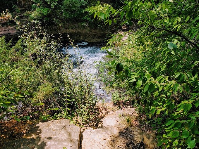
The reason why is because just before you reach the road, you’ll see the marker for Horsethief Cave pointing to the right.
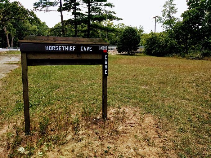
There’s an overlook to the right where you can view Horsethief Cave from up high.
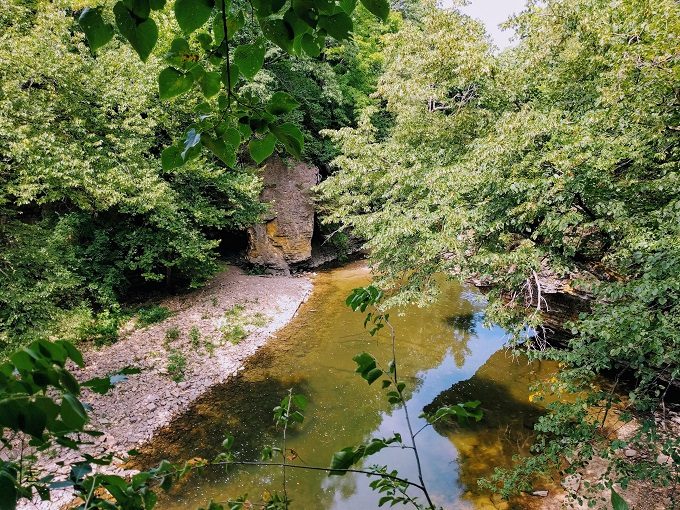
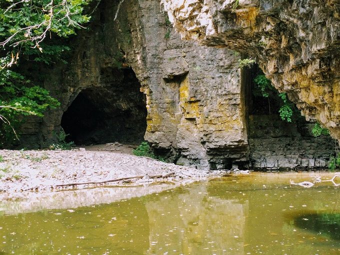
It’s possible to get closer to it though by clambering down. Walk a little further back up the path and you’ll see an opening with a fairly steep path down. We took that route down to Rock Creek, but it turns out that there’s an easier path. We took that easier route on the way up, but the entrance to that path is overgrown at the top which is why we’d missed it originally.
It’s worth making your way down though so long as you can do it safely. I was wearing tennis shoes and they only just had enough grip – my hiking boots would’ve been better. We weren’t prepared for wading in waist-high water, so we didn’t head over to explore the cave.
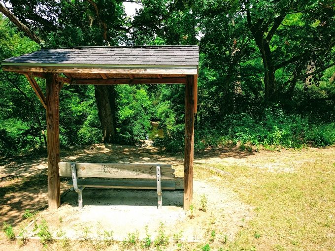
After making your way back up, follow the paved path in the direction that the earlier route marker had advised. While walking along, there’s some covered seating looking out over Rock Creek.
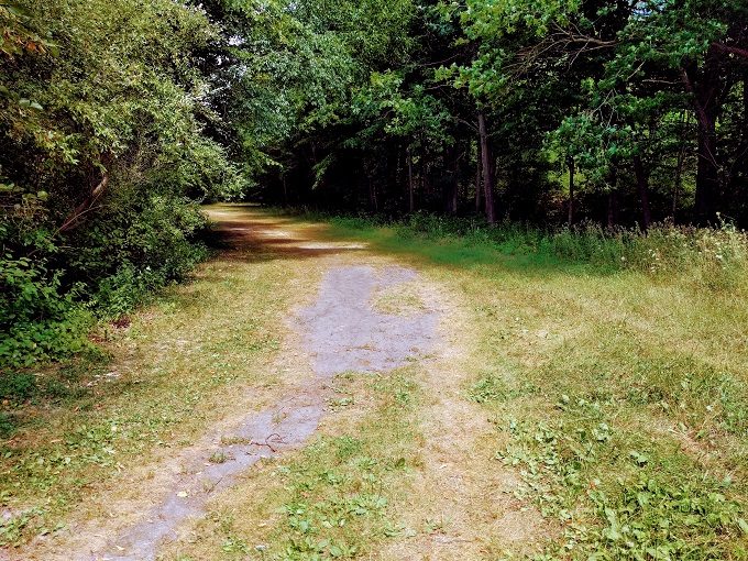
The wide path continues through the trees with the creek running along your left side.
If you keep an eye out, there are several paths of varying steepness down to the creek. They’re not official parts of the Rock Creek Trail, but they make it a much more enjoyable and strenuous walk/hike.
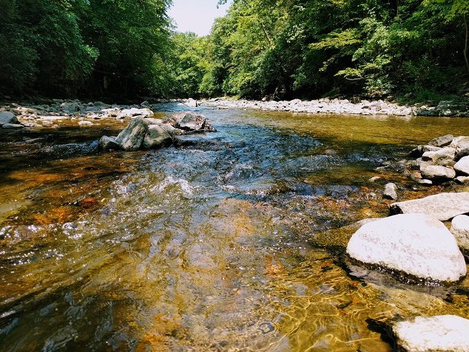
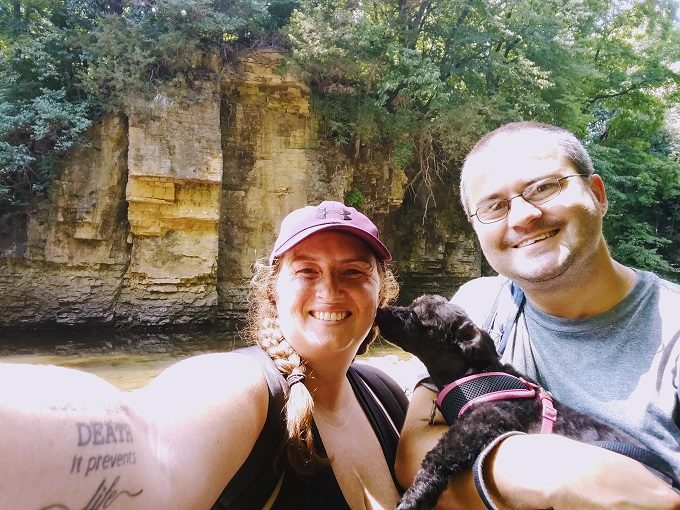
We’d brought our lunch with us, so we sat on a rocky outcrop alongside the creek and enjoyed the sound of the babbling water as we ate. Our dog Truffles also enjoyed wading around in the shallow water at the edge of the creek.
After stopping a while for lunch, we made our way back up to the Rock Creek Trail and continued following it along. After a few hundred more yards, we arrived at an overlook where you could see the “waterfall”.
As you can see from the photo below, it’s less of a “waterfall” and more of a “water-flowing-over-rocks-at-a-gentle-diagonal-angle”. The trail is on the right side of Rock Creek and we couldn’t see a way to get down closer to the waterfall. The left side of the creek seemed to have a trail leading to rocky steps down there, but it looks like that land is part of Camp Shaw-Waw-Nas-See and so isn’t accessible for the general public.
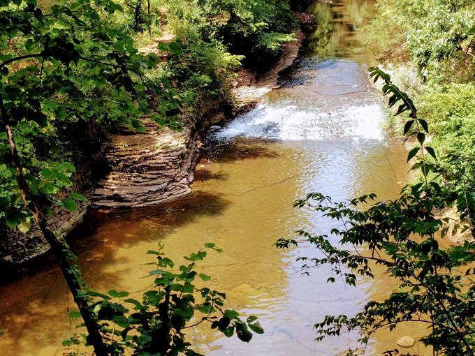
Following the trail along, you’ll see another rocky outcrop giving you a side-on view of the waterfall.
A little further on, the trail curves to the right as there’s a fence due to the land beyond being private property.
Shortly after this, you’ll come to the connector path with the Chief Shaw Trail. That trail is also a two mile loop, so you can extend your walk/hike for a couple of miles before returning to the Rock Creek Trail if you like.
We’d originally considered doing the Chief Shaw Trail as well, but the combination of the hot day and all the clambering down and up to see the river at various points along the trail meant we were more tired than anticipated.
We therefore decided to walk the last ~0.75 miles of the Rock Creek Trail back to the parking lot. Truffles was probably secretly relieved about this decision as she was pretty hot too by that point, but was still enjoying being out for a hike.
Final Thoughts
Rock Creek Trail in Kankakee River State Park is an easy two mile, dog-friendly loop trail. What’s not so easy is the clambering down to Rock Creek, but it’s worth it for the views.
We ended up spending about three hours there as we enjoyed exploring alongside the creek. The trail itself though needn’t take more than 45 minutes, leaving you with plenty of time to hike other trails (like the Chief Shaw Trail) in the park.
Address
Kankakee River State Park, 5314 W. Rt. 102, Bourbonnais, IL 60914
Hello , is the state park open at this time ( November 15 , 2020 ) — on ?
I’m afraid I’m not sure – it’d be best to reach out to them directly. Here’s their website – there’s a phone number on there to give them a call. https://www2.illinois.gov/dnr/Parks/Pages/KankakeeRiver.aspx
Yes, the park is open every day from sunrise to I believe sunset.
Allo Stephen and Shay. I always appreciate the stories offered by fellow outdoor adventurers – especially in this case, because I did visit Kankakee River SP many years ago, but did not experience any of the really cool photogenic areas of the park as represented in the many photos posted online – such as standing on a rocky river bank along the bluffs or being able to access the waters of Rock Cut Creek w/o any rappel gear. And I was focused on finding a path down to the creek, but each faint path observed seemed like it would lead me tumbling over rock, through poison ivy and on the news at 10p. Nevertheless, your blog has inspired me to revisit the park; hopefully not to engage in any awkward acrobatics as I finally meet the waters of Rock Creek. Keep the wandering spirit!
Thanks! And good luck finding the picturesque parts when you return 🙂