Maryland is an interesting state. It has an unusual shape, with the eastern side being fairly flat by the ocean, whereas the western side is more mountainous seeing as it borders West Virginia.
We decided to spend about two months in Maryland on our 50 state road trip, with the first couple of weeks of that time being spent in Frederick on the western side of the state. Having mountains nearby meant there were some good hiking opportunities such as at Sugarloaf Mountain (see here and here for more about that).
I wanted to go hiking one afternoon, but I’d gotten caught up with some website stuff and so got a later start than I’d been expecting. I didn’t want to make the same mistake I made at Sugarloaf Mountain where the hike took longer than expected, so looked for something nearby which wouldn’t take as long.
One of the places we had on our list of places to visit was Cunningham Falls State Park and I saw online that there were some short trails, so I headed there at 3pm with our dog Truffles. The drive there was really pretty, with a creek running along the right side of the road from the direction we were coming from.
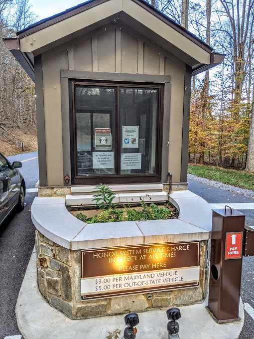
There was an unmanned pay station at the entrance. It costs $5 per vehicle if you don’t have Maryland plates and $3 if you do.
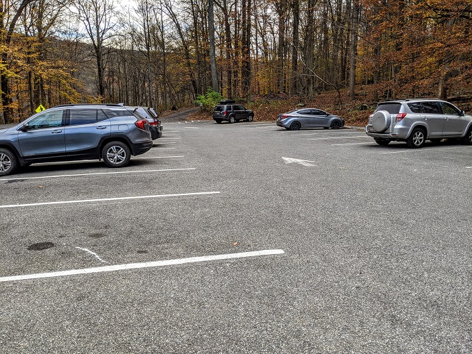
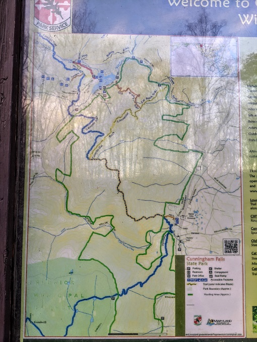
Cunningham Falls State Park has a few attractions in addition to the falls themselves, including a 43 acre lake and the Catoctin Iron Furnace. We didn’t have time to check those out though, so we headed straight to the parking lot for the trailheads to Cunningham Falls.
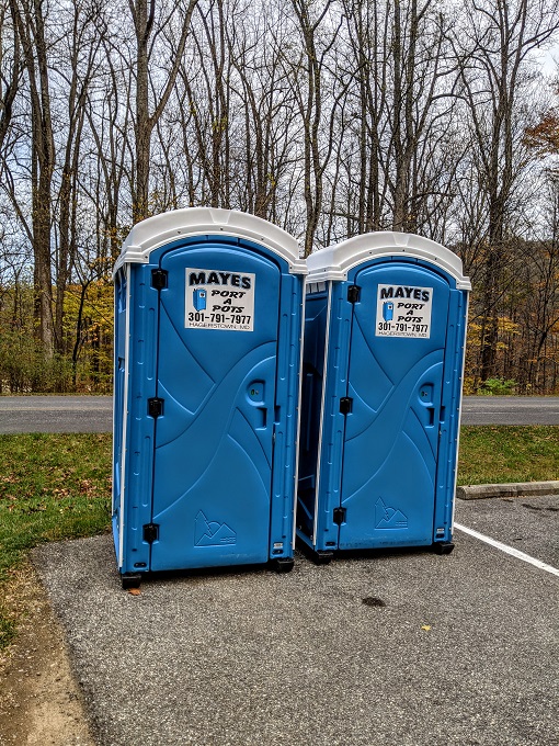
The trails aren’t very long, but there are porta-potties in the parking lot if needed.
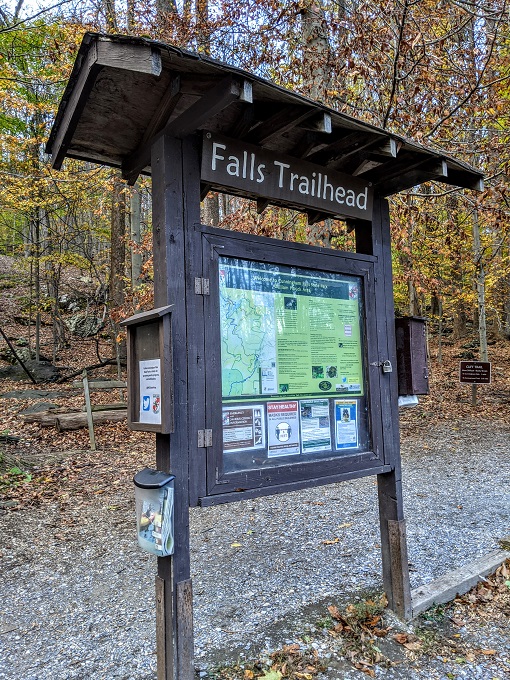
There was an information board at the trailhead which had a map of the trails in the park, along with a description of the trails.
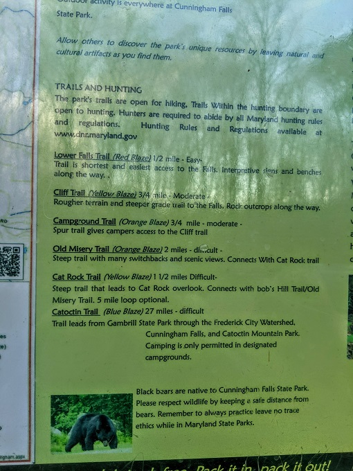
Lower Falls Trail
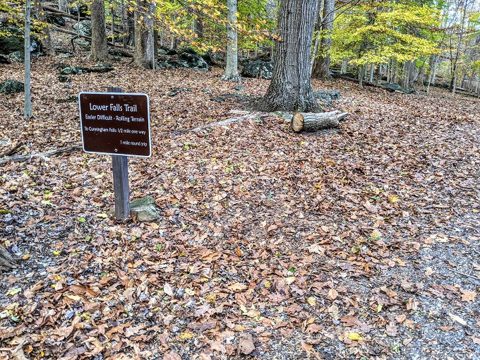
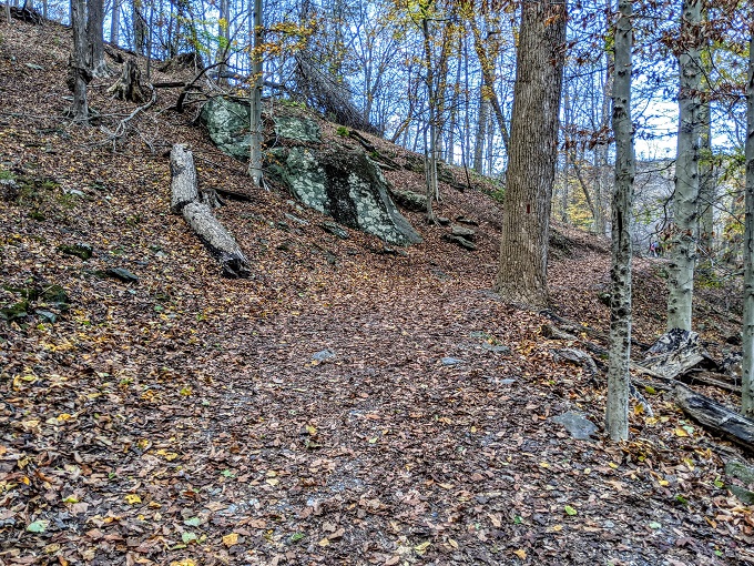
The clocks had gone back a couple of days before my visit, so I decided to take the quickest trail to Cunningham Falls – the Lower Falls Trail – as that was only half a mile long.
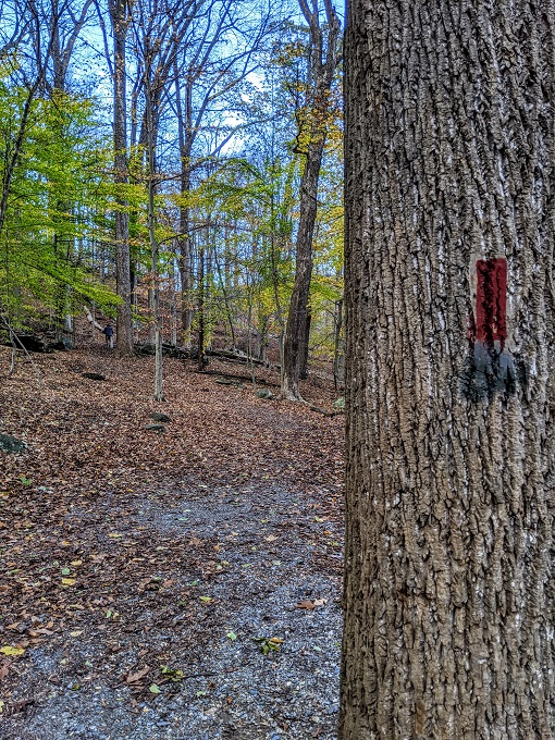
The trail to the falls is very straightforward, but there are red trail blazes along the way just in case.
The Lower Falls Trails goes uphill and downhill a little, but it’s not at all strenuous and you don’t need to worry about wearing hiking boots.
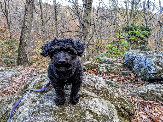
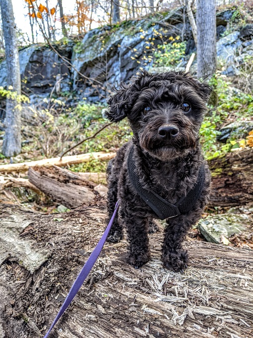
Although I wanted to make good time so that we got there and back before it got dark, I decided to stop and try getting a couple of photos of Truffles. She wasn’t too keen on participating as she kept refusing to look at my phone, but eventually I got her attention.
At one point along the trail there was a rocky overlook-type thing, but it didn’t overlook too much as there was a road below.
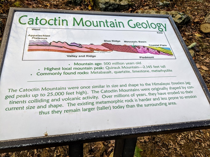
The trail followed along through the woods, with an information board or two along the way featuring information about local geology.
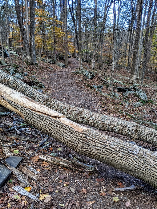
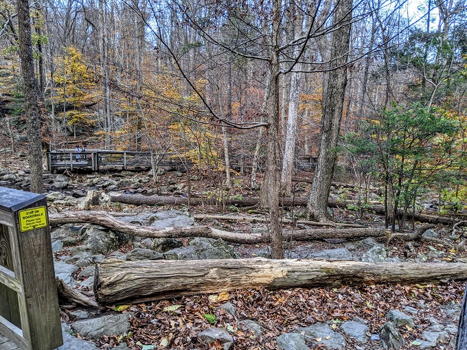
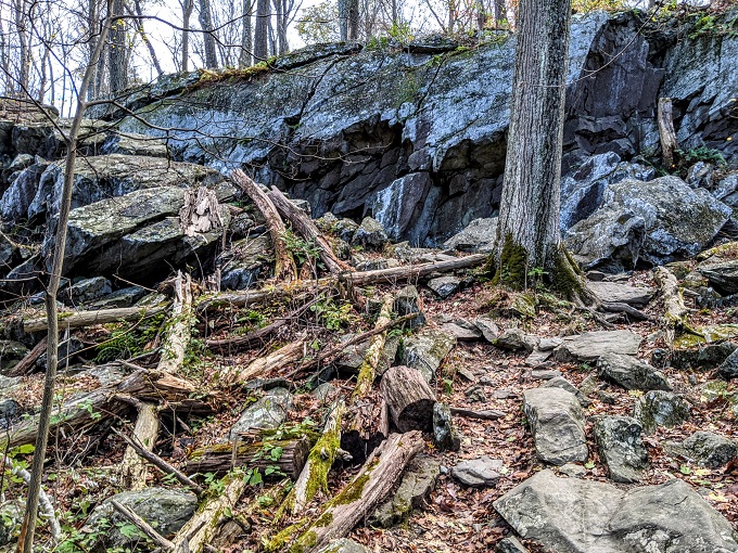
Although the trail was an easy route, there were a couple of downed trees blocking the trail which we had to hop over.
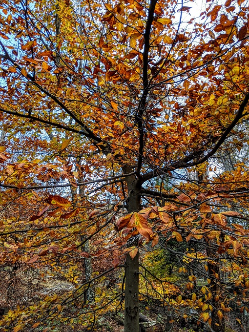
The beginning of November was a nice time to visit due to the beautiful fall colors.
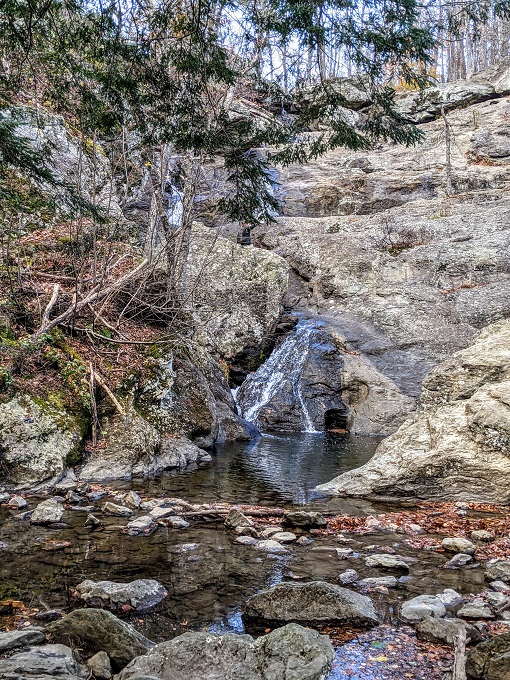
It wasn’t long until Truffles and I approached Cunningham Falls.
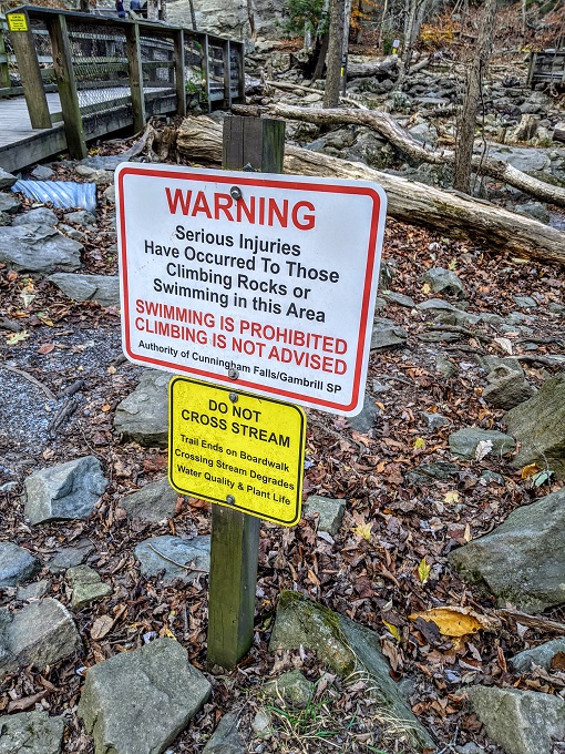
There was an information board about the falls, along with a warning to not swim in the water or climb on the rocks, although that latter warning didn’t deter several other visitors from clambering over them.
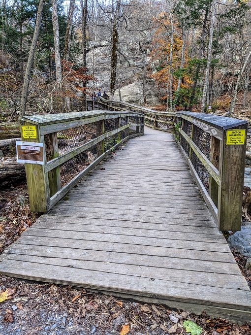
There’s a boardwalk leading up to Cunningham Falls with a wider platform at the end which meant it was possible to socially distance without any issue.
To be honest, the falls were a little underwhelming. That’s presumably due to the time of year I visited as other photos online suggest at other times of the year you’ll see more than the relative trickle that was there the day I visited.
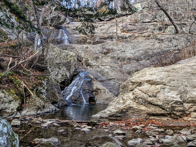
There was another viewing platform on the right hand side of the falls; I’m not sure how you get to that one, but I’m assuming there’s an additional parking lot with a trail that leads there.
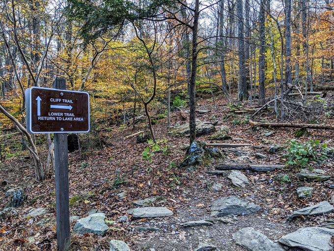
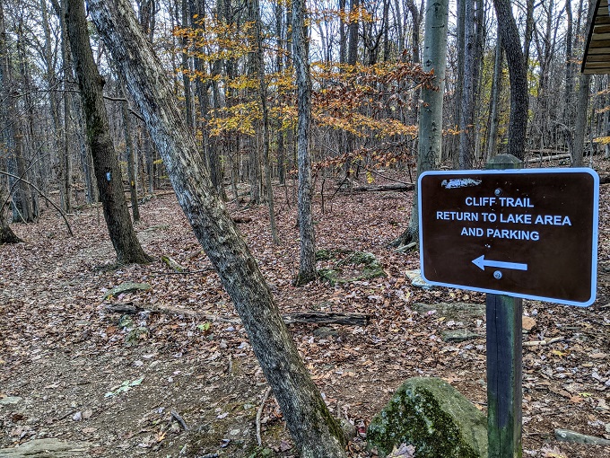
Cliff Trail
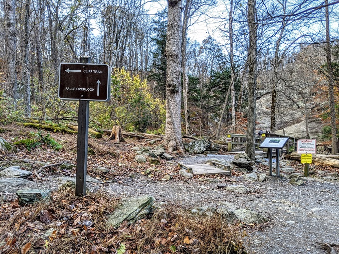
Truffles and I had made good time to Cunningham Falls seeing as it was an easy half mile trail, so I figured we’d take a different route back. We therefore followed the sign for the Cliff Trail which is 0.75 miles long and is a moderate trail.
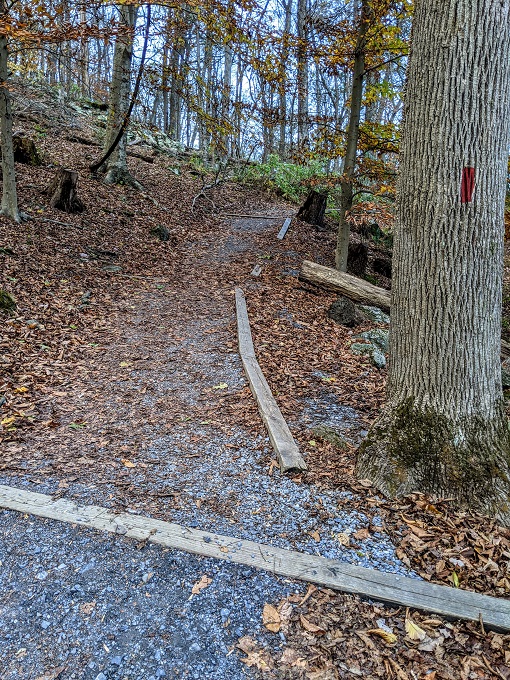
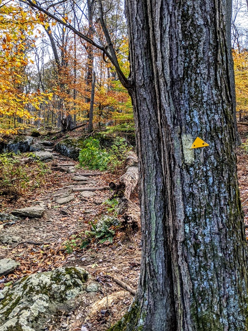
The Lower Falls Trail was marked by red trail blazes, while the Cliff Trail was marked by yellow trail blazes.
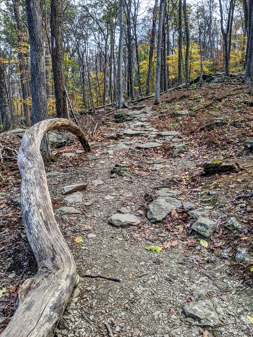
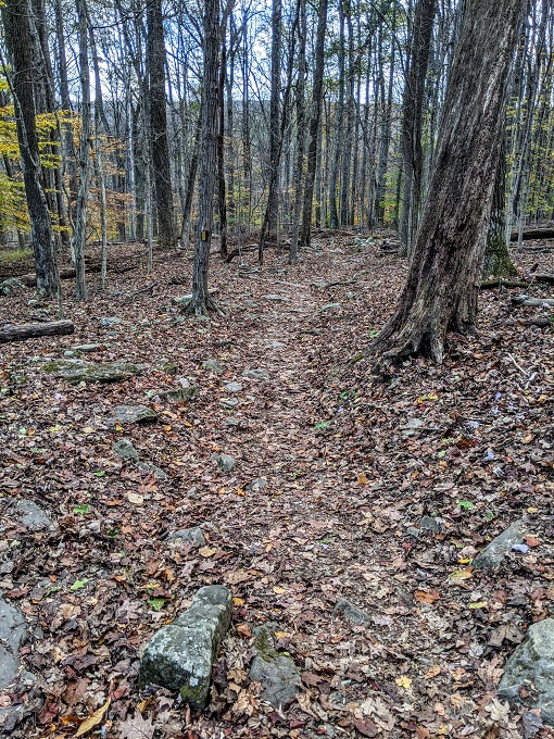
The Cliff Trail is rated as moderate as the terrain is rockier and it’s more steep than the Lower Falls Trail.
I once again had trouble getting Truffles to pay attention, but managed to get her attention long enough to grab another cute photo of her.
She was ready to continue hiking though, so on we went.
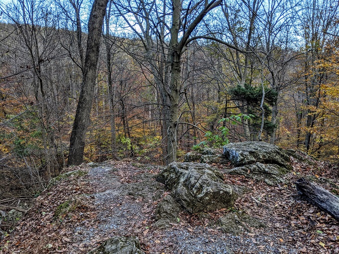
The route along the Lower Falls Trail was easy to identify, but the Cliff Trail wasn’t quite as clear. Part of the reason for that was due to all the fall leaves blanketing the ground. I got a little confused at one point until I realized we were supposed to walk up towards this rock face.
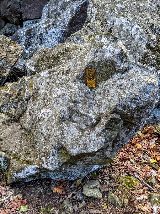
I realized we were on the right path though when I saw a yellow trail blaze on a rock. If you’ll be hiking the Cliff Trail, it’s therefore worth keeping an eye out for blazes on rocks as well as trees.
The blazes on this trail weren’t always located in obvious places though. On most trails you’ll see a trail blaze to indicate that’s the route you need to take; on the Cliff Trail, there were a few parts where it felt like I had to guess where I was supposed to go, then I’d see a yellow blaze as I turned the corner which confirmed I was on the correct route.
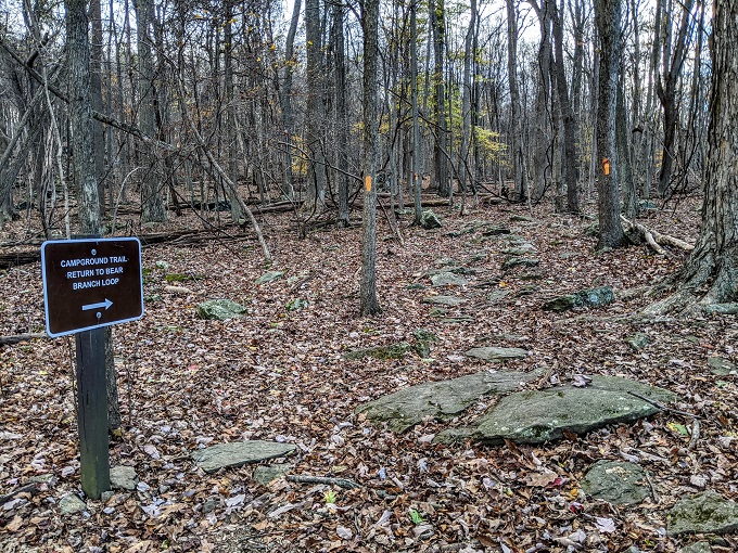
The Cliff Trail meets up with a couple of other trails along the way. The first is the Campground Trail which is marked by orange blazes, so that part of the trail has both colors on trees.
Shortly after that the Cliff Trail meets up with the Catoctin Trail which is marked by blue blazes. You definitely don’t want to end up following the wrong trail at this point as the Catoctin Trail is 27 miles long!
The first half of the trail was uphill, with the second half back to the parking lot being downhill.
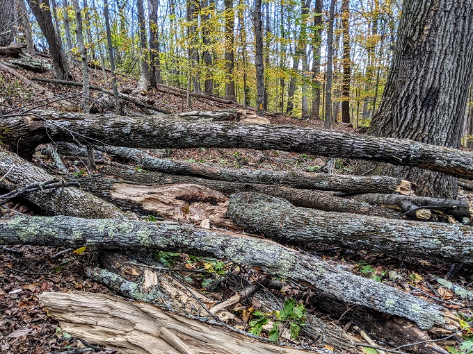
The Lower Falls Trail had a couple of downed trees blocking the trail, but the Cliff Trail had an even more significant tree blockage. At first I thought that perhaps the trail didn’t continue that way, but then I saw a yellow trail blaze just beyond and so Truffles and I scrambled over and under the trees to get through.
Less than 10 minutes later we were back at the parking lot – thankfully before sunset this time!
Final Thoughts
If you’re looking for a relatively quick hike near Frederick, MD, Cunningham Falls State Park is a great place to do that. There’s a mix of trails depending on how much effort you want to put in, with waterfalls at the end. Fall was a pretty time to visit due to the colors, but other times of the year might be better if you want to see more water flowing over the falls.
Address
Cunningham Falls State Park, 14039 Catoctin Hollow Rd, Thurmont, MD 21788
The viewing platform you could see across the creek at Cunningham Falls is for handicapped/wheelchair access from a restricted parking area only 100 yards from the base of the falls. Sorry for the downed trees across the trail. Hopefully, park maintenance or volunteer trail maintainers cleared those soon after your outing!
Thanks for that info. No problem about the downed trees – it made the hike like an obstacle course!