While Shae was still recovering from her surgery during our stay in Bend, OR, I took Truffles for a hike at Smith Rock State Park.
We’d somehow ended up having Smith Rock State Park on our list of places to visit and so it was on our radar, but then a friend also recommended it to us as he’d heard good things about it despite not yet having had a chance to visit it himself (he lives in Portland).
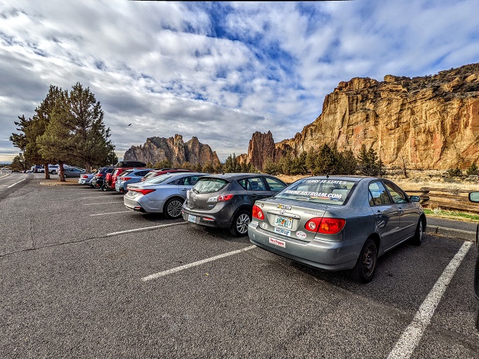
It was a ~35 minute drive north from our hotel to the park. It seemed like a popular day to be out despite it being a random Wednesday in the middle of November as the parking lot was almost full, but I managed to find a spot.
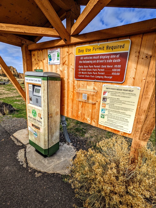
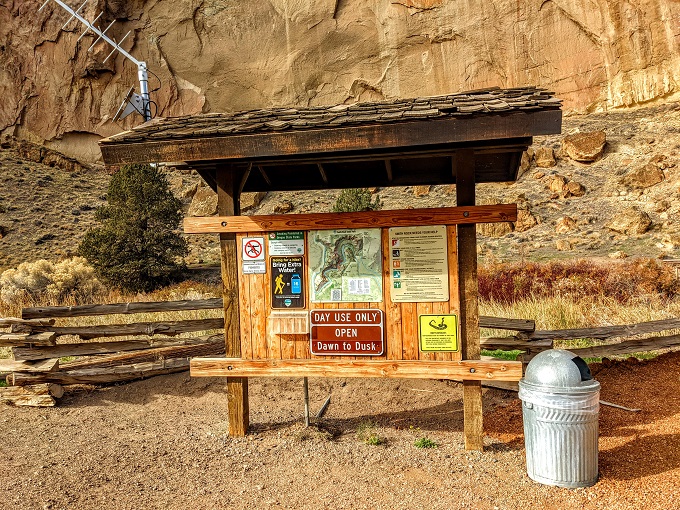
The park required a Day Use permit which was only $5. I’m not always great about remembering to bring cash with me when going hiking which can sometimes be a pain in situations like this, but there was no such problem at Smith Rock State Park because their ticketing machine accepted credit and debit cards. In fact, it only accepted credit and debit cards, so that’s worth being aware of in case you’re planning to visit with cash only.
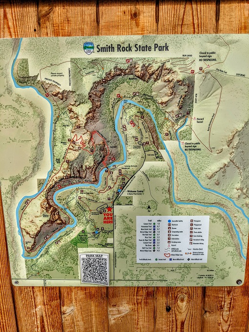
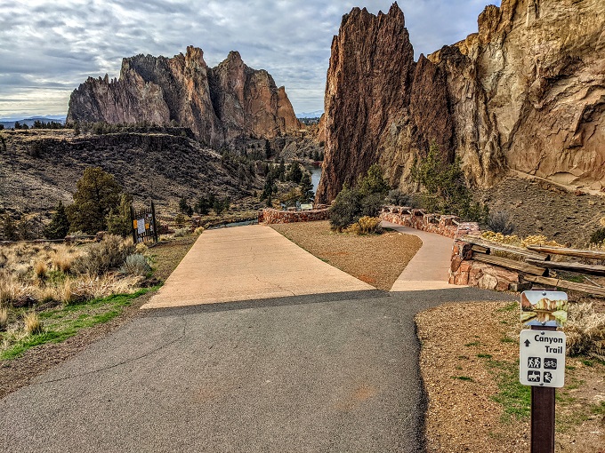
I’d done a little research about the park before driving there and figured we’d probably hike the Canyon Trail. There was a map there displaying the different trails and other facilities in case you want to make a decision once you arrive.
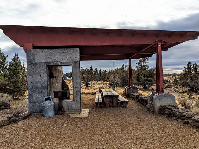
There was a short Rim Trail that provided some views of the park from above if you didn’t want to hike down into the canyon.
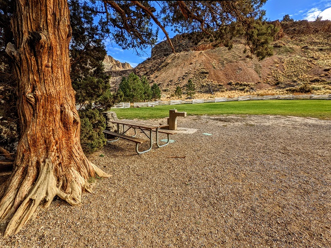
Along the Rim Trail/overlook was a picnic shelter.
Truffles and I wanted something a little more strenuous than just the short Rim Trail, so we started heading down to the Canyon Trail.
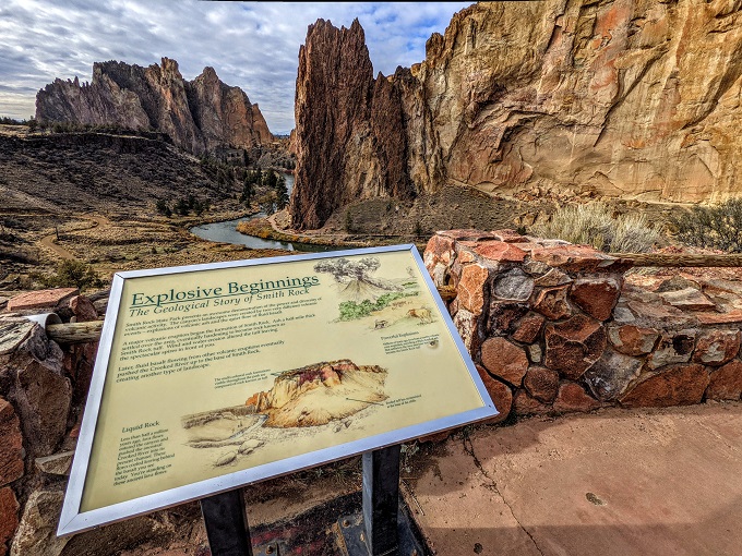
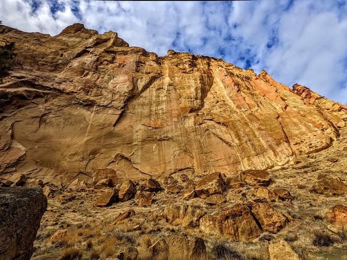
Along the way there was an information board that shared how Smith Rock came into existence. Similar to Newberry National Volcanic Monument, it came about as a result of a volcanic explosion. Here’s what the information board had to say seeing as the text in the photo below is too small to read:
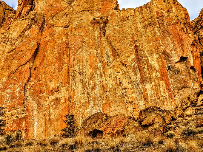
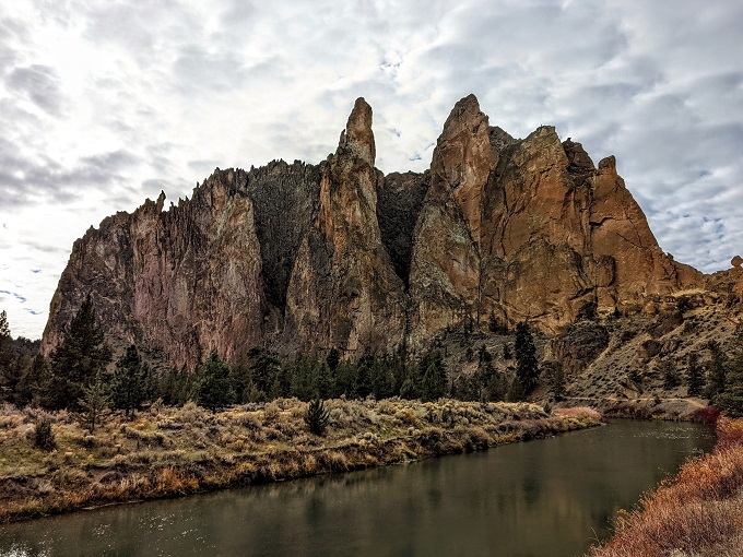
Smith Rock State Park presents an awesome demonstration of the power and diversity of volcanic activity. The canyon’s landscapes were created by two very different volcanic events – explosions of volcanic ash and the quiet flow of fluid basalt.
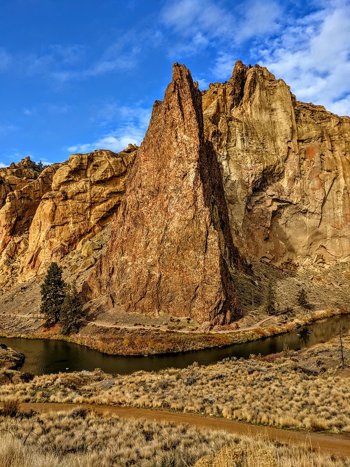
A major volcanic eruption began the formation of Smith Rock. Ash a half-mile thick settled over the area, eventually hardening to become rock known as Smith Rock tuff. Wind and water erosion altered the tuff leaving the spectacular spires in front of you.
Later, fluid basalt flowing from other volcanic eruptions eventually pushed the Crooked River up to the base of Smith Rock, creating another type of landscape.
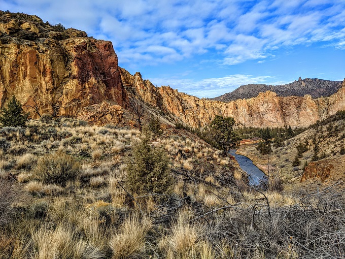
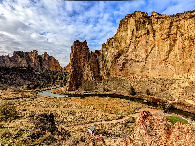
The walk down to the Canyon Trail provided some truly stunning views of the area and I could see what it had been recommended to us.
At the bottom of the hill the Canyon Trail split off in opposite directions; I decided to head right.
There’s an alternative route down to the Canyon Trail (and up again) called the Chute Trail which is steeper than the route Truffles and I took down, but is a quicker way down and up.
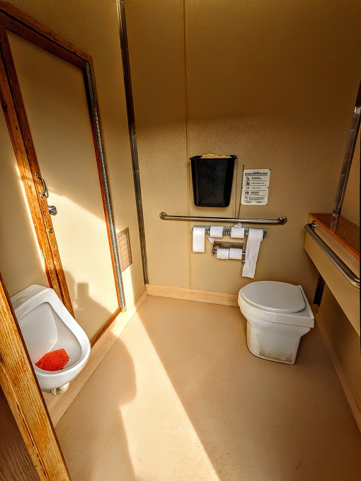
Near the bottom of the Chute Trail was a restroom which might just be the nicest restroom I’ve ever seen on a hiking trail.
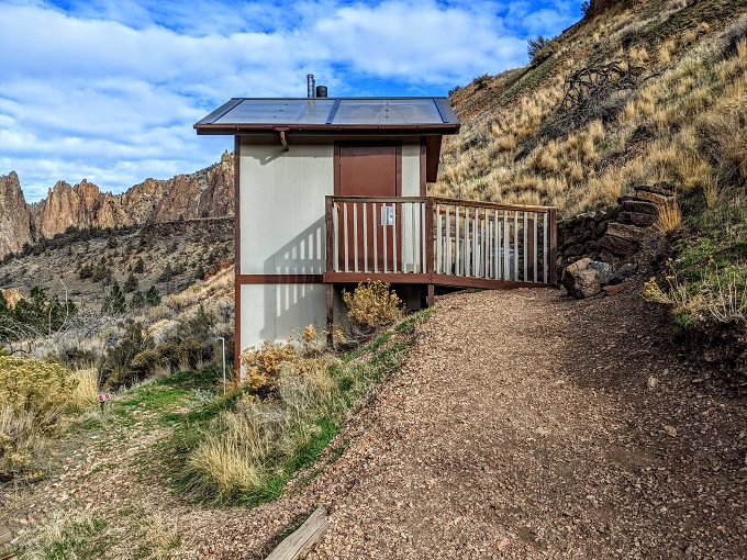
It was spacious, had a composting toilet as well as a urinal, it didn’t smell, was clean, was well-stocked with toilet paper and had hand sanitizer.
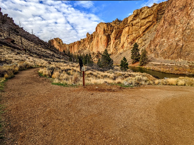
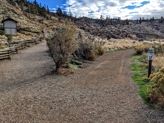
Anyway, enough about restrooms. At the bottom of the Chute Trail where it meets with the Canyon Trail is an information board with a map and an adjacent trash can. There was at least one more trash can along the trail which is a rarity when going hiking. I appreciated having the trash cans as it meant I didn’t have to carry Truffles’ poop bag far before being able to dispose of it. She likes to wait until we’re just too far from a trash can to turn back before she’ll poop on a hike, so having trash cans along the way foiled her dastardly plans that day.
Next to that information board was a picnic table and grassy area where your kids and/or dogs could run around, as well as having a water fountain. With this being Oregon though, I don’t know if the water fountain is weatherized for much of the year.
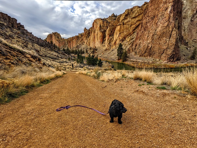
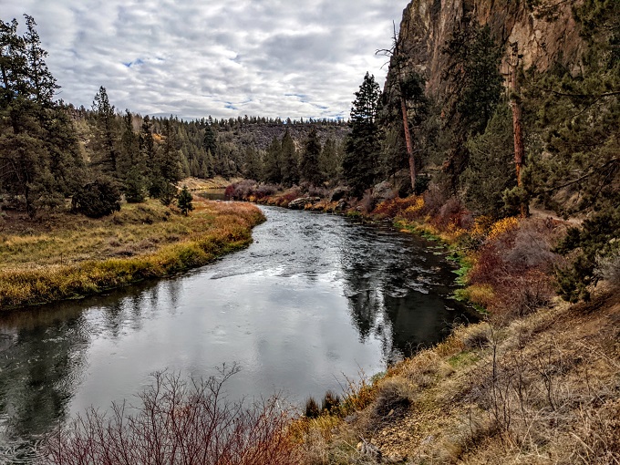
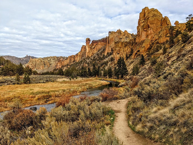
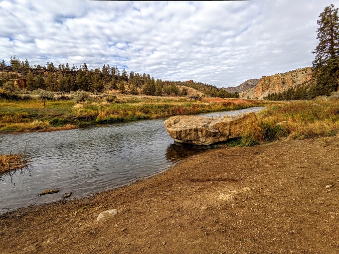
At this point I changed plans. Rather than continuing along the Canyon Trail, I decided to take the River Trail as I figured that might be even more scenic. The River Trail is accessed by crossing a bridge over the Crooked River, so the river is on your left and the canyon walls on your right.
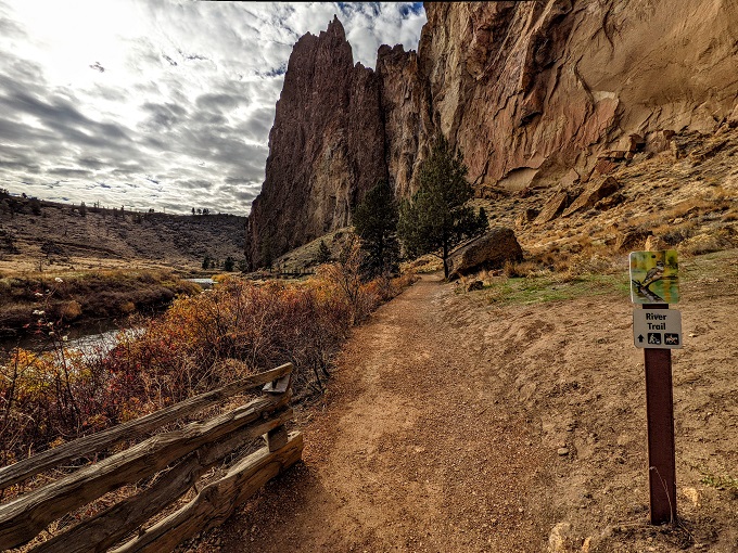
I’m sure the Canyon Trail would’ve been a solid choice, but I’m glad we took the River Trail as it was beautiful. The weather was also perfect; despite it being Oregon in November, it was ~50°F (10°C), fairly sunny and not very windy.
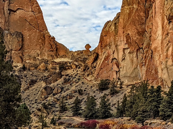
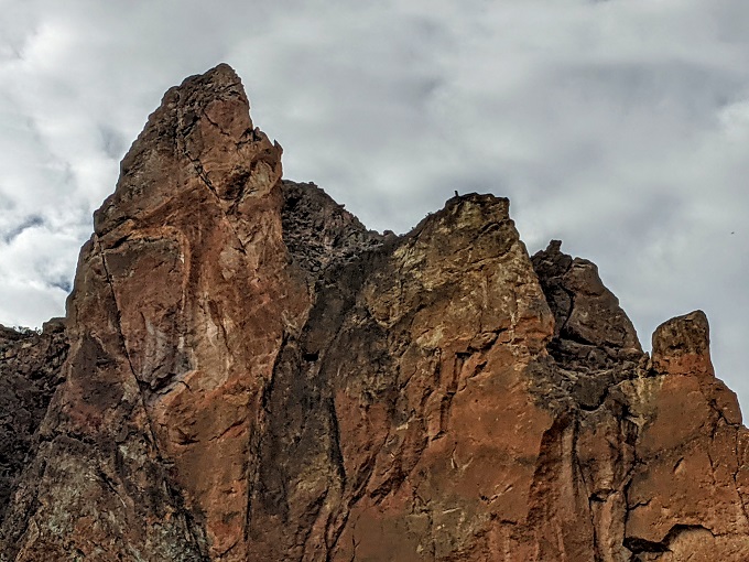
There were a few precariously balanced rocks I noticed along the way, but it’ll probably require many thousands of years of erosion before they topple.
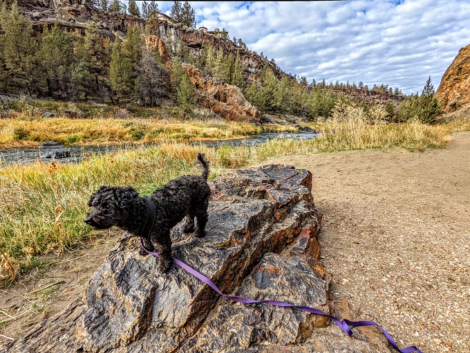
Considering the terrain, it wasn’t too surprising to discover that Smith Rock State Park is incredibly popular with rock climbers. I could see and/or hear rock climbers at many locations along the River Trail and many of the canyon walls are equipped with metal insertions they can use for safety.
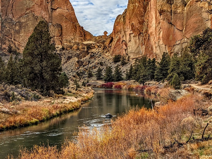
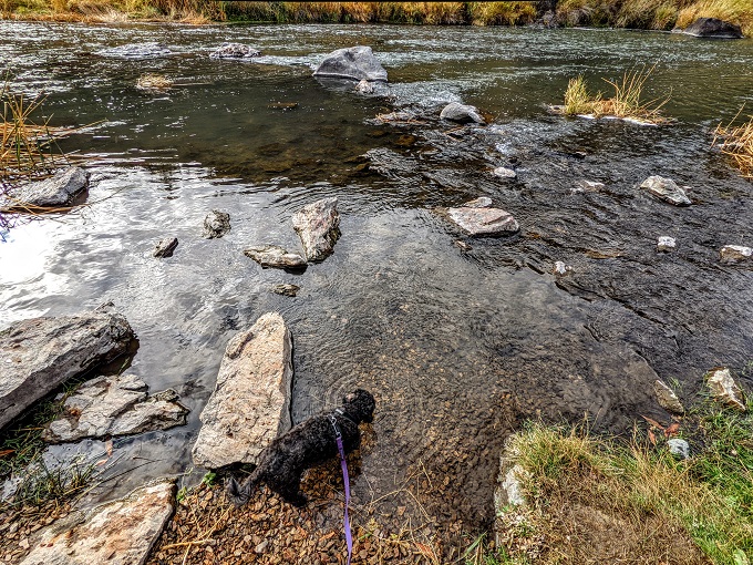
The Crooked River meandered along, with the River Trail following closely alongside it.
Spectacular views of rock formations continued along the way.
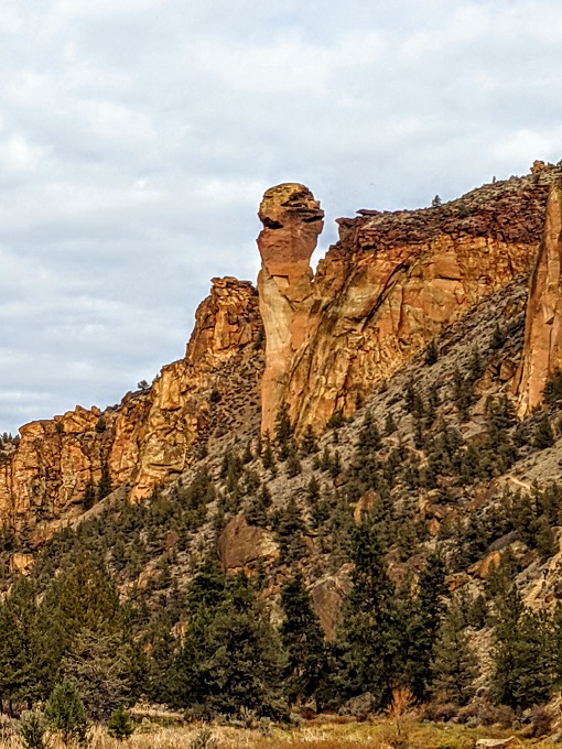
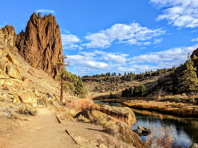
After about two miles we approached what Google Maps was telling me was a rock formation called Monkeyface.
Sometimes it takes some creative imagination to see what a rock formation is named after, but not Monkeyface – his visage was clearly looking to the right.
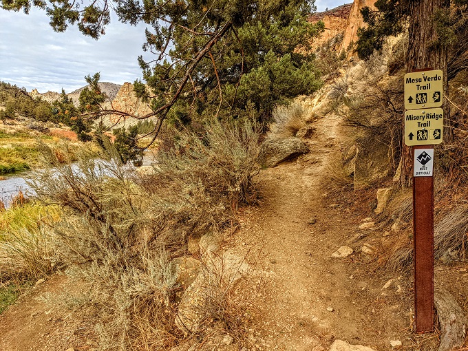
The River Trail soon branched off to the left, while the Mesa Verde Trail and Misery Ridge Trail continued to the right. Although Truffles and I had been looking for something a little more strenuous than the Rim Trail at the beginning of our hike, I wasn’t interested in finding out how miserable the Misery Ridge Trail would be, so we continued along the River Trail.
It was about 1pm by this point and we were both feeling a little peckish. We therefore stopped by the river for some food and drink.
The River Trail would’ve continued another half mile before connecting with the Mesa Verde Trail, at which point we could’ve taken either one back to our picnic spot. However, I had stuff I had to work on later that afternoon and so after having our lunch I decided to just head back along the River Trail rather than taking it to the end. I hadn’t realized at the time that the trail ended half a mile later though, otherwise we would’ve hiked its entire length.
When getting back to the Canyon Trail, we took that back up rather than the Chute Trail. I think that was a wise decision because the last part of the trail was steep enough as it was, so the Chute Trail would’ve been even steeper.
Final Thoughts
Smith Rock State Park is stunning. With volcano-formed rocks, a canyon and a beautiful river running through it, it’s a great place to go for a fairly easy hike (other than the walk back up out of the canyon!) If we return to Bend in the future, I’d happily visit the park again to either hike the same trail or to check out the full length of the Canyon Trail.
Leave a Reply