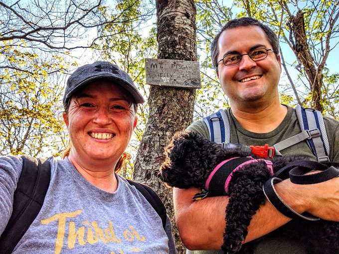
Mt Pisgah in Vermont had some of the most stunning views we’ve experienced from any hikes so far on our 50 state road trip.
It’s a strenuous hike uphill with lots of gnats trying to bite you in the summer, but the effort is worth it once you reach the overlooks that look out over Lake Willoughby.
There are two ways you can reach the summit of Mt Pisgah – the North Trail and the South Trail. The trails meet up, so you can hike it as a loop trail if you want. The problem with that option is that the two trails begin several miles from each other, so once you reach the end of the other trail, you have to walk several miles back to where you parked along Route 5A. There’s no sidewalk along that entire stretch of road so it’s a little precarious, especially if you’re hiking with a dog.
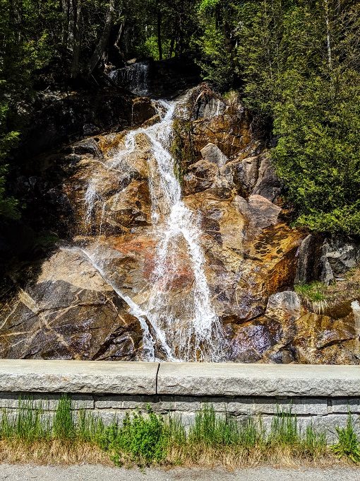
Lake Willoughby can be found in northeast Vermont, with the North Trail starting along Route 5A. Depending on which direction you’re coming from, you might see the waterfall below as you drive along. If it’s on your right, keep going a few hundred yards to the parking area. If it’s on your left, you’ve missed the parking area, so turn around!
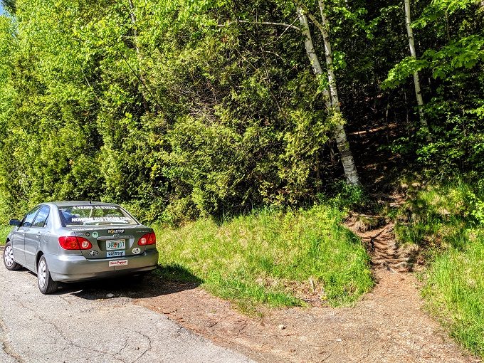
I’m highly reliant on Google Maps when driving, so here’s a link to the parking area and trailhead. There’s space for about half a dozen cars there, so hopefully the trail isn’t too busy if you visit.
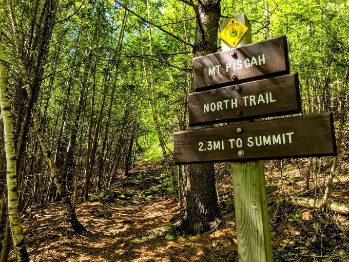
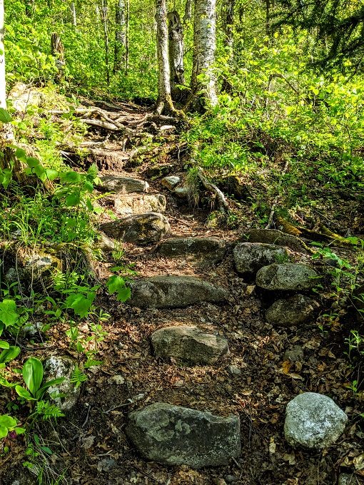
As you can see in the photo above, the trail begins right from the parking area. In case there’s any doubt, a sign points you in the right direction.
At the start of the trail, hiking 2.3 miles each way didn’t sound too bad, especially after hiking 10 miles a few weeks beforehand.
That was a little complacent.
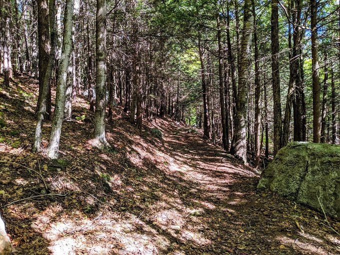
Although the North Trail is only moderate rather than difficult, it’s on the strenuous end of moderate due to much of it being uphill, so enjoy the less steep sections while you can!
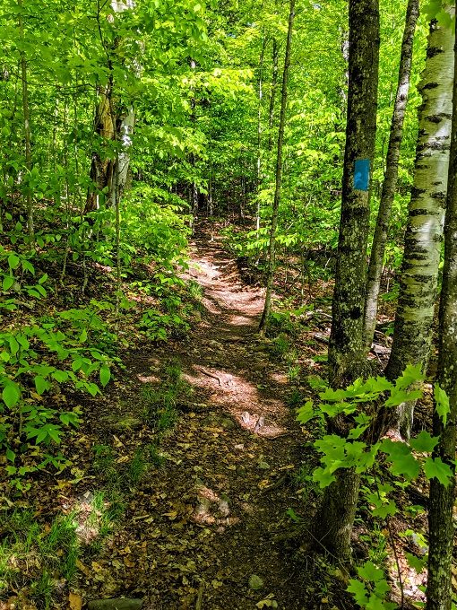
It’s a fairly obvious route along the trail, but there are also blue trail blazes to help guide you along the way.
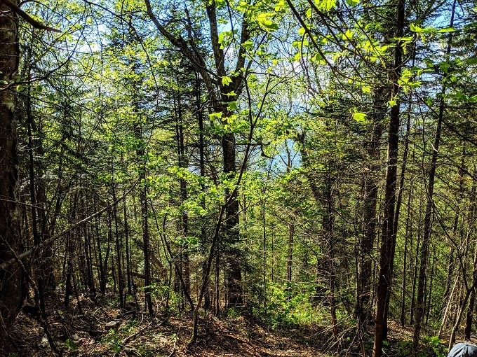
Hiking through Willoughby State Forest in the summer is pretty, although there was one odd section. We went from a lush, green forest…
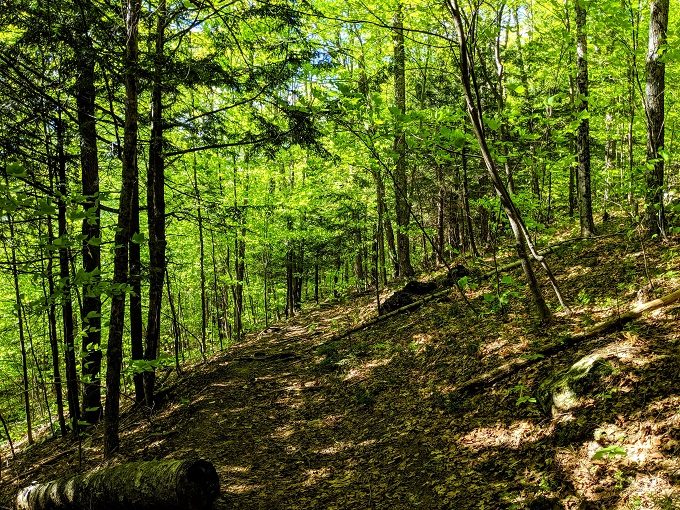
…to a forest which if you saw it in a movie, would lead you to believe something bad was about to happen. Given the transformation from colorful to dark, Shae named it Emo Forest.
What was so strange about it was how sudden that change was. The two photos above were taken when standing in the exact same spot – one facing one direction and one facing the other.
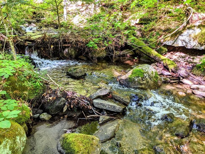
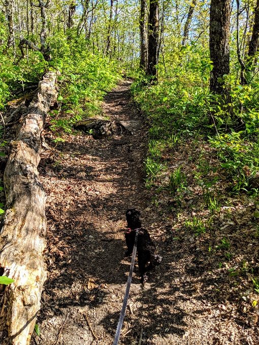
Emo Forest didn’t last for long, perhaps because we ended up passing a stream. The North Trail is pet-friendly and our dog Truffles enjoyed stopping for a quick drink from the stream.
Truffles wasn’t the only creature on the North Trail. During our hike we saw deer, a couple of chipmunks…

…as well as this little slitherer crossing our path.

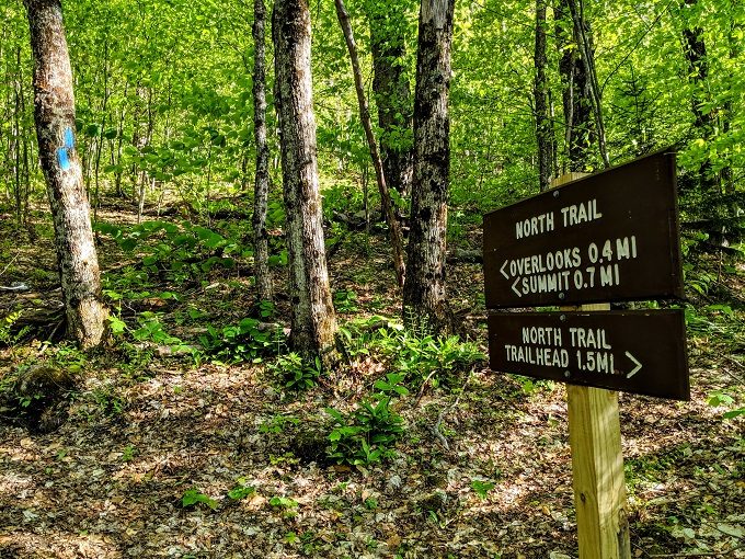
Continuing to head upwards, I saw a sign in the distance. I was worried that it was going to say we still had 1.5 miles to go, so I was relieved when it turned out there was only 0.7 miles to the summit.
Needless to say, reaching the summit meant we had to continue the hard slog uphill.
As you approach the summit, you’ll be able to glimpse Lake Willoughby through the trees. Don’t worry though – much better views will come.
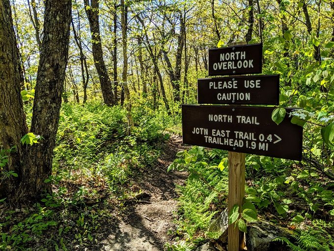
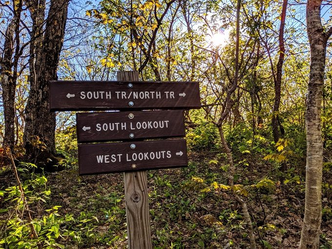
Soon after you’ll see a sign for the North Overlook. We decided to continue on to the summit though, returning to the North Overlook later on.
Despite her tiny legs, Truffles led the way.
We saw a sign for another overlook along the trail, so in the end we decided to check that out before continuing to the summit.
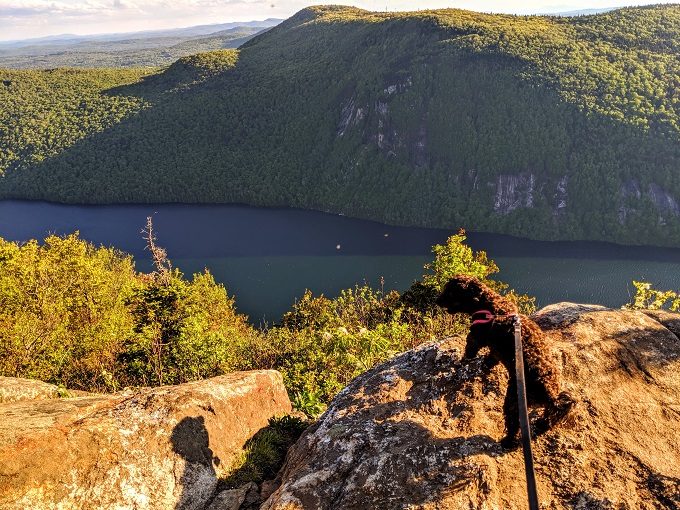
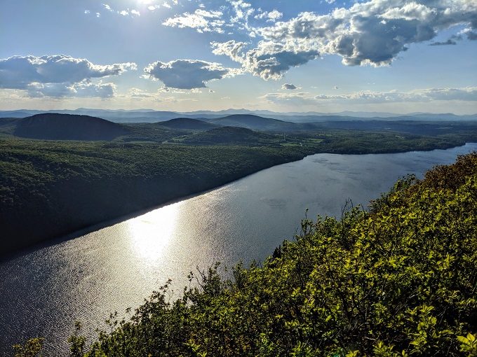
With tired legs and gnat bites over our bodies, it hadn’t been the most enjoyable hike that we’d ever gone on. The views though…the views made it worthwhile.
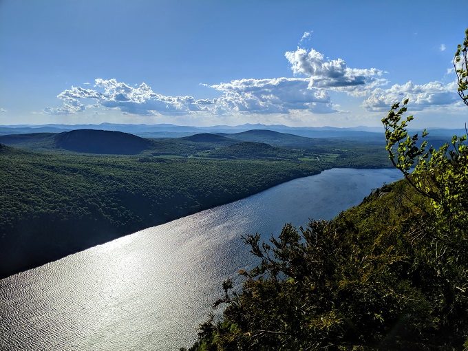
I mean seriously – it’s not every day you get to enjoy this. Looking out at Lake Willoughby on a sunny day with blue skies and mountains in the distance is simply amazing.
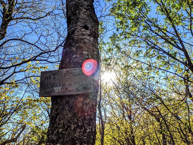
After rewarding ourselves with the views for a while, we continued heading uphill until we reached Mt Pisgah’s summit.
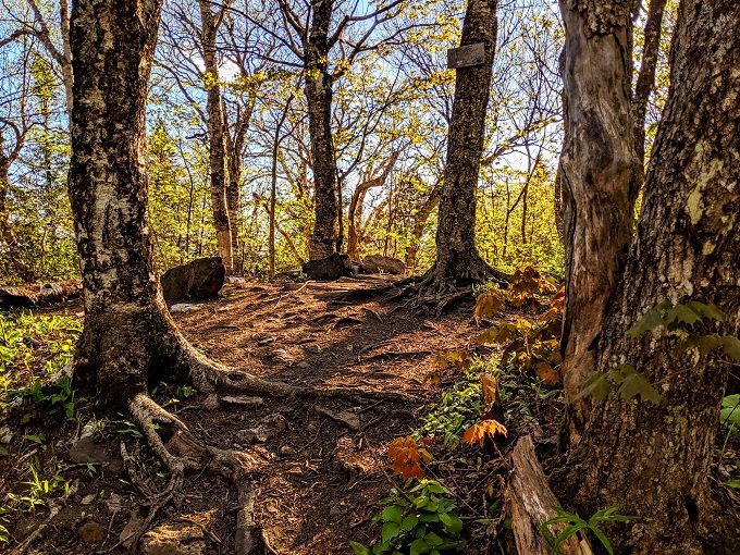
To be honest, the summit itself isn’t very special as trees block the view of Lake Willoughby.
We therefore only hung out up there long enough to grab a couple of photos.
The trail continues beyond the summit as that becomes the South Trail. We didn’t want to take the South Trail down so that we wouldn’t have to walk several miles back up Route 5A to our car afterwards, although we did continue along the path so that we could check out the South Lookout.
The view wasn’t as amazing as the one looking out over Lake Willoughby, but it was hardly ugly.

As we headed back down the North Trail, we stopped off at the North Overlook which we’d passed on the way up to the summit.
Truffles always likes to check out the views when we go hiking, but she quickly retreats from the edge. I was therefore lucky to get this shot for the split second that she looked off in the distance.
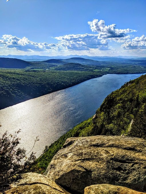
The North Overlook gives you good views off to the left, but at first glance it doesn’t give you as good views off to the right. However, clamber up over a few rocks off to your right…
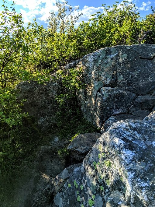
…and you’ll get a better view of Lake Willoughby.
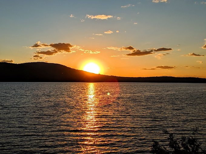
We’d loved to have stayed up there for sunset, but that wasn’t going to be for another 90 minutes. The drive back to our Airbnb in Waterbury Center would take 90 minutes, so we decided to head back downhill as we wanted to get back in time to pick up dinner from a local pizza joint before it closed.
The sun was starting to set as we got back to the car, so we were also grateful to not have to hike down in the dark.

It does feel like we missed out a little though, as I can imagine this view of the sunset over Lake Willoughby would’ve looked even more beautiful from one of Mt Pisgah’s overlooks.
Final Thoughts
If you’re looking for a hike in Vermont, I can highly recommend the North Trail up Mt Pisgah. It’s not easy and you’ll want a lot of bug spray if you hike it in the summer, but the views of Lake Willoughby make it all worthwhile.
Leave a Reply