I’d heard people rave about Sedona, AZ in the past and was curious if it would live up to the hype.
It did!
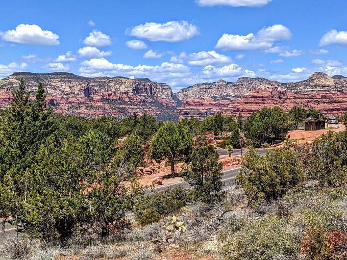
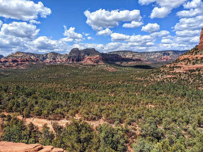
The place is absolutely freakin’ beautiful, with the hike to Devil’s Bridge and the views from there giving you some incredible vantage points, although a subsequent hike to Cathedral Rock had what might be even better views.
With Devil’s Bridge being such a popular place to go hiking, it shouldn’t be too surprising that it can be hard to find parking at times. We visited late morning on Thursday April 22, 2021 and the parking lot (you can find it on Google Maps here) was completely full. We therefore headed back out on to Dry Creek Rd and parked there as there were some pull-offs at the side. Here’s the exact spot on Google Maps in case you want to use it to get directions to this particular parking spot.
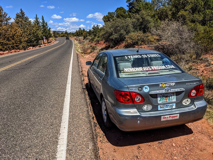
The trailhead is further up the road and as you can see, there’s no sidewalk and so it wouldn’t have been very safe walking along the side, especially because we had our small dog Truffles with us.
We were in luck though. When looking at Google Maps on my phone, I could see that there was a trail running alongside the road just up to our right.
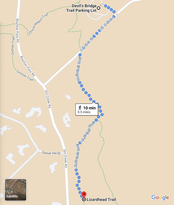
Sure enough, there was a small path leading up to the right of where we’d parked:
That little path led up to the Lizardhead Trail. I’m not sure how long that trail is or where it leads in the opposite direction, but taking it to the left took us back to the road leading up to the main trailhead parking.
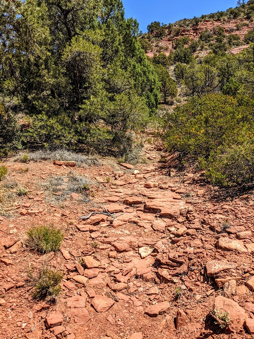
Even walking parallel to the road provides some great views.
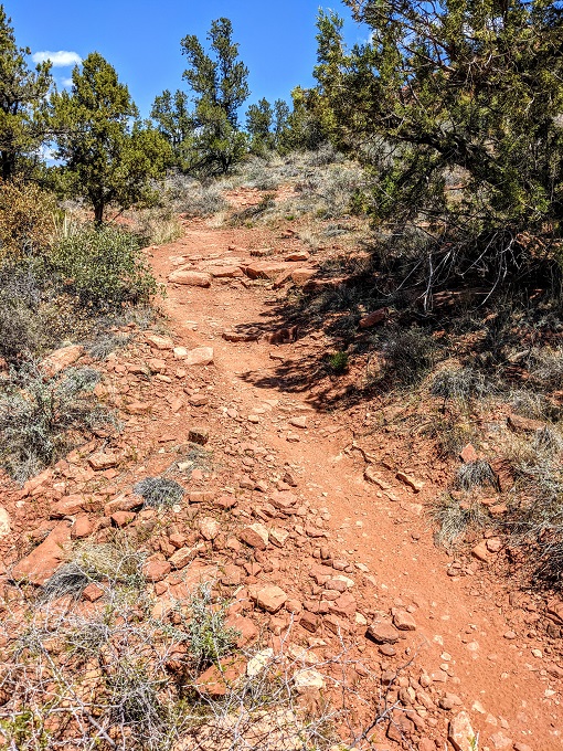
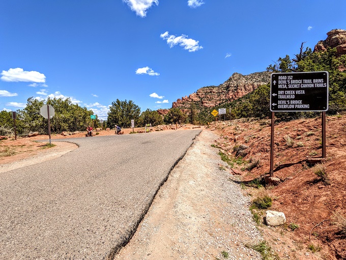
After about 0.3 miles the trail crossed over a road. Rather than continuing on the Lizardhead Trail, we turned right and headed up this road which is the one that leads to the parking lot (off to the left in the photo below).
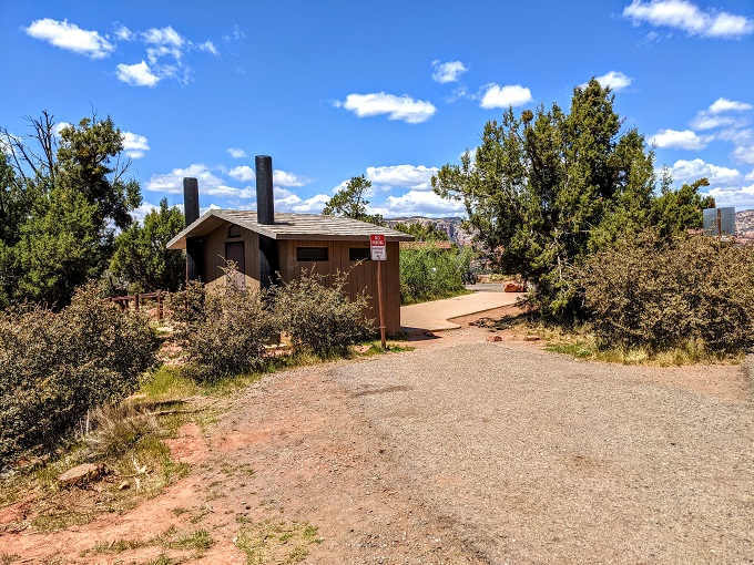
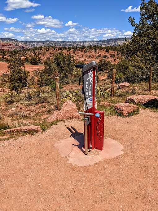
There are restrooms available, along with a bike repair station.
There are three different trails you can take to get to the Devil’s Bridge Trailhead which itself is further on from the parking lot. Route 1 and Route 3 both start at this parking lot, with Route 1 being easy as it takes Forest Road 152 and Route 3 being more strenuous as it takes the Chuck Wagon Trail in a more winding direction. The other option – Route 2 – starts at the Mescal Trailhead and connects up with the Chuck Wagon Trail about halfway along.
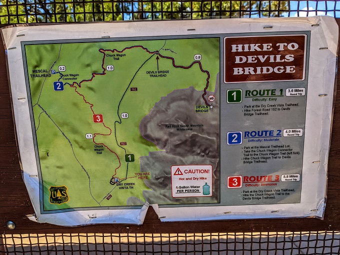
It was a hot, sunny day when we visited, so we decided against taking the Chuck Wagon Trail.
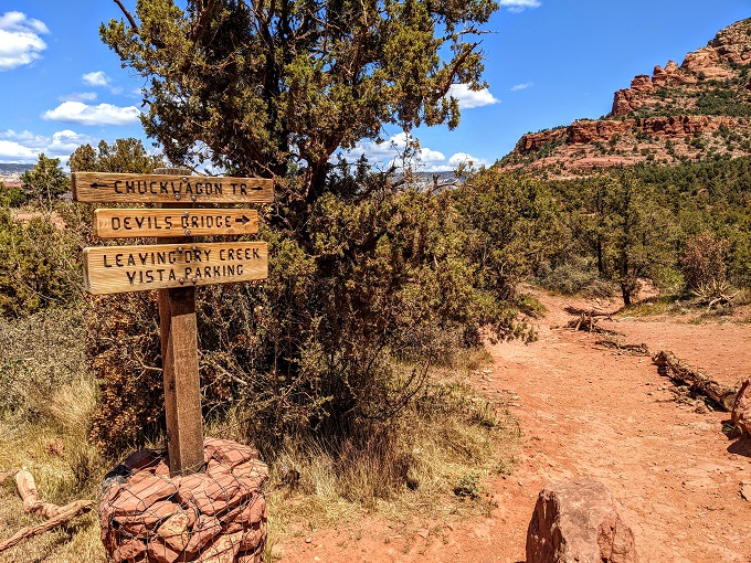
Instead, we took the easier trail (Route 1).
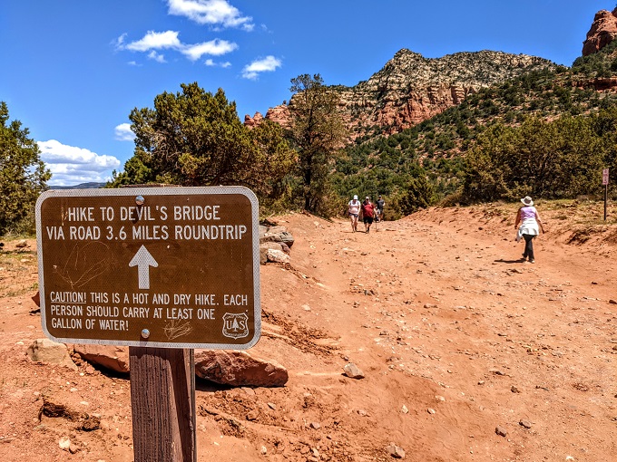
Even though it’s easier, there wasn’t a lot of shade and so be prepared with plenty of water, sun screen, a hat, etc.
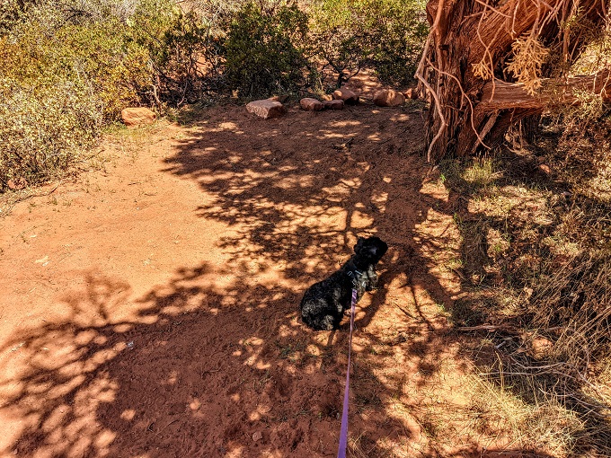
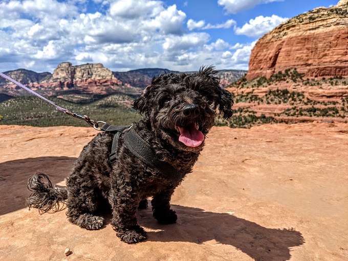
Although there wasn’t much shade for humans, Truffles actively sought out every possible bit of shade suitable for dogs that she could find.
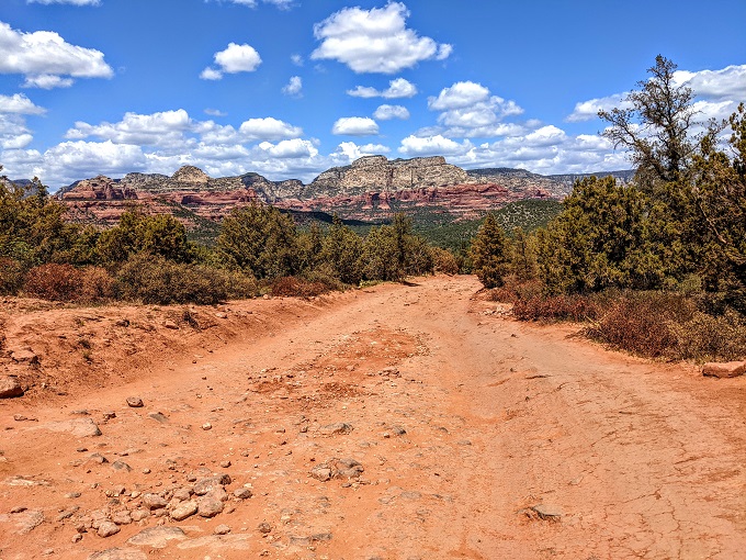
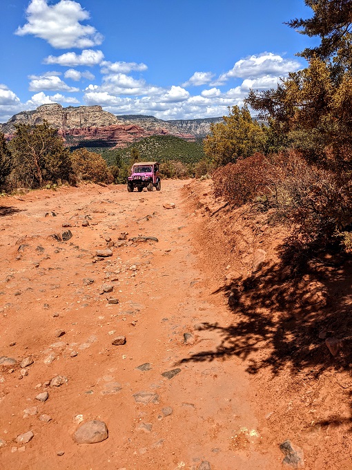
The trail on Forest Road 152 (Dry Creek Road) is about 1.1 miles each way from the parking lot to get to the Devil’s Bridge Trailhead itself. If you want to skip this ~2.2 mile round trip part, you can drive along there if you have a vehicle capable of taking the bumpy road, or you can take a tour with companies like Pink Jeep Tours.
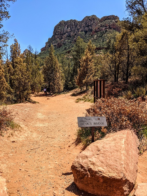
We soon arrived at the Devil’s Bridge Trailhead. From there it’s another 0.7 miles up to Devil’s Bridge itself.
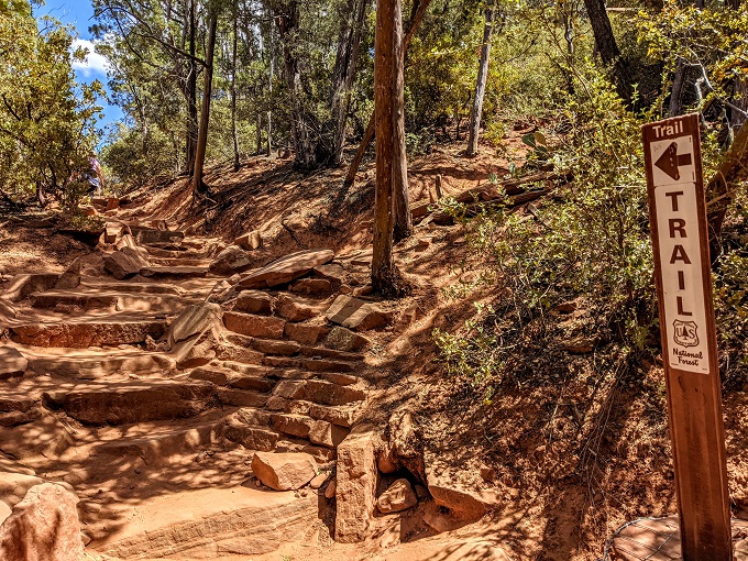
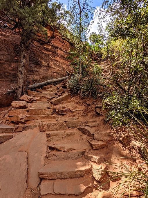
The trail gets a little more strenuous from here as you head uphill, but it wasn’t too bad.
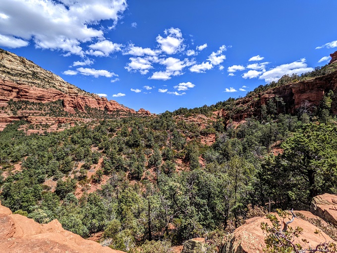
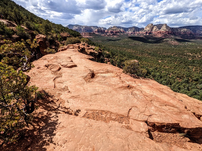
Along the way there was an overlook with beautiful vistas, so be sure to stop and enjoy the surroundings.
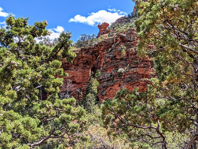
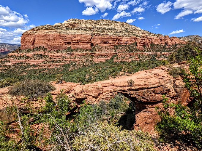
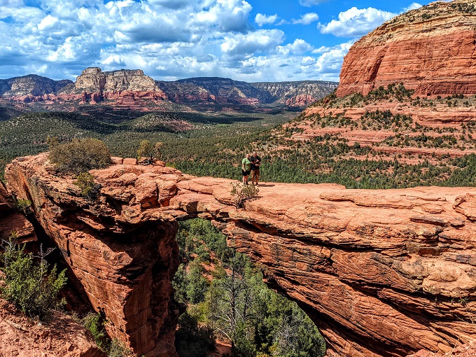
You’ll also be able to see Devil’s Bridge itself, although there are even better views of it to come.
Now that you’ve had a breather, continue taking the trail up.
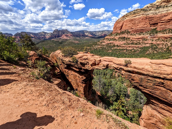
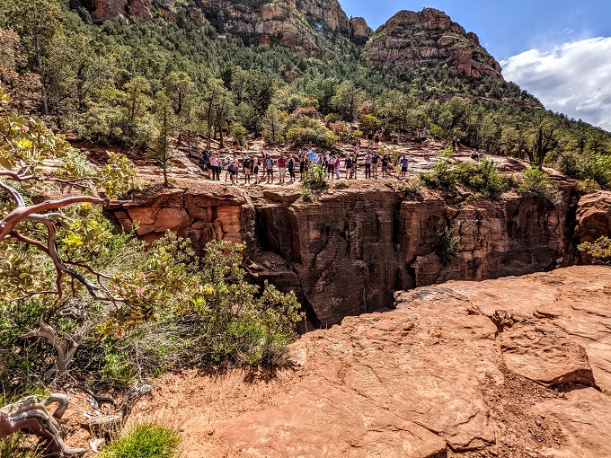
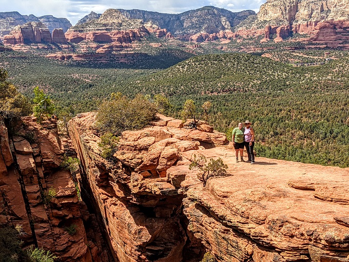
Within a few minutes you’ll arrive at Devil’s Bridge – a natural bridge formation.
People take it in turns to walk out on the bridge to get photos, so there’s a line on this side of the bridge where you wait for your turn. As you get closer to the end of the line, the view you have of Devil’s Bridge with the mountains and canyon in the background is incredible.
Needless to say, this provides some excellent photo opportunities. Some people are more daring than others…
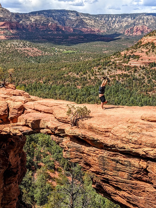
When you’re looking at Devil’s Bridge across the way it looks pretty narrow, so it was kinda scary seeing some of the antics people were getting up to. However, when you walk out on it you’ll discover that it’s wider than you expected and so even if you don’t like heights (Shae doesn’t), it might still be something you’ll feel brave enough to do.
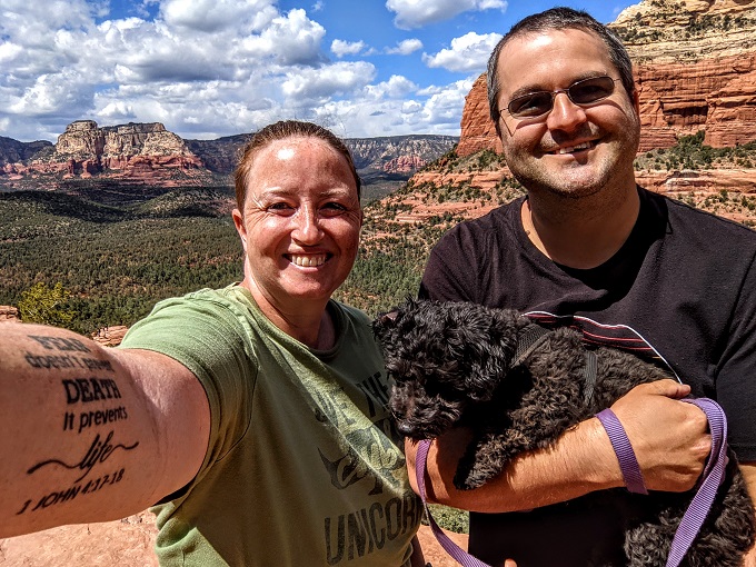
Everyone in line is helpful, so you can leave your phone or camera with the next person in line and ask them to take photos of you.
We’d hiked up there with Shae’s mom, so we left my phone with her to take photos of me, Shae and Truffles.
Shae kept her photo on her so that she could also take a couple of photos of us.
Truffles also took this opportunity for a quick photoshoot herself.
I then headed back with Truffles and Shae’s mom came out on to the natural bridge to join Shae for a few photos.
Final Thoughts
It’s not hard to see why Devil’s Bridge is apparently the most popular hike in Sedona. You have a few different trails you can take to get there depending on how easy or difficult you want it to be, there are amazing views and there’s an adventure element to it seeing as you get to walk out on the somewhat narrow (but not scarily narrow) natural bridge.
If you’ll be visiting Sedona, we’d highly recommend this hike. The route we took – Route 1 – is 3.6 miles round trip. That’s 1.1 miles along the dirt road, then 0.7 miles on a hiking trail up to Devil’s Bridge itself.
Lucky to have lived in Aridzona and visited Sedona long before the “discovery” of vortices! I’ve taken a picnic and ate on Devil’s Bridge and never saw another human…
Wow, that must be a great experience having the site all to yourself!