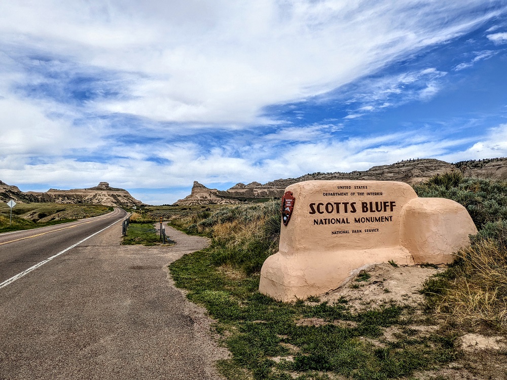
Our first stop in Nebraska was Scottsbluff, a city on the western side of the state near its border with Wyoming. The city is perhaps best known as being the home of Scotts Bluff National Monument, a notable landmark along the Oregon Trail.
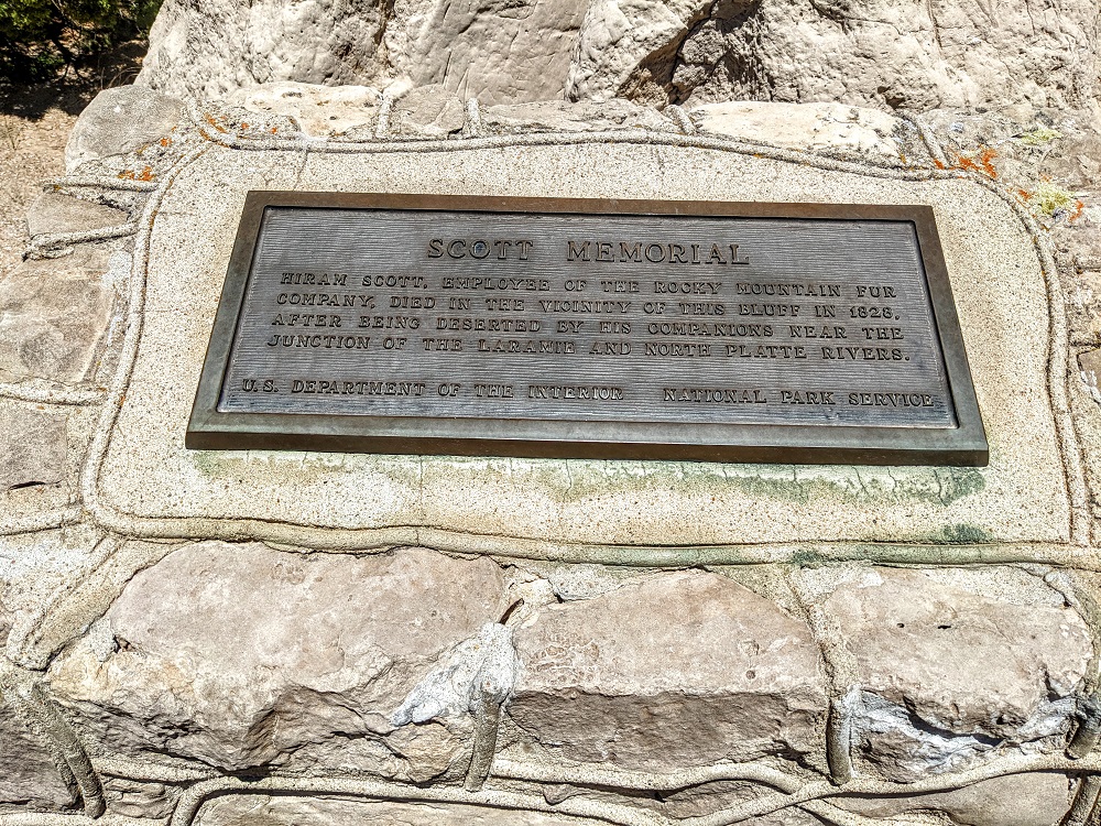
That’s not a typo by the way – the city is called Scottsbluff (all one word), while the National Monument is called Scotts Bluff (i.e. two words). Both were named after Hiram Scott, a fur trapper and trader who passed away near the bluffs that now bear his name.
After arriving, we headed straight to the visitor center which has some exhibits inside about the site’s history and importance as part of the Oregon Trail.
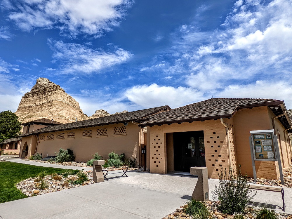
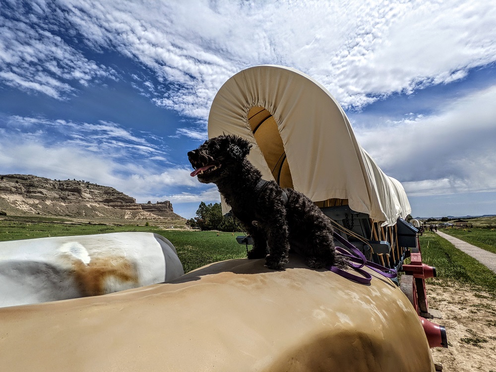
We had our dog Truffles with us, so I waited outside with her while Shae went inside.
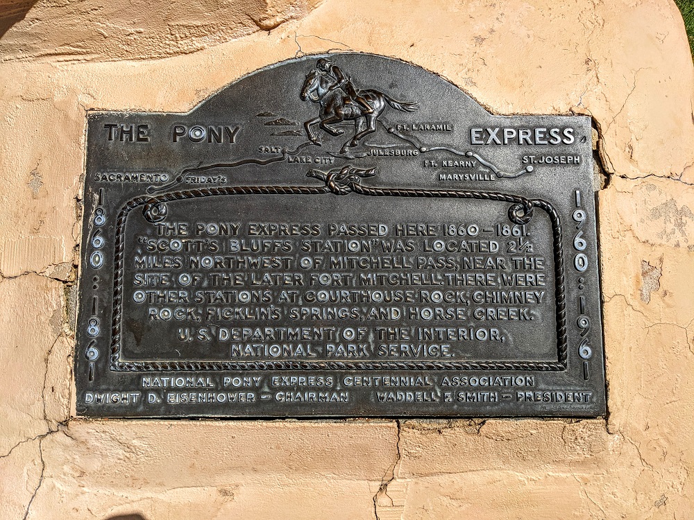
There was a marker out front referencing the Pony Express which used to pass through Scottsbluff. Considering its romanticized history, we were surprised to learn recently that the Pony Express was only in force for 18 months before it went bankrupt as a result of the even faster telegraph service.
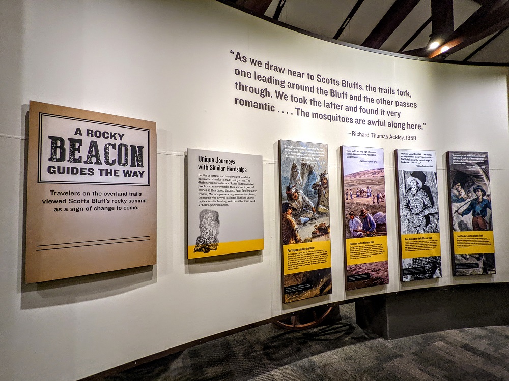
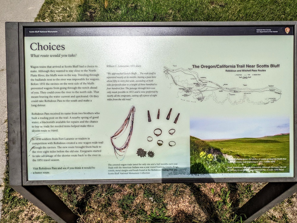
There were some other information boards around too, such as the one below that shared how Scotts Bluff became an alternate route on the Oregon Trail. The hilly terrain initially meant that travelers avoided the area, but an improved trail via Scotts Bluff meant that many people routed that way to cut 8 miles off their journey.
While 8 miles is nothing in a car, for those traveling in covered wagons pulled by oxen, it represented a full day of traveling being lopped off their journey. With limited supplies and all the other challenges they faced (if you’ve ever played the Oregon Trail game, you’ll be well acquainted with those!), saving a day could make a big difference.
We visited on a Sunday at the end of May, so there were a couple of people reenacting what life was like for travelers on the Oregon Trail, giving more information about the challenges they faced, etc.
Truffles got to experience the life of a paw-oneer.
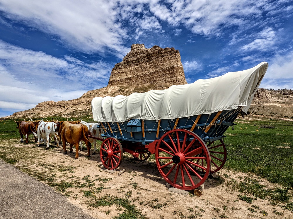
After traveling so far along the plains, coming across the hilly terrain of Scotts Bluff meant it became a well known feature on the Oregon Trail.
After learning about some of the site’s history, it was time to go hiking. Scotts Bluff National Monument doesn’t have much in the way of trails, although there are a few that you can take.
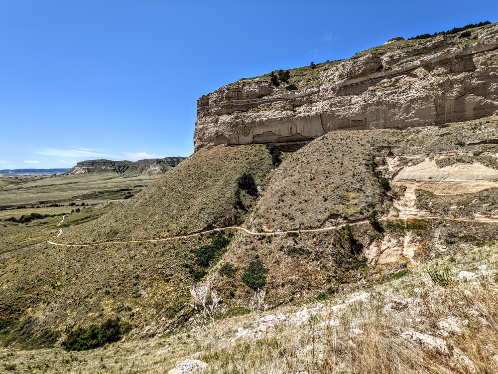
The trickiest one is the Saddle Rock Trail which is the trail we chose. At only 1.6 miles each way it’s not a particularly lengthy trail, but much of the route is uphill on the way to the summit of Scotts Bluff.
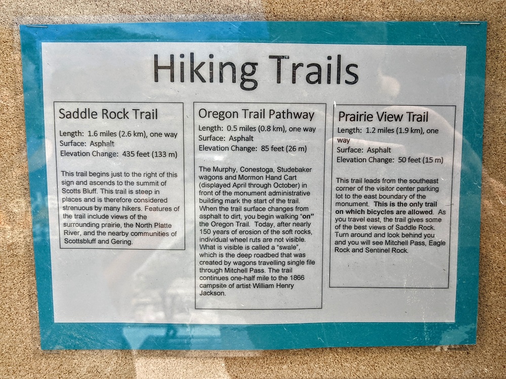
If you’d like to head up to the summit without hiking up there, you can drive the paved road to the top.
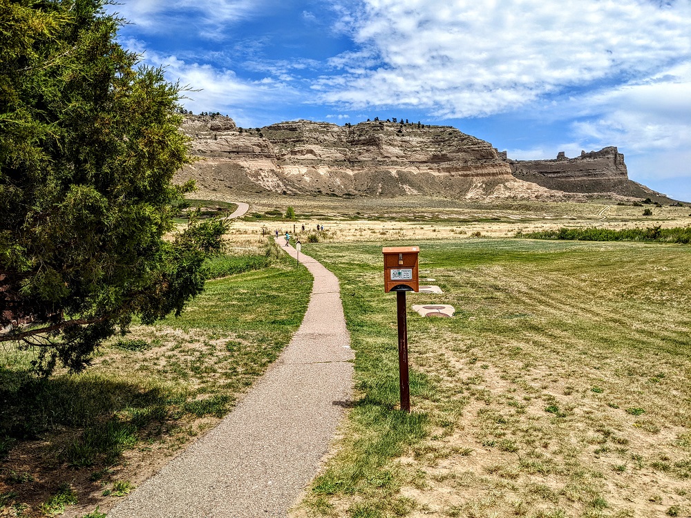
The hiking trail starts at the rear of the visitor center which initially starts with a gentle incline.
It wasn’t long before the trail got steeper. It was 80° F (27° C) the day we visited, but it felt even hotter than that while we hiked because the trail has very little shade providing respite from the sun.
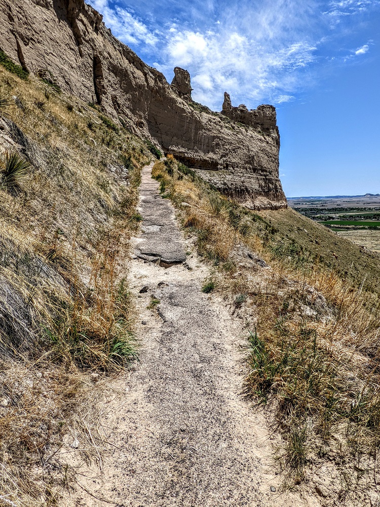
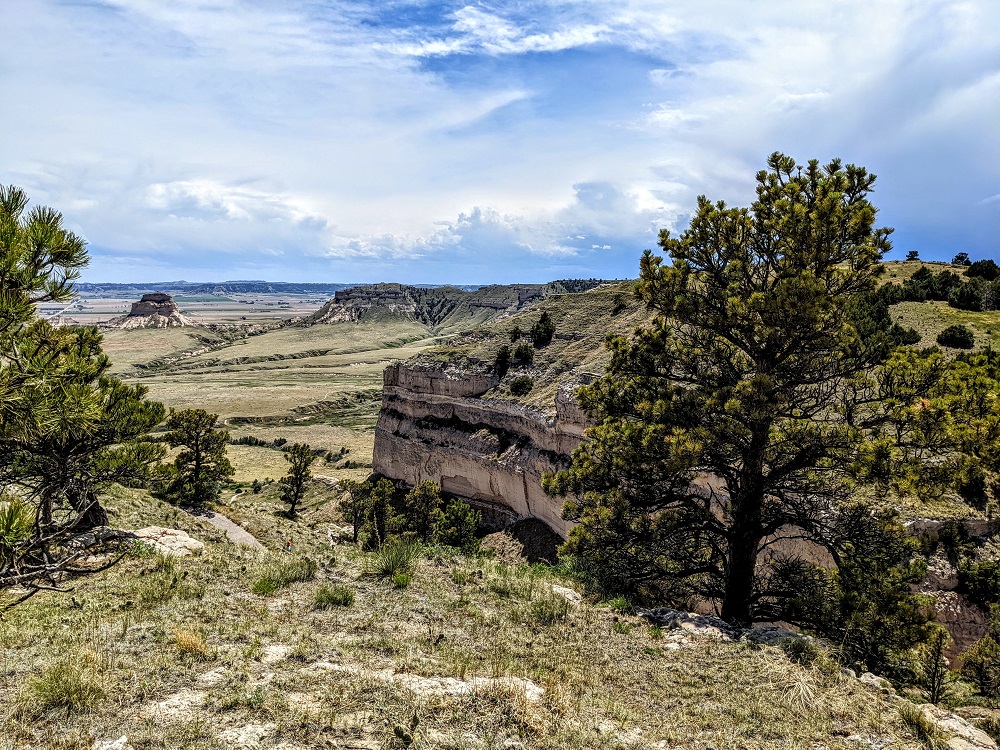
The trail wraps around the bluffs on the way up.
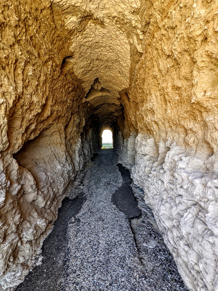
With no trees providing shade on the way up and the overhead sun meaning the bluffs weren’t providing shade either, we were grateful when we got about 2/3 of the way along the trail. That’s because the trail takes you through a foot tunnel through the rock that not only offers shade, but also acts as a wind tunnel to help you cool off. It’s wide enough for people to walk single file in each direction, so we decided to hang out in there for a few minutes to cool off.
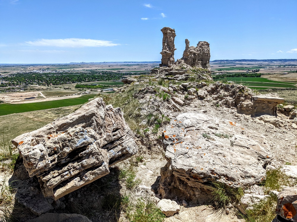
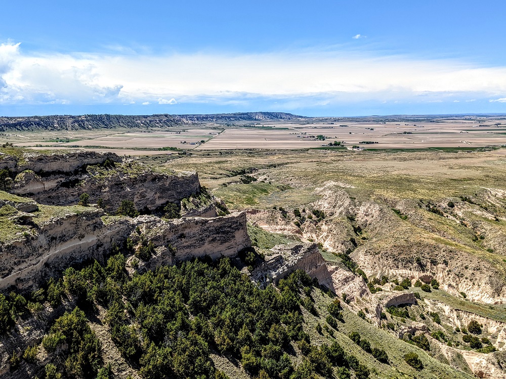
Scotts Bluff has remained a landmark because limestone protected the rock beneath from being eroded as quickly as other rock in the area. However, it’ll eventually succumb to erosion over time, so there are signs asking visitors to remain on specified trails and not go off-piste to explore formations like the one in the photo below.
It wasn’t much further until we reached the summit. There was a memorial plaque dedicated to Hiram Scott which refers to how he died nearby. It’s not known precisely what happened, but it’s thought that his traveling companions abandoned him after their boat overturned and they lost their food supplies and rifles.
With much of the local area being so flat, hiking up ~450 feet provides good views of the surrounding area.
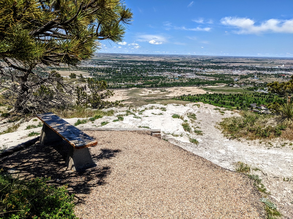
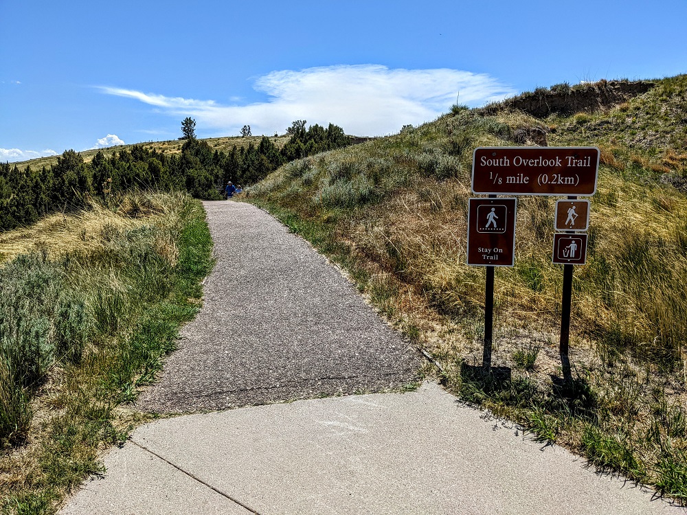
There’s a short walking trail past the parking lot at the summit which leads on to the South Overlook.
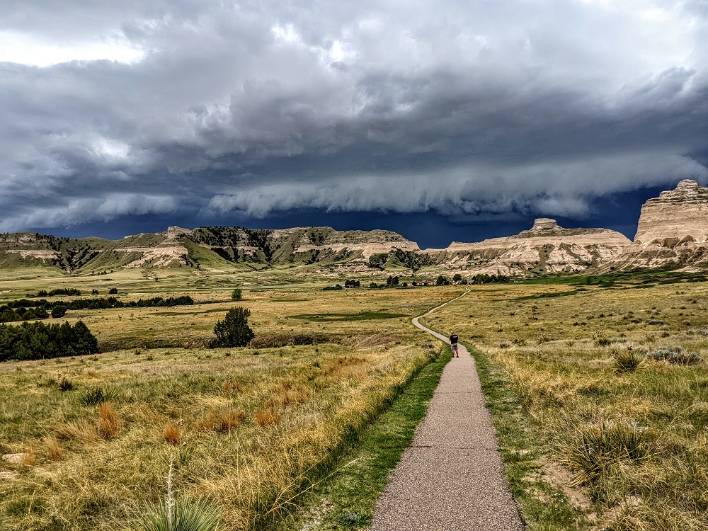
After stopping for a picnic lunch, we made our way back down the Saddle Rock Trail. We’d seen ahead of time that the weather was due to turn that afternoon, so we wanted to get back to the car as quickly as possible.
Despite knowing that bad weather was going to roll in, we hadn’t expected it to happen quite so quickly. Thankfully the change occurred just as were nearing the end of the trail. We could see the weather front approaching fast and at one point there was a noticeable and immediate drop in temperature.
We got back to the car just as the wind strengthened further. However, we weren’t quite done.
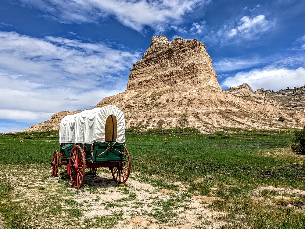
Shae had been recording some videos about Scotts Bluff National Monument during our visit for her students and she had one more that she wanted to record back at the covered wagons. We ran over as quickly as we could against the wind to record the video which was….interesting. It wasn’t the most successful video ever, but it’s entertaining watching it back now.
Here was the outcome where you can see quite how drastically the weather turned in the space of minutes.
Final Thoughts
Scotts Bluff National Monument is an interesting part of the Oregon Trail to stop and visit if you find yourself driving through western Nebraska. With exhibits, hiking and more, there’s a good amount of stuff to experience; just be sure to check the weather forecast before hiking so you don’t get caught out like we almost were!
[…] …and the Carnestoga Wagon, a play on the Conestoga Wagons that pioneers used to travel along the Oregon Trail (like those we saw at Scotts Bluff National Monument). […]