In addition to wanting to see the fall colors while in Maine, we also really wanted to see some moose in the wild. Maine has the highest moose population in the US outside of Alaska, so we were hopeful about our chances and Baxter State Park is supposedly a great place to at least have a chance of spotting them.
We were staying in Kokadjo which was somewhat close to Baxter State Park, so we headed there one morning to try our luck, while also fitting in some nice hiking. Here’s how we got on.
The Drive To Baxter State Park
Google Maps said it would take about 1.5 hours to get from the cabin where we were staying to the entrance of Baxter State Park, but that was overoptimistic. Well, it might’ve been realistic if we had an off-road vehicle, but we’re in a 2004 Toyota Corolla.
Some of the roads on the route there were awful, so bad in fact that we were a little concerned about our car even driving at 10 mph due to all the potholes and large rocks in the road. That’s not necessarily the case for everyone heading to Baxter State Park as there are other routes there on main roads which won’t have that issue; it was just much faster (in theory) for us to take those back roads given our originating location.
Still, it did mean we got to enjoy some scenic views along the way.
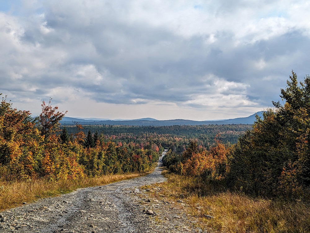
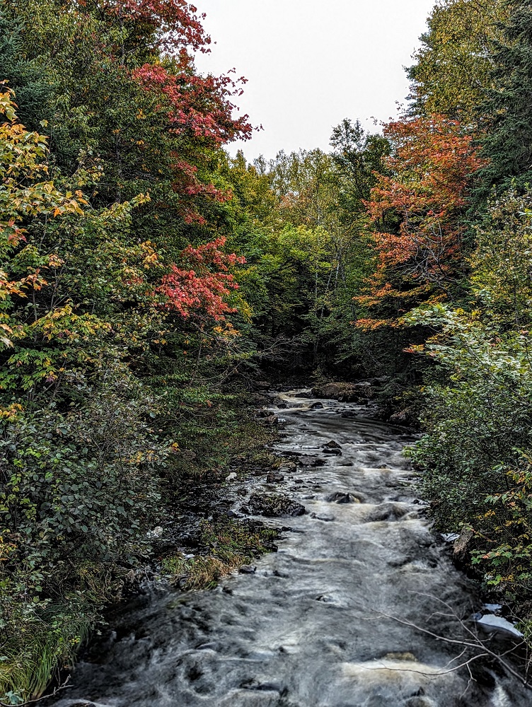
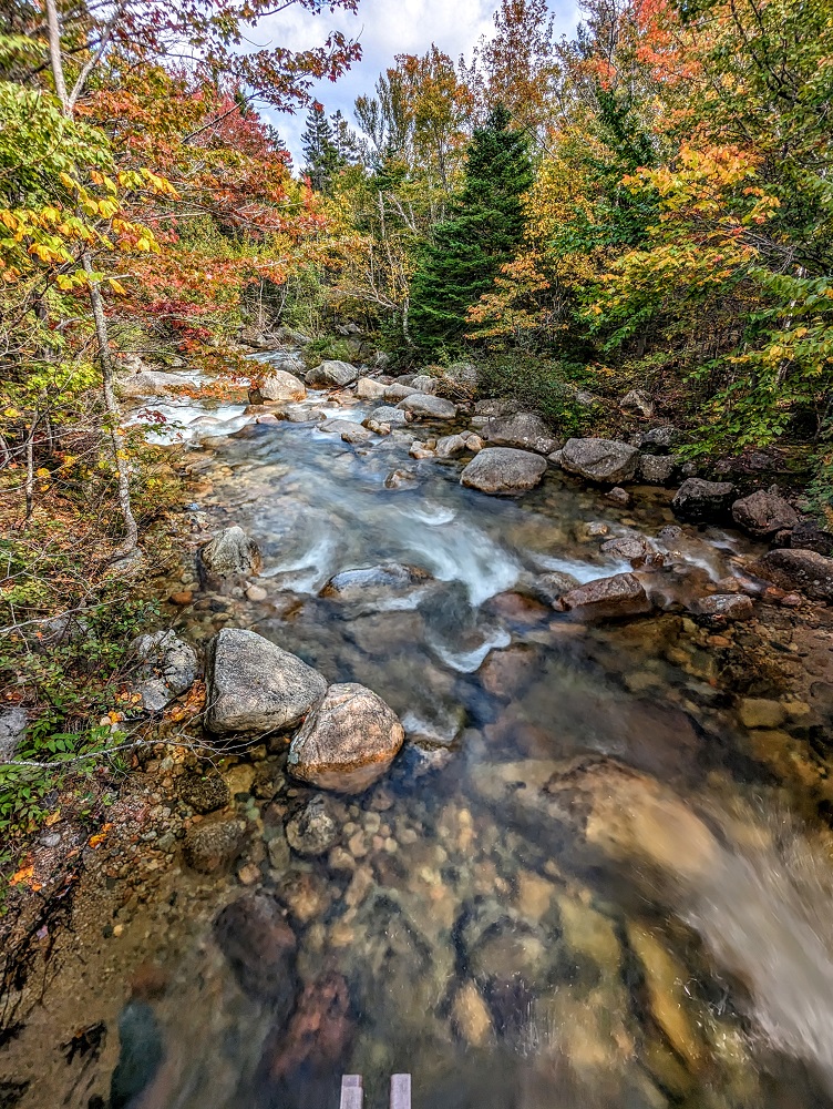
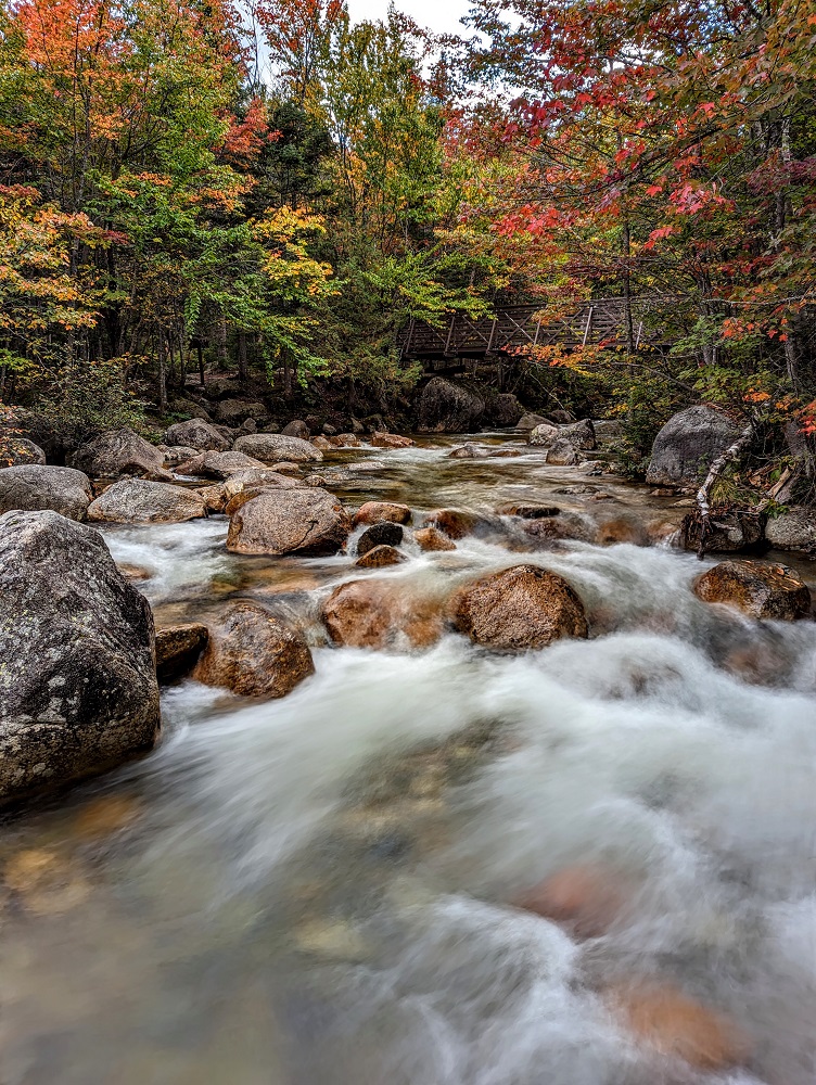
We also crossed over some pretty brooks and rivers along the way. The four of us kept our eyes peeled for moose all along the journey, but particularly so whenever there was water nearby in case we saw them drinking.
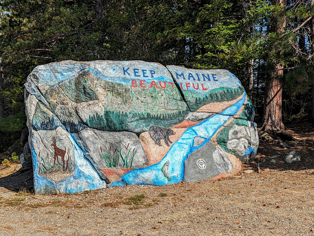
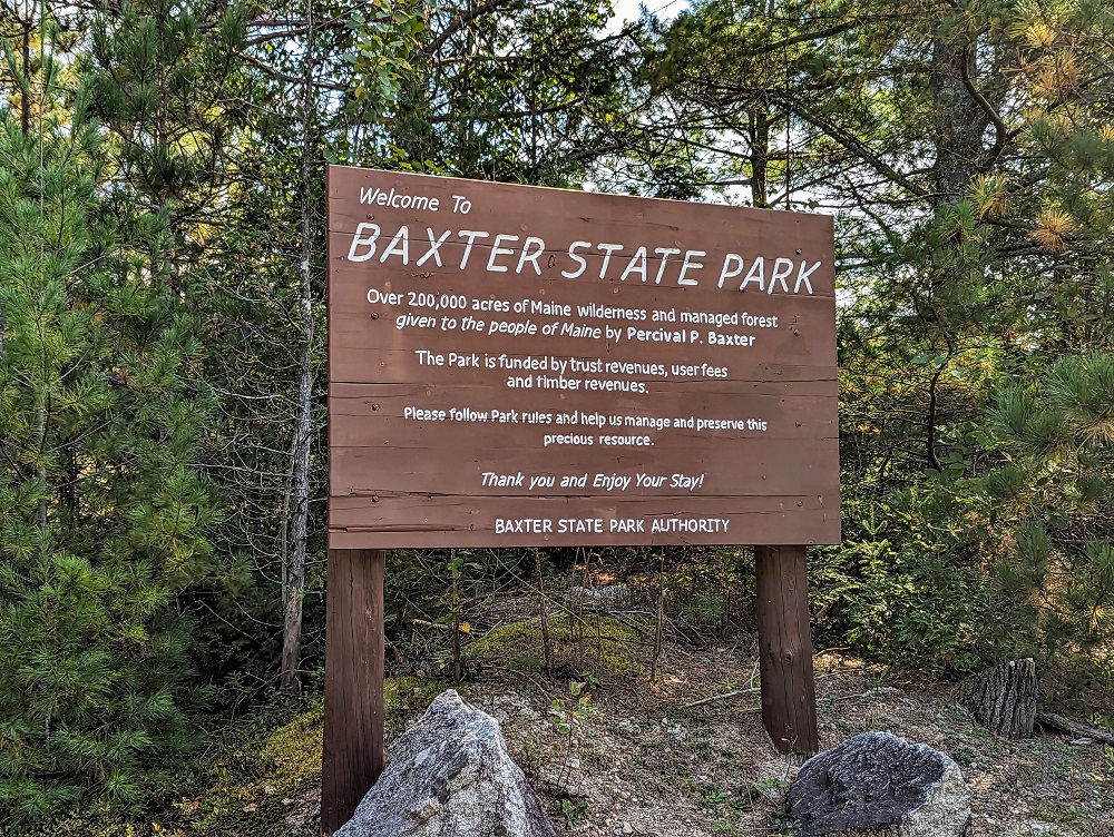
As we got closer to the entrance of Baxter State Park we passed Pockwockamus Rock which had a good reminder.
After about two hours of driving we finally made it to the park.
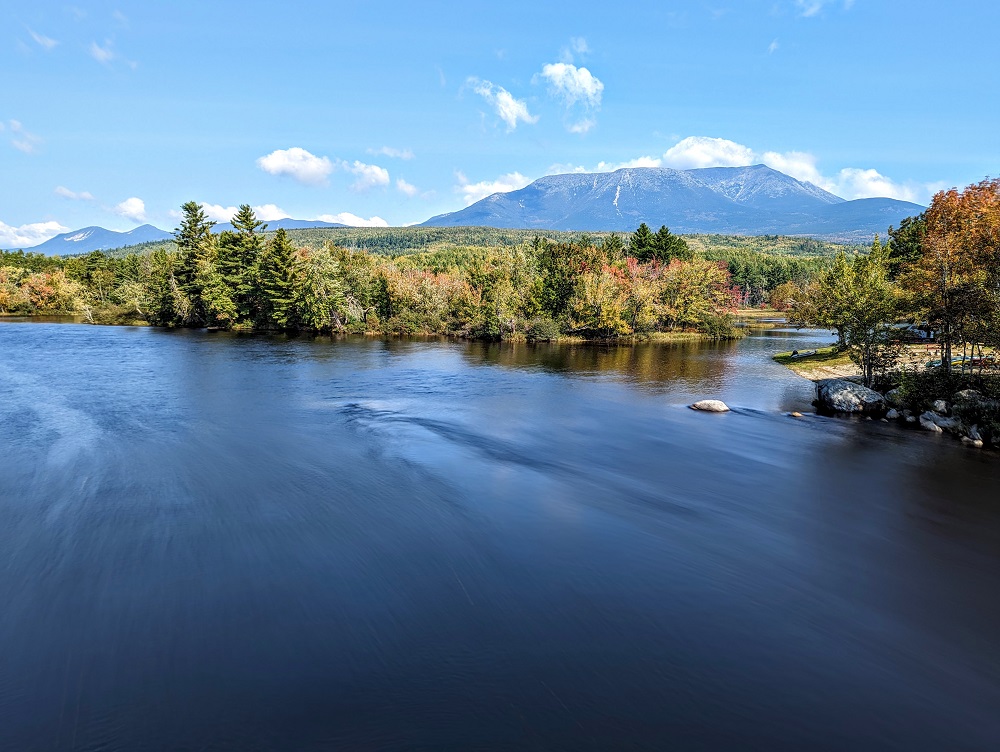
Togue Pond
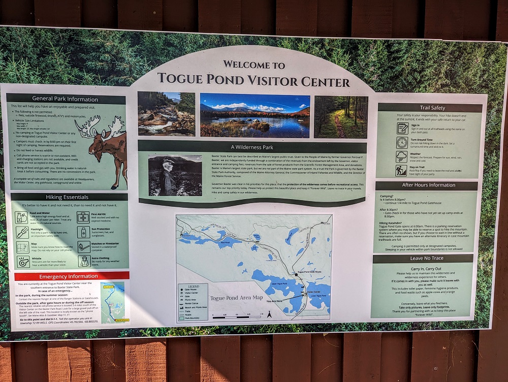
I think Baxter State Park has a few entrances; we entered through the Togue Pond Gatehouse. Before getting there we stopped off at the visitor center to try to get some tips about our best chances of seeing moose in the park.
The employee suggested heading to the Roaring Brook Campground and chatting to the ranger there, but that hiking to Sandy Stream Pond and then Whidden Ponds might be a good option. We’d already had Sandy Stream Pond on our list of hikes to do, so that was good to hear.
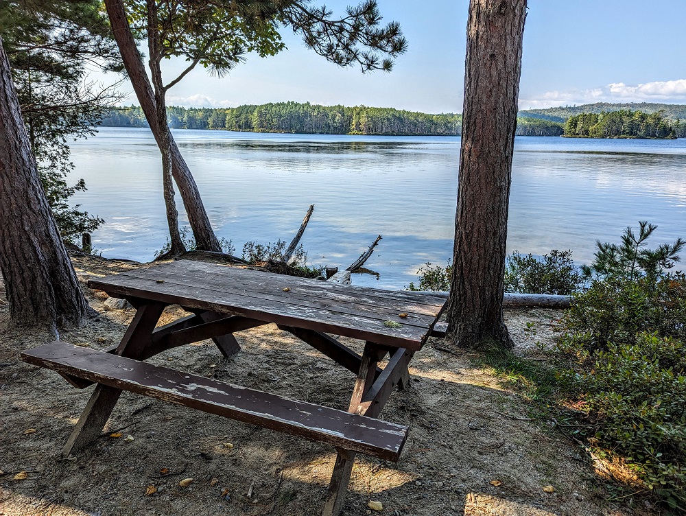
A little further up we stopped at Togue Pond to use the restrooms there. There’s a beach and picnic area there which looked like it would be nice to spend some time at. Unfortunately we didn’t have time for that; Baxter State Park isn’t pet-friendly, so we had to leave our dog Truffles at the cabin. With it being a fairly long drive to and from the park, we needed to maximize our time there and so continued on.
Maine has the option to buy an annual pass to its state parks and we’d bought one at the start of our time in Maine at Lily Bay State Park. There’s a handful of state parks that are ineligible for this pass and unfortunately Baxter State Park is included in that list. The entrance fee was only $16 though, so it wasn’t bad.
Sandy Stream Pond Trail
We decided to start our day by hiking to Sandy Stream Pond. To get to the trailhead you have to park at the Roaring Brook Campground parking lot. I was a little concerned as I’d seen online that the parking lot there can get packed and that it’s hard to find a space. In fact, it seems like in the summer you have to have a parking reservation, but when we visited at the end of September that wasn’t needed. The parking lot was still very busy though.
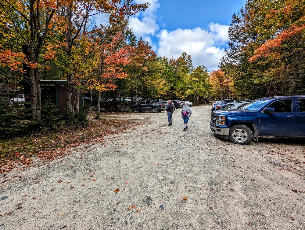
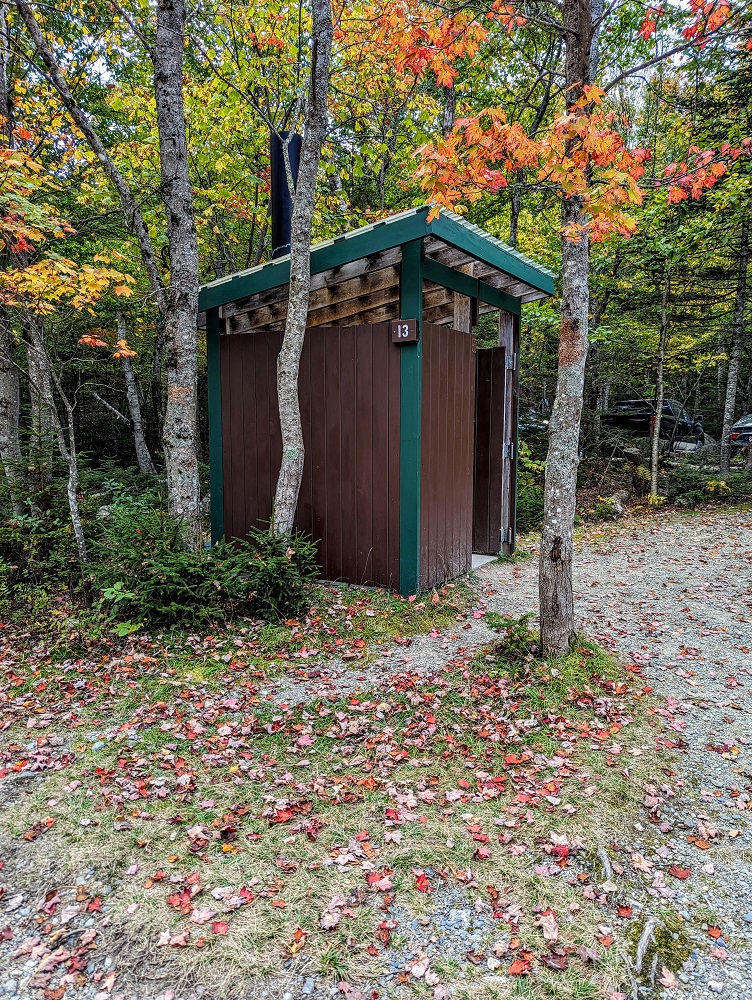
There are lots of pit toilets available all around the parking lot in case you need to use one of those before setting off on your hike.
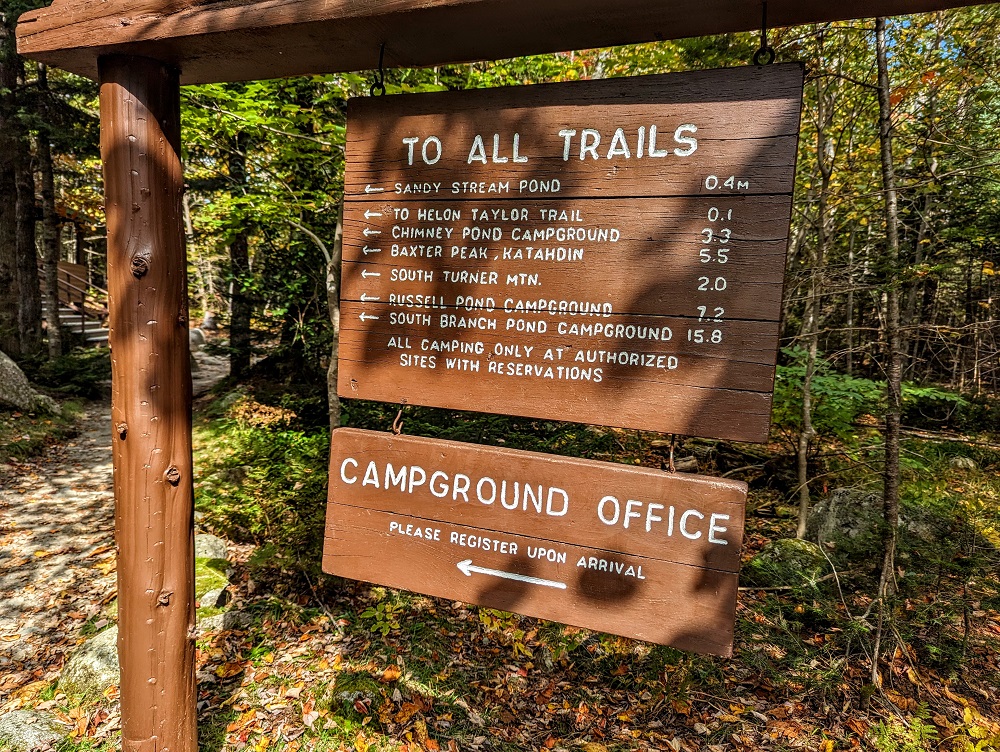
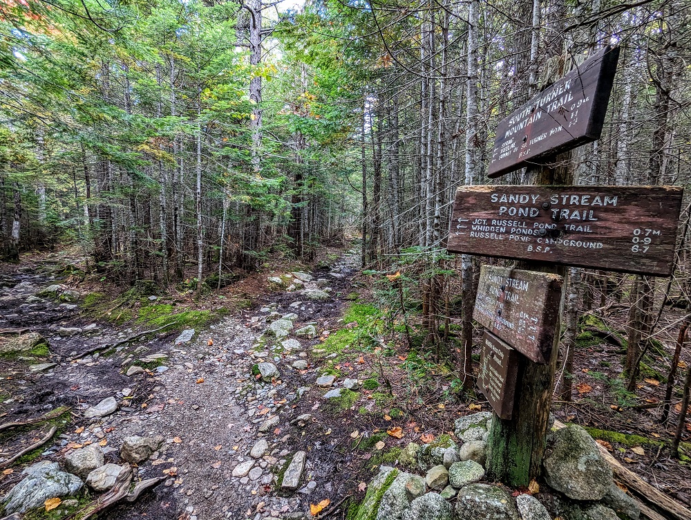
Baxter State Park does a great job with giving directions both to trails and on the trails themselves.
Before setting off on any hikes, the park likes you to sign in, then sign out when you return. I think this is where the ranger was meant to be who’d have been able to give suggestions as to where we might have the best luck spotting moose, but there wasn’t anyone there at the time.
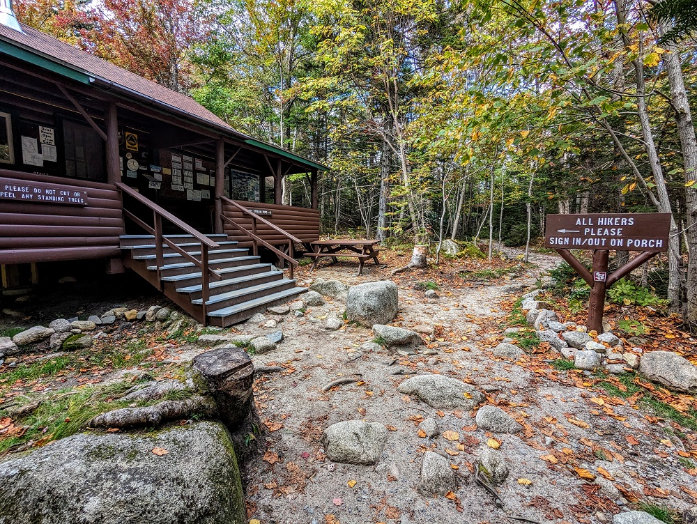
Up on that porch there are information boards with details about the park and the trails, along with trail maps.
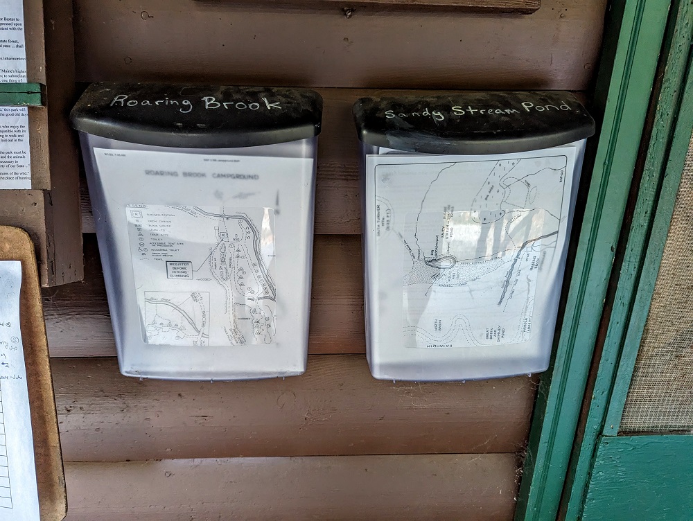
We grabbed one of the maps which displayed a few different trails. That included the one to Sandy Stream Pond, as well as the continuation of the trail on to Whidden Pond, the Roaring Brook Nature Trail and more.
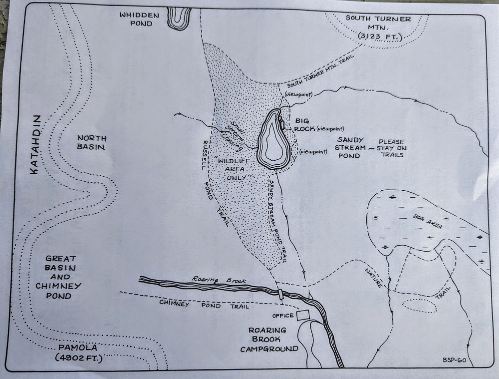
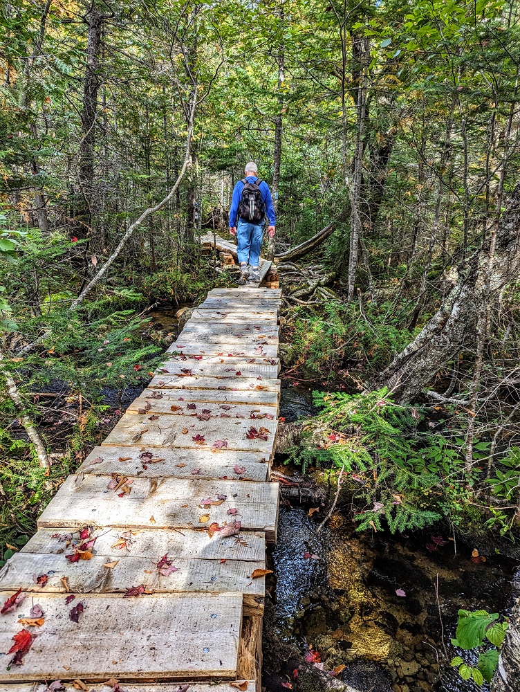
Map in hand, we set off towards Sandy Stream Pond. The start of its trail was just over the bridge crossing Roaring Brook.
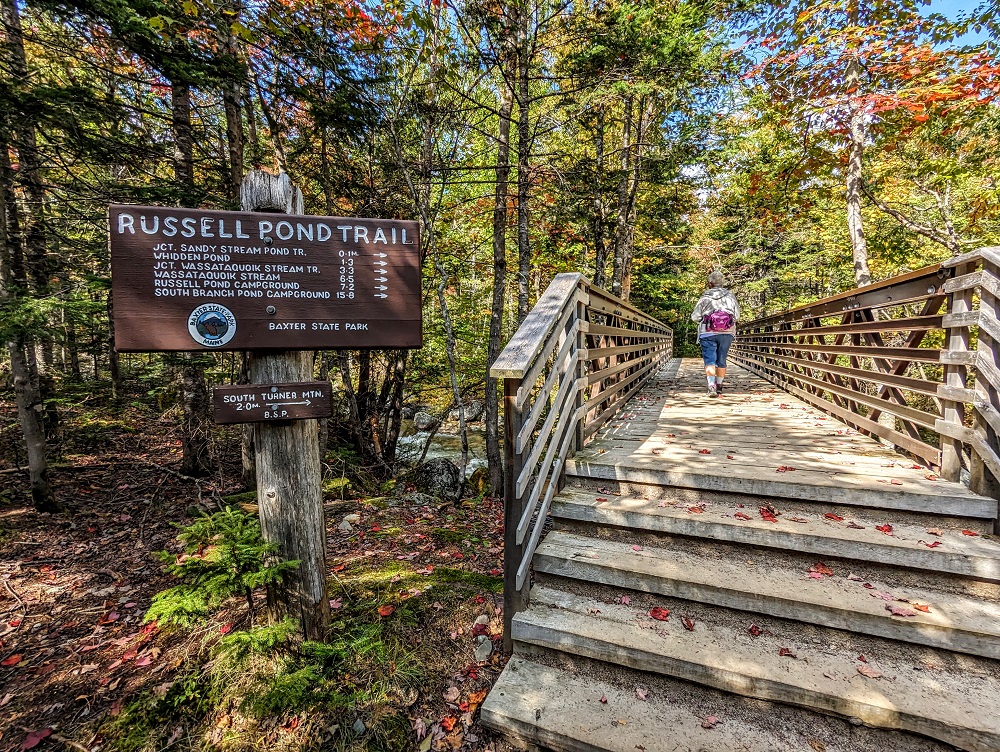
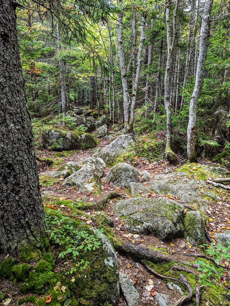
The Sandy Stream Pond trail is only 0.4 miles long and so it’s quick and easy to get there.
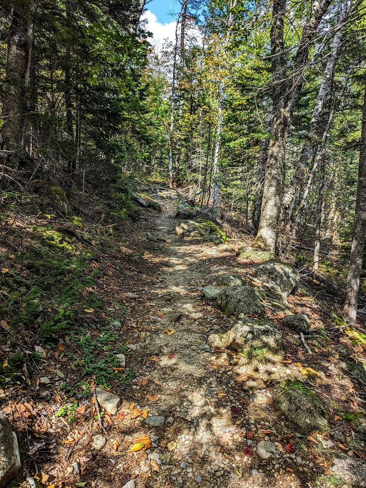
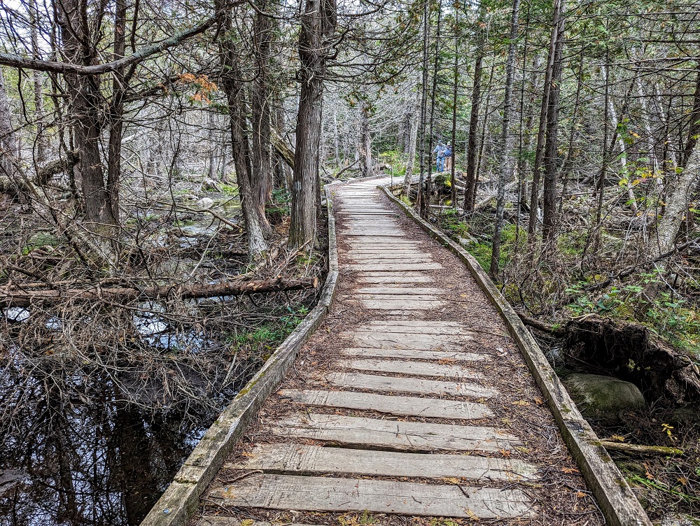
A fair bit of the trail takes you along a boardwalk which starts off nice and wide.
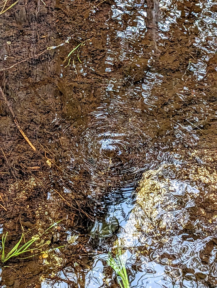
We spotted an interesting feature in the water off to the side at one point – a random whirlpool.
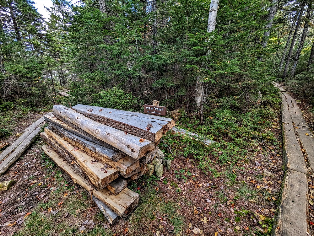
The boardwalk gets narrower, but still wide enough to easily keep your balance at this point. The path soon splits, with a viewpoint being off to the left. That path off to the left eventually leads back to the main trail, so you don’t have to double back if you don’t want to.
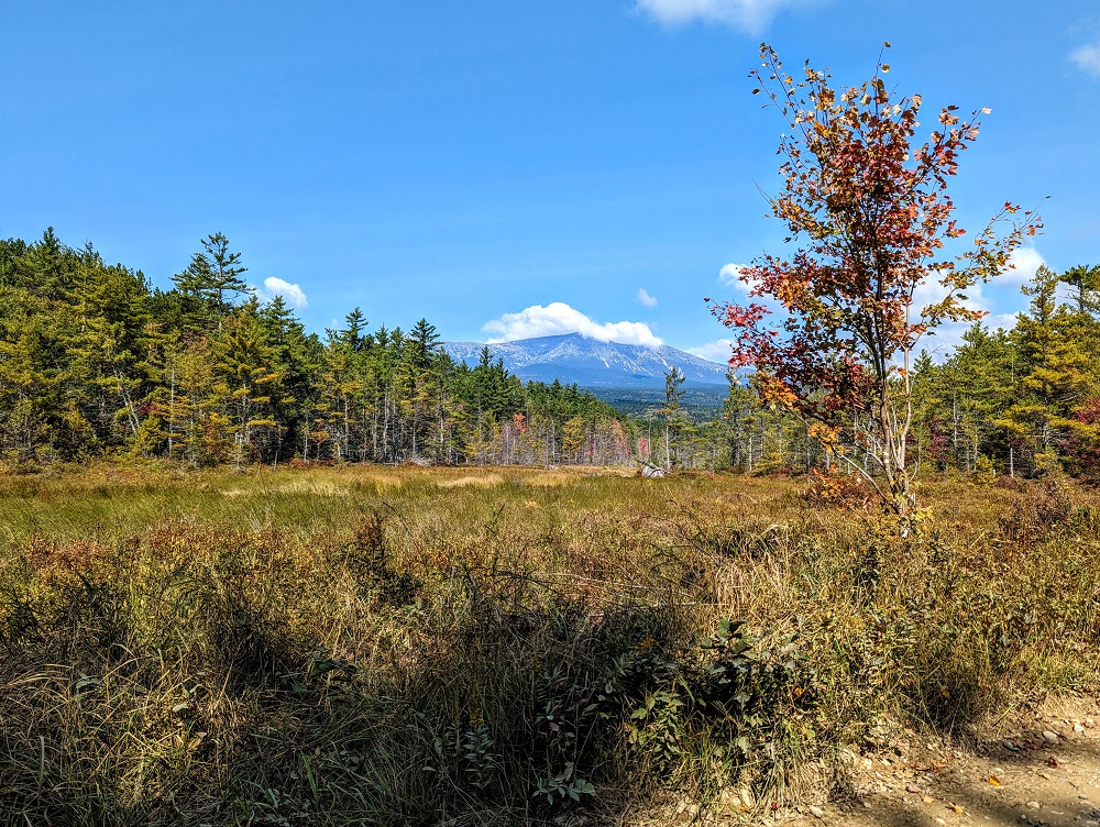
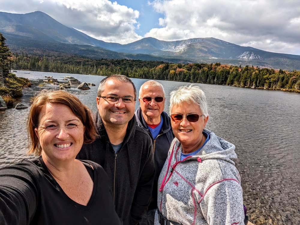
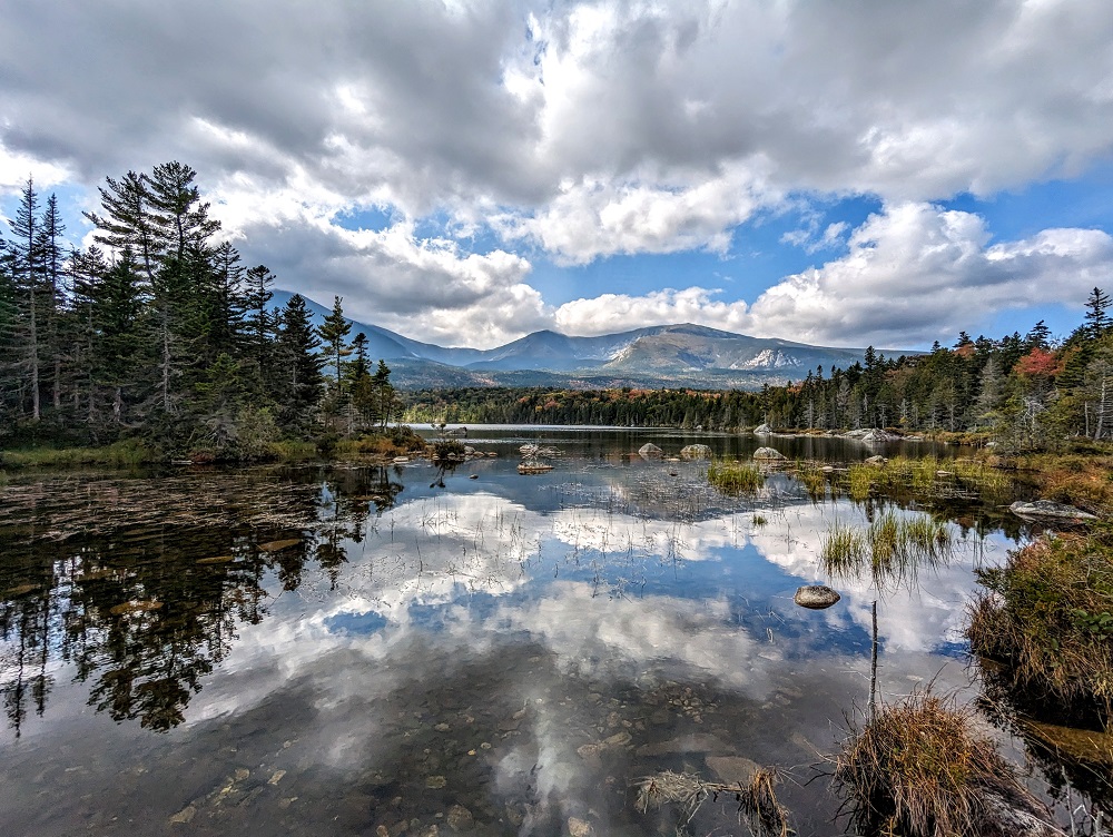
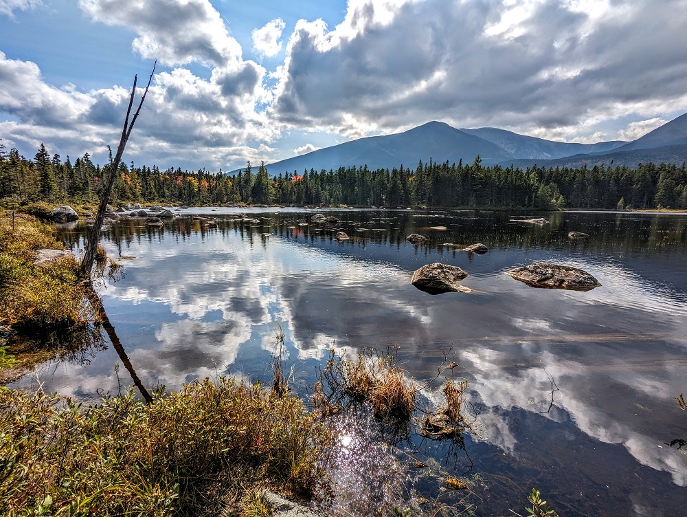
This gave us our first view of Sandy Stream Pond. It feels like what Maine considers a pond, I’d consider a lake! We scanned the area, but no moose were in sight.
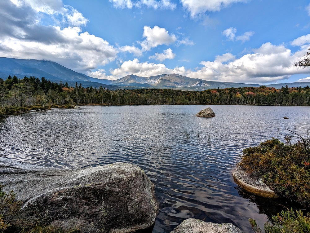
We followed the boardwalk along the edge of the pond back round to the boardwalk on the trail itself until we saw a sign for Big Rock Viewpoint. I’d figured this would give us a good view of a big rock, or perhaps a mountain that was being referred to as a big rock. Nope – the viewpoint itself was on a big rock.
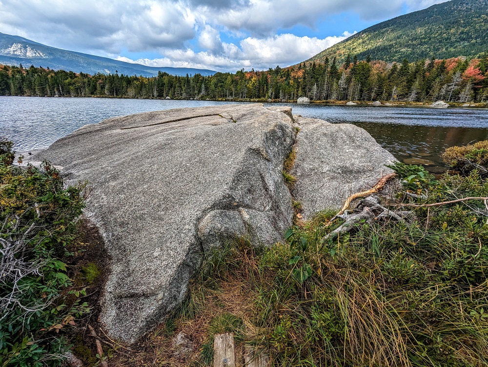
The rock had a ledge in the middle of it which was perfect for sitting on comfortably, so we decided to have our picnic lunch there and enjoy the view of the pond. We continued scanning the shoreline around the pond while eating, but alas there were still no moose.
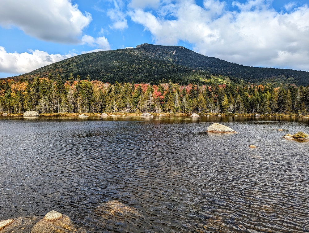
After finishing lunch, we continued along the trail which took us to another viewpoint giving us a different vantage point on the pond. Despite seeming like the perfect watering hole, the fact that it was about 1:30pm meant there wasn’t much chance of seeing a moose and sure enough, there weren’t any.
Whidden Ponds
When arriving at Baxter State Park, the ranger at the entrance had mentioned Whidden Ponds as being a spot where we might possibly see moose. The trail up there continued beyond Sandy Stream Pond and wasn’t far away, so we decided to try our luck.
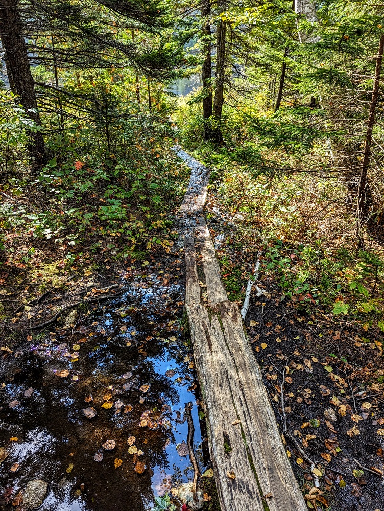
The Whidden Ponds Trail is fairly level, so it’s not a strenuous mile-long hike there. It’s worth having good footwear on though as it can get muddy, wet and rocky.
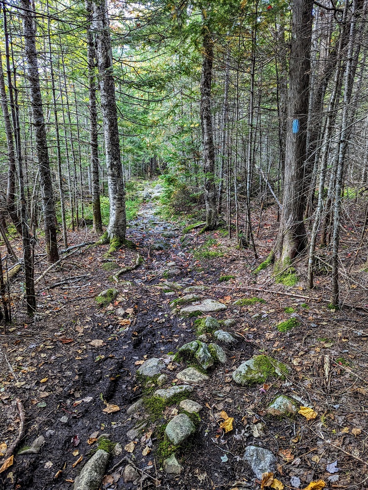
There were some boardwalks along the way to avoid the mud, but they weren’t in as good condition as some of those on the Sandy Stream Pond trail. Some sections were also much narrower, so having good balance can help.
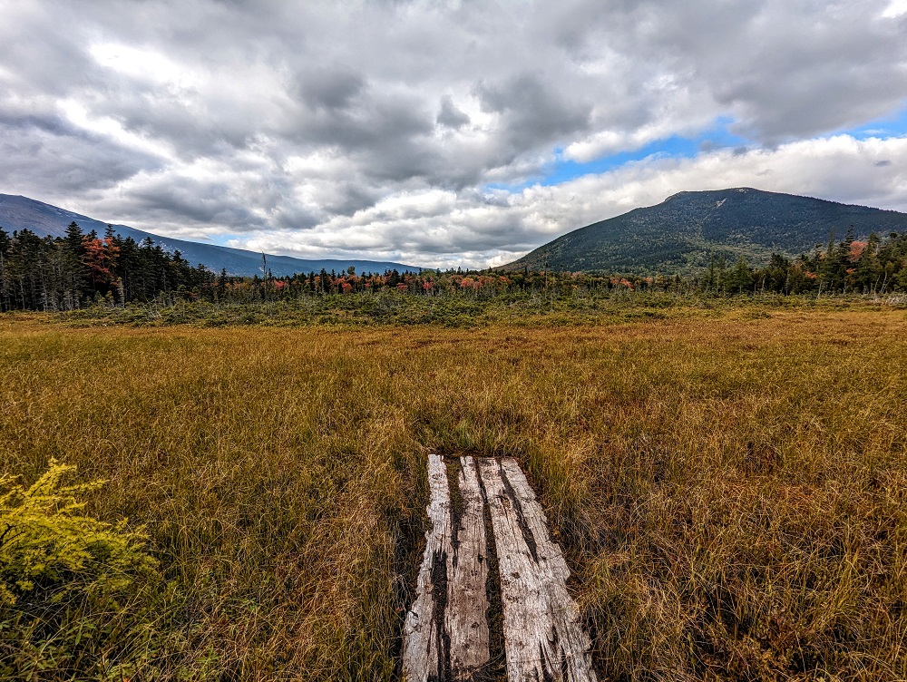
The boardwalk led out to Whidden Ponds which provided some beautiful views of the pond, trees and nearby mountains. We’d hoped that its location a little further away from more trafficked trails would give us a better chance of seeing moose, but sadly not.
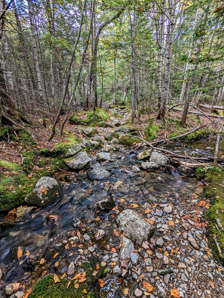
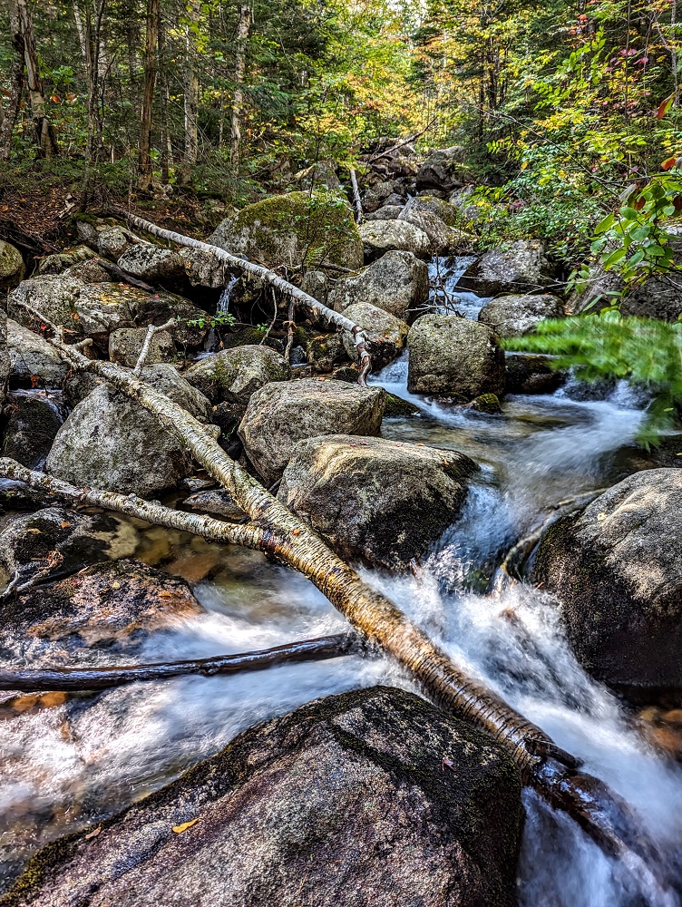
This was a loop trail, so after checking out Whidden Ponds we continued back along the Russell Pond Trail. This crossed over something labeled on the map as ‘Small Stream Crossing’ but which seemed a little wider than what I’d consider a small stream. Still, with lakes being called ponds, I guess it shouldn’t have been surprising that this was regarded as a small stream in Maine 😉
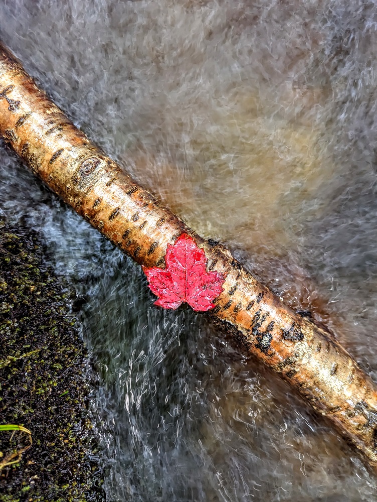
And here’s a photo of a maple leaf on a branch in the stream just because I thought it looked cool.
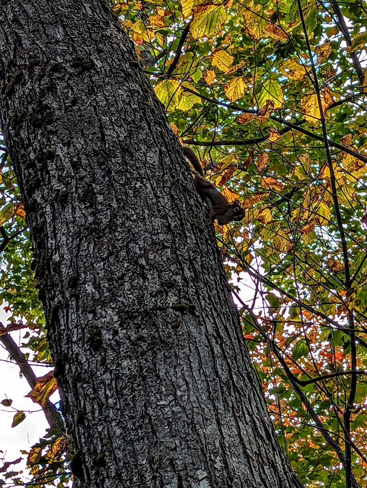
The only critters we saw up to that point were squirrels. Something we’ve noticed during our time in Maine is that squirrels seem much skinnier here. They don’t look emaciated or anything like that – just streamlined.
Roaring Brook Nature Trail
When setting off on our hike to Sandy Stream Pond earlier that afternoon, we’d passed by the start of the Roaring Brook Nature Trail. It looked like that went along Roaring Brook, so when we approached the end of the Russell Pond trail (near the Roaring Brook Campground parking lot), we headed off to the left to take that trail.
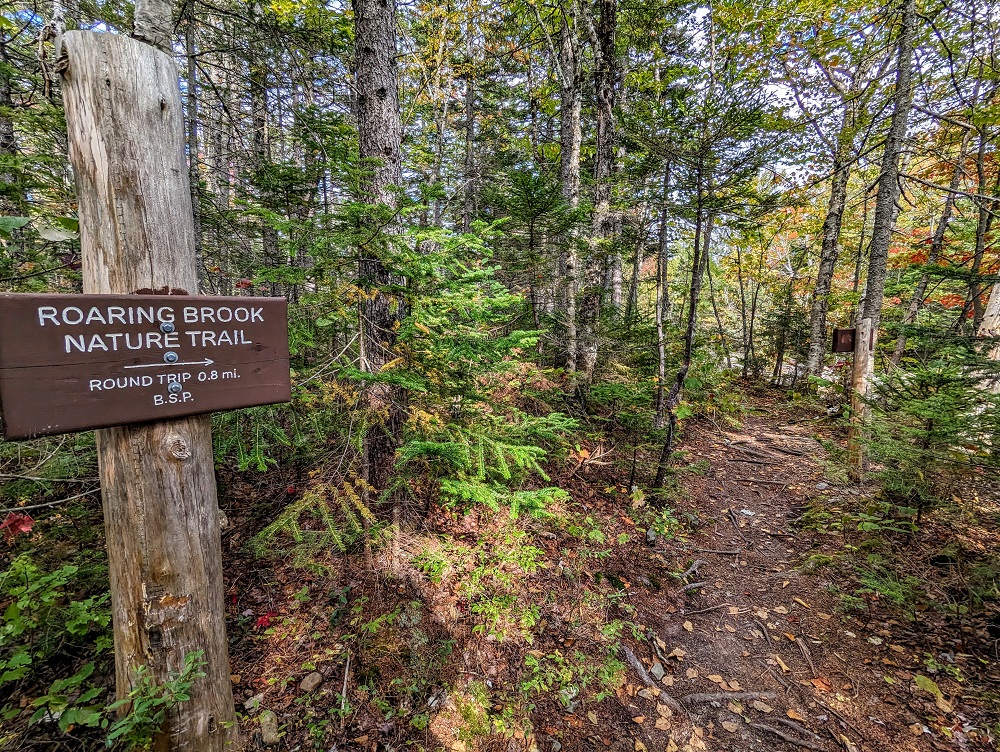
The Roaring Brook Nature Trail is 0.4 miles each way, so it’s another quick and easy hike to do. The first section does indeed take you along Roaring Brook.
It’s not long before the Nature Trail branches away from the brook, taking you towards the bog area which marks the end of the trail.
That bog was one of the other reasons we decided to do this trail. Moose can sometimes be found roaming through bogs and, with the afternoon getting on, we hoped they might be more likely to be out and about.
It felt like our chances might be good because along the trail we saw some moose poop.
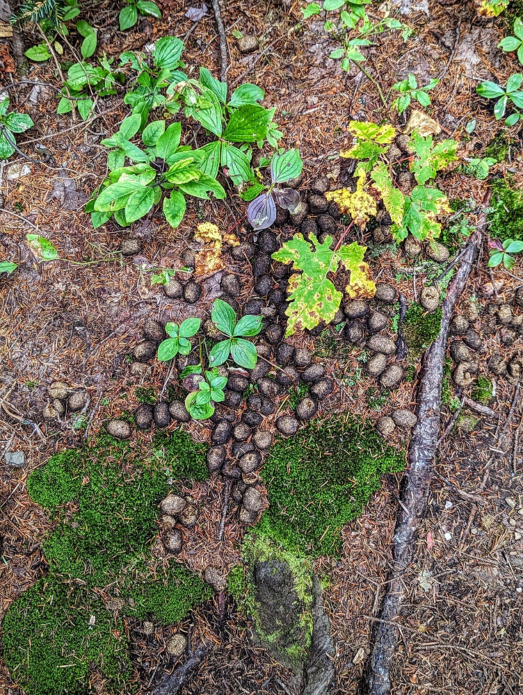
We kept our eyes peeled and lips sealed so as not to disturb any moose that might be lurking nearby or in the bog. When reaching the bog there was a boardwalk leading out into the edge of it. We scanned the area and scanned again, but alas – no moose once again.
Foiled again! It was 3:30pm at that point so, with a two hour drive ahead of us and not wanting to drive that same road back in the dark, we decided to call it a day and hiked back to the parking lot and headed back to our cabin.
When we got back to the trailhead, I went up on to the porch to note down that we’d returned from our hike. While I did that, Shae and my parents got chatting to a guy who’d just arrived who’d just done what we’d been unable to do. As he was entering Baxter State Park, he’d come across a moose wandering around, so he showed us the video he’d taken of it – so jealous!
Final Thoughts
Despite not seeing moose ourselves, we had a lovely day in Baxter State Park with some pretty hiking. It’s a very scenic park and one we’d like to return to in the future, possibly to camp or stay in a cabin there to increase our chances of moose sightings.
We were particularly disappointed for my parents as they’ve not seen moose in the wild before. Shae and I had seen some while driving through Colorado before, plus we’re spending a couple of months in Alaska next year and so should see some then.
[…] they encountered turbulence while on their way towards the mountains of Baxter State Park. The plane’s vertical stabilizer broke off while over the east side of Elephant Mountain […]