After spending a few days in Charlottesville, Shae and I drove back to Portsmouth, VA just before I headed off for my 40k To Far Away adventure.
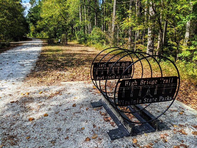
On our way back down, we decided to stop off at High Bridge Trail State Park in Rice, VA. We’d seen photos of it online and it looked beautiful; it also didn’t require too much of a detour, so it seemed like a good opportunity to stretch our legs on the way back.
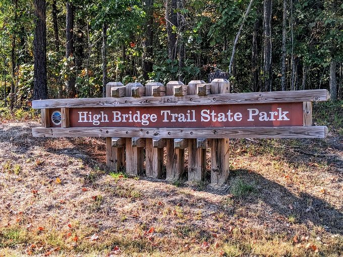
High Bridge Trail is a trail that was converted from a former rail line. The trail is more than 30 miles long, although the bridge itself is just under half a mile long.
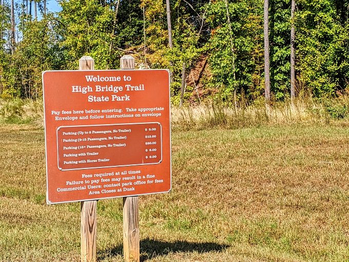
Depending on how you travel to High Bridge Trail State Park, it might be free to visit or you might have to pay. If you walk or bike, it should be free. If you drive there, you have to pay for parking to help support the park. The photo below isn’t too clear, so the pricing is as follows:
- Up to 8 passengers, no trailer – $8
- 9-15 passengers, no trailer – $13
- 16+ passengers, no trailer – $30
- With trailer – $8
- With horse trailer – $9
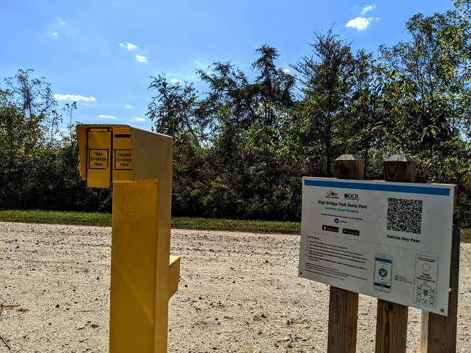
On the other side is where you can get an envelope to deposit your parking fee. Alternatively, you can pay using the Viply app.
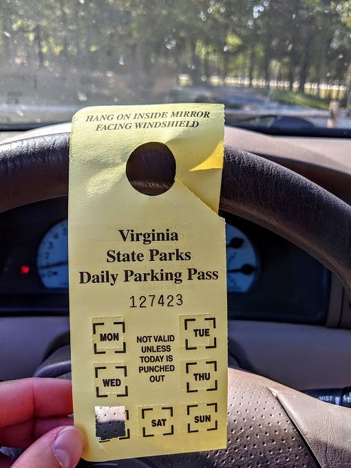
We paid cash and hung the parking pass on our rearview mirror. Be sure to punch a hole for the day you’re visiting as I almost forgot to do that.
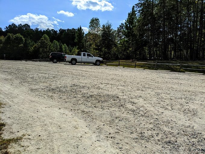
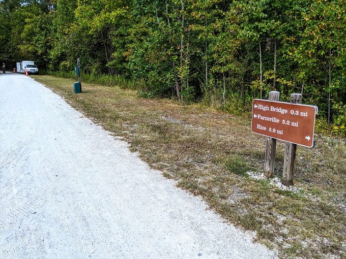
There are a couple of parking lots near the bridge. There’s one in Farmville which is about a mile away from the bridge. We wanted a shorter walk that day though as we still had some driving to do, so we parked at the lot in Rice as it’s only 0.3 miles from the bridge.
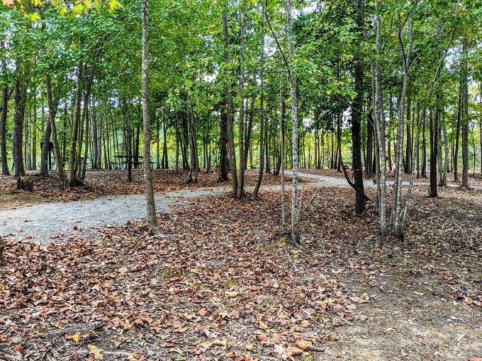
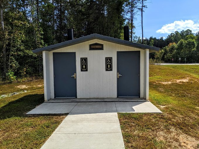
I’m not sure what facilities the Farmville parking lot has, but the one in Rice had picnic tables and restrooms (albeit without running water). It was 2pm by the time we arrived, so we decided to have our packed lunch at one of the picnic tables before setting off for the bridge.
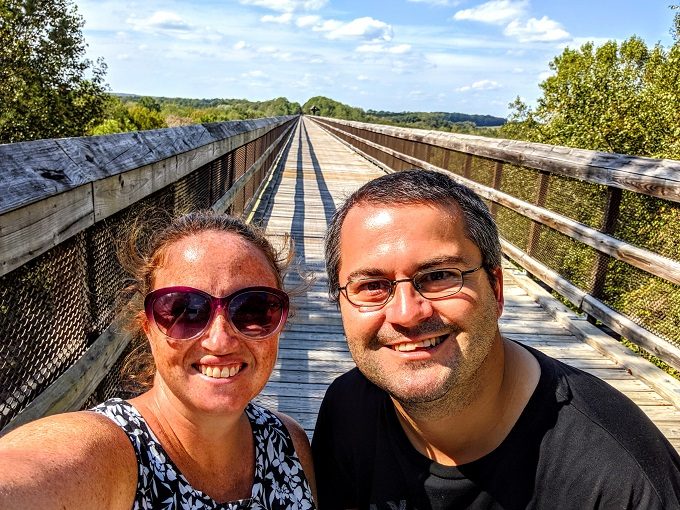
Having eaten our lunch, we headed towards High Bridge Trail. As I mentioned earlier, the trail is more than 30 miles long and so you can choose to head to the left or the right. Seeing as we wanted to walk across the bridge, we headed to the left.
The trail is very bike-friendly, so there was what appeared to be a bike rack near a bench in case you needed to rest your legs.
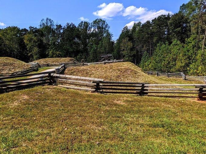
Following the path along, there’s a section off to the left called Camp Paradise. This was a Confederate fort during the Civil War and was named Camp Paradise due to how well the soldiers were taken care of by the local people. There were a couple of information boards at this spot giving a little more history about Camp Paradise, along with the role played by African Americans in building the fort.
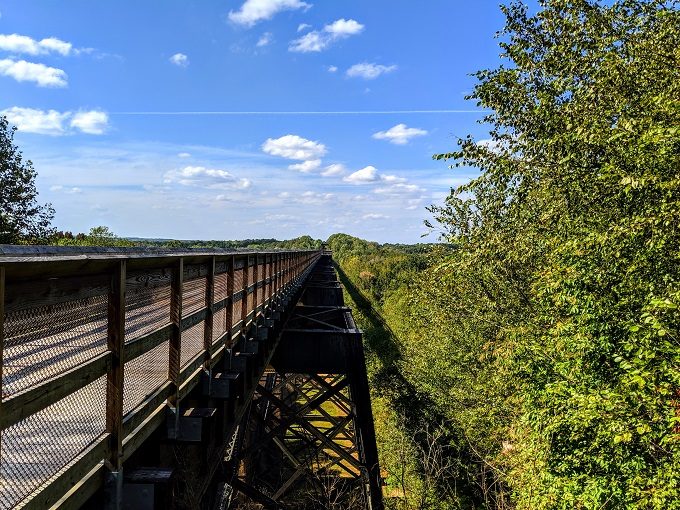
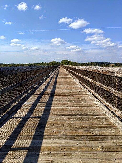
After another couple of hundred yards we arrived at High Bridge, a Virginia Historic Landmark.
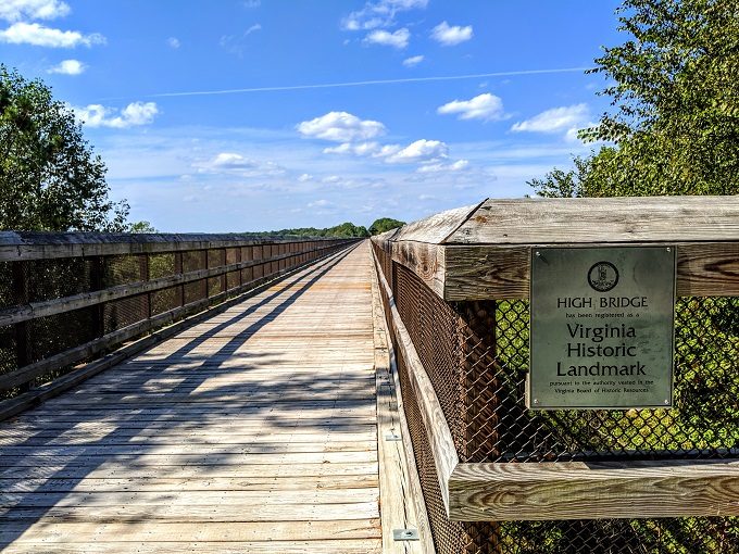
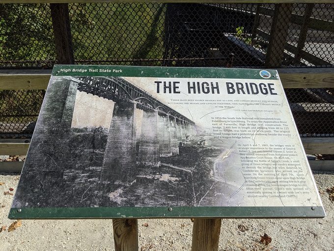
On both sides of the bridge there’s a board providing more information about its history. You can’t really see the text in the photo below, so here’s what it says:
“There have been higher bridges not so long and longer bridges not so high, but taking the height and length together, this is, perhaps, the largest bridge in the world.” C.O. Sanford, South Side Railroad’s chief engineer, 1852
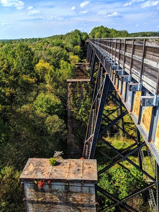
In 1854, the South Side Railroad was completed from Petersburg to Lynchburg. To cross the Appomattox River east of Farmville, High Bridge was constructed. The bridge, 2,400 feet in length and ranging from 60 to 125 feet in height, was built on 21 brick piers. The original wood bridge had a pedestrian walkway beside the tracks and a wagon bridge below.
On April 6 and 7, 1865, the bridges were of strategic importance to the armies of General Robert E. Lee and General Ulysses S. Grant as they moved westward from Richmond toward Appomattox Court House. On April 6, following the Battle of Sailor’s Creek, a small group of Union infantry and cavalry attempted to destroy the bridge but were deterred by Confederate horsemen who arrived on the scene.
On the morning of April 7, quick marching Union troops came upon High Bridge as the Confederates were setting fire to it after crossing. Using the lower wagon bridge to continue their pursuit, Grant’s men pressed on, eventually coming in contact with Lee’s army around nearby Cumberland Church.
Despite being less than 0.5 miles long, the bridge disappears into the distance.
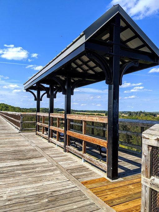
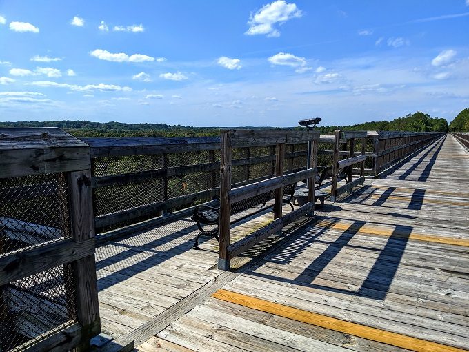
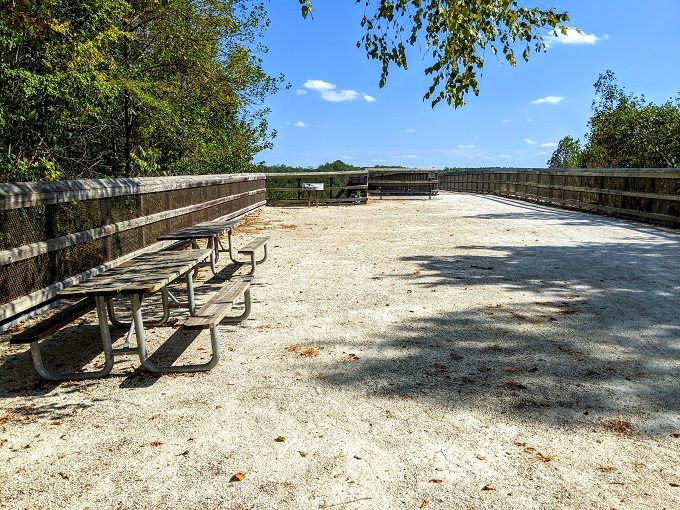
There are a couple of shaded seating areas along High Bridge which can be much needed during the hot Virginia summer.
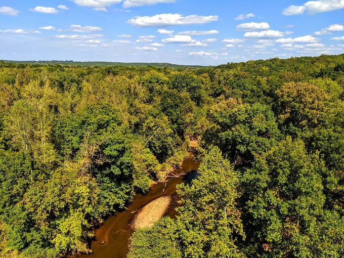
About halfway across we crossed over the Appomattox River.
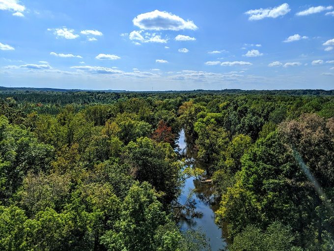
Despite being about halfway, it still looked like there was a long way to go.
Towards the end of the bridge there was a set of binoculars which were free to use. Although you get beautiful views of the surrounding area up on High Bridge, it didn’t feel like the binoculars really added anything, although maybe I was just looking in the wrong place.
Off to the left of the bridge you can see some of the old brick piers that supported the original High Bridge.
Once we reached the end of the bridge, we turned around and headed back. Horses are allowed on High Bridge Trail and across the bridge, but you have to dismount before setting off across the bridge.
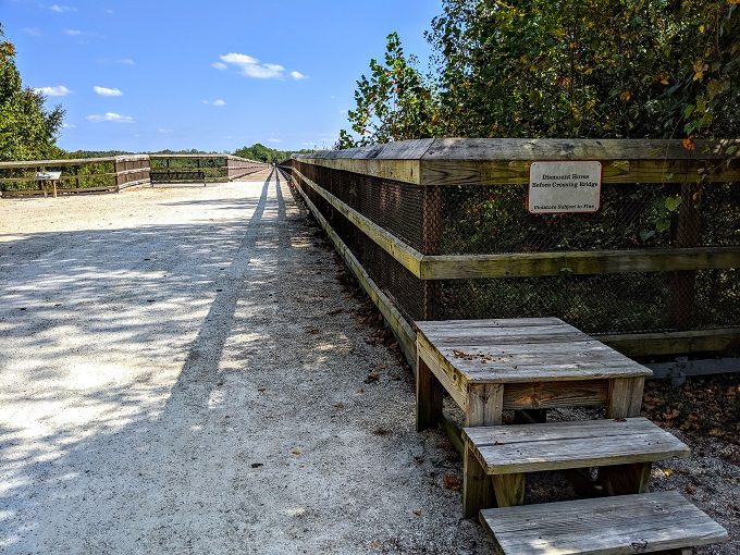
If you need a sit down once you’ve walked across, there’s a picnic table on the other side too.
Once we arrived back on the other side of the bridge, we headed back towards our car. Along the way we passed a mobile gift shop which is set up there from Friday to Sunday each week.
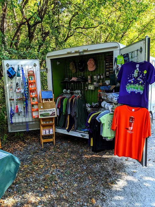
We got chatting to the friendly guy working there and bought a couple of postcards before setting off back down to Portsmouth.
Final Thoughts
High Bridge Trail State Park was a great little stop on our drive through Virginia. From the Rice parking lot it was a 1.5 mile walk across the bridge and back – a perfect distance to stretch our legs, get some fresh air and take in the surrounding views.
Address
High Bridge Trail State Park, 1466 Camp Paradise Rd, Rice, VA 23966
Thank you for sharing. We were looking for things to do while staying in VA a few days.
Hope you have fun there 🙂
Thank you for sharing .