While researching hiking trail in Albuquerque, I came across an intriguing option which I knew I had to do.
Back on February 19, 1955, TWA Flight 260 took off from Albuquerque airport and crashed in the Sandia Mountains 10 minutes later.
Police, the New Mexico Mountain Club and volunteers hiked up to the crash site, but everyone on the flight had sadly passed away. They were able to recover their bodies, but the plane wreckage was left in place due to its remote location.
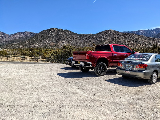
The wreckage can still be visited today by hiking the Domingo Baca Trail, so I headed up there during our stay in Albuquerque last month. Similar to the Pino Trail, you head to Elena Gallegos Open Space and park at the Pino Trailhead. The entry fee is only $1 or $2 depending on what day of the week you visit.
I’d recommend having Google Maps on your phone and looking up the Domingo Baca Trail on there as that can help ensure you take the right trail initially while walking through Elena Gallegos Open Space.
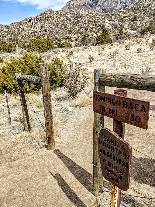
After about 0.75 miles you’ll come to this sign for the trail. The trail is much more obvious once you’re through this gate, but there are still one or two spots where you could go wrong a little later on.
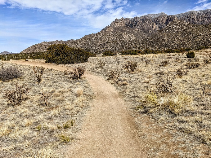
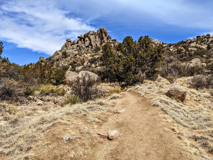
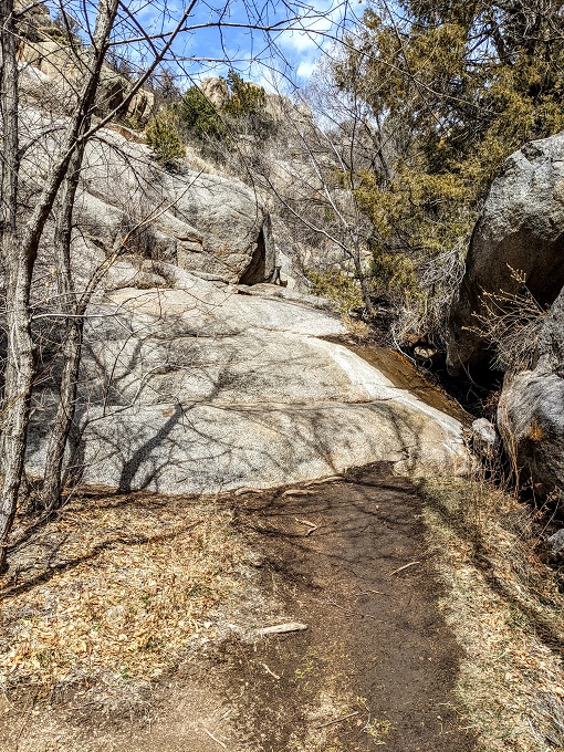
The trail continues up a gradual incline towards some interesting rock formations.
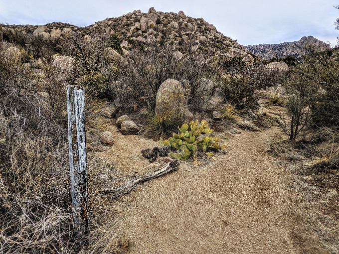
At this point you can’t really take a wrong turn, but there’s a trail marker or two confirming that you’re on the Domingo Baca Trail.
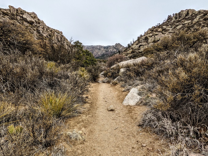
The trail continues on and takes you into the Domingo Baca Canyon.
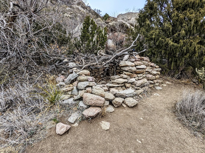
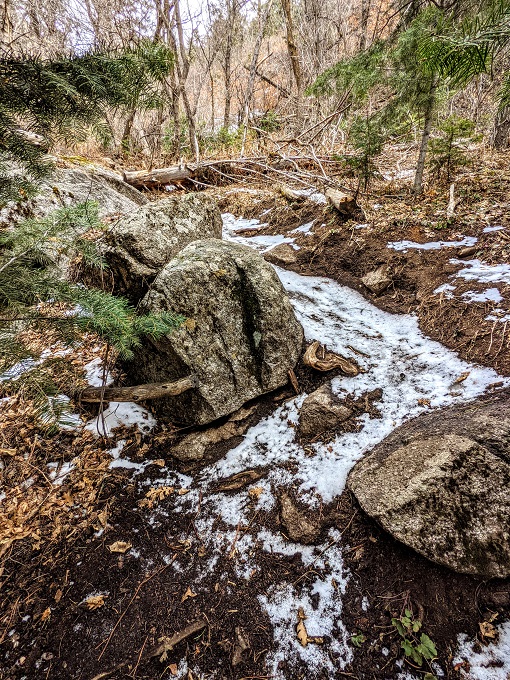
The trail isn’t too strenuous at this point (although it us uphill continually) and passes a makeshift stone shelter (or semi-shelter).
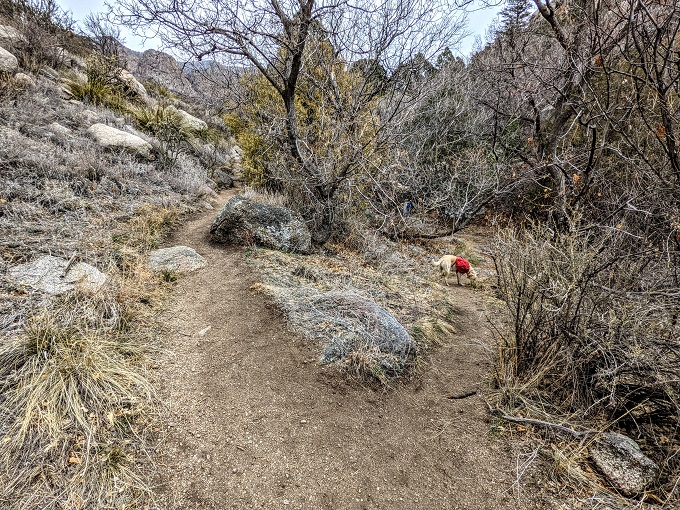
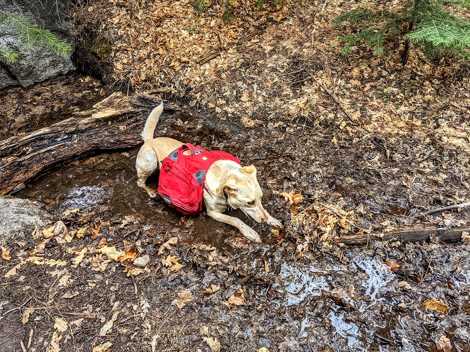
There was a lady out hiking with her dog along the trail who was very helpful. She mentioned that there were a couple of sections where it was easy to take the wrong path, so she let me know which way to head.
For example, when you reach the section below, you need to take the path off to the right rather than the left. I’m not sure where the left side leads – perhaps it meets back up with the trail further on, but I took her advice and turned right.
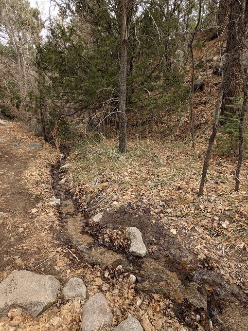
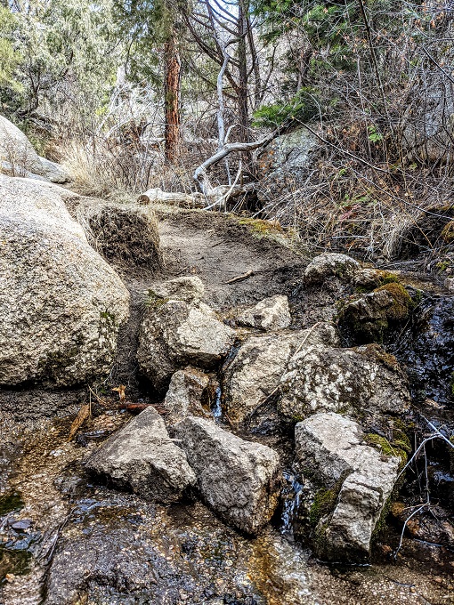
There was a stream running through the canyon which the trail follows alongside and crosses over at times. I imagine in the summer it dries up, but I hiked the trail in March 2021 soon after there had been snowfall, so it was still fairly active.
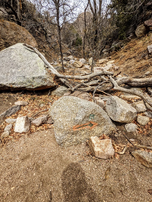
The fellow hiker also gave me a heads up that when I reached the point in the photo below that I needed to head up the trail to the right. The rock in the photo below has an orange arrow pointing to the right indicating where you need to go and there were some branches placed across the path behind it.
However, apparently the branches aren’t always there and so it can be easy to miss the orange arrow and continue walking into the canyon behind. If you’re tracking the route on Google Maps you’d presumably soon notice if you ended up off the trail, but this prevents you from having to turn back.
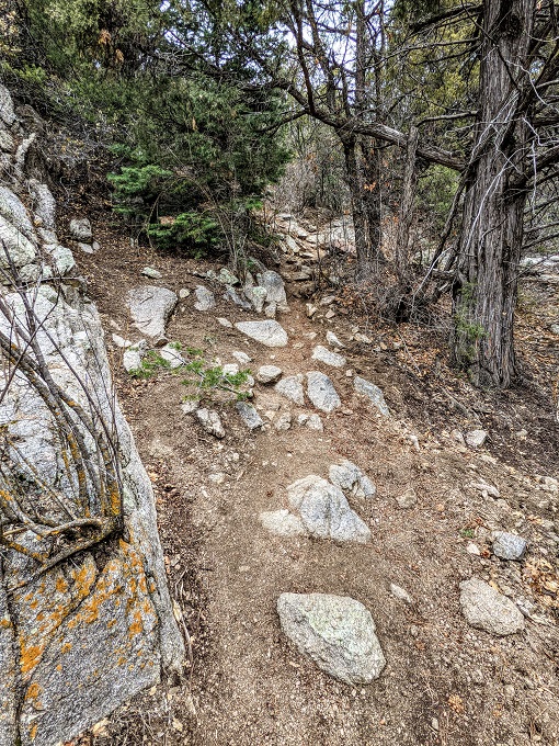
The trail is rated as difficult for several reasons. It’s already at high altitude and the trail is pretty much relentlessly uphill, plus there are a lot of rocks to traverse along the way.
Even if you have good grip on your hiking boots, be careful on the trail as there are some places where it’s easy to misplace your footing. For example, even though the rock in the photo below wasn’t wet, it was very smooth and I slipped over while walking up it.
As mentioned earlier, the Domingo Baca Trail crosses back and forth over the stream and so there are some wet, slick rocks you might need to cross depending on how much water is in the stream when visiting.
The other hiker wasn’t planning on hiking the entire trail, but her dog was making the most of their outing as he had a wonderful time playing in the stream, eventually settling down in the muddiest section he could find.
The trail continues uphill, seemingly getting more steep as it goes. I normally go hiking with our dog Truffles, but she stayed back at the hotel with Shae for this one as I wasn’t sure quite how difficult the trail was going to be. In hindsight, she could’ve easily done it as she hiked the Pino Trail with me and that one was harder going, but it was probably for the best because it meant that she wouldn’t feel the need to be disrespectful and mark the crash site.
It wasn’t until hiking the Domingo Baca Trail that I realized how much I relied on her for pacing myself. She always wants to stop and sniff everything which means every hike takes longer, but pauses are naturally built it. I therefore had to pace myself much more and stop and take several breathers on the hike, with more frequent breathers the higher I ascended.
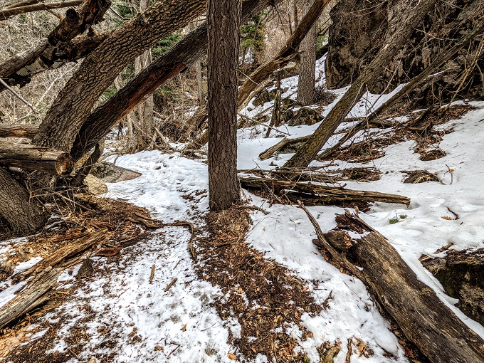
At about the 2.75 mile mark there was a noticeable temperature drop, so it perhaps shouldn’t have been too surprising that there was still some snow on the ground. The hardest parts of the Pino Trail were the long stretches of ice and snow I had to hike without spikes, so I was a little concerned when I turned a corner and saw this.
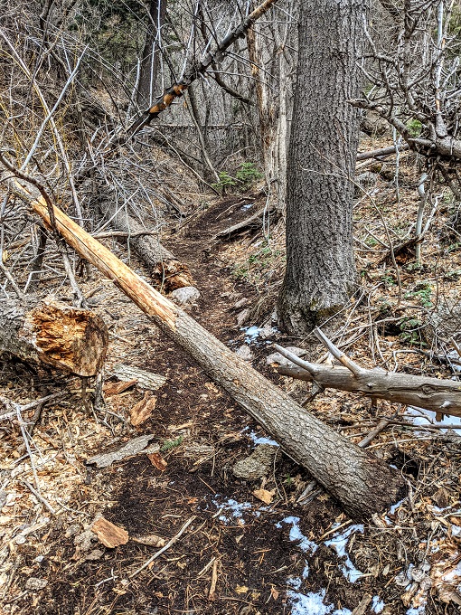
That snowy section was short-lived and wouldn’t be an issue on a summer hike, but there were other obstacles to come. As the trail progressed, there were several downed trees which had to be crawled under or clambered over.
The trail once again got a little more snowy, but that didn’t last for long and wasn’t too slippery.
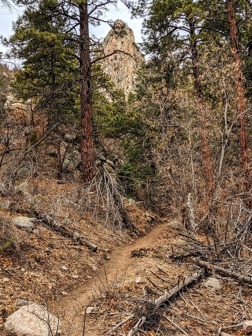
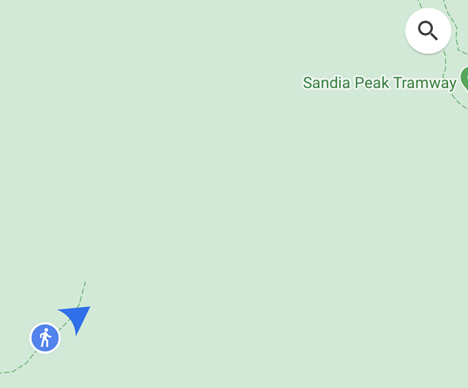
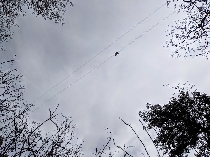
The trail heads ever closer to the mountains and cliff face, with the Sandia Peak Tramway running overhead.
If you do this hike and track your progress on Google Maps, you’ll notice that shortly after the point in the trail shown in the photo above, the trail seems to come to an end which is after 3.25-3.5 miles or so (depending on which route you originally took through Elena Gallegos Open Space).
When you get to that point, you’ll still not have come across the TWA 260 crash site. I’d thankfully seen online before setting off on the hike that you have to continue another half mile or so beyond what seems to be the end of the trail on Google Maps, otherwise I probably would’ve figured that I’d somehow missed the wreckage.
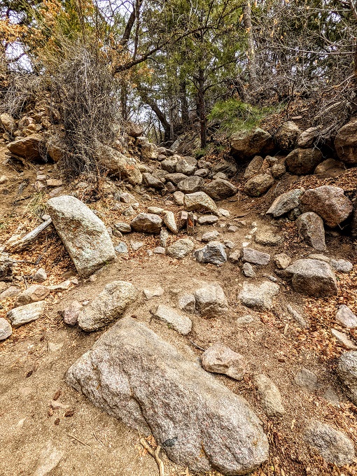
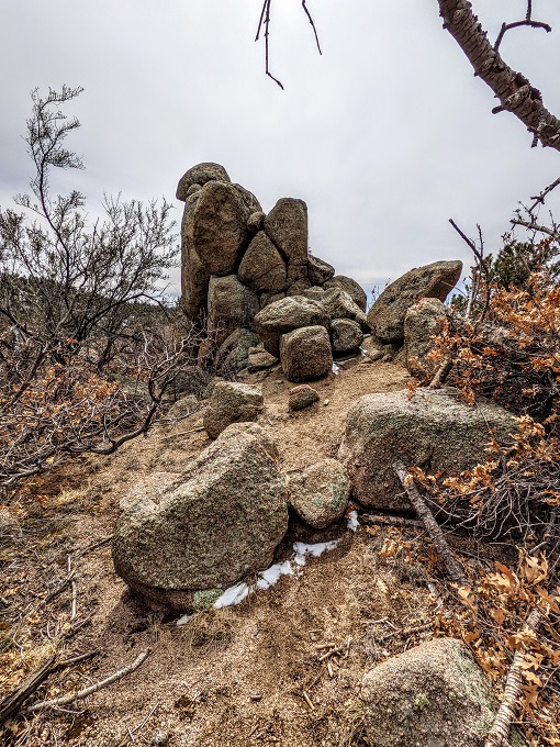
Keep following the trail and you’ll pass this rock formation.
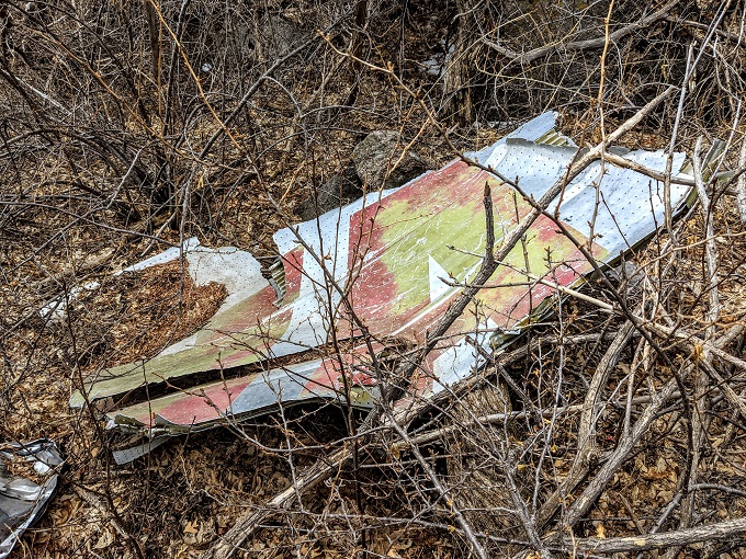
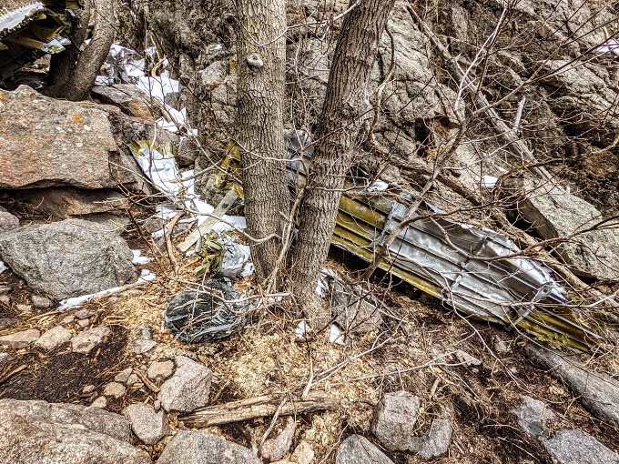
About half a mile after what Google Maps suggested was the end of the trail I spotted the first piece of wreckage behind a boulder.
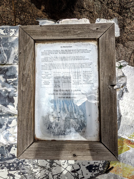
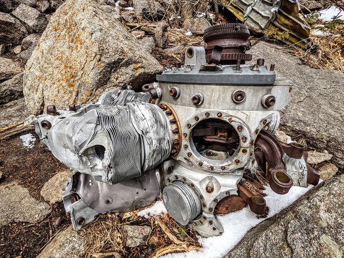
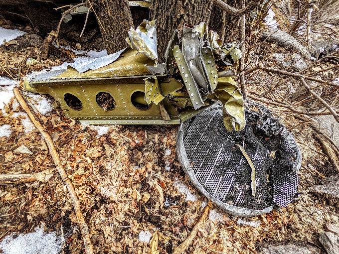
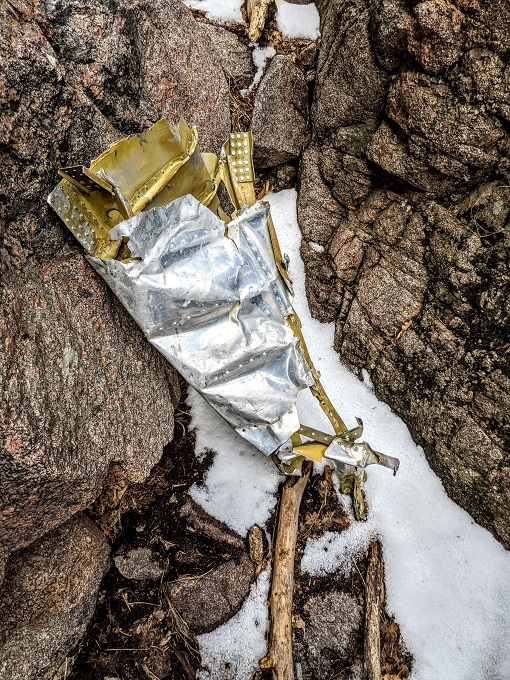
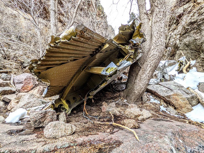
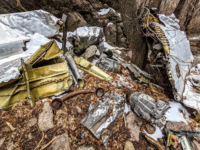
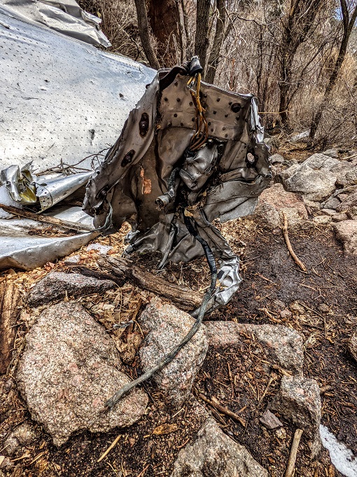
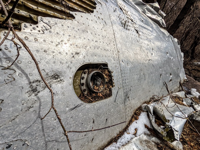
Just a little further up is where the bulk of the wreckage can be found, with a memorial mounted to it which provides more information about the crash of flight TWA 260.
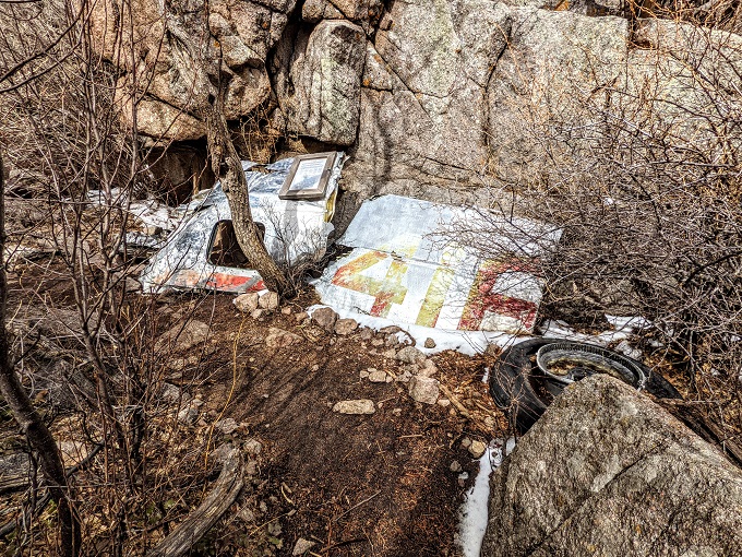
The Domingo Baca Trail seemed to end here, so I just wandered around the site to take it in.
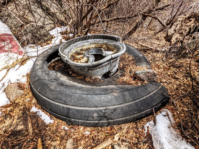
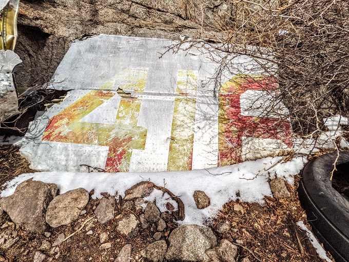
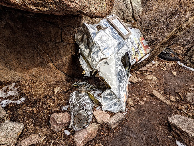
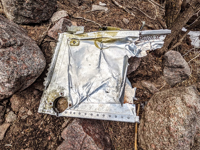
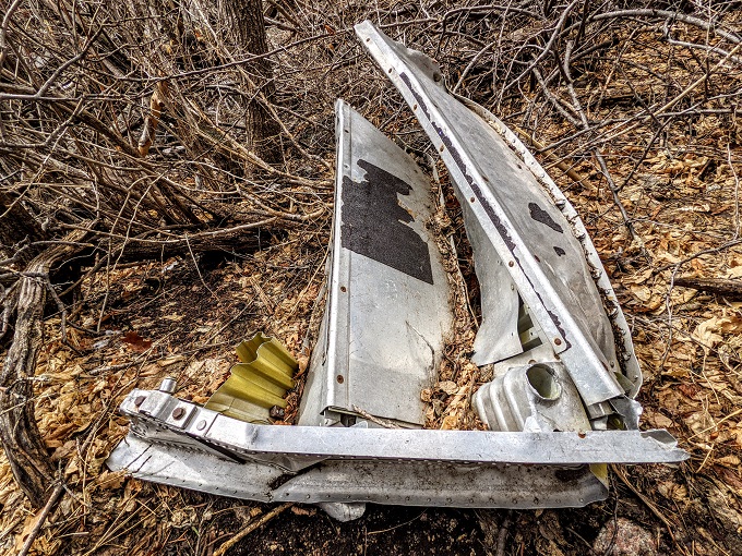
These photos might make it seem like there was a lot of wreckage remaining, but there actually wasn’t as much as you would expect. Although the plane was left on the mountain, air accident investigators would’ve had to recover some of the wreckage to try to determine the cause of the crash, while it wouldn’t surprise me if some hikers had taken pieces of the TWA 260 wreckage over the years seeing as it’s been sitting on the mountain for more than 65 years.
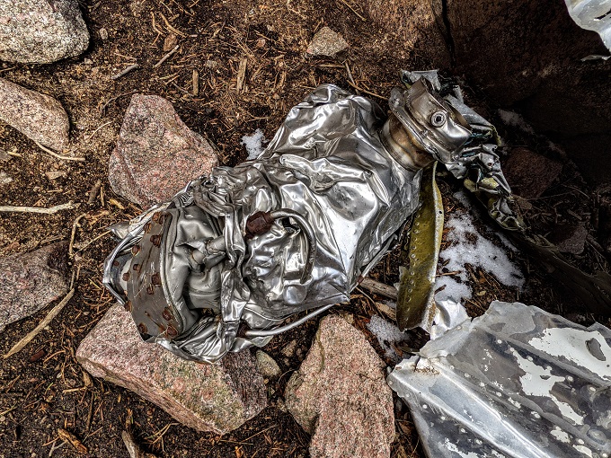
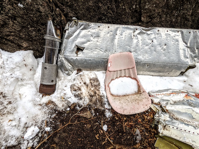
The most poignant part for me was seeing this single plastic seat on the ground.
Being so high up in the mountains meant that the crash site was silent other than the sound of the wind and the Sandia Peak Tramway running straight overhead.
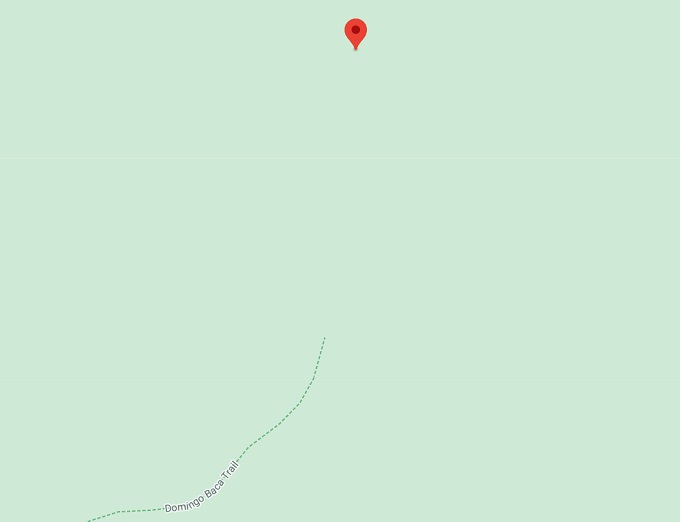
As you can see on the screenshot below, the crash site ended up being pretty much north of the end of the trail on Google Maps, although it’s a winding route to get there.
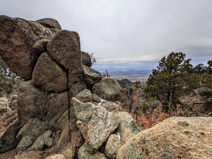
It was about 3pm by this point and I was hungry as I hadn’t had lunch yet, but it didn’t feel appropriate to stop and eat at the crash site, so I headed back down to the rock formation about a quarter mile back down the trail.
It was the perfect spot for lunch because there were comfortable rocks to sit on and provided great views looking out over Albuquerque. It was a little windy though, so I was grateful that I’d brought a warmer jacket to wear while eating.
For as difficult as the hike was on the way up, the hike on the way down was far easier. Although there are some steep parts where you have to be careful not to pick up too much momentum while going downhill, it wasn’t too hard going.
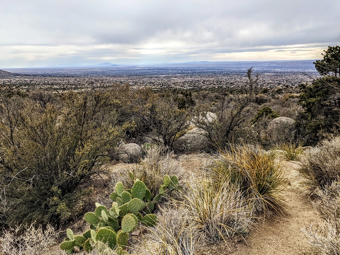
The views while heading down continued to be lovely.
Final Thoughts
The hike up the Domingo Baca Trail is a fairly brutal four mile hike up (and a much easier four miles back down), but it was worth it to visit this sad but fascinating piece of aviation history.
If you hike the trail in warmer weather, there is some welcome shade along the way, but you’ll want to bring plenty of water with you.
Interesting read, and looks a decent hike. I imagine you’d be hungry after that.
Yep, my lunch felt like it was well-earned.
Small world! I live in Albuquerque…I found your site tonight while looking up Doubletree amsterdam reviews. Thanks for the reviews!
Thanks!
Do you have the GPS coordinates of the crash site? What time did you leave? And get back to parking area?
Assuming that Google tracked my exact location correctly, the GPS coordinates of some of the wreckage were at 35°11’41.6″N 106°26’32.9″W – it was all in that general area, so that should hopefully help you get there more easily once you’re nearby.
Looking back at the timestamps of the photos, it looks like I set off about 12:30pm and got to the crash site about 2:45pm. I think I’d had lunch along the way and hadn’t been rushing up, so someone in good shape who doesn’t stop for lunch would be able to do it much faster.
I’m not sure what time I got back to the parking area though as I didn’t take many photos on the way down or when I got back. I can’t imagine it took much more than an hour back down though – maybe less?