I enjoyed all the hiking opportunities we had while in Los Alamos, so I wanted to continue that when we moved on to Albuquerque for 12 days.
After taking a look at the options online, I decided to hike the Pino Trail. It’s a nine mile out and back trail (i.e. 4.5 miles up and 4.5 miles down) which was pretty hard going, especially because of the recent snow.
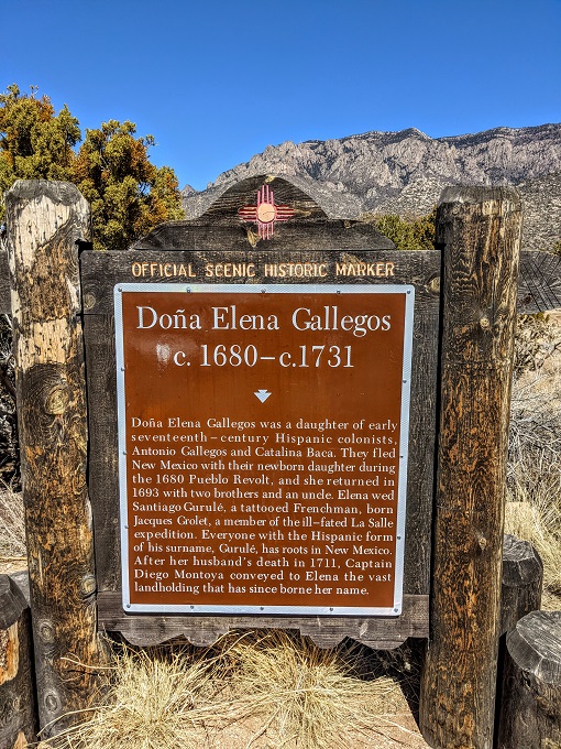
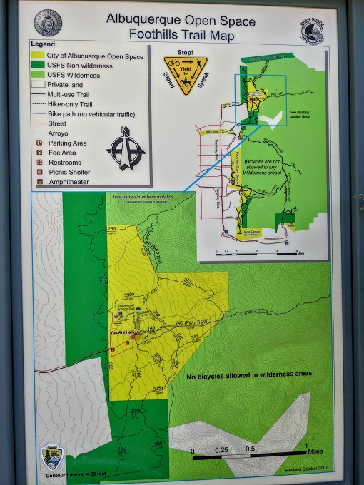
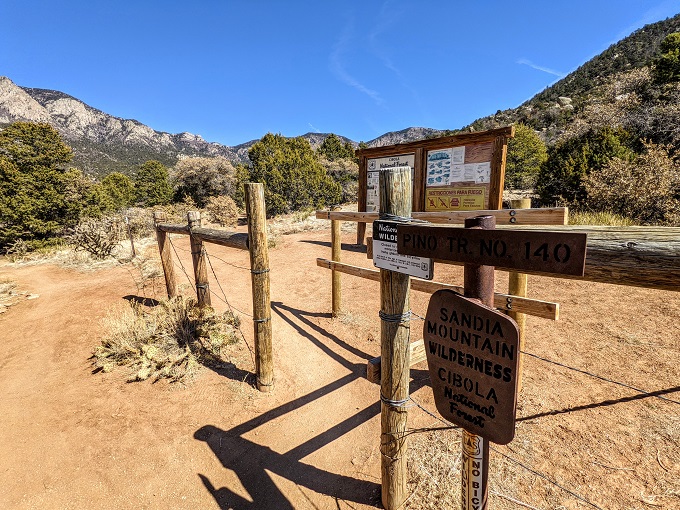
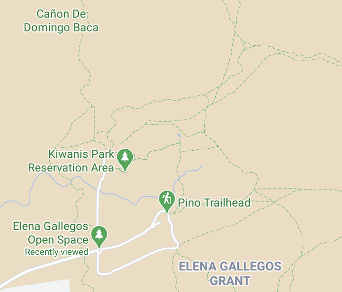
The trail starts at Elena Gallegos Open Space and leads on to Sandia Mountain Wilderness which is in Cibola National Forest. There was a $1 entry fee when I visited; I think it’s $1 on weekdays and $2 at the weekend, but I didn’t take a photo of the price when entering and the couple of times I visited it was midweek and so I only ever had to pay $1.
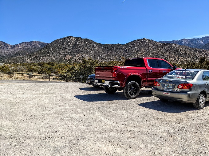
When entering the park, you turn right and head up the road until you get to the Pino Trailhead. There are three parking areas on a loop, so just park wherever you see a space.
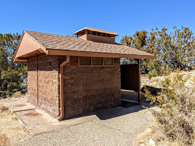
The trailhead has restrooms as well as a pump to fill up your water if needed.
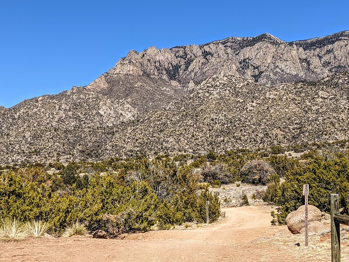
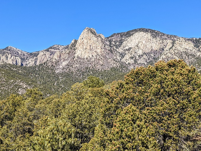
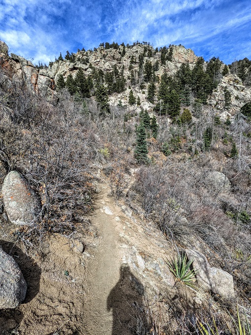
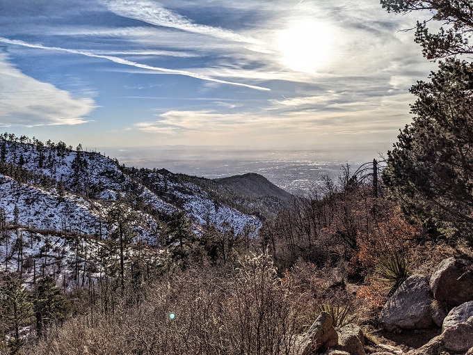
The first mile or so of the Pino Trail takes you through the park, with the trail being clearly marked along the way. Although it’s not too steep, this initial section is all uphill and doesn’t provide any shade. What it does provide is some lovely views of the Sandia Mountains.
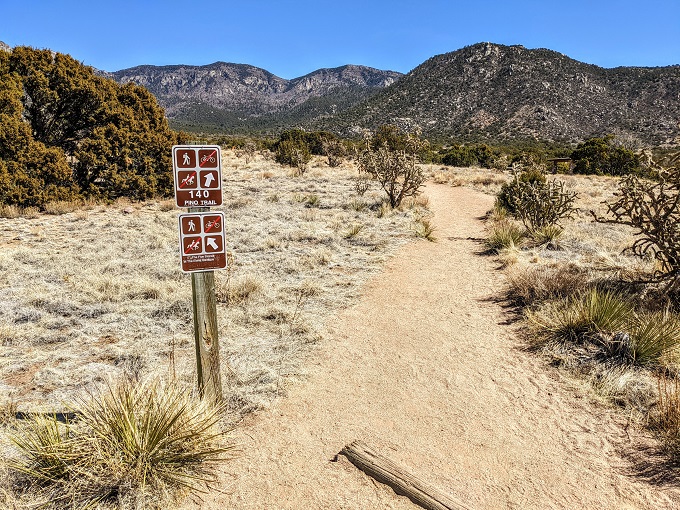
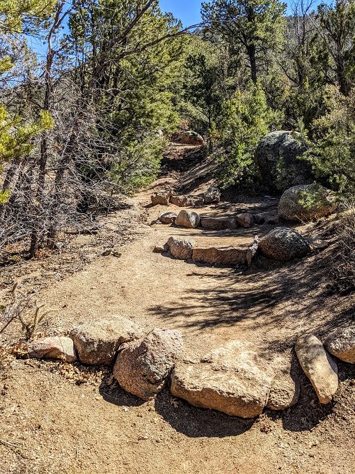
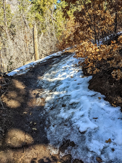
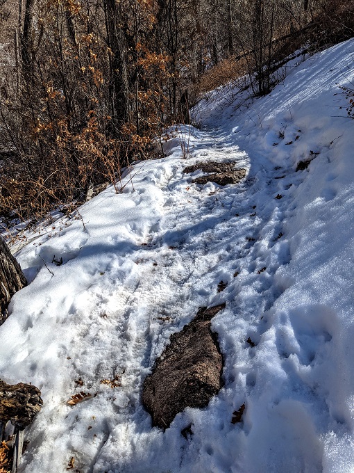
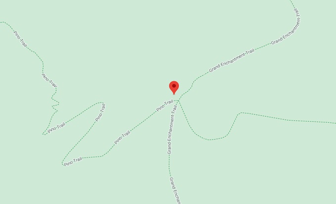
After about a mile you’ll come to the section in the photo below which is where the trail really gets going. There was a guy sitting on a bench nearby who gave me a heads up that there was snow about halfway up; what I hadn’t appreciated was how much tougher that would make the trail.
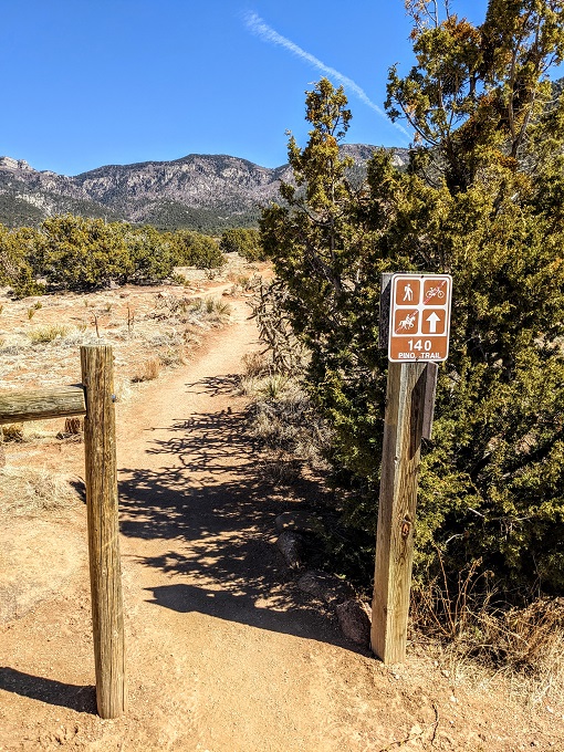
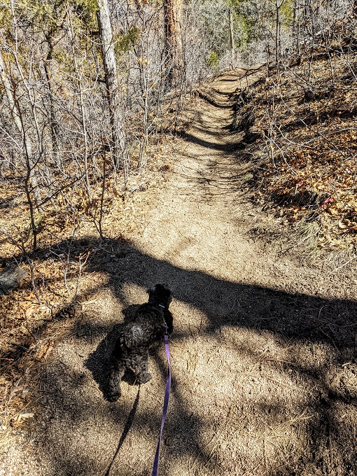
One of the nice things about the Pino Trail is that it’s very easy to find your way up. I didn’t notice any trail blazes on the trees marking the way, but the route seemed obvious to me and I’ve been known to get lost on other hikes!
If you’re concerned that you might get lost, simply make sure that you have Google Maps on your phone. The Pino Trail is mapped out on there and you can follow your route along even if you don’t have any cell signal.
Unlike some hikes where the uphill is tempered by downhill sections, the Pino Trail is almost entirely uphill on the way out.
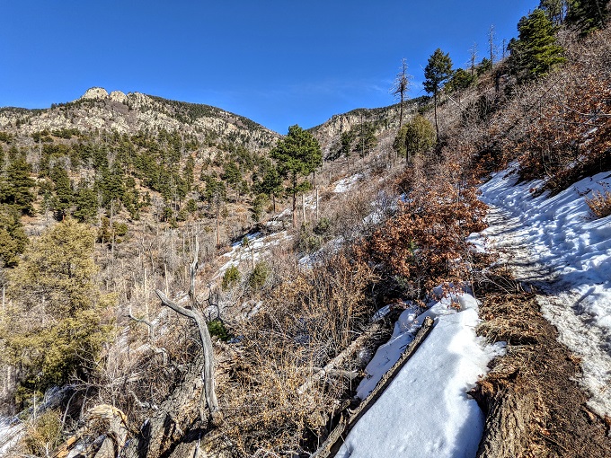
Again though, the mountain views help make up for it.
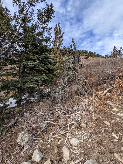
As the guy I’d briefly chatted to earlier had cautioned, about halfway up the mountain snow and ice started appearing on the ground, although it wasn’t too bad at first.
The snow soon disappeared, so I was hopeful we were free and clear.
Alas, I was wrong. As we rounded a corner, the snow and ice reappeared on the trail.
Despite only being small, Truffles initially enjoyed getting to walk through snow again.
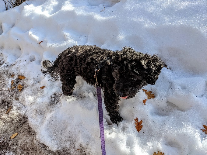
After a while she enjoyed it much less. The snow and ice had turned slushy which seemed to be making her paws too cold. Truffles refused to walk any further in the slush, so I ended up having to carry her for a little while. This was a little precarious as I was having a hard enough time keeping myself from falling over. I still ended up slipping a couple of times while carrying her, but thankfully I tipped to my right into the snow rather than the left which would’ve sent us downhill.
I didn’t have any spikes for my hiking boots as I wasn’t anticipating it being that icy before heading off, so those are something I’ll get in the future if it looks like I’ll be hiking in the snow.
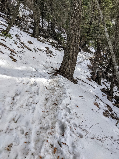
The snow and ice continued for what seemed like a mile from about the 2.5 mile stage. Truffles and I hiked the Pino Trail on March 11, 2021 which was soon after a winter storm had rolled through the area which is why there was somewhat fresh snow on the ground still.
Thankfully there were a few sections which had enough sunlight to be able to melt the snow which meant Truffles was happy to continue walking.
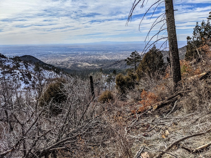
Be sure to look around in all directions as you hike up because you get some great views looking out over Albuquerque.
I don’t know if it was just my legs feeling more tired, the altitude getting to me (the hike starts at ~6,500 feet above sea level and only goes up from there), hunger or the cold, but the final half mile or so of the trail felt brutal.
It wasn’t helped by the fact that it felt like it got more steep towards the end (as evidenced by all the switchbacks), plus the snow and ice returned. The one saving grace was that the temperature had dropped more due to being up this high, so the snow was more compacted than slushy which meant Truffles was happy continuing to walk on it.
The Pino Trail is likely brutal to hike in the summer too due to the heat, but a nice feature of the trail in hot weather is that there’s a fair bit of shade along the way.
At this point I was closely following my progress on Google Maps and was relieved to see that I was almost at the end. The Pino Trail ends where it meets the Grand Enchantment Trail.
The end of the trail seemed to be where there was half a dead tree.
There was a short path covered in snow continuing upwards, so I think that’s what connects up with the Grand Enchantment Trail. That’s a trail that runs 770 miles from Phoenix to Albuquerque, so I wasn’t really feeling that at that point 😉
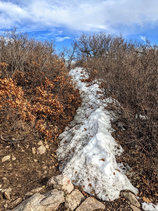
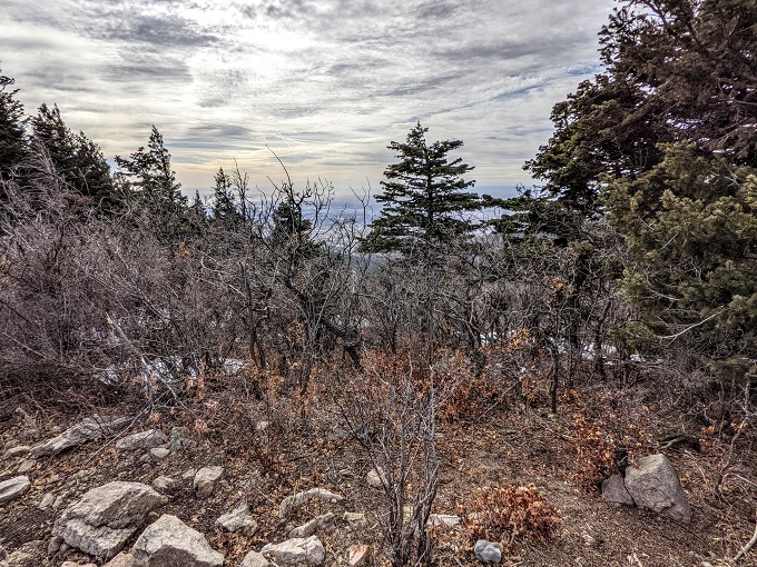
Although the views on the way up were wonderful, the view from the end of the Pino Trail wasn’t quite as impressive due to all the trees in the line of sight.
The temperature had dropped quite significantly up there, in large part due to how windy it was. Truffles and I were both hungry though (it was 4pm and I’d not had lunch yet), so we tried to find a little shelter from the wind behind a tree and both ate some food.
We didn’t spend long up there; part of the reason was due to how chilly it was, but I was also concerned about the daylight situation. The clocks weren’t going forward until the following weekend, so sunset was due to be at 6:11pm. That gave us two hours to get back down which I knew would be pushing it, especially because we’d have to be careful not to slip on all the snow and ice.
Some views were just too good to ignore though, so I still ended up taking a few photos on the way down.
For as quickly as we were hiking down, the sun seemed to be setting even more quickly.
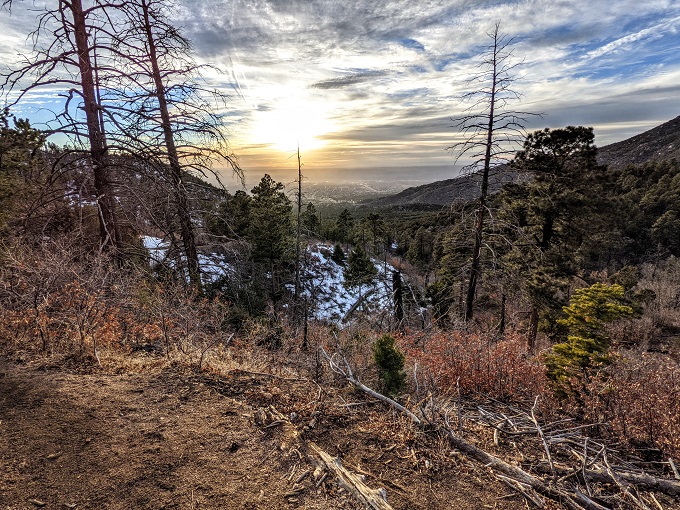
We made it past all the icy sections before sunset which was my biggest concern, so I got to enjoy the pink/red hue on the Sandia Mountains as the daylight started to fade.
The pink and red soon turned to darkness. My phone takes pretty good pictures in the dark, so the photo below makes it look like there was more daylight towards the end of our hike than there actually was.
We’d managed to hustle down the mountain in pretty good time which meant it was only the last mile or so of the hike where it was much darker.
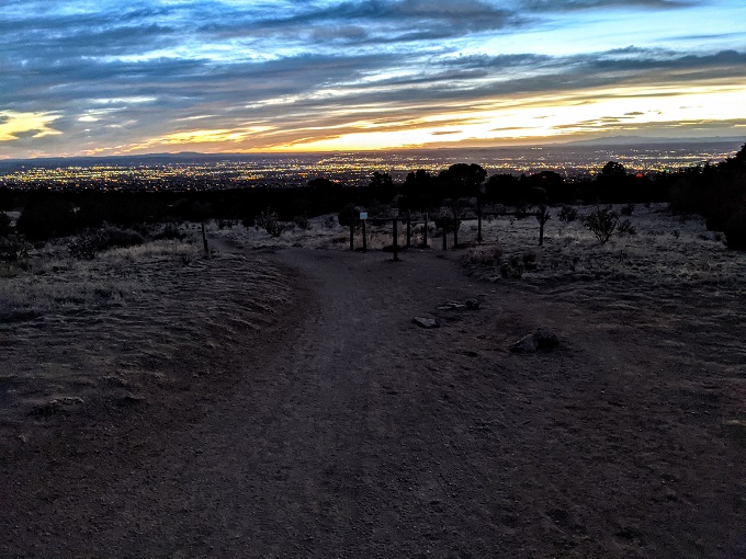
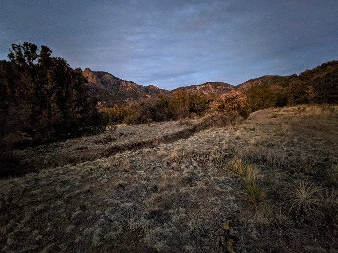
It quickly got even darker than what’s seen in the photo above, so the last half mile or so through Elena Gallegos Open Space was done using the flashlight on my phone as it was simply too dark to see where we were walking.
The trails through Elena Gallegos Open Space are also all on Google Maps, so I was able to follow my way back to our car at the Pino Trailhead. I still managed to take a wrong turn at one point in the dark, but thankfully noticed before we went too far in the wrong direction.
Final Thoughts
The Pino Trail is a fairly difficult trail in Albuquerque, mainly due to the altitude and the fact that the ~4.5 miles out are pretty much all uphill.
In the winter and early spring the trail can be even harder due to snow, so learn from my mistake of not having spikes on my hiking boots.
In the summer that’s obviously not going to be an issue, but having enough water will be. Although there’s a reasonable amount of shade on the trail, you’ll still want to bring plenty of water as you’ll need it.
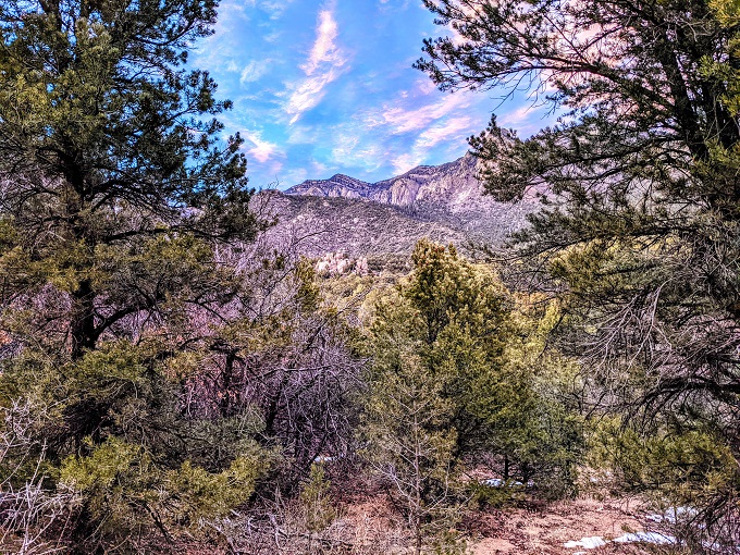
[…] Domingo Baca Trail, so I headed up there during our stay in Albuquerque last month. Similar to the Pino Trail, you head to Elena Gallegos Open Space and park at the Pino Trailhead. The entry fee is only $1 or […]