The La Luz Trail was hard, but it was worth it.
When we visited Albuquerque earlier this year, I hiked the Pino Trail (tougher than expected because of snow I wasn’t expecting) and the Domingo Baca Trail which was particularly interesting due to plane crash wreckage at the end of the trail.
Towards the end of that time in Albuquerque I learned about the La Luz Trail. The La Luz Trail takes you up the Sandia Mountains (where both those other trails are) and across to the Sandia Peak Tramway. From there you can either hike back down or you can ride the tramway down. This was a trail I was determined to hike, so when we returned to Albuquerque for the International Balloon Fiesta, I decided to take the challenge.
I wasn’t sure if my legs would have anything left in them after hiking up the mountain as it’s ~7.5 miles up. As a result, I bought a one-way tramway ticket the night before and headed to the trailhead the next day.
I made two mistakes at this point. The first is that I got a bit of a later start that day and so didn’t get to the trailhead until almost 12pm. That mistake would come into play later that day.
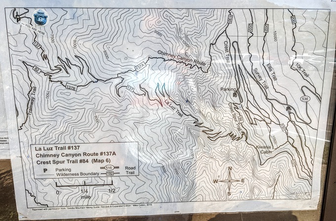
Parking
The other mistake is that I parked in the wrong parking lot. I used Google Maps to direct me to the trailhead and it did that correctly – sort of.
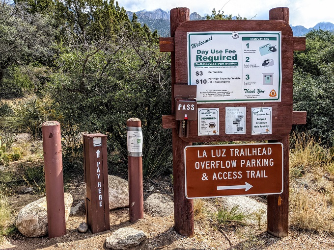
What I hadn’t paid attention to when arriving were the words ‘Overflow Parking & Access Trail’. Overflow parking meant that where I parked wasn’t at the actual trailhead.
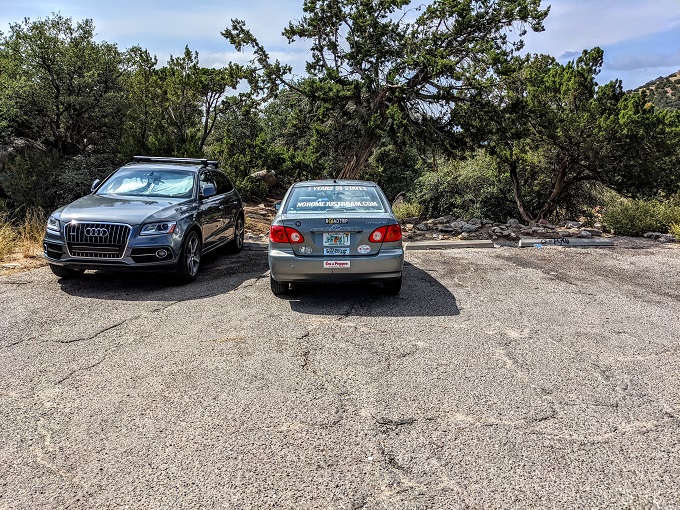
There was a trail next to the parking lot, so I took that up. It wasn’t until I reached the main trailhead parking lot that I realized my mistake. It wasn’t a huge issue, but it’s 0.3 miles all uphill from the overflow parking lot to the main parking lot, so that’s another 0.3 miles your legs need in them.
To help ensure you don’t make the same mistake, this is the parking lot location on Google Maps that you want when hiking the La Luz Trail.
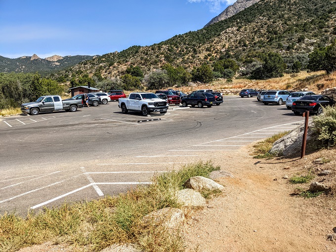
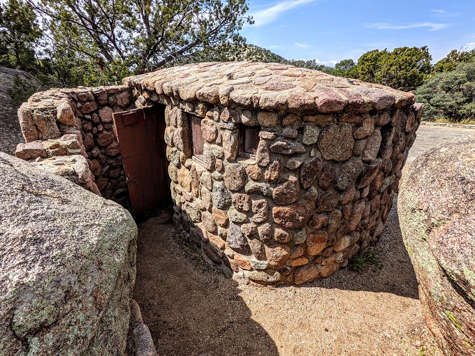
Both the main and overflow parking lots have a restroom you can use before setting off.
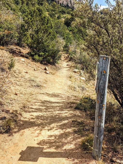
La Luz Trail
The main parking lot also has a trail map. As you can see, the La Luz Trail has a lot of zigzagging indicating that there are a lot of switchbacks which means it’s going to be a pretty steep climb.
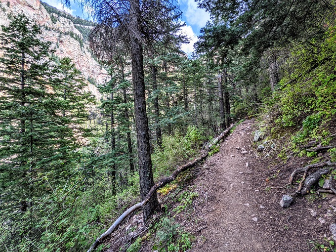
And that climb started straight away.
I did this hike on September 27, 2021 and it was the perfect day for it. There had been heavy storms a couple of days before, but that had cleared and it was sunny and 74° that day.
It felt warmer than 74° though, so I was grateful for the rare spot of shade along the trail.
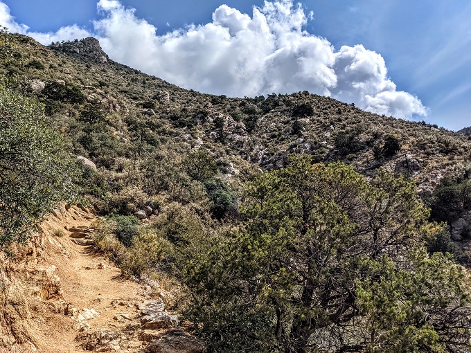
I imagine the La Luz Trail might be a little harder to keep track of in the winter when there’s snow on the ground, but it was clear which way to go along the way. There were also the occasional trail markers, but they were few and far between.
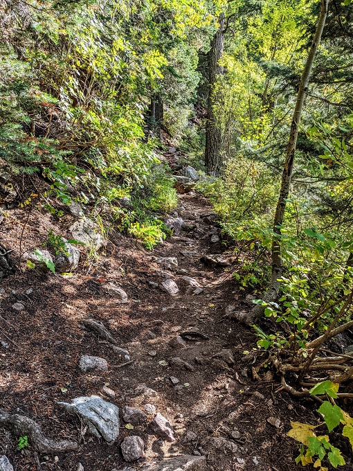
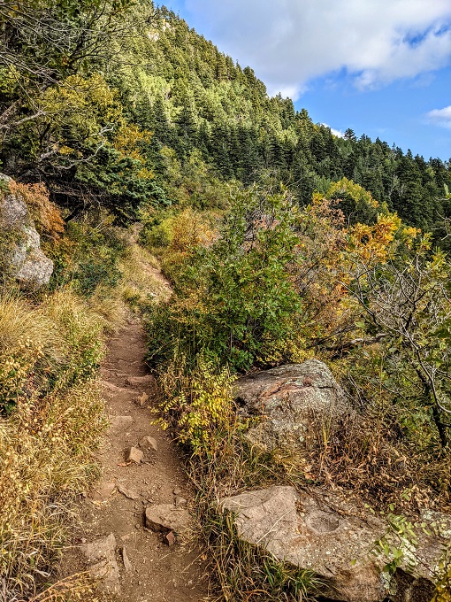
Seeing as you’re hiking up a mountain, there are a lot of switchbacks along the way. Some of those have large rocks where you can sit and take a breather; there are also many other large rocks along the trail where you can rest your legs if needed.
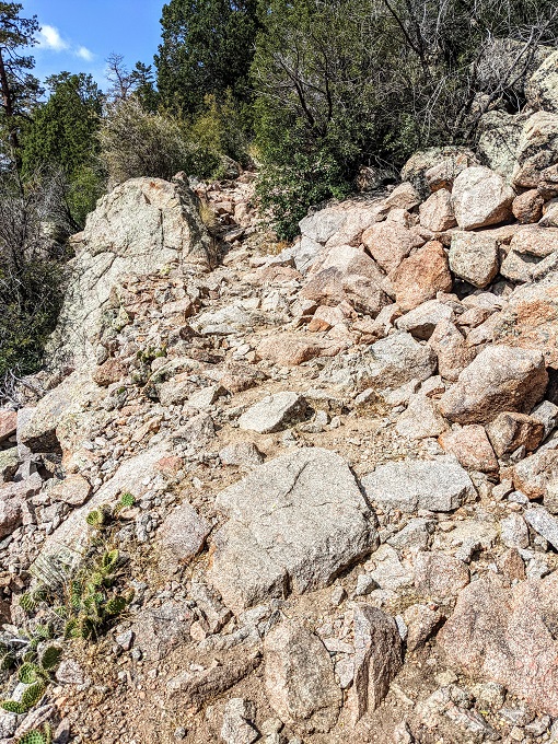
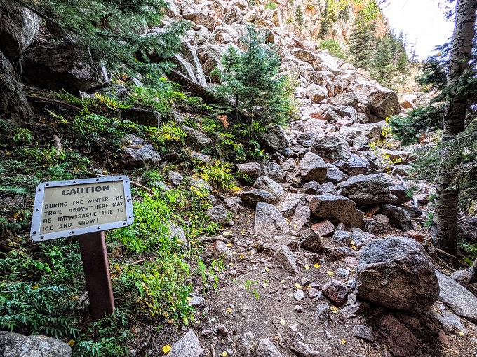
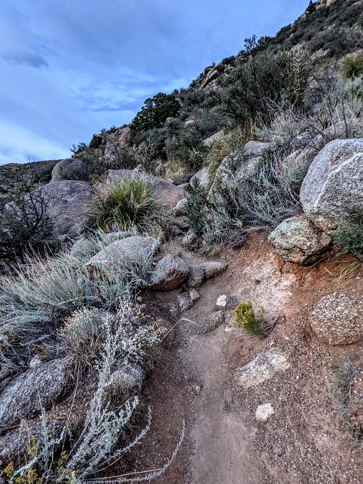
About halfway up the trail there was a section that looked like there had been some kind of rock fall. This isn’t the only one you’ll come across when hiking the La Luz Trail.
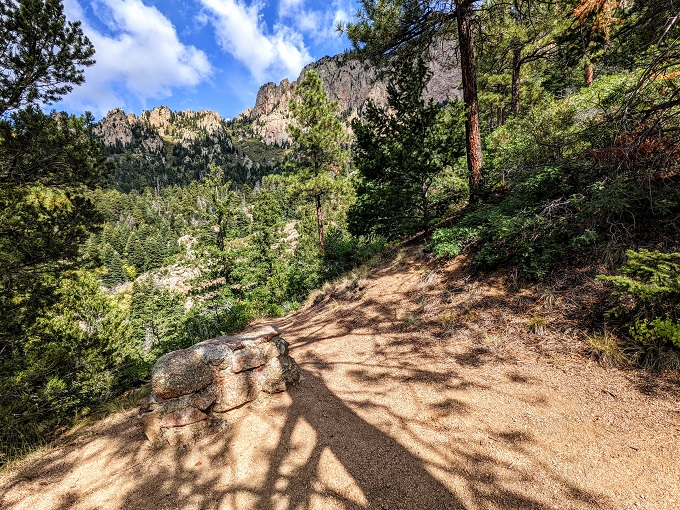
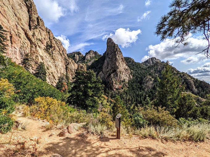
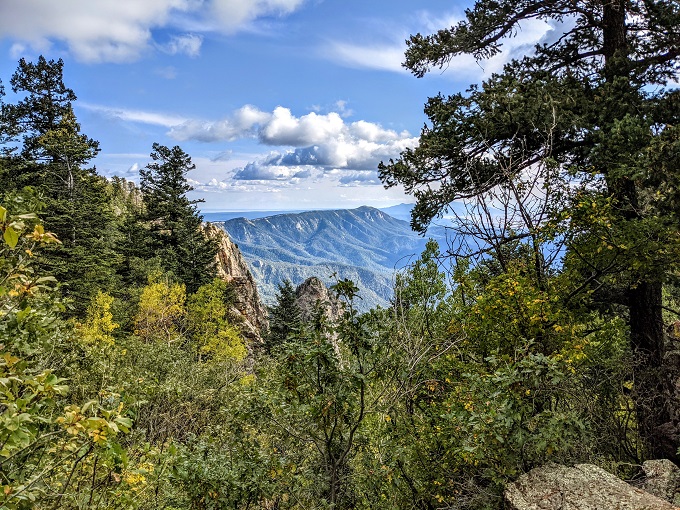
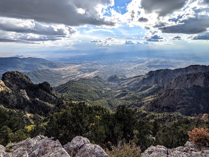
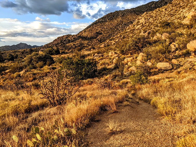
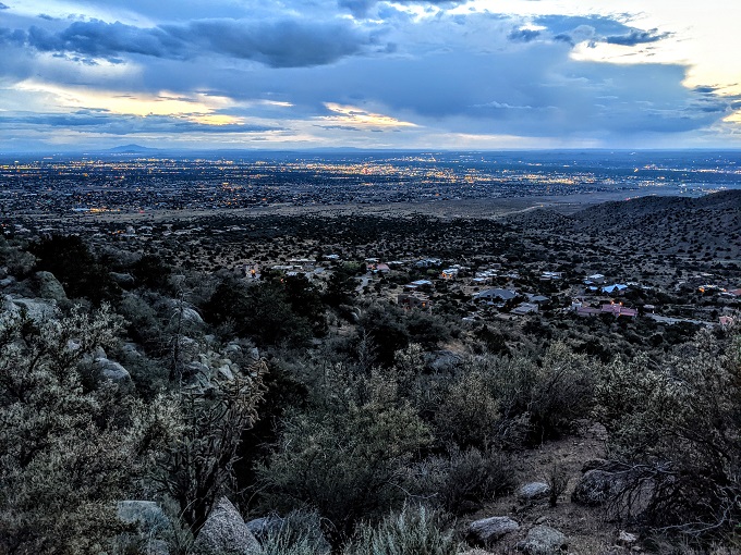
Try not to get too focused on the trail itself though. Be sure to stop and enjoy the views on the way up as they get progressively more beautiful.
After about 5.25 miles (taking into account the extra 0.3 miles I’d hiked from the overflow parking lot), there was a sign letting me know how much further I had to go.
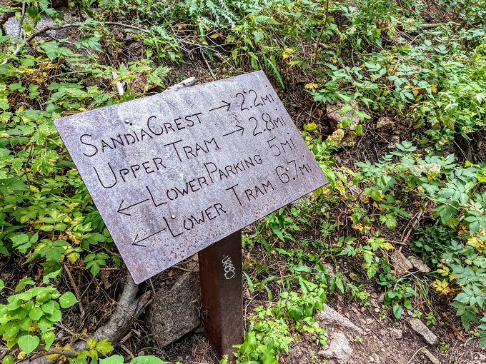
The 2.8 miles to the Sandia Peak Tramway weren’t going to be easy though. Having already hiked 5.25 miles uphill, my legs were getting tired.
The elevation didn’t help matters either. The La Luz Trail starts at about 6,600 feet above sea level which is about 1.25 miles high (higher than Denver, CO), so the air is already thinner. By the time you reach the tramway, you’re at 10,378 feet which is almost two miles above sea level.
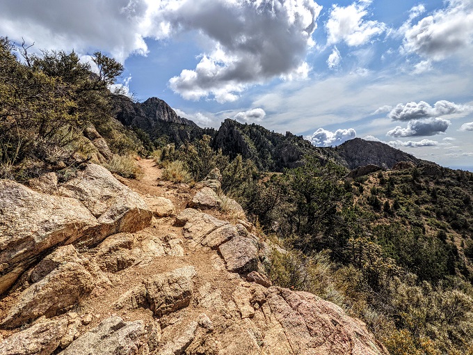
You then have rocks to clamber over. I don’t know if this was caused by a regular rockfall or if it had been dynamited (perhaps during construction of the tramway), but be prepared for a non-flat hiking surface. Although it doesn’t really look it in the photo below, it was fairly easy to identify where the trail continued, although I’m glad I didn’t have to contend with ice and snow!
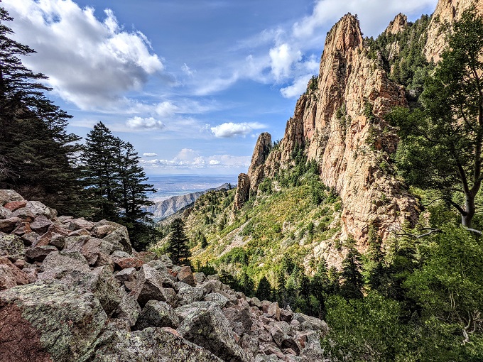
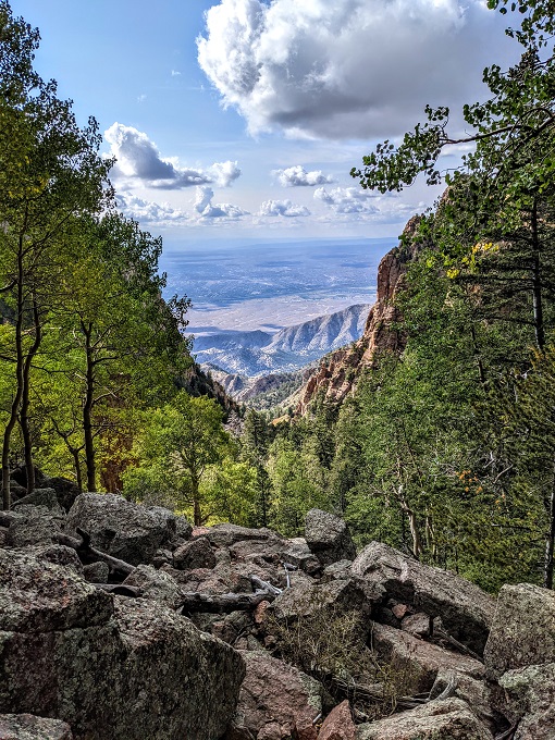
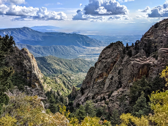
The extra effort needed to clamber over the rocks is partially offset by the continual picturesque views.
Every so often my legs would feel like they didn’t want to go on. It was always at that point that the La Luz Trail seemed to have mercy and threw in a flat or non-steep section. The respite never lasted long, but it was always gratefully received.
Switchbacks mean there are a few sections where you have to clamber over the rockfalls, but those sections are always paired with lovely views of Albuquerque below.
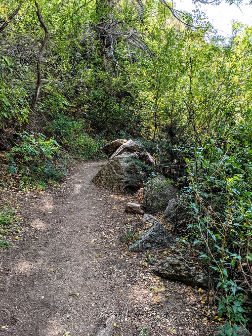
The trail continues ever upwards, throwing in a little shade here and there.
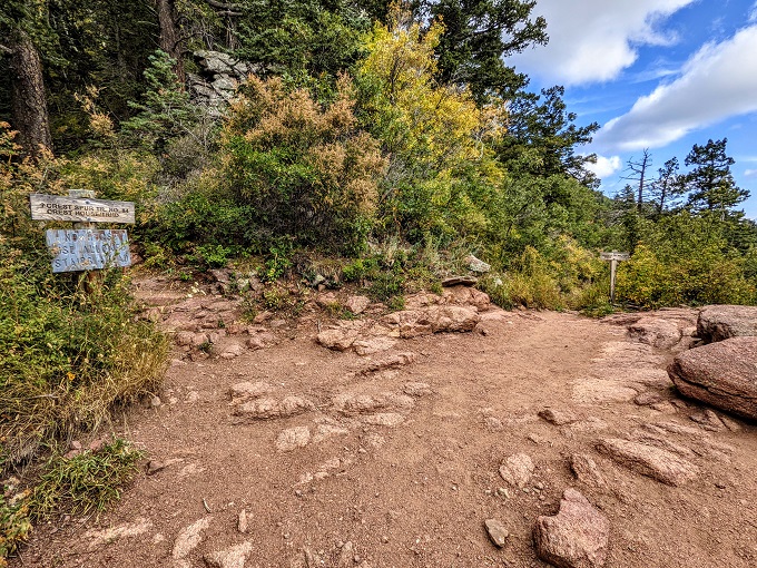
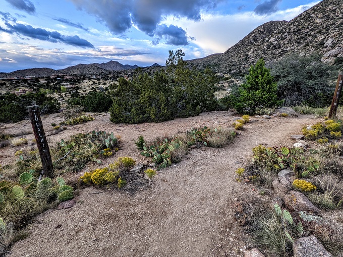
The sign earlier on the La Luz Trail advised that there were 2.2 miles to Sandia Crest and 2.8 miles to the Sandia Peak Tramway. However, that doesn’t mean that you reach Sandia Crest on the trail and then only have 0.6 miles to go.
Instead, there’s a split in the trail. You can take the trail up to the left to Sandia Crest or continue straight ahead to the tramway. I wanted to check out Sandia Crest, but it was 4:30pm by this point and with sunset being at 6:56pm that night, I was concerned about how long it would take to get up there and back, then on to the tramway and eventually back to the car. Not hiking up to Sandia Crest ended up being a wise decision for reasons that I’ll share shortly.
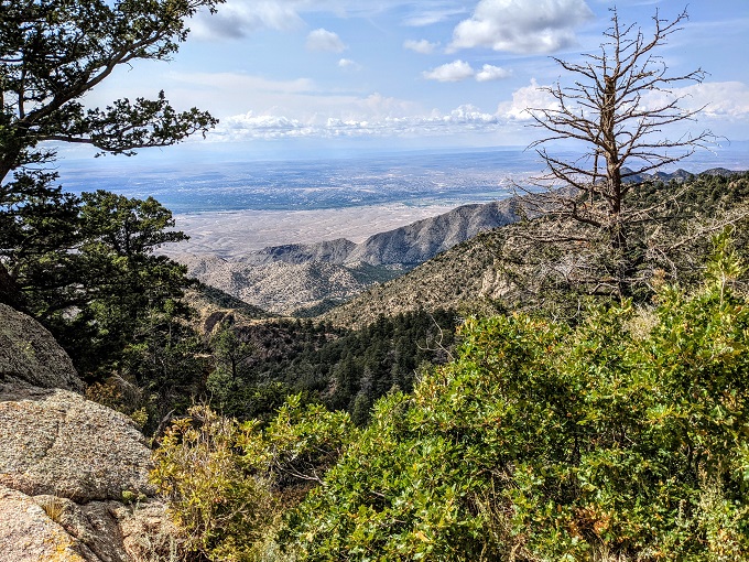
At this point it was possible to see the Sandia Mountains continuing in the distance.
The La Luz Trail up until this point had been almost relentlessly uphill. From here to the tramway though, the trail was far easier. There’s still a bit of a climb up to the tramway, but the incline is far more gradual and there are several flat parts of the trail along the way, as well as one or two parts that actually go downhill a little.
The trail follows alongside the mountain and there are some sections with views unobstructed by trees. It was at this point that I truly knew that hiking the La Luz Trail was worth the effort. The view in the photo below was particularly stunning.
It was soon possible to see the tramway in the distance.
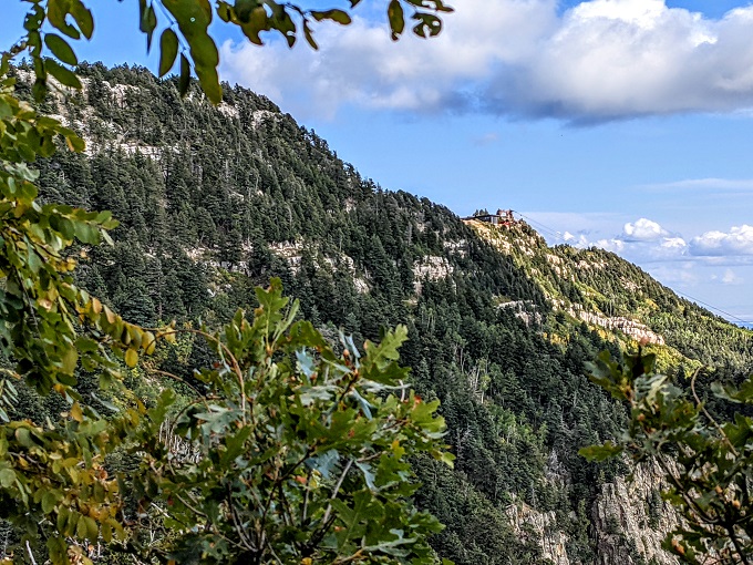
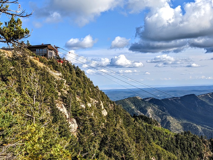
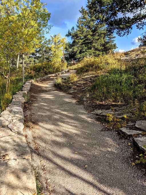
One final paved path led up to the tramway and signaled the end of the La Luz Trail.
After hiking just over eight miles, my legs were glad that I’d finally made it to the top.
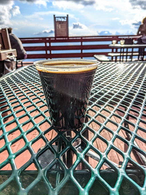
I decided to reward myself with a stout from the bar at Ten 3 Restaurant at the top of the mountain. At this point I had a decision to make. Should I hike back down or take the tramway down. It was about 5:15pm at this point and, with sunset at 6:56pm, I thought it’d be too risky hiking back down as I knew there was no way I’d be able to do 8 miles in about 1.5 hours.
After finishing my drink, I lined up to head back down on the tramway, getting to the bottom at about 6pm. Unfortunately, I hadn’t done enough research about the next stage.
I’d read online that you could hike up the La Luz Trail and take the tramway down. I also knew that there was the Tramway Trail leading from the tramway to the La Luz Trailhead parking lot.
What I hadn’t realized was quite how far it was.
Tramway Trail
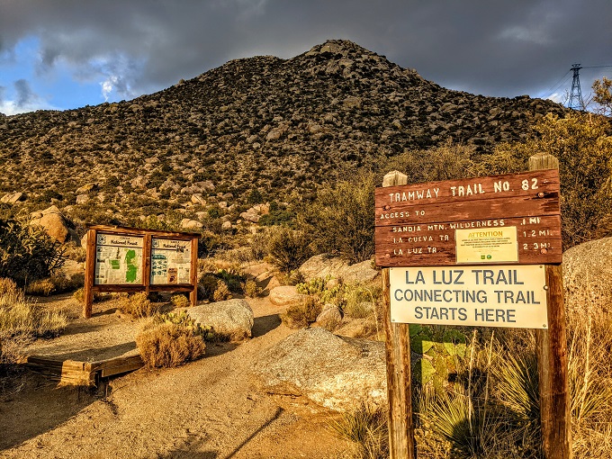
The Tramway Trailhead sign said it’s 2.3 miles to the La Luz Trail. That’s true, but it wasn’t what I expected. I thought that meant it would take me to the La Luz Trailhead, but it didn’t. It led me to the La Luz Trail, with a further distance to go to get back to the trailhead parking lot.
At this point I was getting concerned. When looking up the distance on Google Maps, it said that there were four miles to go. With it being after 6pm and sunset occurring just before 7pm, it was looking like I’d have to find my way back in the dark.
I probably should’ve just gotten an Uber from the tramway parking lot back to our car, but I thought Google Maps might’ve been a little mistaken as it doesn’t always pick up all hiking trails. That’s happened to me before, so I figured perhaps it was only ~2.5 miles back to the car. If so, I thought it’d be possible to get back before it got too dark.

It turns out that Google Maps was right and I was wrong. It was indeed four miles back. This wasn’t much fun for several reasons. For starters, my legs were already toast after 8 miles uphill – hiking another four miles hadn’t been on the agenda. That was made harder by the fact that the first three of the four miles were uphill, with only the final mile back to the parking lot being downhill.
The Tramway Trail isn’t always very well-marked either. There were a few points along the trail where it wasn’t clear which way I should go. I therefore ended up walking through a gully or wash. Thankfully I didn’t end up too far off the trail – it was obvious from tracking my route back on Google Maps that I’d gone off track.
Sunset came and went, so it got progressively darker. Thankfully there was still some light, but I knew at some point I’d need the flashlight on my phone to continue finding my way. With my battery at 28%, I texted Shae to let her know where I was and that I’d be putting my phone on airplane mode to conserve some of its juice.
I managed to make it most of the way back without needing to use the flashlight, but the last 15-20 minutes or so it was needed.
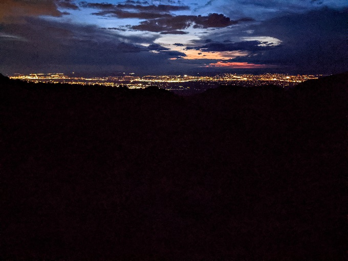
I finally got back to the car at about 8pm – an hour after sunset – with 18% left on my phone’s battery. In hindsight, I wonder if I should’ve just hiked back down from the tramway seeing as I probably would’ve arrived back at a similar time and at least it would’ve been eight miles downhill rather than three miles up and one mile down on the Tramway Trail.
Then again, I probably would’ve hit the rockfall sections just as it would be getting dark, so I guess it was good I didn’t risk losing my footing clambering over those. As it was, the hike back from the tramway had been just over four miles (accounting for the fact that I had to go further back to the overflow parking lot), so by the time I was done I’d hiked 12.25 miles that day. If I’d hiked back down, I’d have been at ~16.25 miles.
When I arrived back at the car, I was relieved to be done, but also glad that I’d had both the opportunity and the ability to hike the La Luz Trail. It was the longest and hardest hike I’ve ever done, but also one of the most beautiful and most satisfying. If you enjoy hiking and ever visit Albuquerque, I’d highly recommend the challenge of hiking the La Luz Trail.
Oooh great write-up; I added this hike to our wish list!
Awesome! In theory the trail is pet-friendly too, although dogs aren’t allowed on the tramway and so Bugsy would have to be able to hike both up and down if coming along with you. I ended up leaving Truffles at the hotel with Shae because she might’ve managed to make it up, but I’d have likely been carrying her down in the dark if hiking the 8 miles down too!
I loved reading about your hiking experience in Albuquerque. Your descriptions really made it come alive for me. Happy travels!
Thanks!
Thanks for the article. I had been wondering how to get to the Tramway at the top of the mountain and now I learned that the trail splits off near the top of the mountain to either the Sandia Crest or to the Tramway. And I also learned that if I park at the La Luz Trailhead and take the Tramway down, I will have to either walk an additional 4 miles back to my car via the mainly uphill Tramway Trail or take an Uber or make other arrangements. So, I may start my hike from the Tramway Parking lot at the bottom of the mountain and hike the Tramway Trail to the La Luz Trail and continue on to the top, but like you detail, that would be a grueling 12.5 mile hike. Great information! Thanks.
I’m glad it was helpful 🙂 If you started at the Tramway parking lot, you’d probably end up only having a ~10.5 mile hike rather than a 12.5 mile hike. That’s because you wouldn’t have the ~1 mile to and ~1 mile from the La Luz trailhead parking lot to where the Tramway trail connects with the La Luz trail.
While that makes it shorter than you’d been anticipating, doing it that way would be pretty hard-going too. That’s because you’d end up tacking on 2.5 miles to the hike at the front end and the La Luz trail gets more strenuous the higher you go.
Perhaps those first 2.5 miles wouldn’t be so bad though at the start – they might’ve only felt so hard because I’d already hiked the 8 miles to the top already that day!
Thanks for this great write up! The maps and everything else I’ve looked at regarding these 2 trails is so confusing.
Cool, I’m glad it’s helpful. If it helps put your mind at ease any, I’ve been known to get lost on hikes a few times and didn’t have a problem finding my way on this trail.
Thank you so much for writing this post! I’m a local but needed to refresh my memory about the logistics at the bottom. Super helpful.
Great, I’m glad it was helpful. Have fun on the hike!
Thanks for the write up. I was looking into this hike as well and decided to start at the tramway parking lot. The glitch is that the tramway parking lot appears to open at 9am, which is pretty late to get going. 4 extra miles doesn’t sound like much fun though just to get going a bit earlier.