I don’t think I’ll ever get tired of how beautiful New Mexico is and the longer we spend there, the more beauty we find. Gallup was no exception.
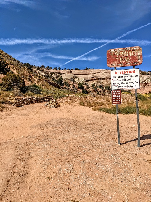
We stayed there for five days last month as there were some attractions nearby we wanted to visit like the Ice Cave & Bandera Volcano. Something we didn’t have on our original list but are glad we ended up doing was hiking the Pyramid Rock Trail at Red Rock Park.
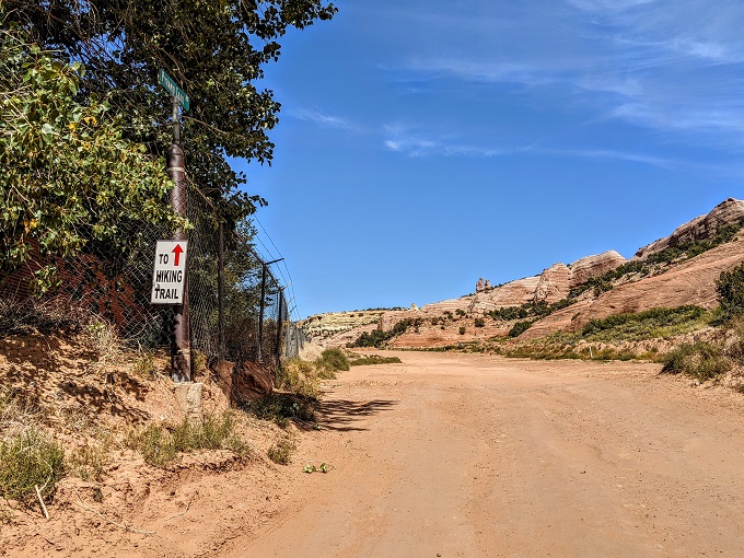
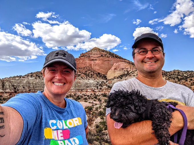
The park was only a few miles from our hotel (the less said about that hotel, the better), so one afternoon Shae, Truffles and I headed to Red Rock Park for the hike. You have to drive fairly far along the dirt road through the park, but thankfully there were several signs directing us where to go.
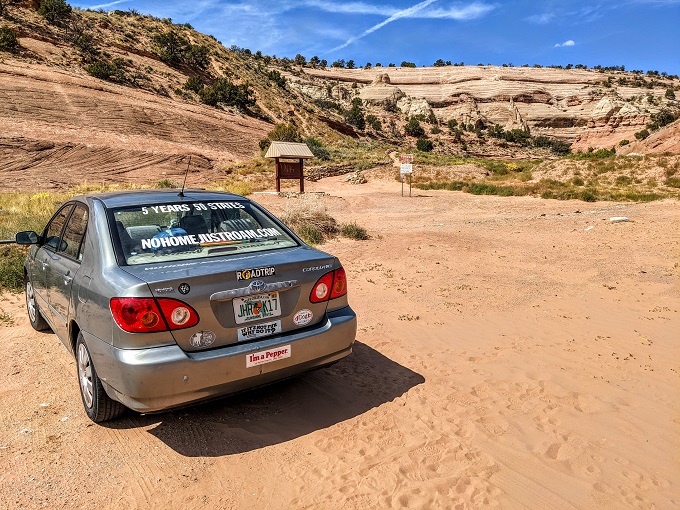
We eventually made it to the trailhead parking lot. We were the only ones there that afternoon, although there were a few other visitors by the time we returned from our hike. I think people were there for sunset which I can imagine would be beautiful reflecting off the red rock in the park.
We weren’t too sure what kind of footwear we’d need for the trail, so we both put on our hiking boots. This ended up being the right option, especially due to the accidental diversion we took on our way down later on.
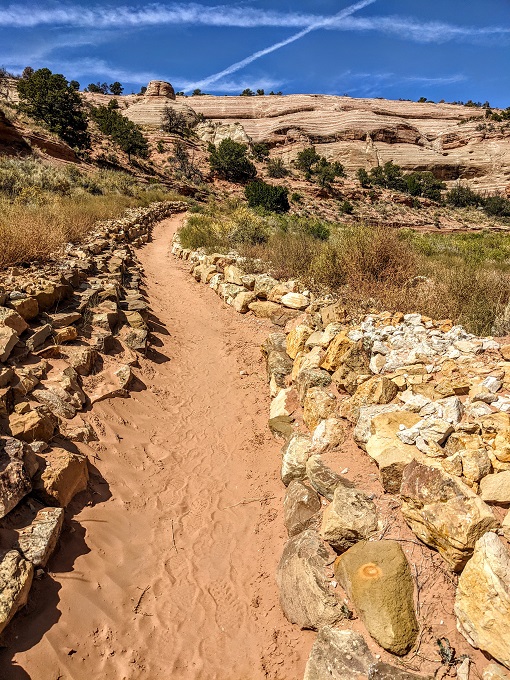
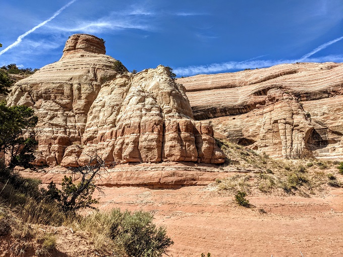
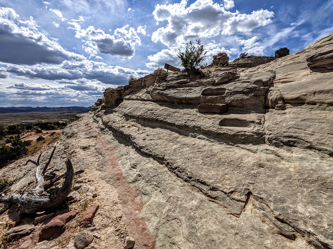
The Pyramid Rock Trail is beautiful for a number of reasons, with one of the main ones being all of the different rock formations and striations along the way.
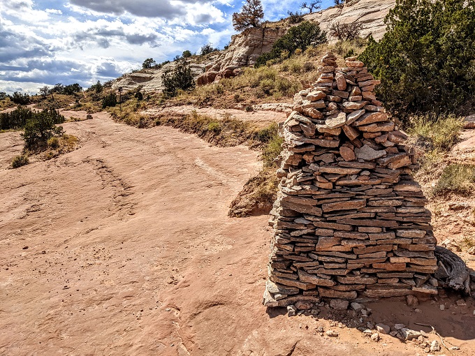
Most of the Pyramid Rock Trail is easy to identify, but there are some sections with rock piles that serve as trail markers so that you know you’re continuing in the right direction.
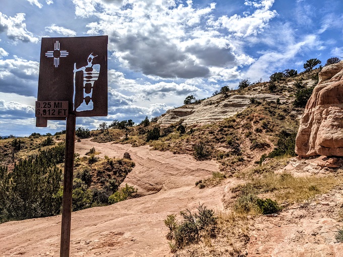
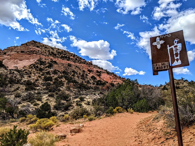
There are some additional markers that let you know how far you’ve hiked and the current elevation. Gallup is already at a high elevation, so only quarter of a mile after we’d started the hike our elevation was 6,912 feet above sea level. For reference, that’s almost 1,700 feet higher than Denver – the Mile High City. If you’re not acclimatized to the altitude, that can make hiking a little trickier, especially if you’d been at the lowest point on Earth just a month earlier!
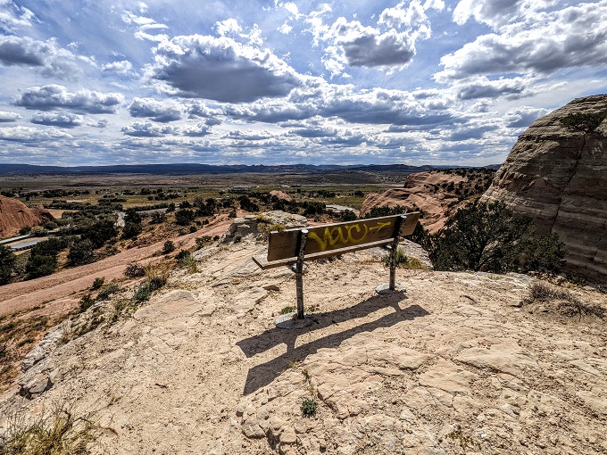
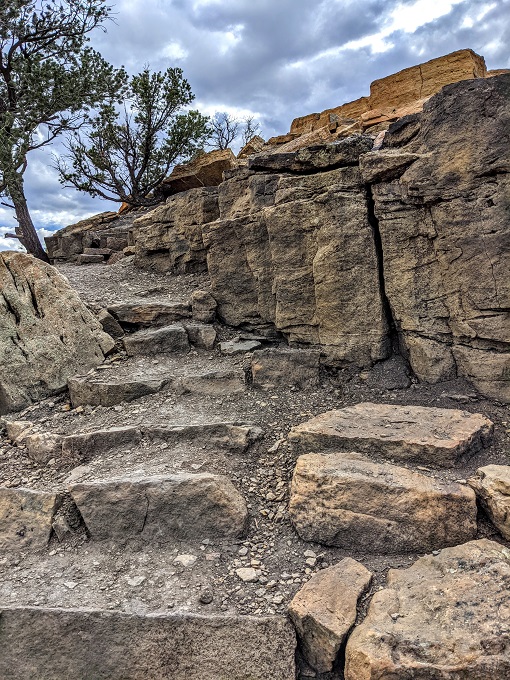
As mentioned earlier, some parts of the trail have rock piles to indicate where the trail leads. It’s always possible for those to be set up on the trail due to the incline, but there are usually other indications as to the route such as these steps cut into the stone.
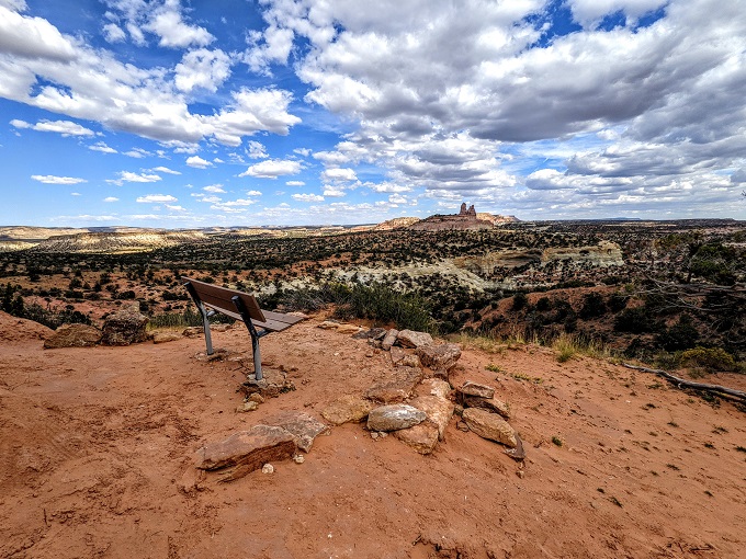
Those steps led up to an overlook with a bench where you can pause and enjoy the view out over Gallup if you want. The Pyramid Rock Trail has several of these benches along the 1.7 mile trail up.
The next section of the trail had more rock markers noting the way.
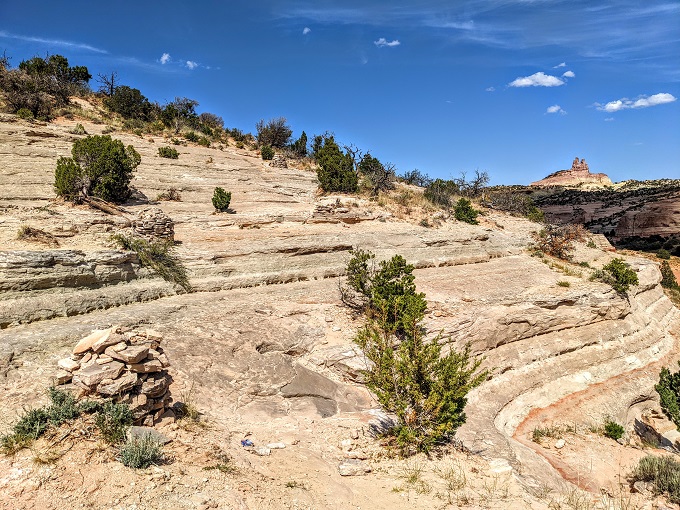
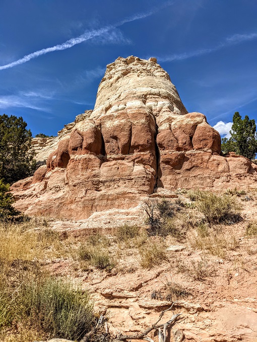
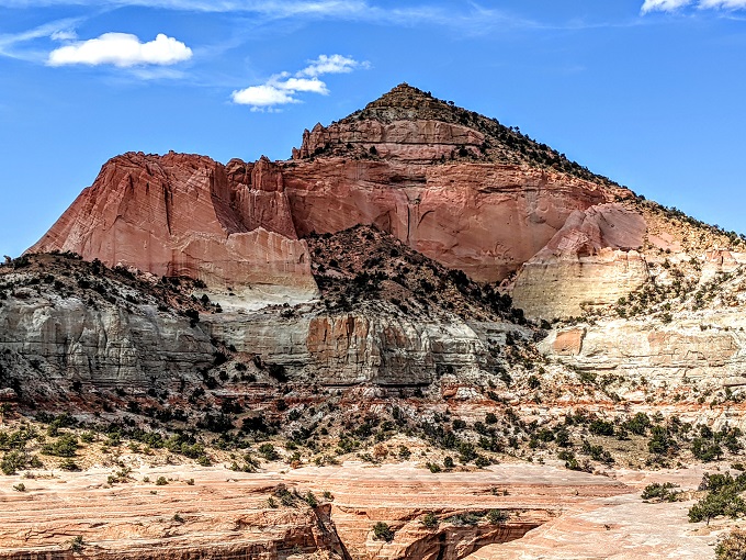
After about half a mile, we finally saw why it was called the Pyramid Rock Trail.
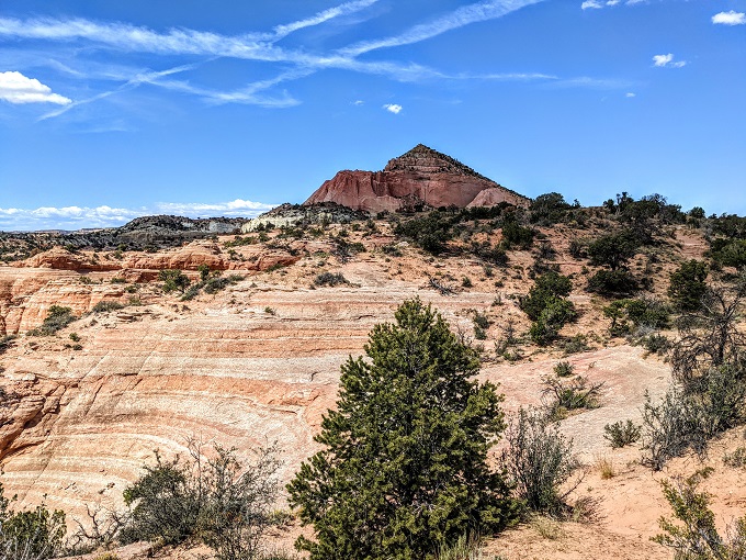
Yep, it’s the Pyramid Rock Trail because of the rock that looks like a pyramid. That was kind of funny seeing as we did this hike only a month after seeing the actual Pyramids of Giza.
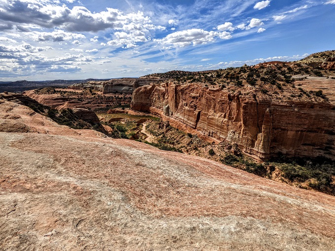
It was about 2:30pm by this point, so we decided to stop for lunch. On the left side of the trail there was a flat section of rock with a canyon in front of it, so we decided to go down there to eat.
Just before we had lunch I took this video to give you a better idea of the surroundings.
After lunch we took a little wander around the flat rock area, getting a little closer to the canyon edge.
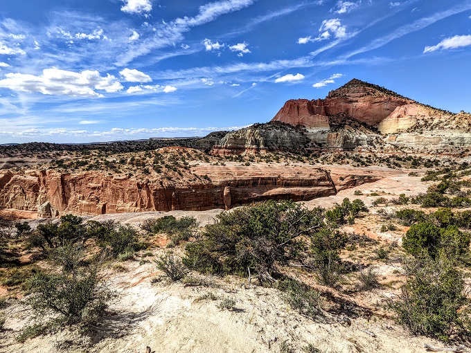
At this point we didn’t know if the Pyramid Rock Trail was called that simply because it provided views of the mountain or if we’d actually be hiking up Pyramid Rock. It looked like it was more than a mile away to the top, so we figured that perhaps the trail led around the other side of the mountain.
The further we progressed along the trail though, the more we realized that it was likely we’d be hiking up Pyramid Rock. With the trail being mostly uphill at this point and thus gaining elevation all the time, it’s nice that there are still some spots where you can sit and take a breather if you need. It’s even better that you get to enjoy views like this too:
Sure enough, the Pyramid Rock Trail in Gallup does indeed lead you up to the top of Pyramid Rock. The hike itself isn’t difficult per se, but it can be a little strenuous due to much of it being uphill and the fact that your elevation is almost 1.5 miles above sea level by the time you reach the top.
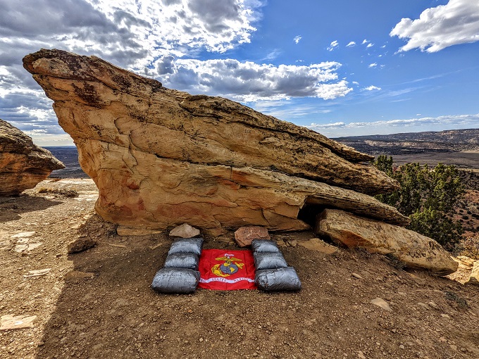
Just before the peak there was a memorial to a fallen Marine from Gallup.
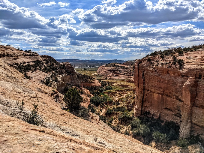
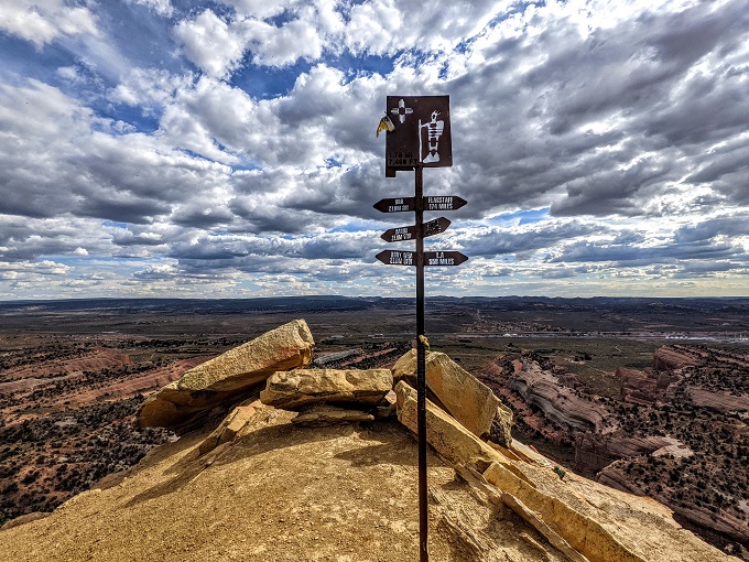
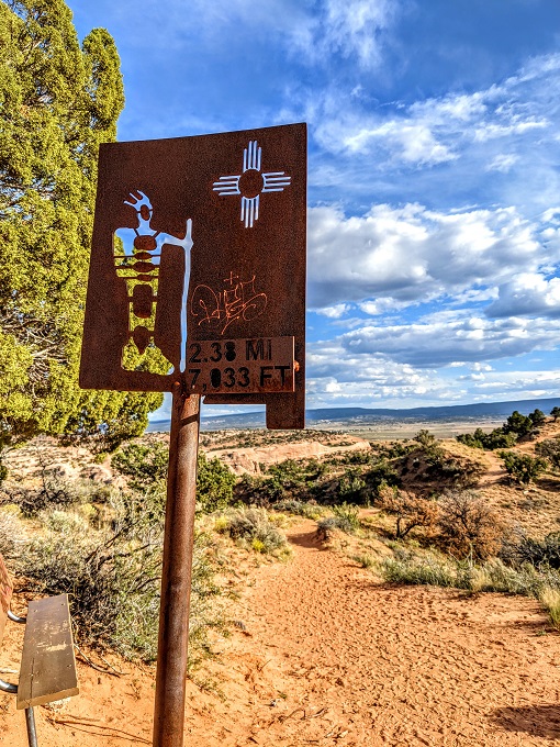
Just a few steps more and we were at the peak of Pyramid Rock. There was another marker letting us know that we’d hiked 1.7 miles and were at 7,460 feet above sea level. There were also directional signs letting us know how far we were from Albuquerque, Flagstaff, Miami, Seattle, New York and Los Angeles.
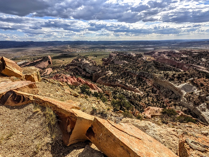
As you might expect, the views from up there were pretty good.
Here’s a panorama video from the top. And yes, those are bugs you see flying around in the video. There wasn’t a bug problem along the trail whatsoever; even at the peak there wasn’t a bug problem for the most part – they just seemed to really like the marker for some reason.
After hanging out at the top of Pyramid Rock for a while, we started making our way back down. At some point we continued along what we thought was the trail, but apparently it wasn’t. Thankfully we didn’t end up too far off track, but we also couldn’t work out where we should be going back.
We thought that the trail was at the top of a hill on the other side though, so we climbed up there to check it out. Shae and I were both grateful that we’d worn our hiking boots as it helped us get some grip in the dirt. I don’t think we were the first people to have gone the wrong way as there seemed to be an unofficial path going up where other people had also gotten lost.
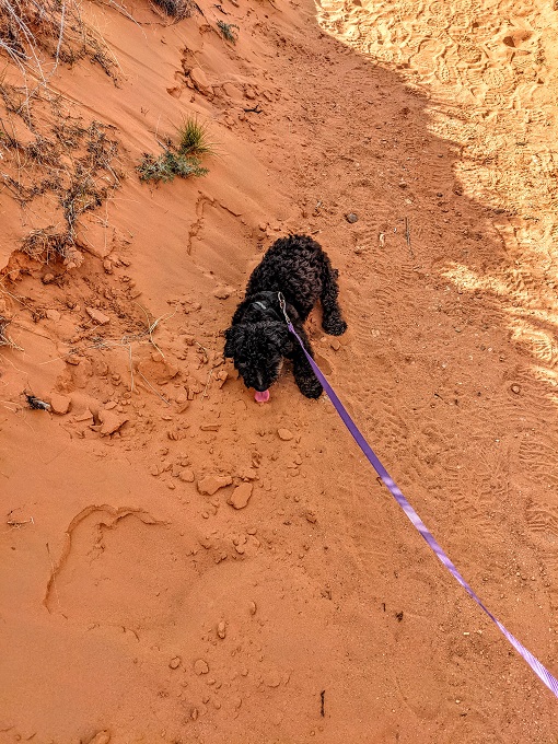
Sure enough, we ended up back on the Pyramid Rock Trail. While we were on the incorrect trail, Truffles laid down a couple of times and refused to move. At first we just figured she was being obstinate, but then we wondered if she knew we weren’t on the right trail and that was her way of letting us know that we shouldn’t continue that way any further.
Our pride at her Lassie-like capabilities turned to eye-rolling when she continued trying to lay down in the dirt on the way down once we were back on the correct trail. Apparently she was just being dramatic. She’s hiked 10 miles before, so the 3.4 miles that day weren’t the big deal she was making them out to be!
We noticed something fun on the way down. The trail markers that told us how far we’d hiked on the way up continued telling us how far we’d hiked while we were on our way down as they took into account the 1.7 miles to the top.
Final Thoughts
The Pyramid Rock Trail was a surprisingly lovely 3.4 mile round trip hike to the top of Pyramid Rock in Gallup, NM. Although it can be a little strenuous at times due to much of the 1.7 miles to Pyramid Rock being uphill and it being at a high elevation, it’s not a difficult hike. It’s also worth the effort thanks to the beautiful views you get of Pyramid Rock along the way and the views of Gallup and the surrounding area from the top.
It’s completely free to visit and park at Red Rock Park and the trail is pet-friendly.
Address
Red Rock Park, 825 Outlaw Rd, Church Rock, NM 87311
Thank you once again for taking me along on your hike. Just beautiful
Glad to have you along for the ride 🙂
Could you give me permission to use your photograph of Pyramid Mountain in a forthcoming book on the Life and Times of Louis Agassiz; the famous Swiss geologist? I a a professor Geology at the University of Toronto; one of Agassiz’s students climbed the mountain in 1853 and described its geology.
Thank you!
Nick
Yes, please feel free.