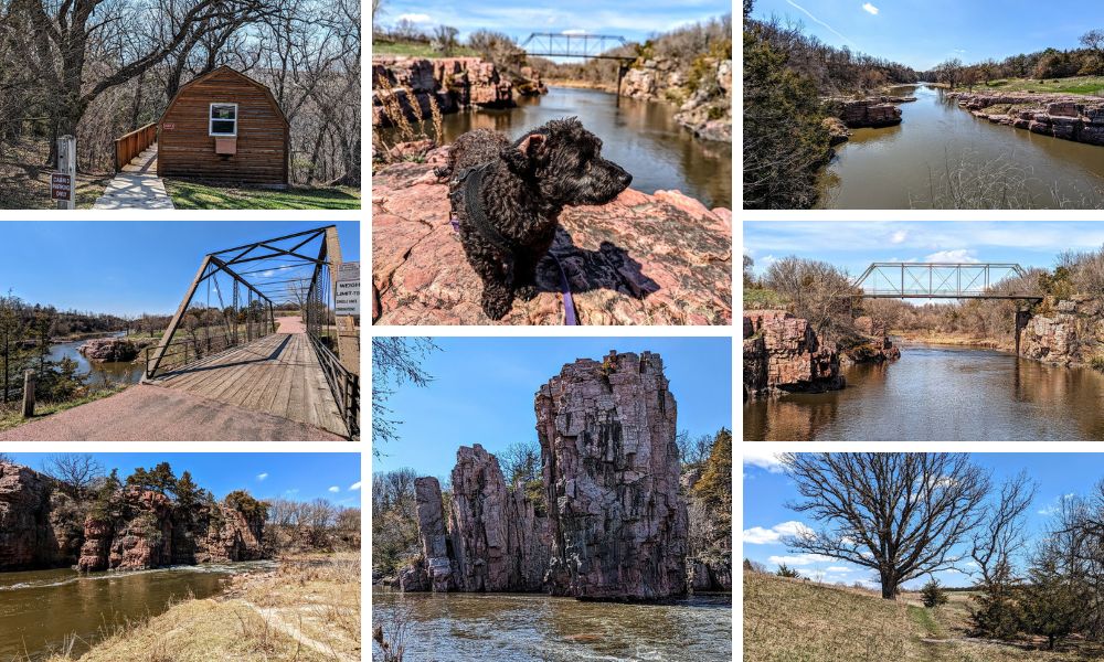
A couple of days after arriving in Sioux Falls, SD, Truffles and I went out for a hike at Palisades State Park while Shae was working.
Palisades State Park is in Garretson, about 30 minutes northeast of Sioux Falls. We’d planned to stop at Devil’s Gulch Park first, but the road leading down to that park had a locked gate, so we headed on to Palisades.
Palisades State Park Entrance Fee
South Dakota offers an annual State Park entrance license for $36. However, we weren’t due to be visiting many other State Parks while in South Dakota, so I just paid for a daily license for $8. One of the nice things about Palisades State Park is that there’s a machine at the entrance which accepts credit cards, so you don’t have to worry about having exact cash as there was no attendant on duty.
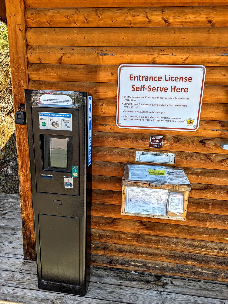
Next to the payment station was a wooden box with maps of the state park in it.
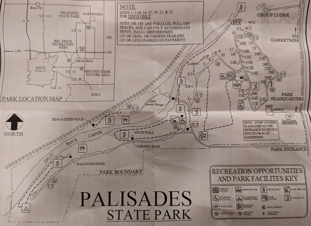
Camping In Palisades State Park
As you can see on the map above, you can camp at Palisades State Park. There are a couple of dozen sites for tent camping and RVs…
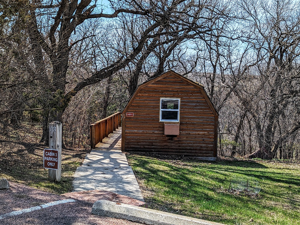
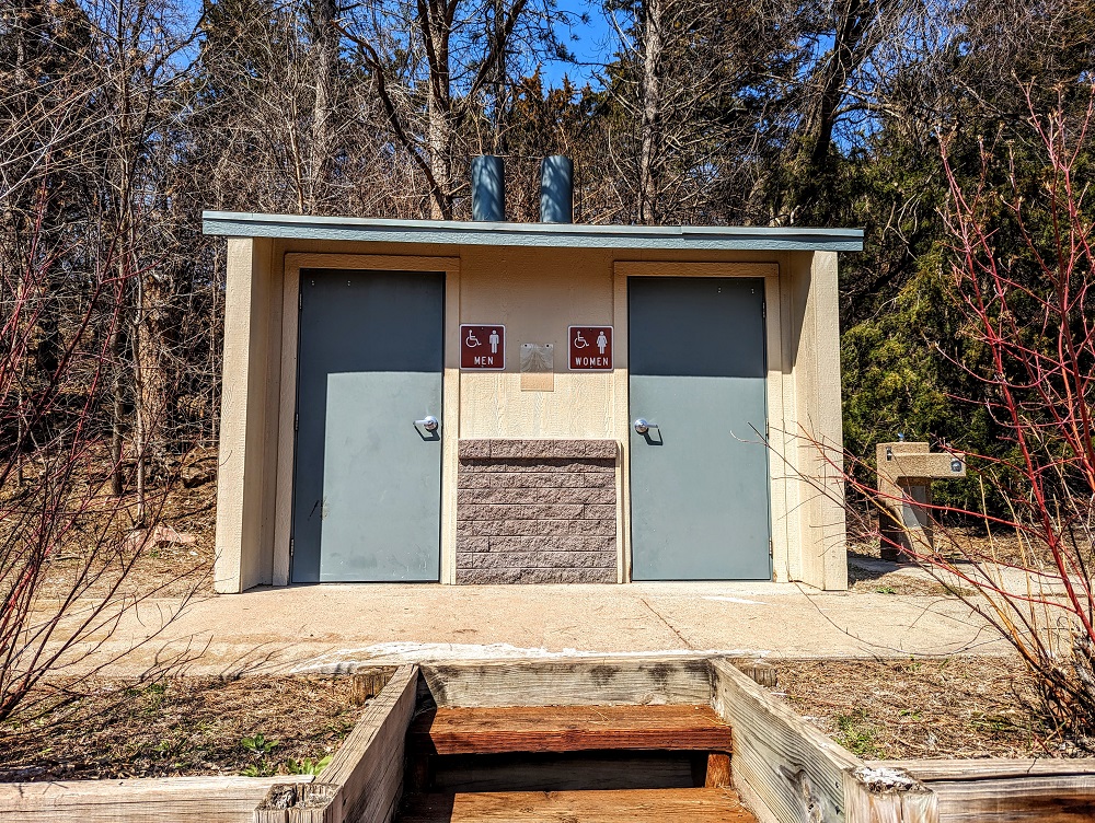
…along with about 10 cabins. The cabins look nice and new from the outside, but are quite rustic. They apparently only contain beds, power outlets and a window air conditioning unit, with a picnic table on the deck behind them. The cabins don’t have running water inside which means you have to use the vault toilets at various spots in the park, or the campground shower and bathroom building. There are various water fountains around the park, notated on the map above with a W in a circle.
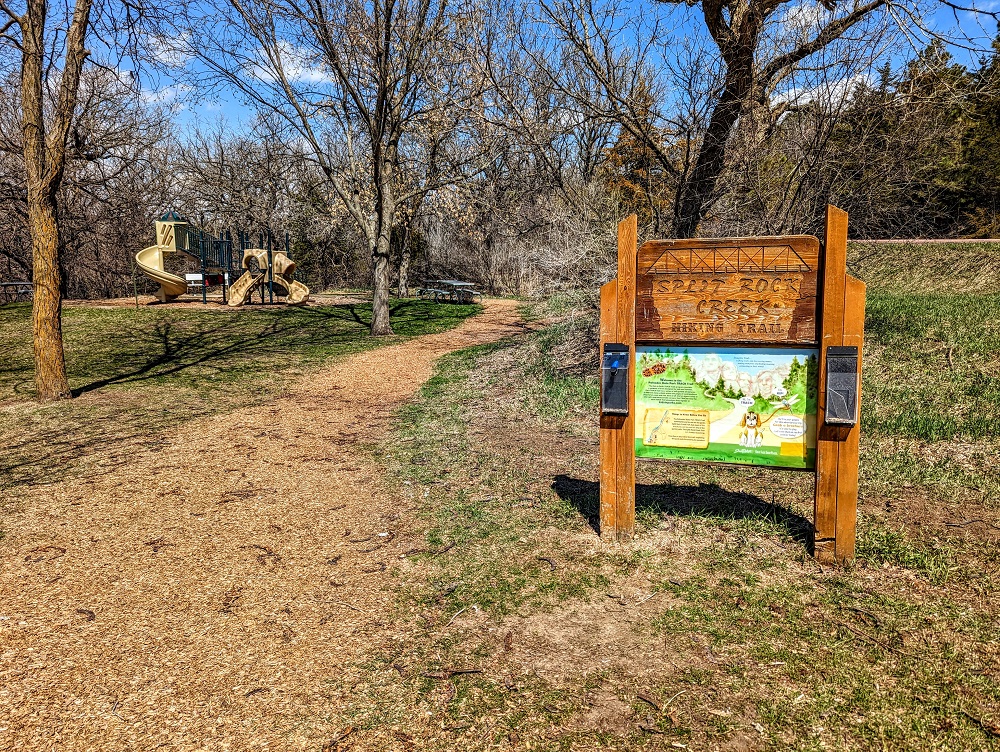
Split Rock Creek Trail
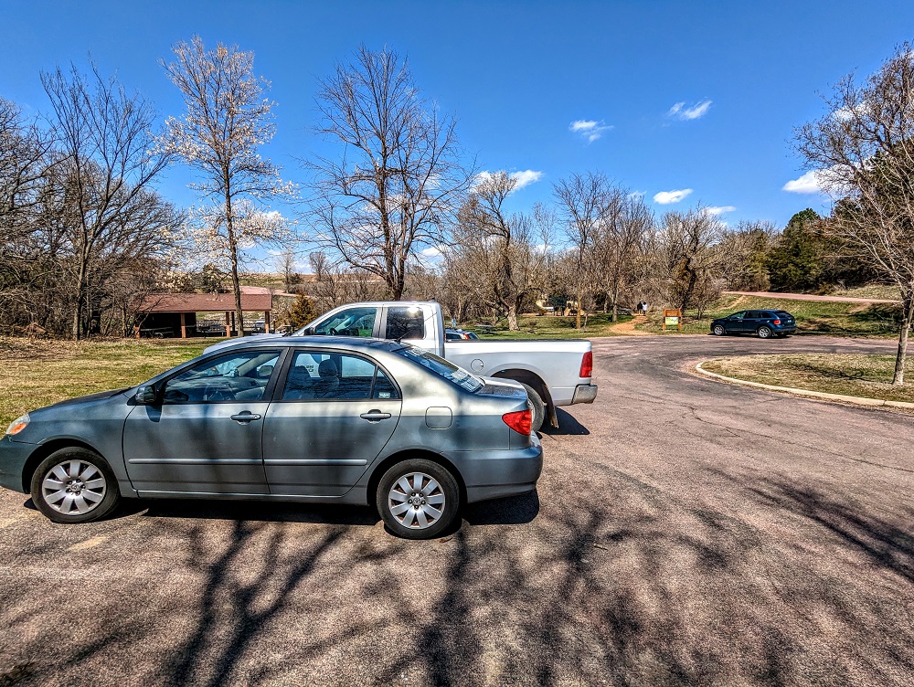
Near the entrance of the park is a parking lot at the trailheads for both the Split Rock Creek and South Wall trails.
Truffles and I set off on the Split Rock Creek trail first, following the path as it headed uphill a little.
The trail crosses over a road. To the left will be the 1908 Palisades Iron Bridge – more about that later. To stay on the Split Rock Creek trail though, cross over the road and continue along the path on the other side.
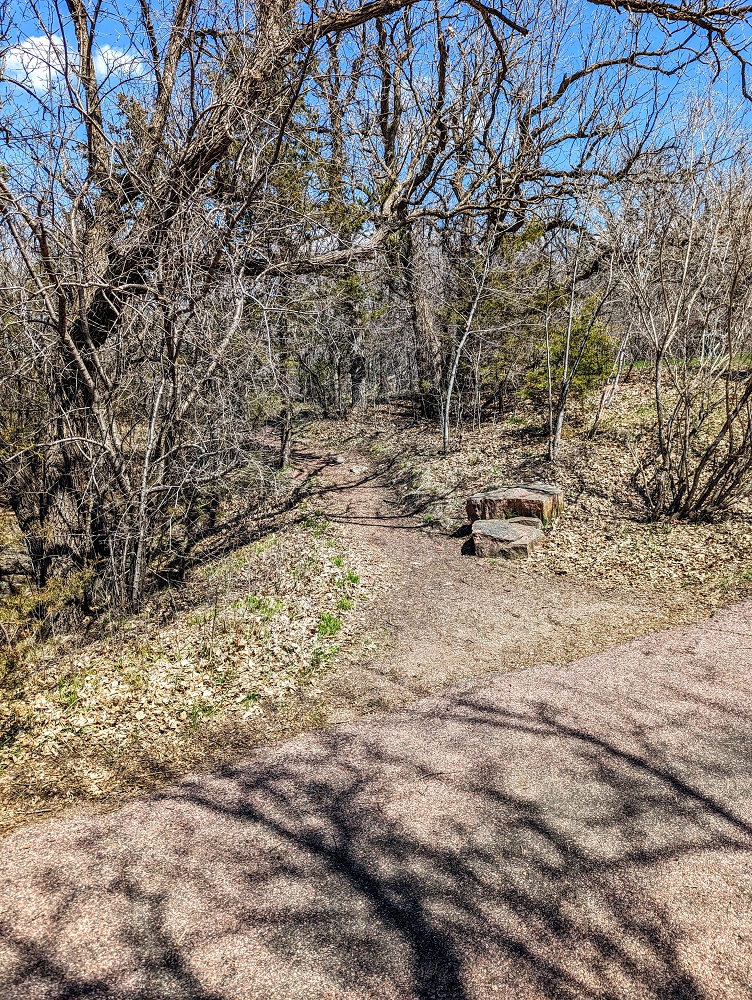
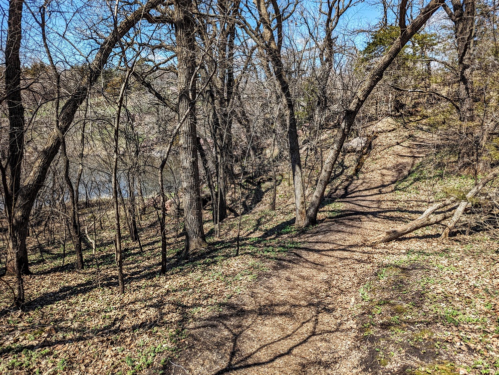
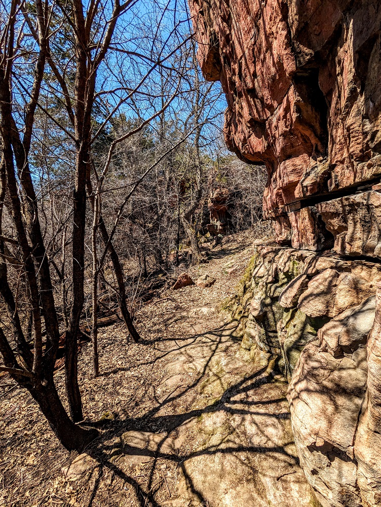
The trail initially follows along Split Rock Creek higher up. There are a few section off to the left where you can scramble down, so you’ll ideally want hiking boots on if doing that.
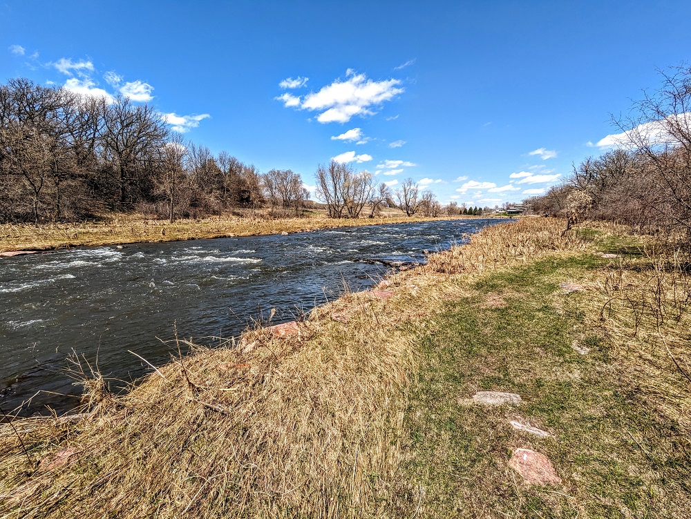
The trail itself soon leads down to Split Rock Creek though and is a very pretty section of the park.
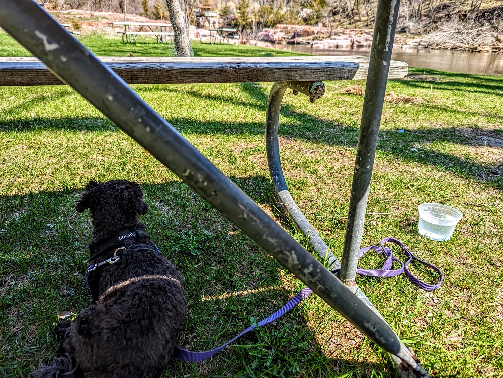
It was a little chilly out that day and Truffles had been to the groomer recently, so she had some clothing on to keep her warm when we first set out.
There were some large rocks along the trail, so we stopped by the creek to have some lunch as they made for a good seating spot. Palisades State Park is several miles from I-90 and the lightly trafficked Hwy-11 is about a mile away, so it’s an incredibly quiet and peaceful park. It was therefore lovely hearing nothing but the creek and the occasional bird chirping.
Once we were done eating, we continued along the trail.
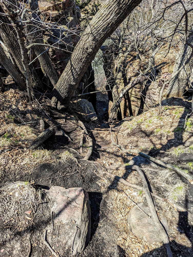
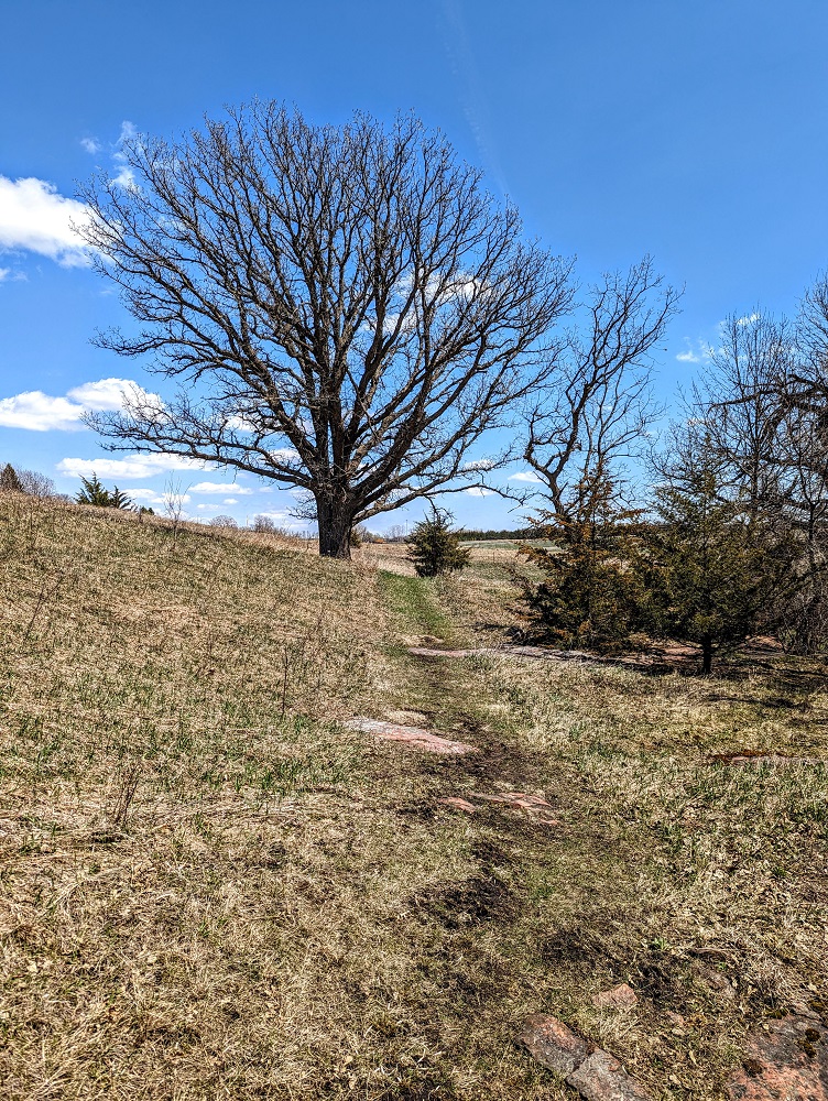
It follows the creek for a little while, then heads up a gentle hill to the right. If you visit when there’s snow on the ground, I’m not sure how easy it’ll be to find your way around as there aren’t any trail blazes; the trail is obvious when there’s no snow though.
The trail loops back around to the right where it continues along a rock wall.
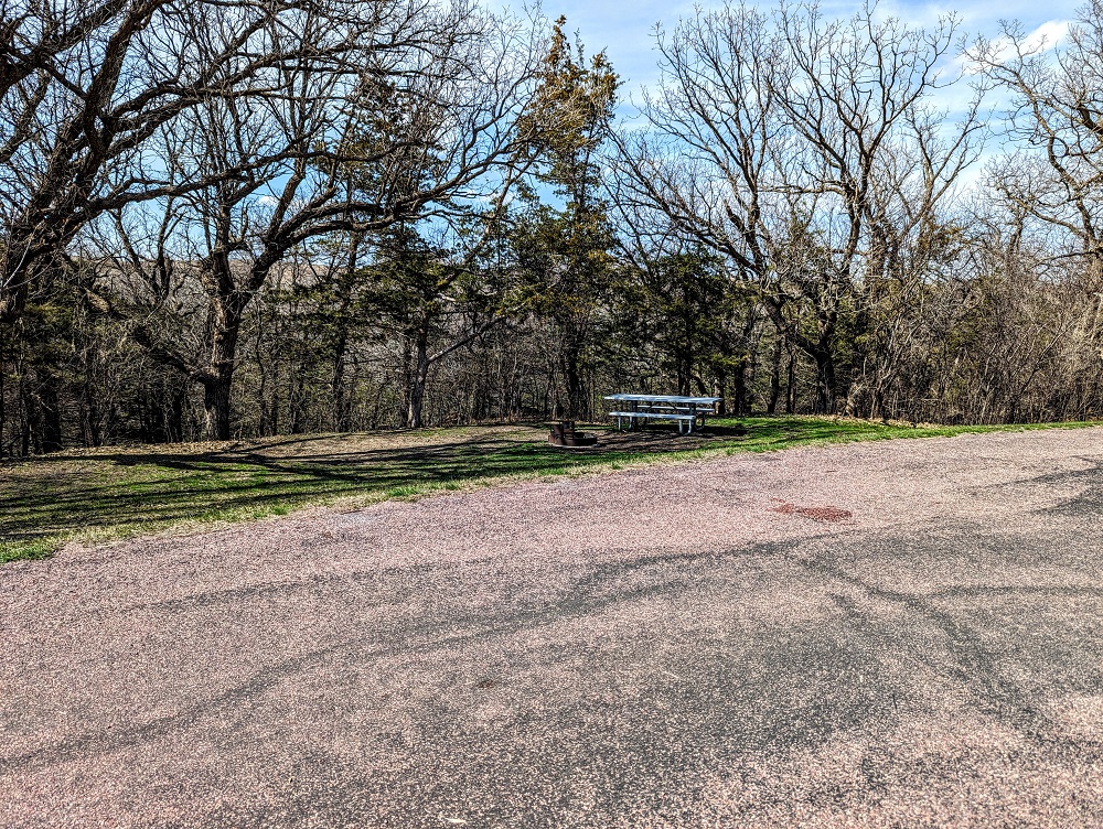
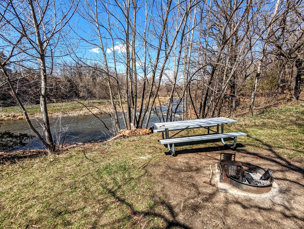
You’ll then come upon a clearing with a picnic table and grill overlooking the creek from slightly higher up.
It’s not much further until you get back to the start of the trail as the entire trail covers about 1.5 miles and wasn’t very strenuous. It’s definitely worth having sturdy footwear though. I only had on a pair of tennis shoes rather than my hiking boots and there was an uphill section at one point that was muddy and I lost my footing; that likely wouldn’t have happened if I had my boots on.
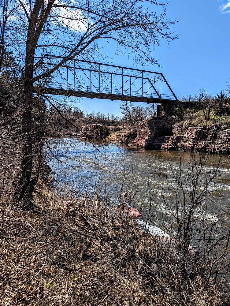
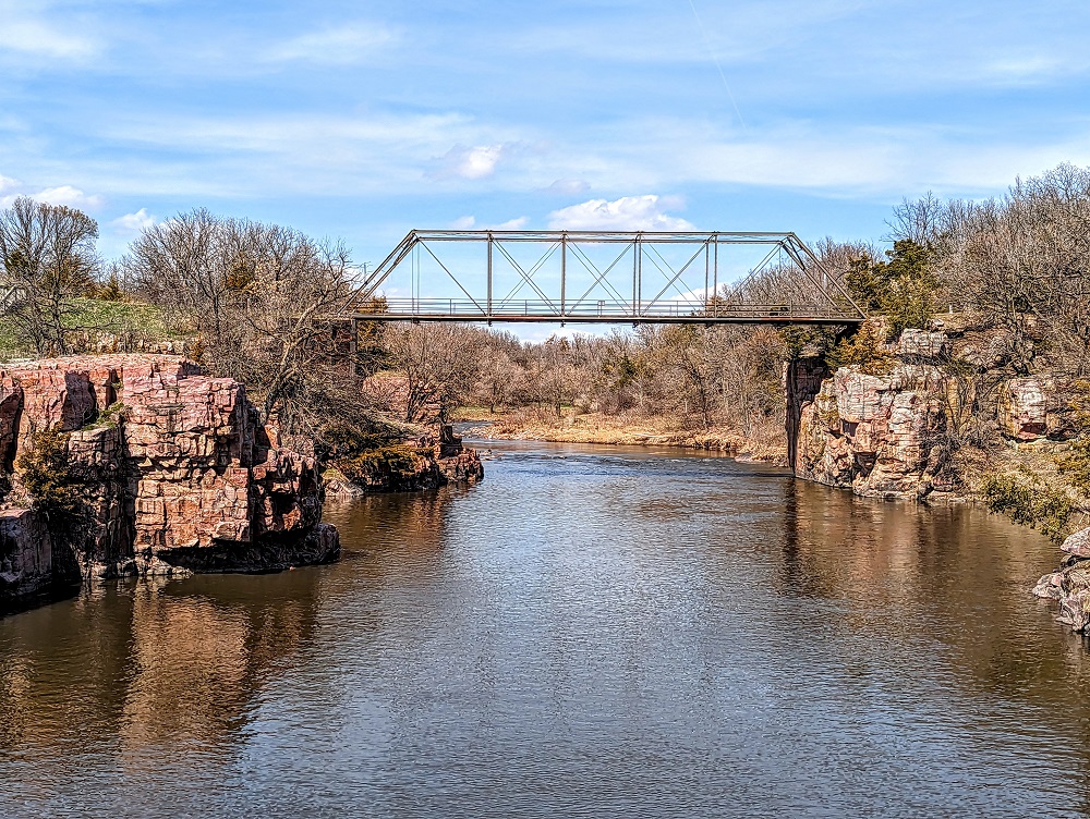
1908 Palisades Iron Bridge
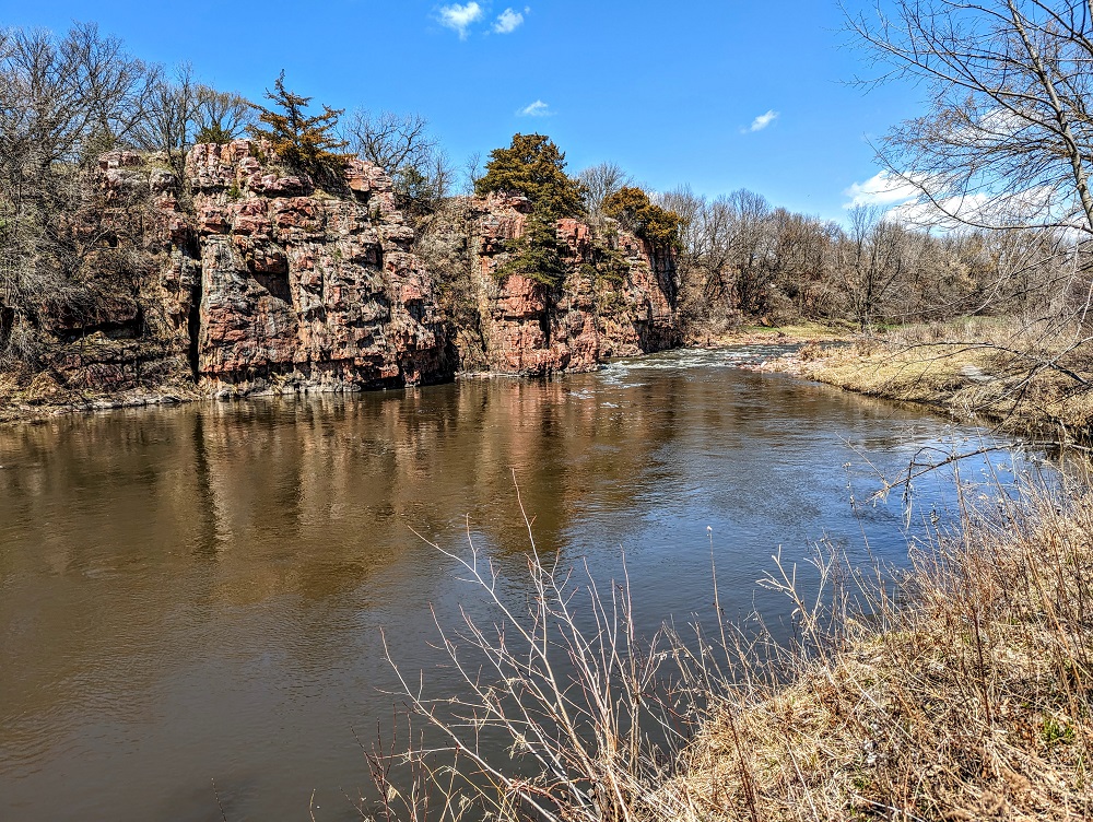
On our way back to the trailhead, we stopped to check out the 1908 Palisades Iron Bridge.
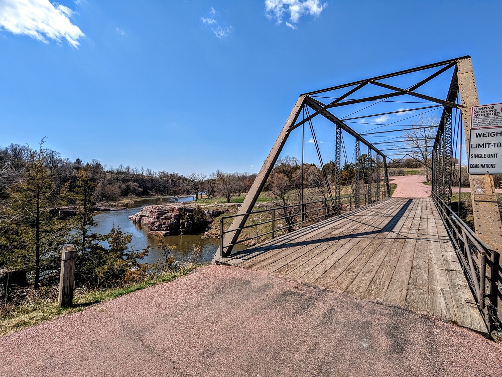
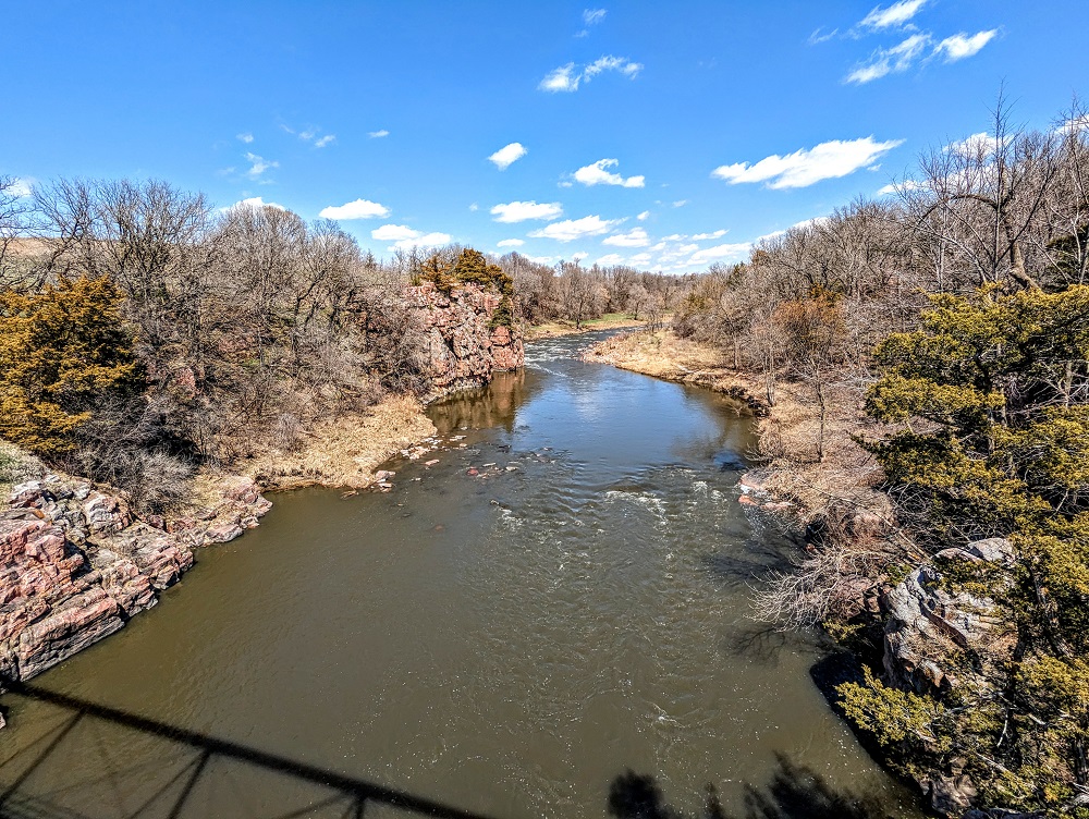
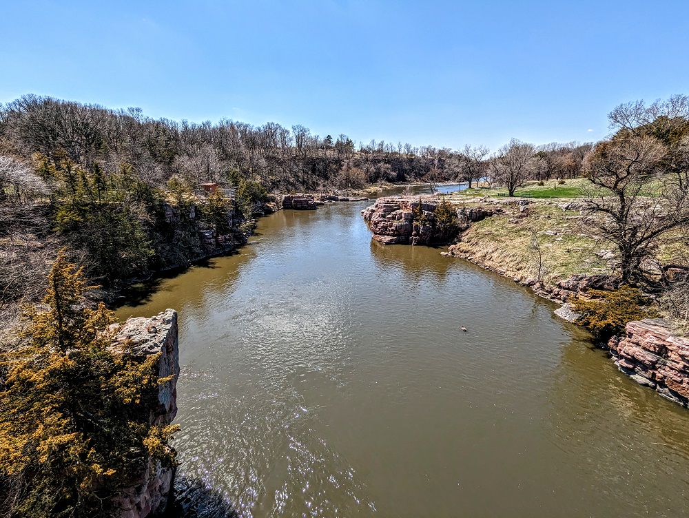
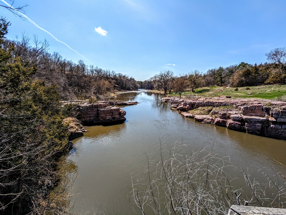
It gives you a great vantage point of Split Rock Creek in both directions.
There was a historic marker on the other side of the bridge sharing its history:
In 1908 the Western Bridge and Construction Co. of Omaha, Nebraska, built this Pratt Through-Truss Bridge. Workers fastened beams together with diagonal bracing to create a strong, rigid framework. Each beam of a truss bridge shares a portion of the weight of the bridge to help displace the weight and stress of crossing traffic. The steel bridge rests on natural abutments of Sioux quartzite.
A milldam bridge was built nearby in 1870 when G.W. Patten erected a flour mill on high ground northeast of the dam. Water from Split Rock Creek powered the mill. Built of heavy timbers and large boulders, the bridge was wide enough to drive over with team and wagon.
In 1883 a bridge was built on this site. It made the uphill grade less abrupt for loaded wagons heading to Patten’s Mill and the village of Palisade. An ice jam destroyed this bridge in the spring of 1896 by lifting it from its moorings and floating it downstream.
The 1908 Palisades Bridge was listed on the National Register of Historic Places in 1999.
Palisades State Park Amenities
On the side of the bridge with the historic marker, there’s a short set of steps leading down to another picnic area along the creek.
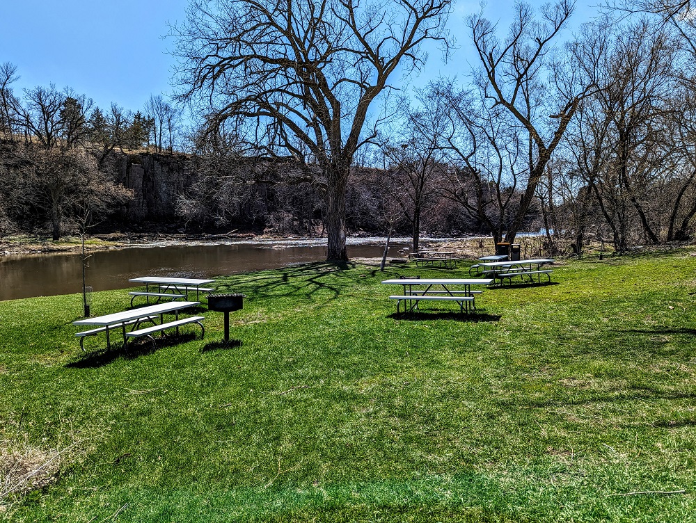
It had warmed up a little by that point as the sun had come out and the breeze had died down, so we stopped and sat at one of the tables for a few minutes to enjoy the sound of the creek.
Near the picnic tables were some vault toilets – one of six sets around the park – along with a water fountain outside.
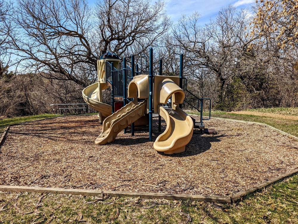
Back by the trailhead parking lot there’s a playground for small children.
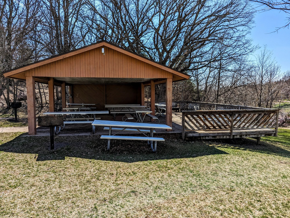
Nearby is a good-sized picnic shelter with numerous picnic tables, along with an uncovered deck overlooking the creek with a couple more tables.
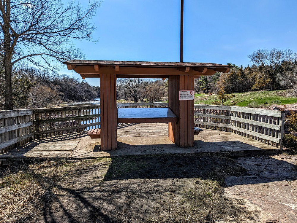
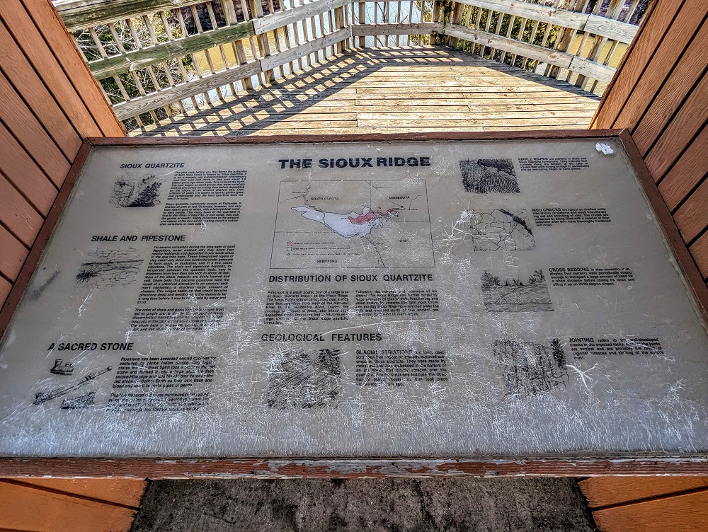
Off to the side of that was an overlook with an information board sharing some geological details about Palisades State Park.
South Wall Trail
Seeing as the Split Rock Creek trail had been fairly quick due to it only being 1.5 miles long, we decided to explore the park in the other direction by hiking along the South Wall trail.
The trailhead is off to the left of the overlook in the pictures above.
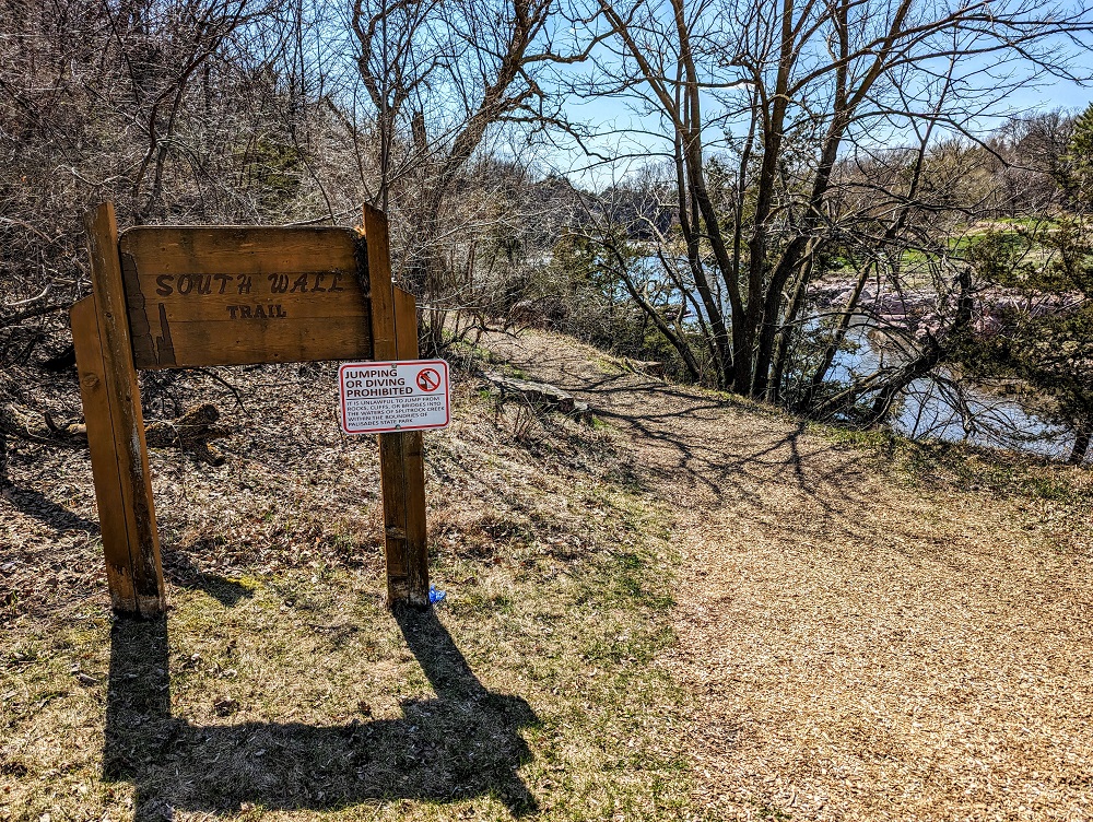
Similar to the Split Rock Creek trail, there weren’t really any trail markers beyond the initial trailhead sign. Like that previous trail though, it was obvious which way we should go seeing as there was no snow on the ground.
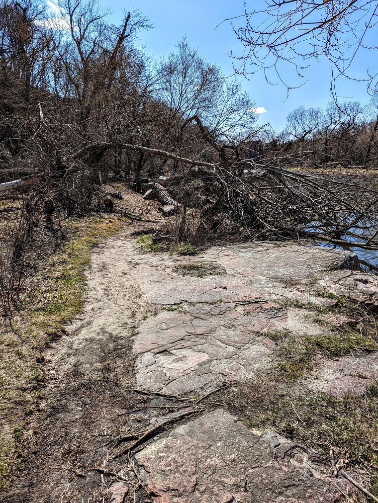
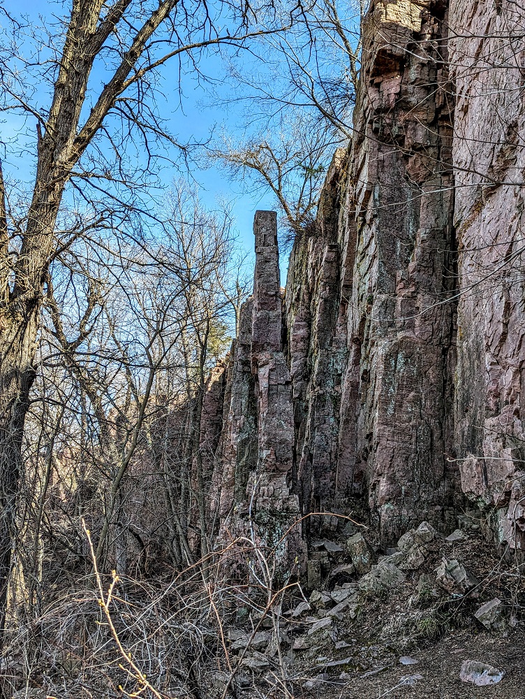
The trail is sandwiched between the creek on the right hand side and the (south) rock wall on your left.
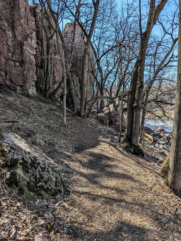
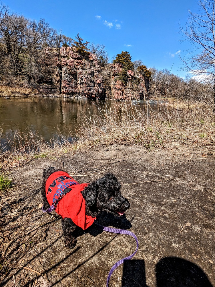
The South Wall trail is a half-mile loop trail, so it doesn’t take long to get to the end of it. It dead-ends at the creek with a view of some rock formations on the other side. Based on the map I’d gotten when arriving at the park, I think the formation in the middle of the creek is known as Balancing Rock.
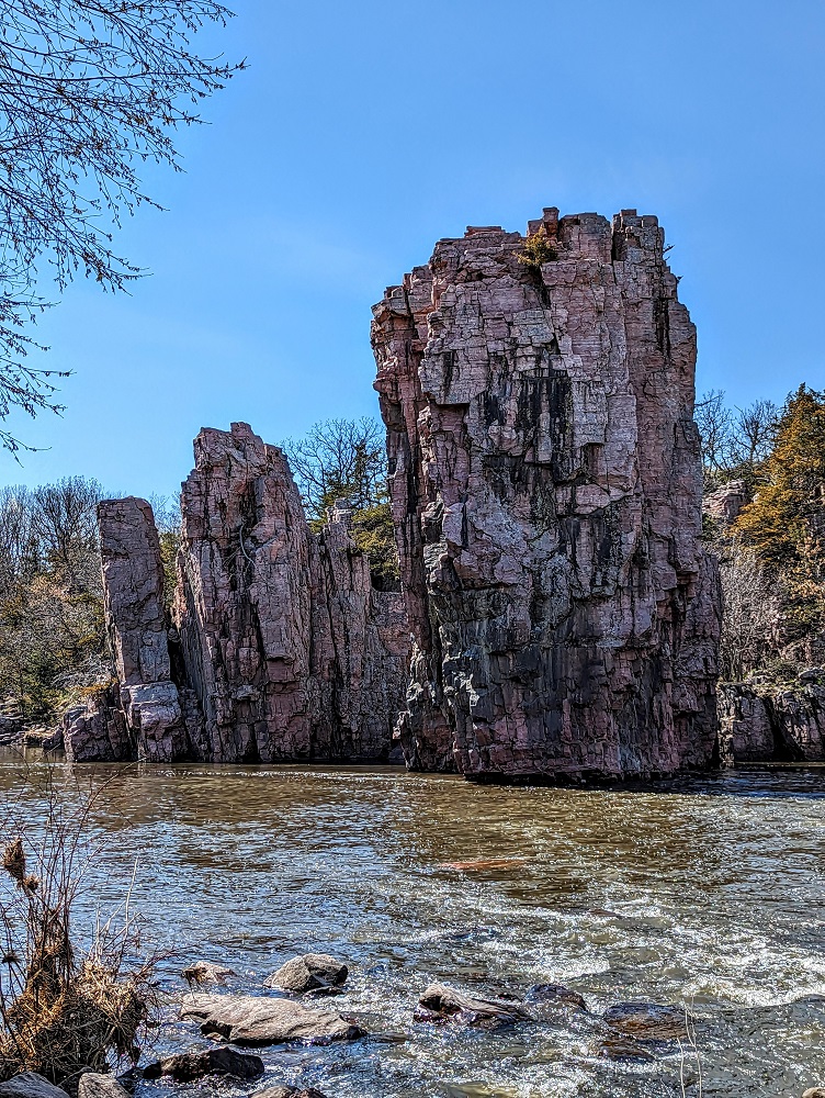
On the way back I noticed another formation which is apparently called Chimney Rock. It’s easier to see why it’s called that from the side view.
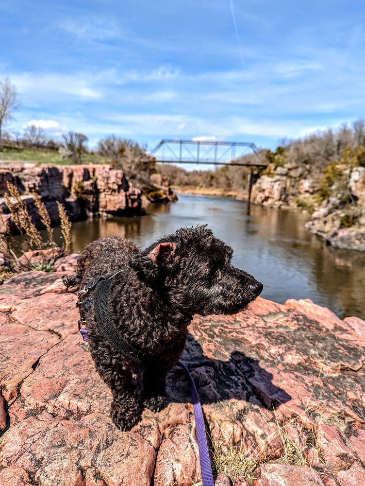
At the start/end of the trail, there’s a rocky outcropping that gives you a good view of the bridge and was the perfect spot to get another photo of Truffles. Unfortunately she steadfastly refused to look at the phone!
Final Thoughts
Palisades State Park is a cute little park about 30 minutes Sioux Falls. ‘Little’ being the operative word because it’s less than 160 acres which makes it the second smallest state park in South Dakota.
Still, if you live in or are visiting Sioux Falls or somewhere else nearby, it’s a beautiful place to go for a couple of easy hikes along a pretty creek.
Leave a Reply